Work had come to an end. The snow was melting, and the ski lift queues had disappeared. The season was over, and it was time to leave Jimmy’s House in Hakuba, with all its inhabitants the winter had collected. Moving out was sad, saying goodbye to the family of strangers I’d adopted over the last 4 months, all going separate ways; but it wouldn’t be bye for good.
The Nakasendo Trail is the ancient road between Tokyo and Kyoto, which was used by Samurai and merchants in the Edo era, between the 1600s and 1800s. Small parts of the old road still remain intact, and are open to tourists to hike and experience all year round. Mic (also from Jimmy’s House) and I both desired to backpack the trail, so we set off on our adventure at the end of the snow season in mid-March…
~ Camping in Matsumoto ~
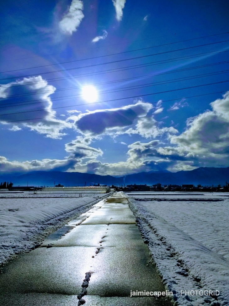
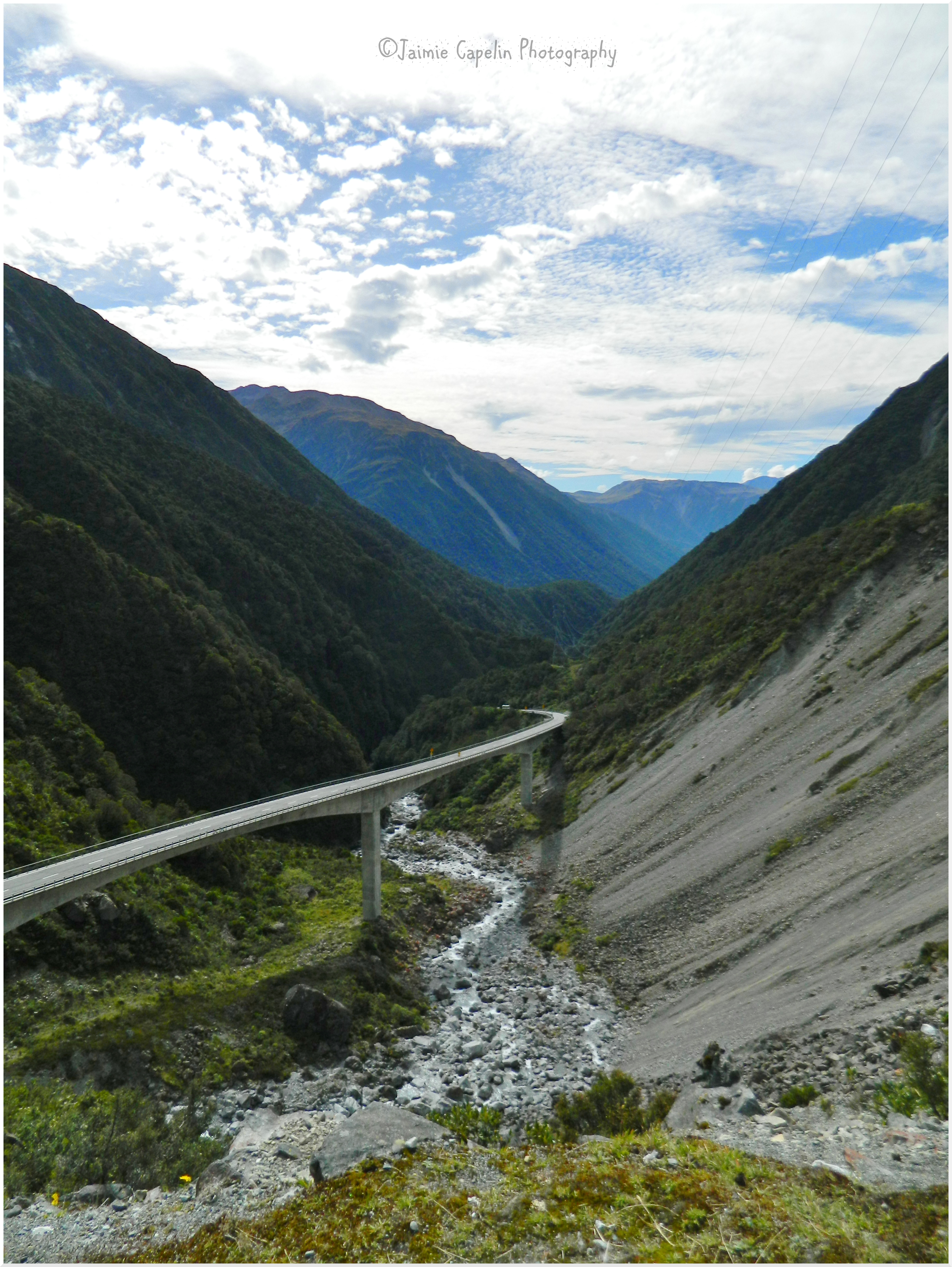
Road to Matsumoto
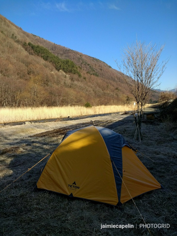
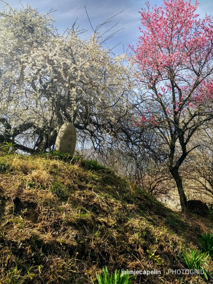
Somewhere on a hill near Minami-Matsumoto Station, across a vast stretch of paddies and crops, we set up camp. Our view was of the Matsumoto suburbs across the valley, to the dramatic mountains on the other side. Mic and I had left Jimmy’s House, catching the 12:30pm train from Kamishiro station to Matsumoto, with fellow housemates, Gerry, Cam and Zac somewhere closely behind. (Zac had recommended the camping spot, and the three of them were to meet us there on their bicycles, commencing their own bike-packing journey.) We’d walked for around 45 minutes in the warm sunshine through a network of rice fields until we reached the foot of the mount. Passing two shrines, and some of the first cherry blossoms of the season, we climbed the steep, snowy path to the plateau, which was to be our home for the next two nights.
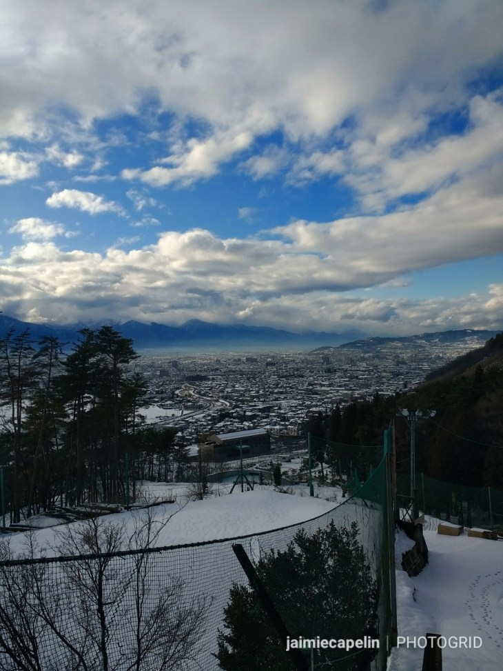
Room with a View
As dusk began to creep at the edges of the horizon, and our camp set up, we gave up waiting for the three boys, assuming they’d found somewhere else for the night, and we walked in twilight to the nearest 7eleven convenience store for dinner. An hour later, we traipsed back up the hill to our tent, finding ourselves following three tyre tracks in the snow! “Bikes! Three of them!” Mic exclaimed, and as we climbed, torch light beamed down the hill, and we heard Zac, Cam and Gerry cheering.
Our tents floated on the snow, lit from within like wish lanterns, with the stars strewn across the clear sky competing with the lights from the city below. Sitting around Mic’s campfire, spinning yarns and trying to keep warm, one by one we turned in, and endured our first freezing cold night, sleeping on the snow.
That was the coldest I have ever been in memory. We’d somehow convinced ourselves that snow was an insulator, but alas. It was anything but! The boys were all up at dawn, having given up on sleep; Zac, Gerry and Cam preparing for an early departure on their bikes. Meanwhile I was still huddled in a ball in my sleeping bag, with some deluded belief I’d stop shivering and fall asleep soon. Though they were the worst two nights, the mornings that followed were beautiful.
The sun rose behind the trees, slowly spreading a thawing warmth over us. I sat in the tent, packing and readying for the day ahead, while Mic did his yoga stuff outside on a patch of grass. Two birds of prey circled above us, calling to eachother, gliding and diving gracefully against a sapphire sky. The town clocks chimed from somewhere below, as the sun melted the snow, and all felt peaceful. This is a very tranquil, happy place in my memory.
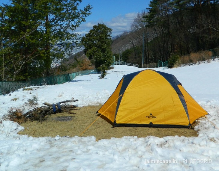
First Camp
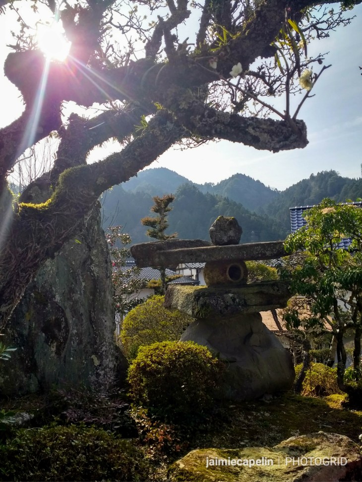
~ Matsumoto Castle ~
Standing bold between water and mountain, Matsumoto-jo is a premier historic castle, dating back to 1594, and is a Japanese national treasure. You can walk around the castle’s moat for free, passing beneath the impressive defensive gate, and through the park with a pictoresque red bridge that arches over the vibrant green moat. As with many important buidings, hundreds of Koi swim around in the waters, multi-coloured, enormous and gawping. As well as sharing their name with a Japanese synonym for ‘affection’, Koi are an important symbol of strength. In Japanese folklore, the little Koi in the Golden River wanted to swim in the Blue River, beyond the Great Waterfall. Any fish that showed the courage to swim upstream into the waterfall, grew wings and was transformed into a dragon by the gods.
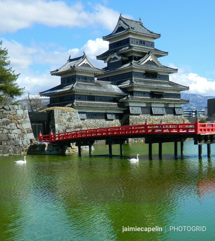
Matsumoto-jō
We wandered through the sunny city and met with another Jimmy’s Housemate – Jake, who took us to an onsen before dinner.
~ Japanese Onsen ~
These luxurious public bath houses are definitely something you should try at least once! I have to admit, it took me ages to go to my first onsen, because I was nervous. After all, you have to be naked! Men and Women are separated in public onsens: women enter through the red veil, and men enter through the blue. When I finally went to my local onsen in Hakuba Goryu, I had the whole place to myself, which is great if you’re feeling uncomfortable about waltzing about in a public space with no clothes on, but it meant I had no one to follow and learn the etiquette from. So, when I strolled into the onsen in Matsumoto with my towel wrapped around my torso, with at least 20 Japanese women – who had clearly left their towels in the locker room – pretending not to look at me, I felt very Gaijin! Quickly stuffing my towel on a nearby shelf and submerging myself up to my neck in the hot water, I subtly watched the other women. They were simply relaxing, washing, quietly chatting and laughing among themselves, totally naked and totally comfortable, not judging another soul, and I quickly realised I had nothing to worry about. I thoroughly enjoyed the array of different spas, including a jet stream massage seat, and multiple outdoor spas. Relaxing in an outdoor lounger, submerged in warm water beneath a beautiful magnolia tree, I watched dusk fade the sky, breathing a cool breeze on my face.
~ Yakitori and Beer with Jake ~
I met with Jake and Mic in the lobby, and we headed across to a nearby Yakitori resaurant. Yaki means grilled, and tori means bird, but Yakitori can cover just about any meat or vegetable that can be skewered and grilled. We ordered everything on the menu and washed it down with a mug of Asahi, raising our glasses to ‘Kampai’ (cheers) to good food and good times.
~ A Train to the Middle of Nowhere ~
Our second morning in our tranquil camping spot was severely interrupted… I’m going to be totally honest here – if you’re a fellow traveller, and you’re planning on free camping, that’s great! We searched the web on free camping in Japan before embarking, and it is accepted, provided you are respectful and discreet. But, DO NOT LIGHT A FIRE, unless you are in a place with a designated fire pit, or you could be fined up to 30,000yen. We learnt this the hard way. Now we know.
Leaving Matsumoto on the sunny March morning, trudging through rapidly melting snow, we caught the train on the Chuo Mainline Railway to Kiso-Hirasawa. It felt like we were back in the Hakuba Valley, where the tracks cut round mountain bases and through evergreen trees, passing occassional communities of a few houses in the woods.
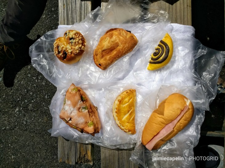
A cold wind blew, though the sky was deceivingly blue. There wasn’t a soul in sight as we got off the train, yens at the ready to pay at the ticket booth in the station, but there was no one there! The tiny village of Kiso-Hirasawa was deserted too, and we found a small park nestled between houses, to sit and enjoy our 7eleven sandwiches out of the wind. The village had a narrow street lined with old Japanese buildings – which were all closed for lunch – Mic likened it to Nizawa Onsen: another ski town, famous for its hot springs. The street eventually met with the main road, adjacent to the Kiso river.
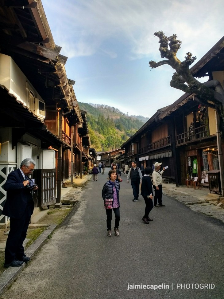
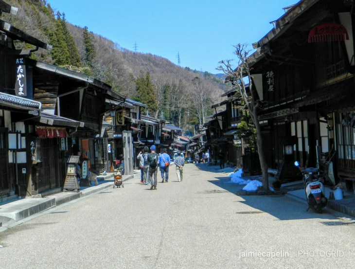
We walked along the highway to the next town – Narai – which took around 30 minutes, and while the walk was rather dull, with trucks passing at high speed and our backpacks cutting into our shoulders, the traditional Post Town was worth it on arrival!
Evening in Narai-juku
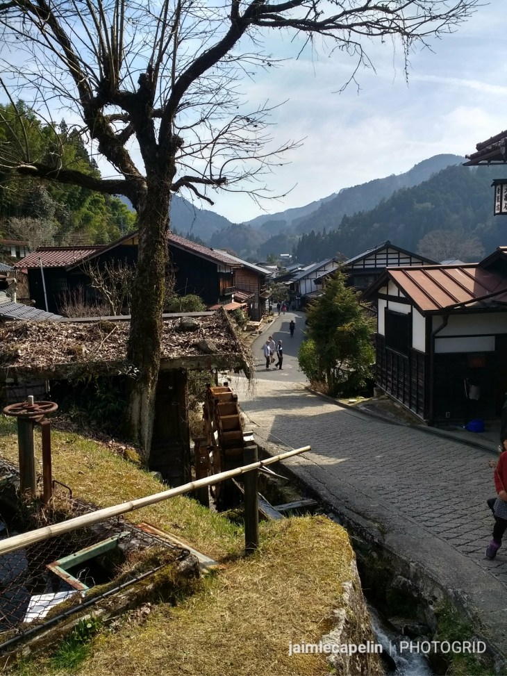
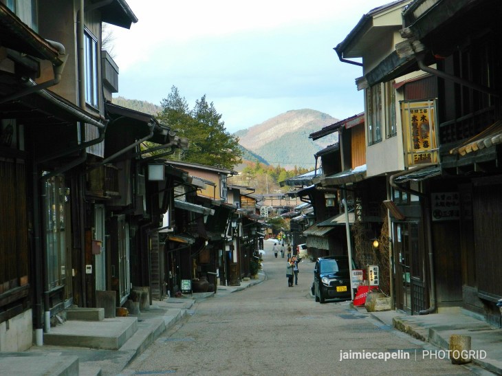
Narai (Narai-juku) is the midpoint of the Nakasendo highway, which connected Tokyo and Kyoto in the Edo era. It is also the northern most Post Town, and still resembles it’s authentic purpose from that period.
~ An Unplanned Detour ~
I really wanted to stay and emerse myself in the ancient Japanese culture, but most places were already closed, and with no space to camp, and no available accommodation, we were forced to move on for the night. The man at the Narai tourist information centre was very helpful, firstly telling us we were crazy for wanting to camp because it was “samui” (cold), and secondly recommending a nearby Chinese restaurant where we could eat before our journey. Mic found a guesthouse two stops away on the train, and although it was a little more than our desired budget, we knew we’d thank ourselves for it later. …Or would we?
Darkness had fallen fast and heavy by the time we’d had dinner, and we caught the train to Harano. “It’s about an hour’s walk from Harano station,” Mic said, consulting Google Maps on his phone. Rubbing my sore shoulders, I smiled and nodded. “No problem!”
More than two hours later, we more or less collapsed through the lobby. The guesthouse was nestled in mountain peaks, at the top of a very long, very steep, very dark winding road. We’d hiked it in the pitch black of night, with just the aid of my head torch, passing nothing but ominous woodland, a few uninhabited houses, and what sounded like mountain rivers and rapids in the dark. Both of us ached; my shoulders and hips were bruised from my backpack, and I was very concerned about the rest of my backpacking plans. It felt like the longest two hours of my life, and there were moments when I didn’t know if I’d ever make it to the guesthouse.
The worst feeling of dread, and fear of letting us both down, was quickly turned into the best feeling of relief, and hope yet. A hot bath, and soft, white linen, fresh on an actual bed with an actual mattress, and a cosy wall lamp mounted above. My head hit the pillow and I was gone.
Morning came, bringing fresh sunshine into the room through the white curtains. We made the most of the included breakfast, realising as we stared out the dining room window, that we were quite literally somewhere in the mountains. A young shiba-inu who’d barked at us the night before, was sunbathing on the porch, and the kind hotel owner agreed to drive us back down the mountain to the train station.
Sunbathing Shiba-inu
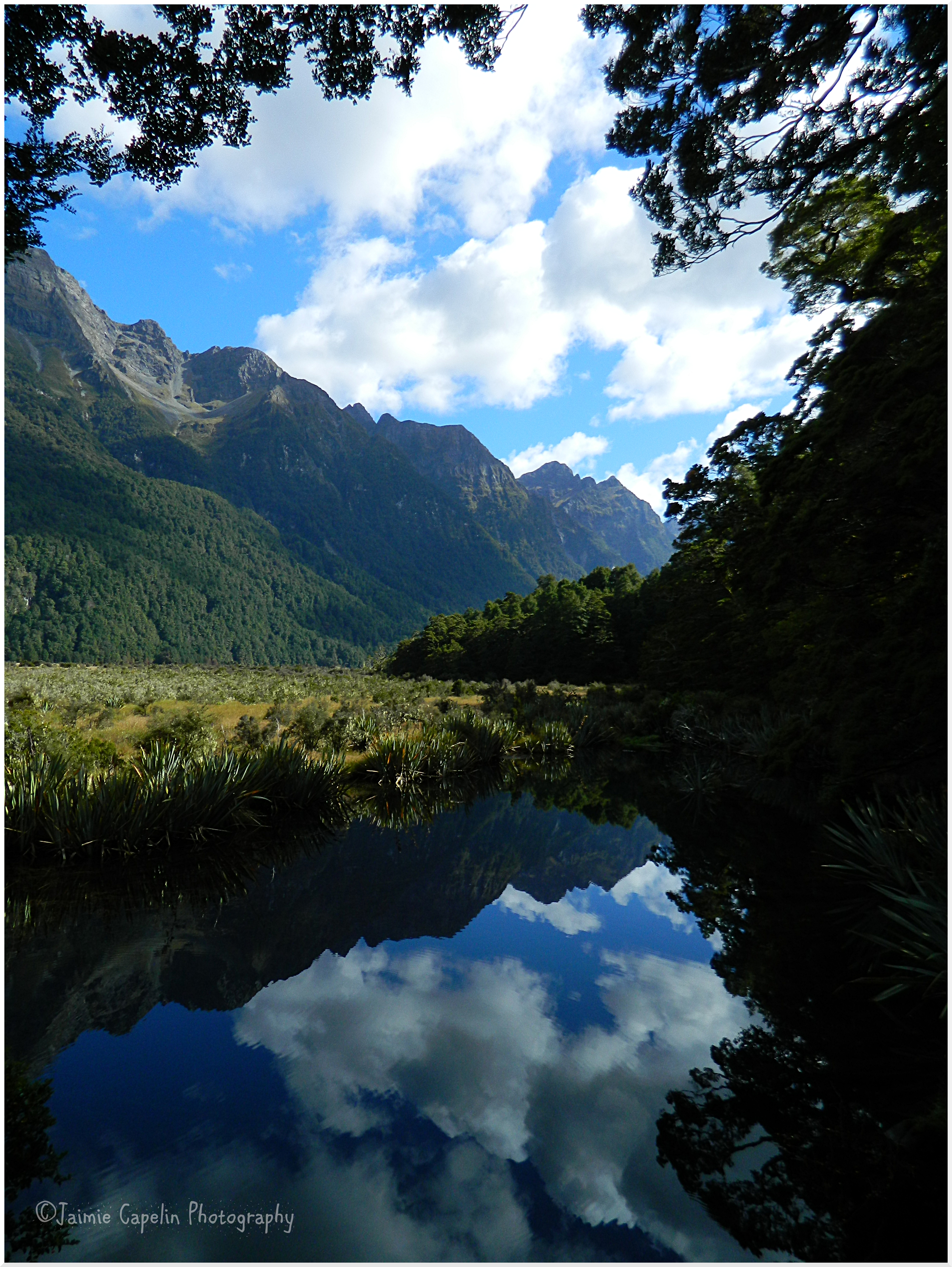
We drove for at least 20 minutes, past peaks and ridges and enormous dams; rivers cascading down into the valley. Our host pointed out a huge, white-capped mountain peak – Mt. Ontake – the second tallest active volcano in Japan, at 3067m. He told us we were in the Central Alps, and we would have had quite a long walk ahead of us to get back on track!
Back at Harano station, we soaked in the warm, valley sun, and gazed up at the mountains we’d hiked the night before, in awe of ourselves! Had it been light when we arrived and we’d known that was where we were going, I don’t think either of us would have even attempted it! The train took us back to Narai, and we continued where we left off.
~ Narai- juku ~
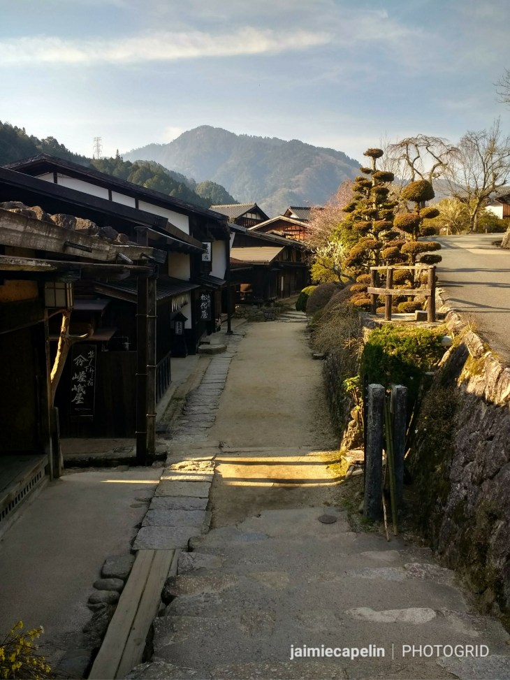
Exploring Narai-juku
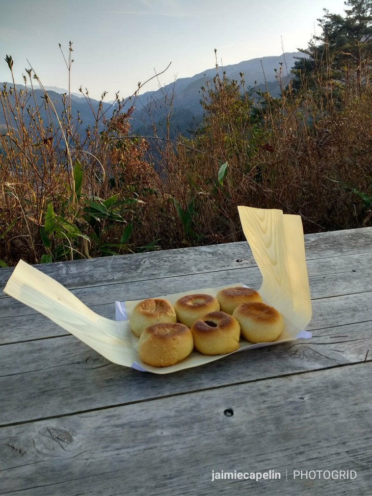
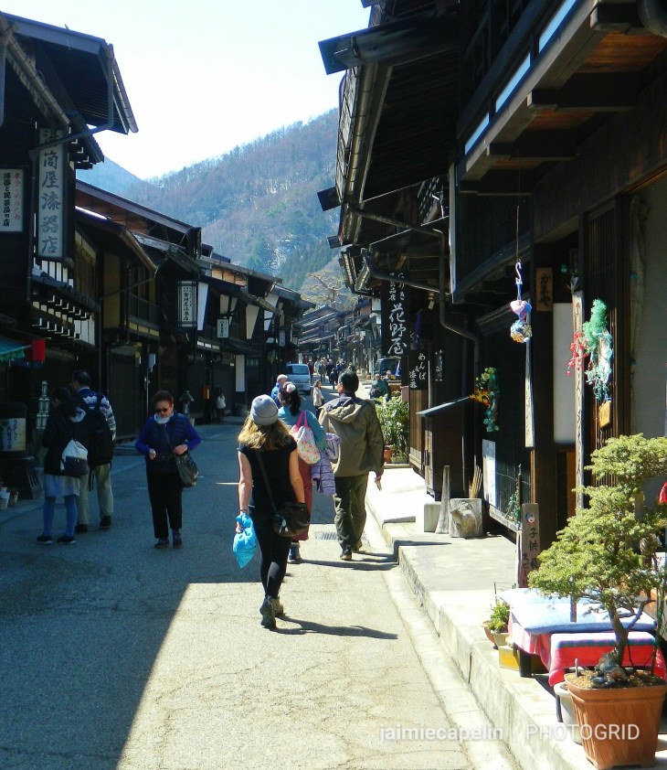
The little Post Town was thriving in the morning sun. All the little wooden shops were open, and tourists were bustling up and down the narrow street, checking out the authentic goods for sale. You can buy lots of traditional, hand crafted lacquerware in the Kiso valley, as that is the region’s oldest trade, and you’ll see it displayed in almost every shop you pass in Narai, as well as homemade flavoured rice crackers, perfect energy snacks for hiking.
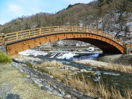
Narai Bridge
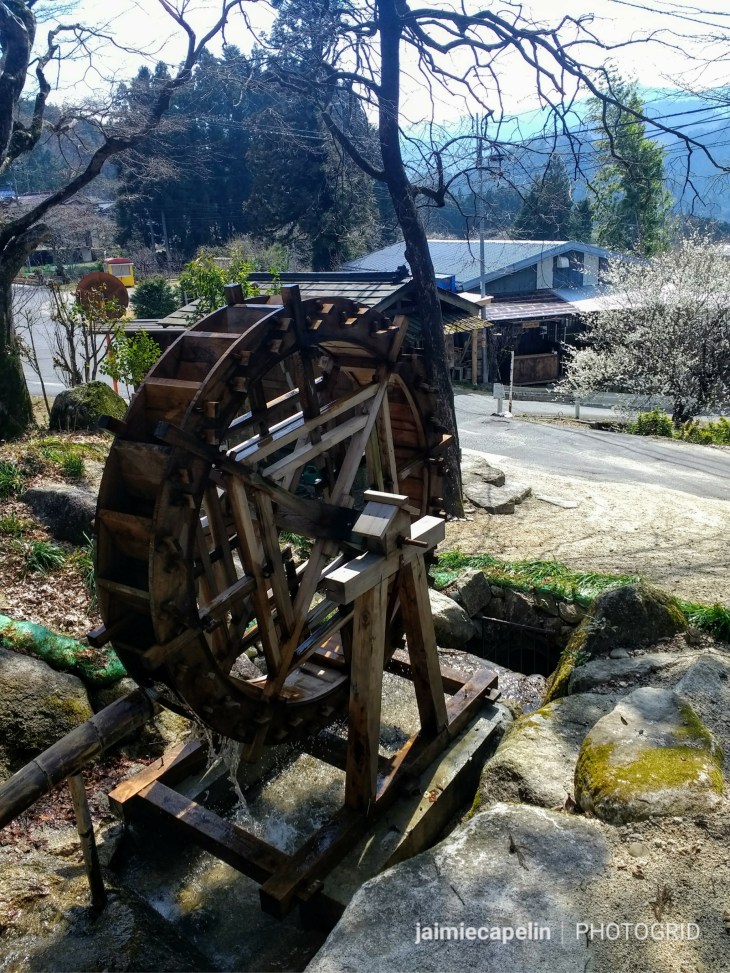
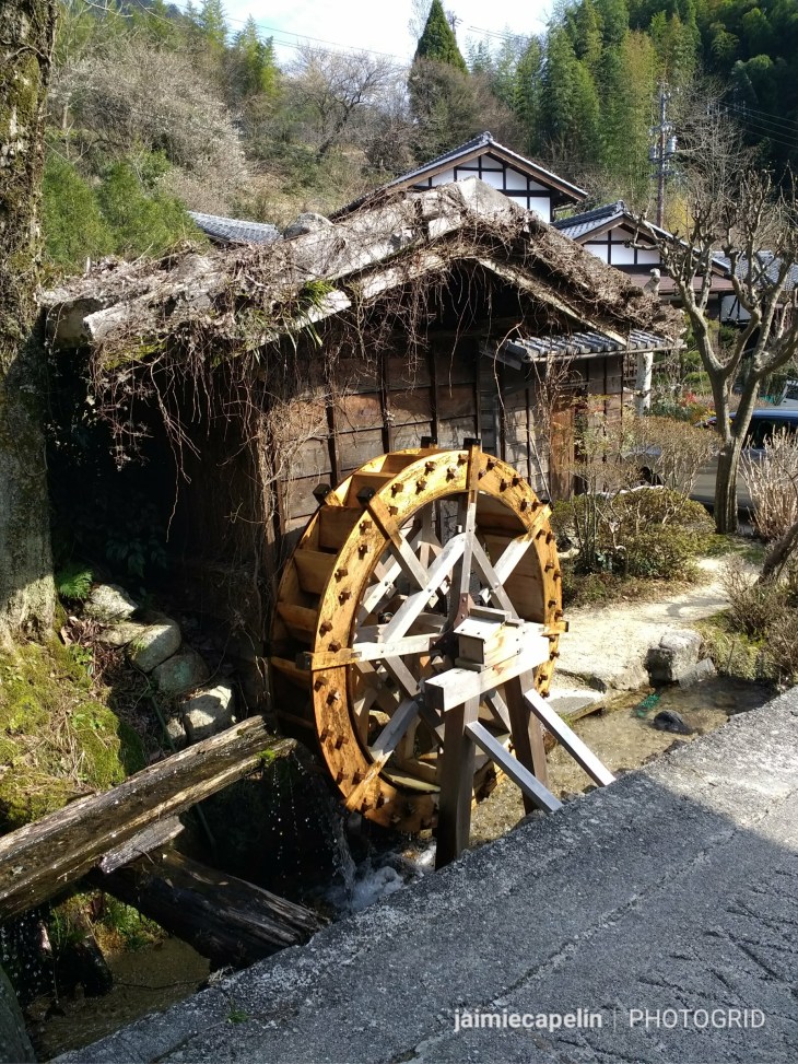
We checked out the arch bridge, inspired by a Japanese drum, and built out of 300yr old Cypress trees, and walked the length of the town, passing six ancient water fountains. We originally thought these fountains were linked to hidden shrines, but on further research, discovered that they are the original water fountains that supplied water to travellers and villagers in the Edo era, and are still very much used today.
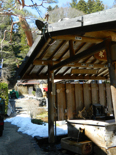
Traditional Water Fountain
Finding a tiny coffee shop along the street, with a door shorter than me, and flowers in baskets decorating the exterior, we decided to go in. We enjoyed some fresh drip coffee and marvelled at the miniature architecture inside the old building.
After purchasing some rice crackers for the road, we headed to the far end of Narai-juku, following signs for the Torii Pass.
~ Torii Pass ~
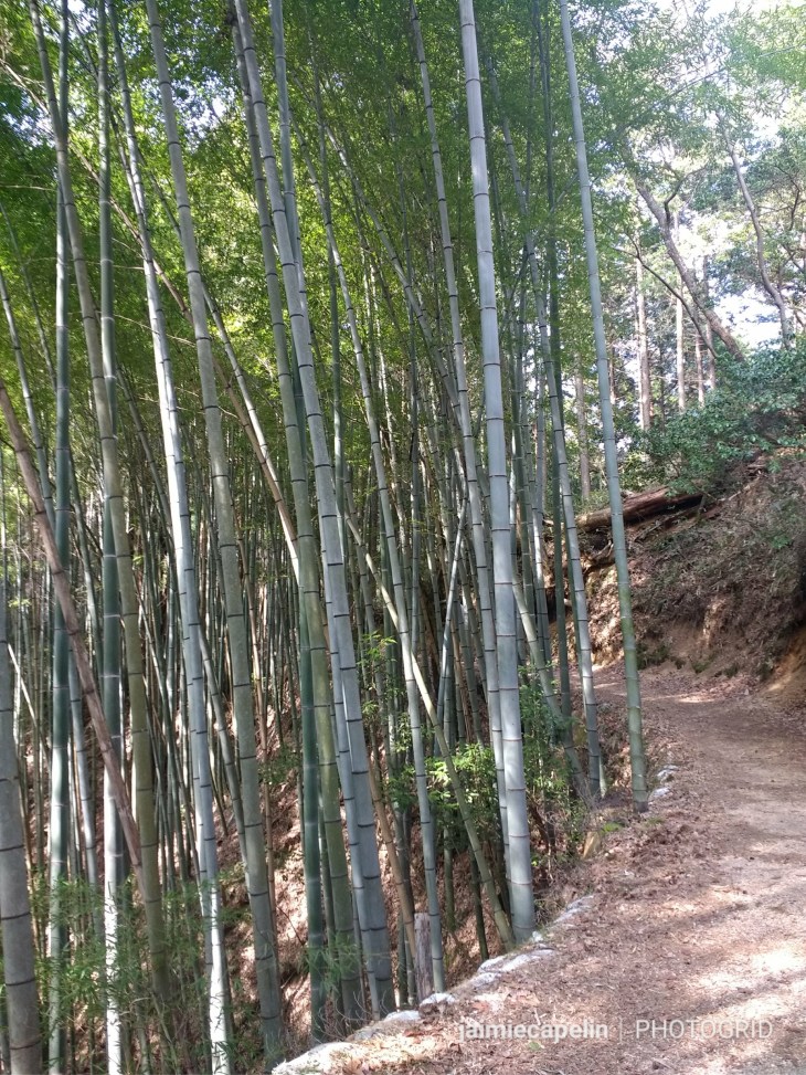
The Torii Pass crosses the mountains between Narai and Yabuhara – the next Post Town on the Nakasendo Trail – and is a steep ascent. It is most popular to do the route in the other direction, as it is slightly more downhill, but it made sense for us to do it backwards from our starting point in the Nagano Prefecture.
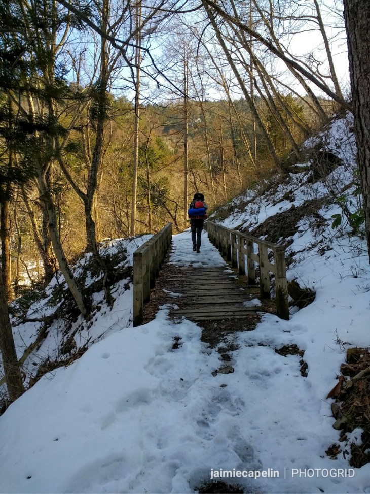
Leaving from Narai-juku late morning, we hiked up the stone-cobbled path, ascending into evergreen woodland, and crossing a gully with a river flowing down it. There was compacted snow on the path from the get go, so with our heavy packs on our backs, (Mic and I had swapped for the day, as his was a slightly better fit, even though they weighed the same) and careful footing, we were slow-going.
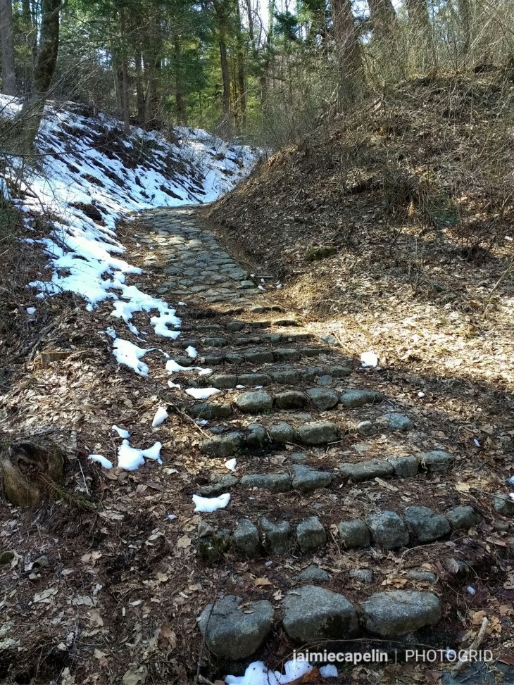
Start of the Torii Pass
Despite the snowy alpine altitude on the cusp between winter and spring, the sun beat down through the trees and we were in shorts and singlets in no time! We passed some Japanese locals who laughed at us, exclaiming that word again, “samui” (cold) while in their thermal fleeces, but in our defence, they weren’t carrying 18kilos on their backs, and they were going down hill! Another couple of hikers passed by, telling us to keep our eyes open for snow monkeys, as they’d just seen some crossing the gorge.
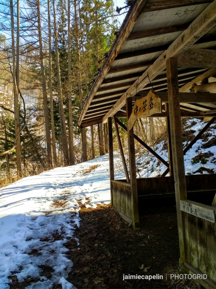
Old Rest House
Passing an original rest house – an old wooden structure like a bus shelter – we paused for a drink before continuing up the strenuous footpath. We turned a corner, and sure enough, there was a snow monkey, clinging to an overhanging branch right beside us, looking right at us before fleeing. Then I started noticing them everywhere, flying down the banks by the dozen, scampering over logs across the river to the other side, screaming to each other, babies in tow. Mic wasn’t as lucky – he wasn’t wearing his glasses.
Climbing the Torii Pass
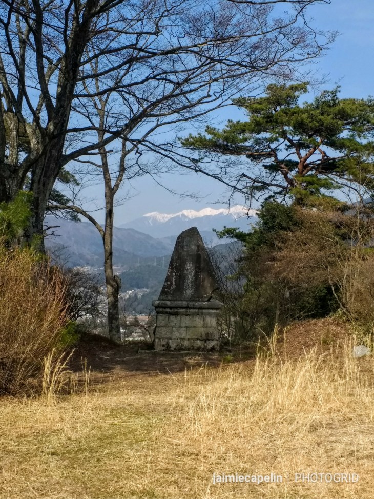
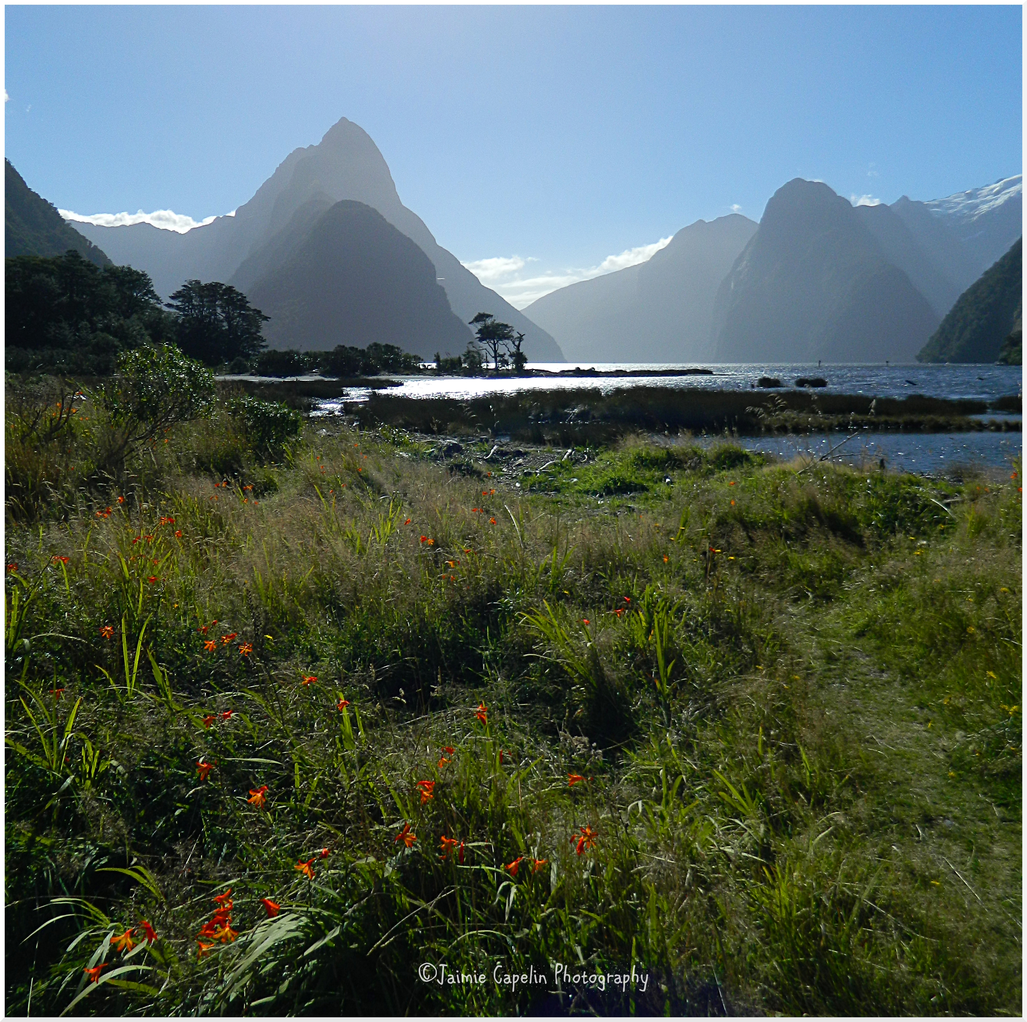
The path zig-zagged higher and steeper yet into the reaches of the mountain, snow and ice underfoot, up to the ridge where the road forked and began to descend to Yabuhara. From the path, we saw a big, stone torii gate, standing atop a mound covered in cedar trees. Climbing the stone steps up, we discovered an ancient, sacred Shinto shrine, overlooking Mt. Ontake volcano in the distance. There is a collection of ancient structures, surrounded by stone figures of samurai and monks, each figurine scattered with silver yen, and silhouetted against the golden mountain backdrop, in the light falling through the cedar trees.
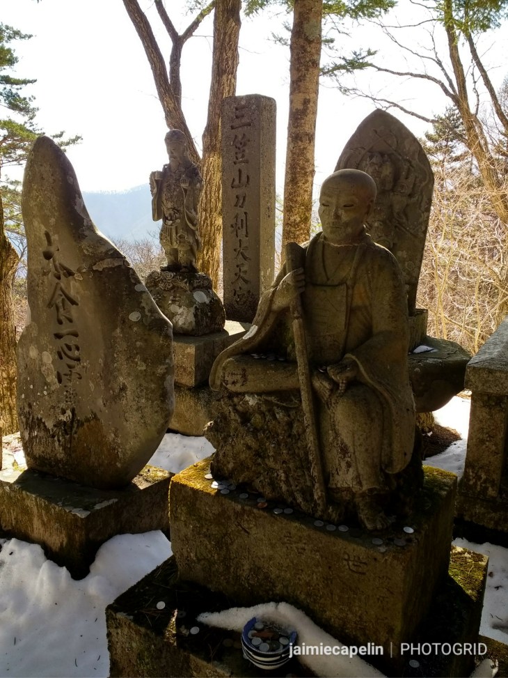
Ancient Monk Statue
The path curved downwards, past postcard views of the Kiso Valley, along treacherous puddles of ice and frozen moss, until it flattened out into a cobbled woodland path, eventually widening into a road that meets up with the highway at Yabuhara. We’d successfully completed the first leg of our Nakasendo journey.
~ Yabuhara ~
Evening was approaching early as the sun threatened to disappear behind a peak, leaving us in the shadow of the mountains. Our backpacks were heavy, our bodies tired, and ducking down a steep, narrow residential road, Mic and I could almost taste dinner on our tongues, following the Westernized signposts for Yabuhara Post Town. Mic had already spotted a sign for a soba noodle restaurant, written in English, and was hungrily saying that he could smash a bowl of noodles!
We arrived at the top end of Yabuhara’s main street, to find it deserted, and the soba restaurant closed. “That’s alright, we’ll find something else!”
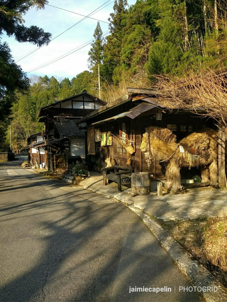
Yabuhara Post Town, like Narai, is a narrow, winding street lined with old wooden buildings. However, unlike Narai, it was more residential, with genuine houses, grocery shops, a clothes shop, a few barbers and a bottle shop. Everything was closed. We decided it was because it wasn’t 5pm yet, and usually restaurants open then for dinner, so we set off to find a camping spot.
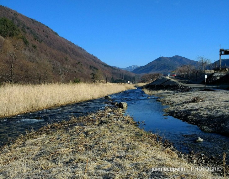
Second Camp
We scoped out an ideal patch on the river bank, and as we pitched our tent, a local dog walker stopped to ask if we were camping there. Mic and I looked at each other nervously, “Hai,” (yes) we responded, and tried to ask if it was alright: “Kyampu OK?” The dog walker wafted the question away with his hand, “Yes, yes, OK, OK!” making an ‘OK’ symbol with his hand. Phew! But then he laughed and shook his head, “samui!” (cold). We all laughed, and he wished us good luck and continued with his walk.
He wasn’t lying. The sun was setting and the temperature was dropping rapidly. Stomachs growling, we walked the length of Yabuhara – we hadn’t eaten since our hotel breakfast in the mountains – even the traditional guest houses were closed. Concern growing, we came across a man who’d just stumbled out of a doorway leading upstairs to the sound of people laughing and singing. “Sumimasen!” (excuse me) Mic said, grabbing his attention, and asking him where we could find dinner. The man doubled over, laughing, shaking his head. “No dinner! No shop!” he said, and then, pointing up the stairs, “Drink! Come, come!” he insisted, and with a shrug, we followed him up into a little bar.
~ Dinner with the Locals ~
Five senior men sat in a line at the bar, each with their own entire bottle of Suntory whisky. The bar lady welcomed us, introducing herself as Mayumi, and the men all budged up so we could sit down between them. Mayumi poured us a glass of whisky each, donated kindly by the man I’d sat next to, and gave us both half a banana. She asked if we liked Yakisoba, and 15 minutes later, she produced two large bowls of noodles, filled with vegetables, seafood, pork, and delicious flavours, and watched with a warm, satisfied smile as we tucked in. I felt like a lost orphan in a story who’d just been taken in by a sweet grandmother!
The evening went on in swigs of whisky, with several phonecalls to wives, telling them to set up the spare beds for a couple of Gaijins they’d just found, repeating that word “samui” over again – too cold to camp. Then the microphones came out, and suddenly it was a karaoke bar! The old chap next to me did a Frank Sinatra duet with Mic, while I clacked some castanets, stifling my histerics!
As the hour grew late, Mic and I put on our jackets and asked Mayumi-chan what we owed. She looked at the chaps, and they all agreed, nothing! A gift from them! Shaking hands and saying “Arigato Gozaimas” (thank you very much) many times, we bid farewell to our new friends, overwhelmed by their limitless kindness, and made our way back to the river for another chilly night. At least there was no snow.
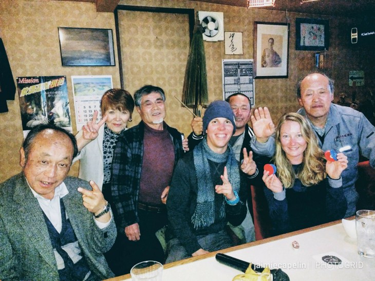
Dinner with the Locals
… To Be Continued …