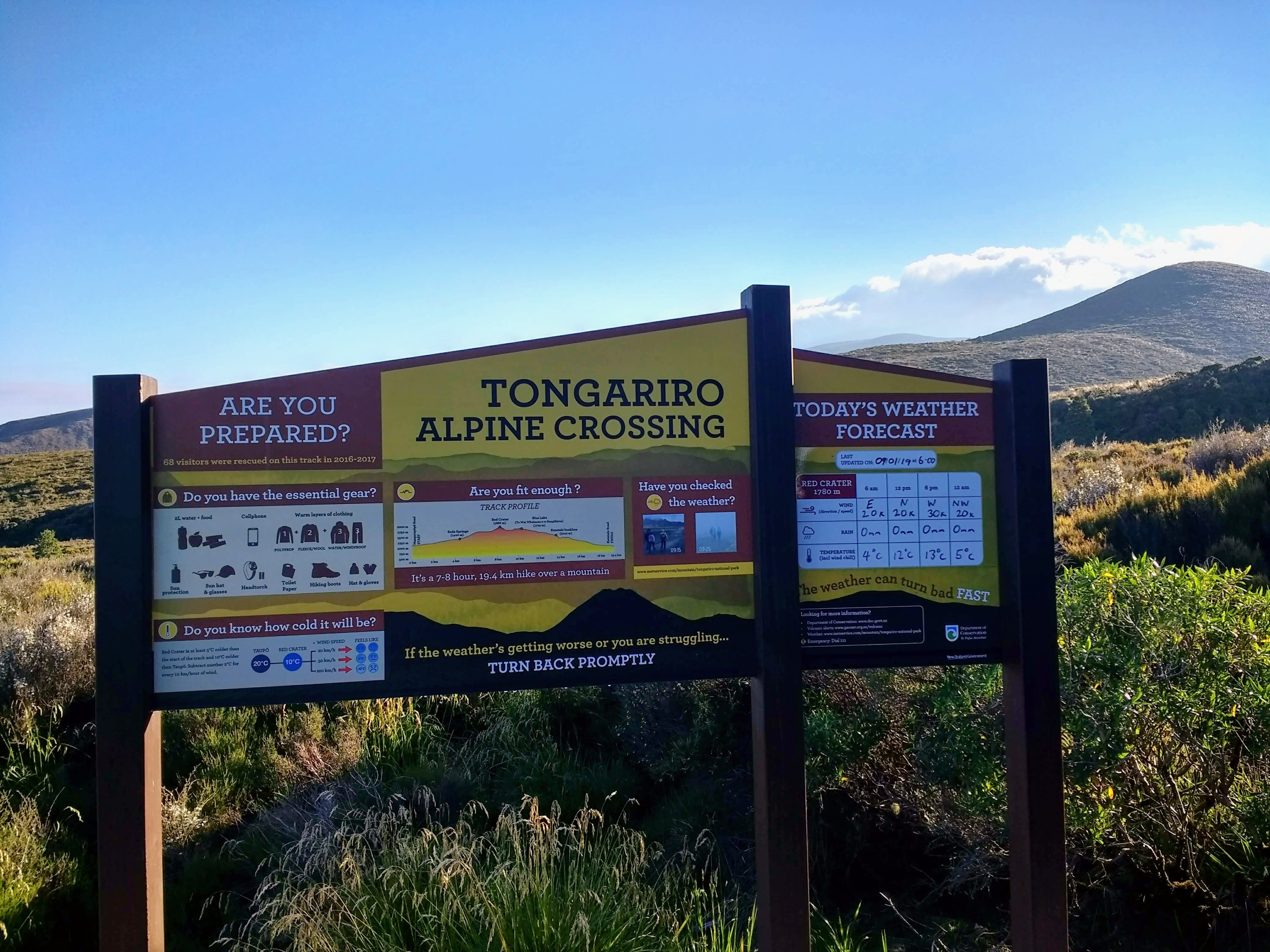
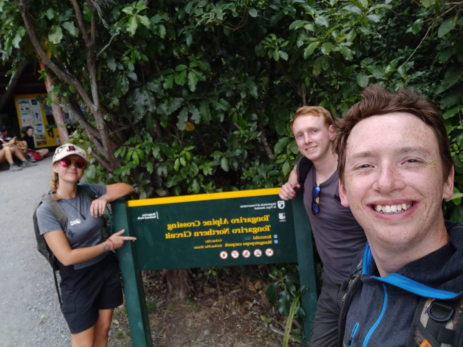
The Tongariro Crossing had been on my bucket list for about 6 years, and finally, in January 2019, my opportunity arrived. Friends of mine, Simon & Mike, two brothers from back home, happened to be visiting New Zealand while I was staying with family there, and so we decided to take on the crossing together. According to my Strava app (which may or may not be accurate) it is about 14 miles (22km), with an elevation gain of about 2,762ft (850m), and crosses between 3 of New Zealand’s iconic active volcanoes. It is recommended that you fully plan the journey, with plenty of water, snacks, sun protection, good hiking shoes with support, and layers of clothing. Always check the weather, as whatever the weather is doing at ground level, it changes fast and will be at least 5 degrees colder at the crater.
A January Day, 2019
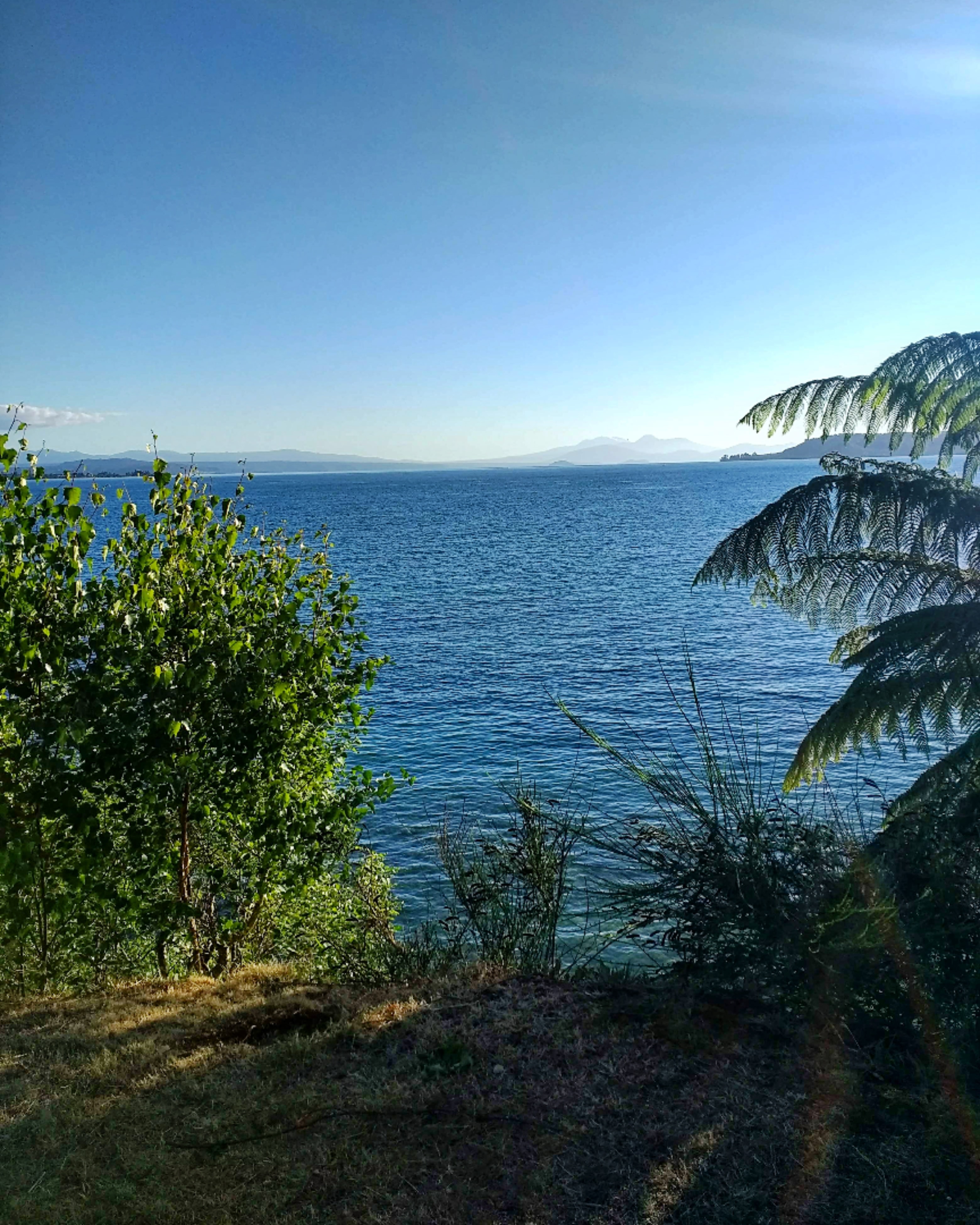
5:30am – Summer Bellbirds ‘pinged’ outside the Turangi motel, on the south side of Lake Taupo, as my hiking buddies and I awoke to make bacon sarnies. After breakfast, we packed up the car and set off beneath the grapefruit sky to Ketetahi Long Stay Car park, about half an hour’s drive from Turangi.
7:00am – We boarded the shuttle bus from Ketetahi Long Stay Car Park to Mangatepopo Hut – the opposite side of Tongariro National Park, to the start of the Tongariro Crossing.
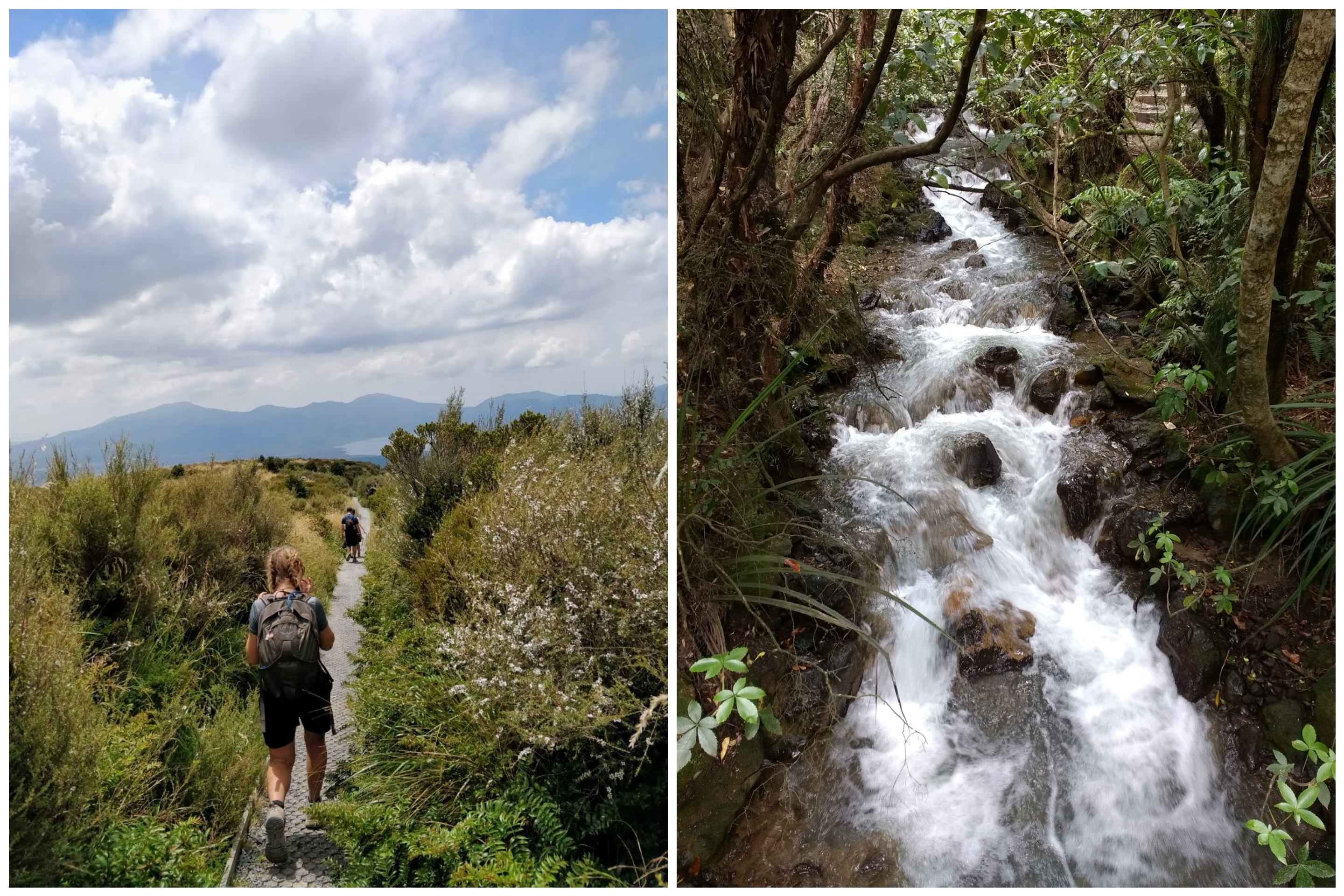
7:30am – 5°c, clear, light winds – As the sun hid behind the mountains before us, we checked all our gear, stretched our legs and used the facilities. We began hiking, gently climbing the grassy hillside, the sun making its glaring appearance over the crest and quickly raising the temperature to T-shirt weather. Through the sulphurous pumice fields, we hiked, where white daisies sprout from the rough, black earth.
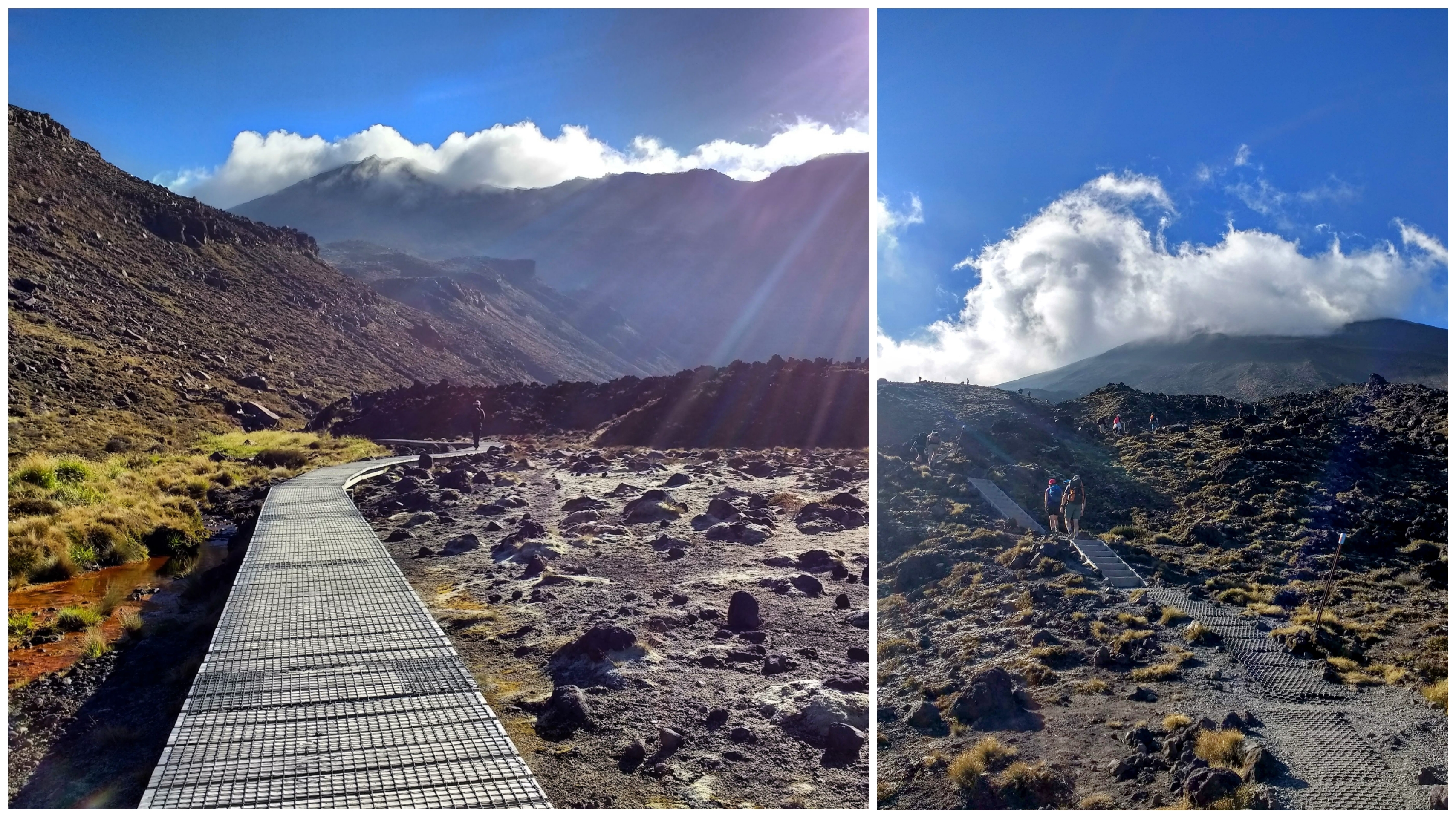
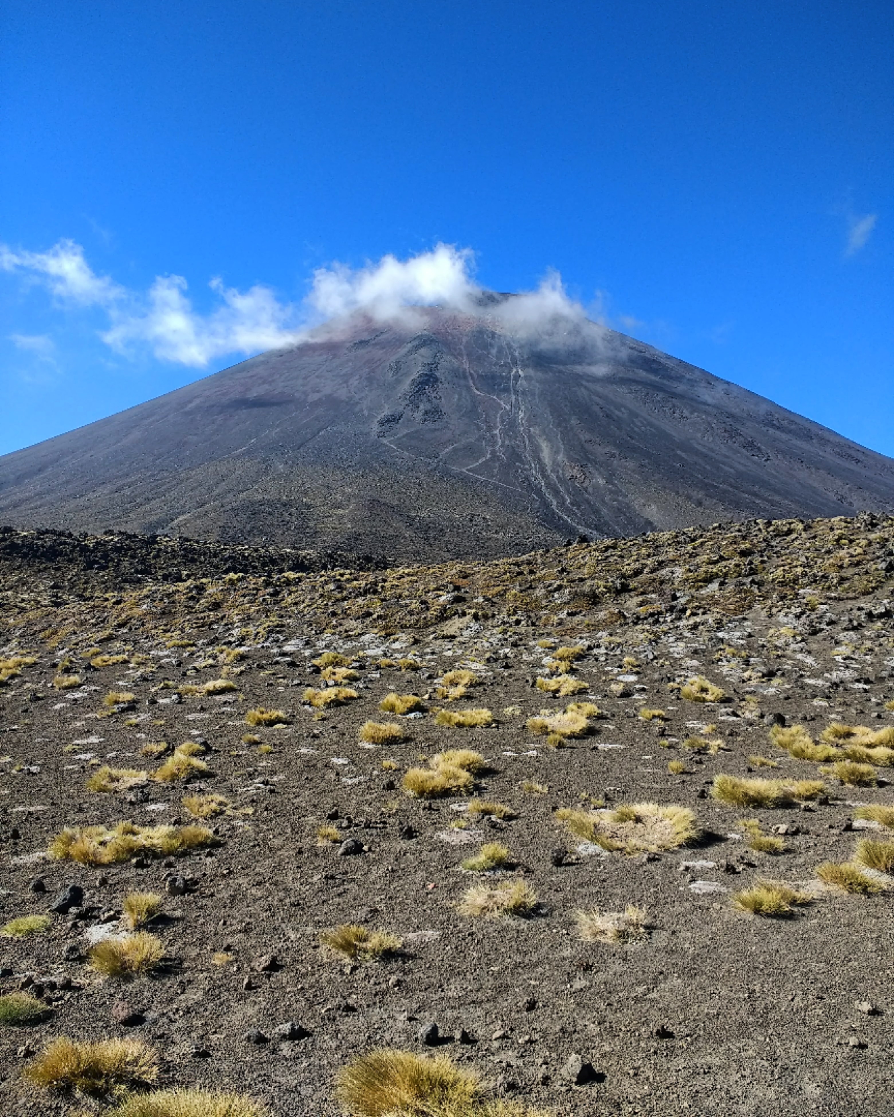
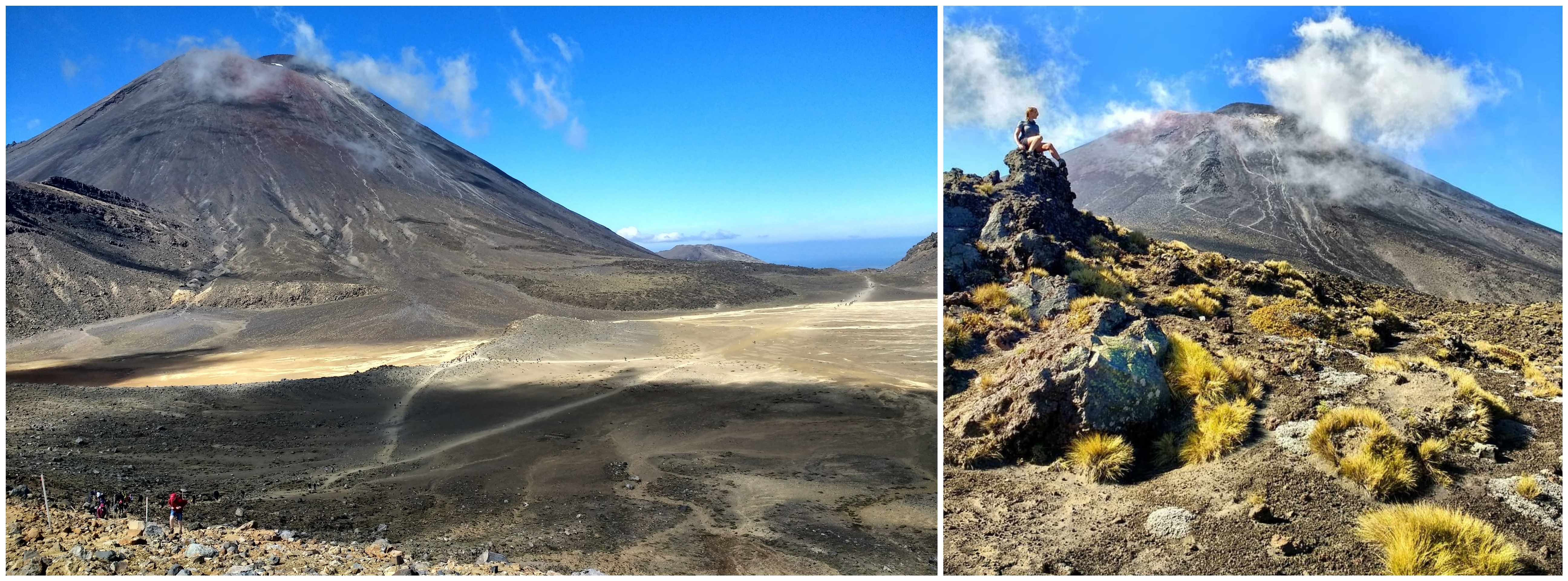
The path led onto a boardwalk, which crossed the silty plains of strange moss, framed by dark, jagged rock. Mount Ngauruhoe – known for portraying Mt. Doom in Lord of the Rings – loomed over the pathway, puffs of mist unfurling from its craters, casting its long, morning shadow over the landscape.
We began to climb; rock and man-made steps paving the lung-squashing incline. As we did, a panoramic view of the vast national park stretched out behind us.
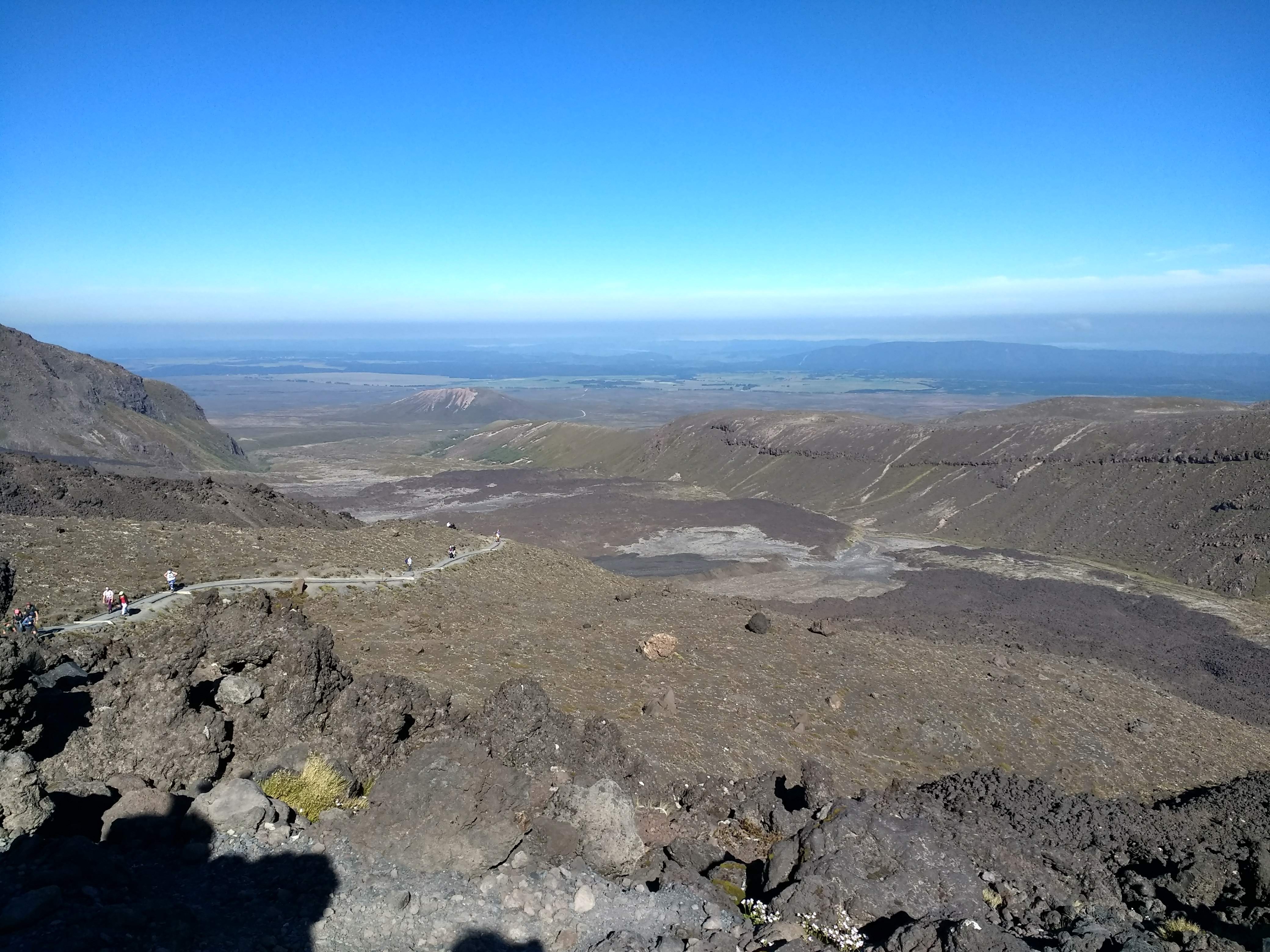
Suddenly we were level and a giant plateau of sandy rock appeared before us, surrounded by an uneven black rim. We followed the trickle of hikers across the plateau, at the foot of impressive Ngauruhoe, and began to scale the lip on the other side.
A fast, thick fog was moving over the summit, so we paused on the steep side of the lip for lunch. The air quickly became cool and dark, and it wasn’t long before we, and fellow hikers around us, had donned thermal jackets.
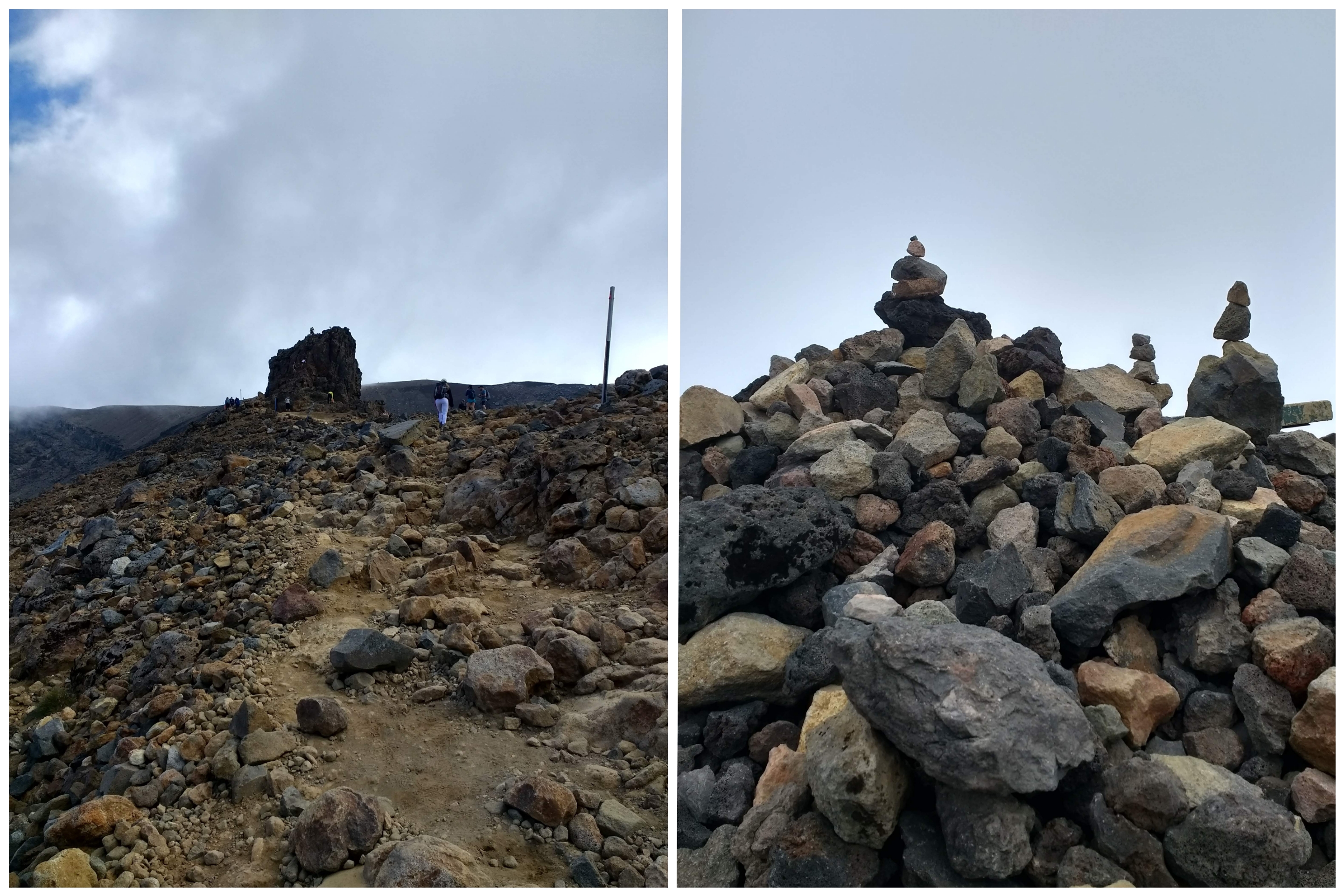
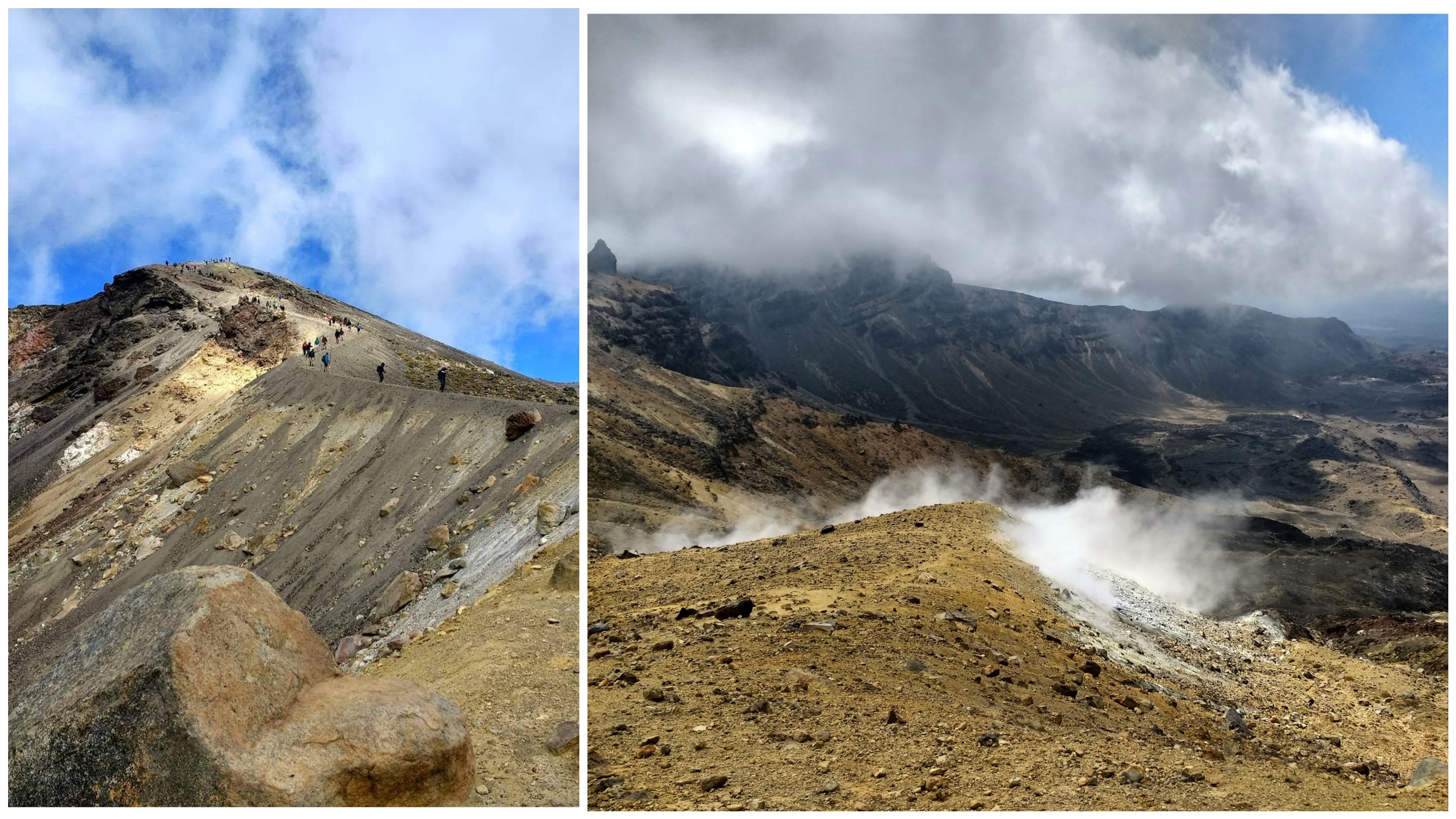
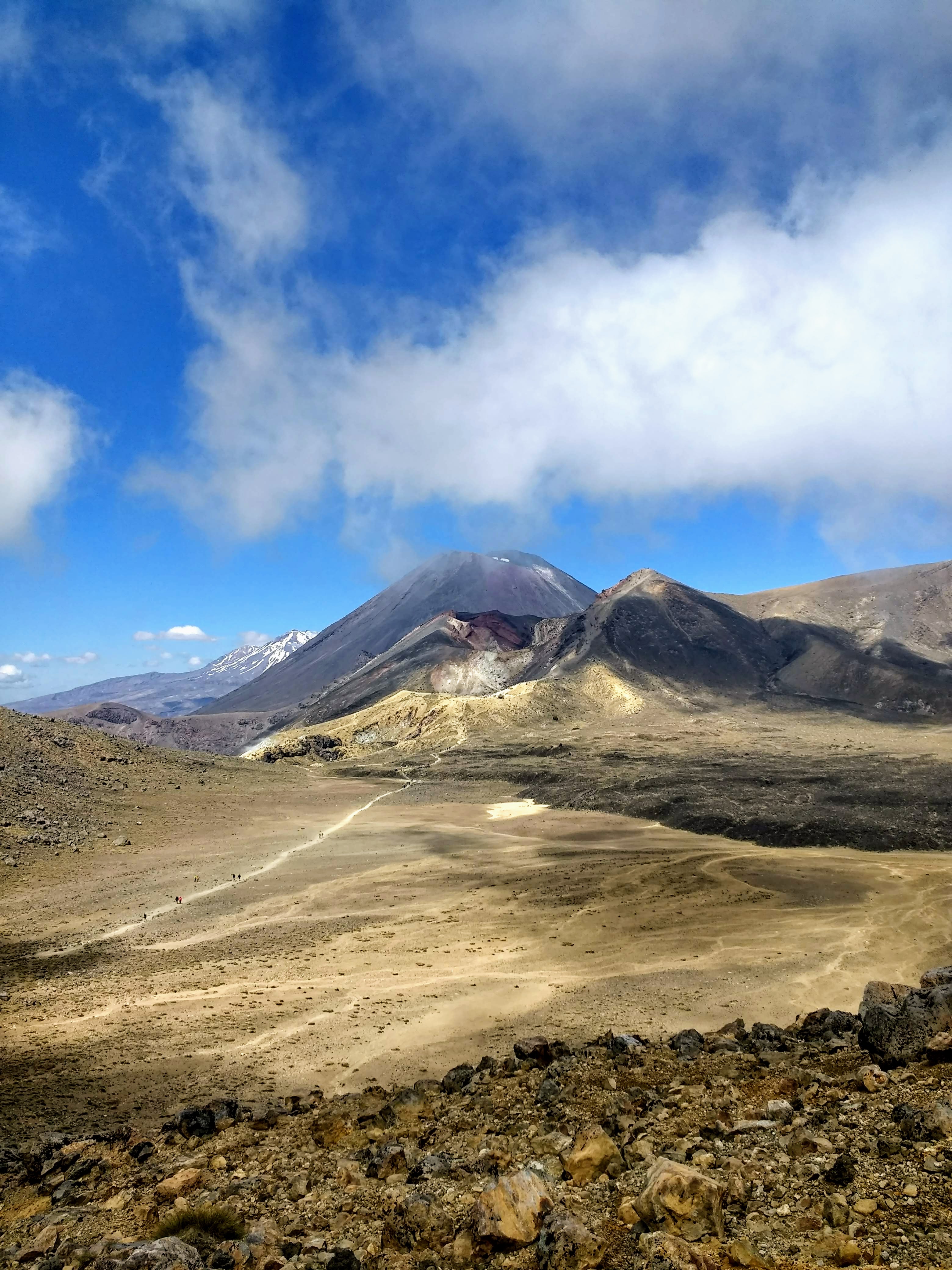
The route up is a treacherous combination of loose scree and sand, on both sides of the summit of Tongariro’s Red Crater, making footing impossible, and you have to kind of cross country ski your way over. At the top, a huge mound of rocks and pebbles marks the summit, built over the years by each hiker adding a stone. You feel like you’re on the edge of the world, especially when you can’t see through the dense fog!
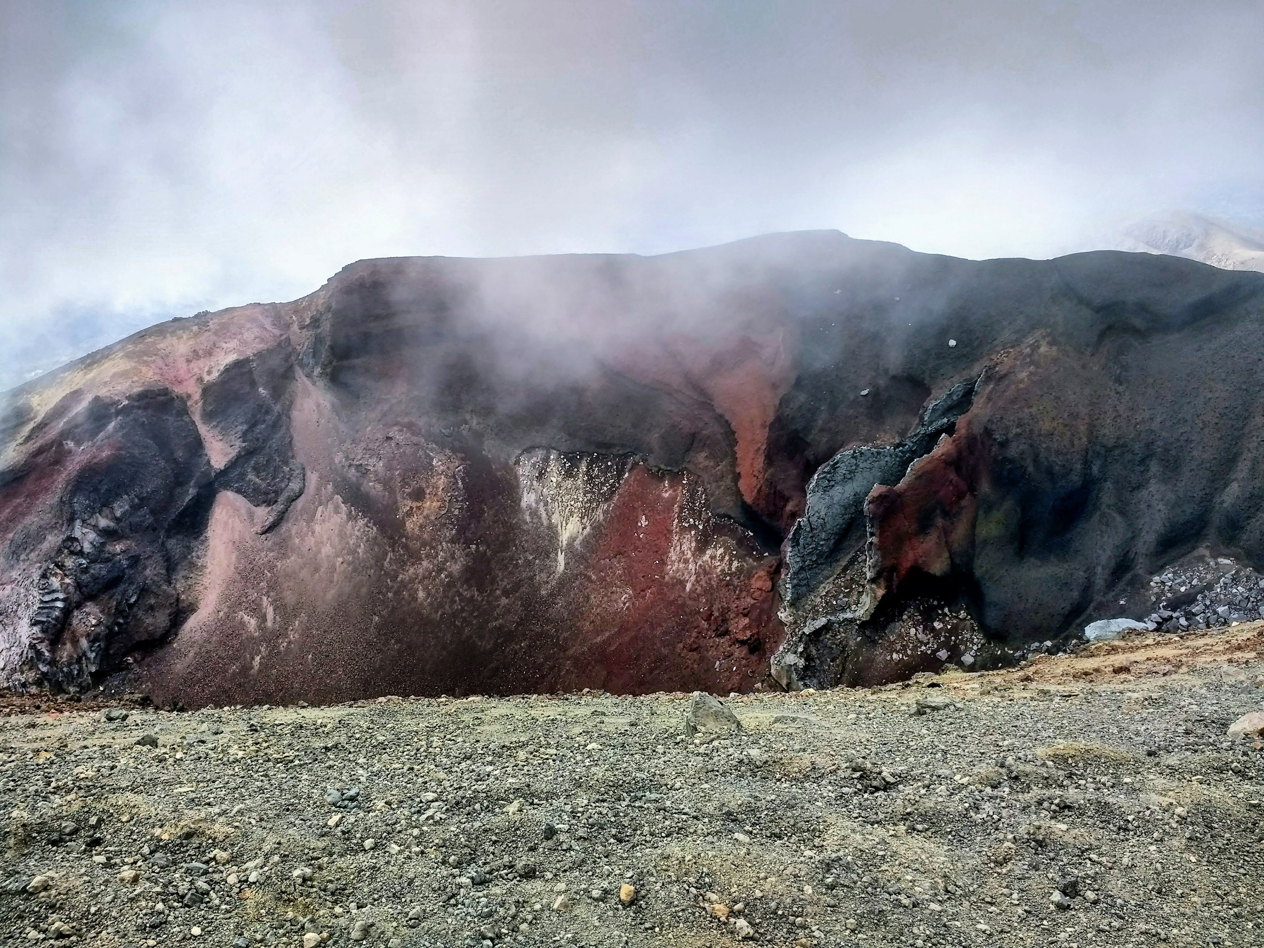
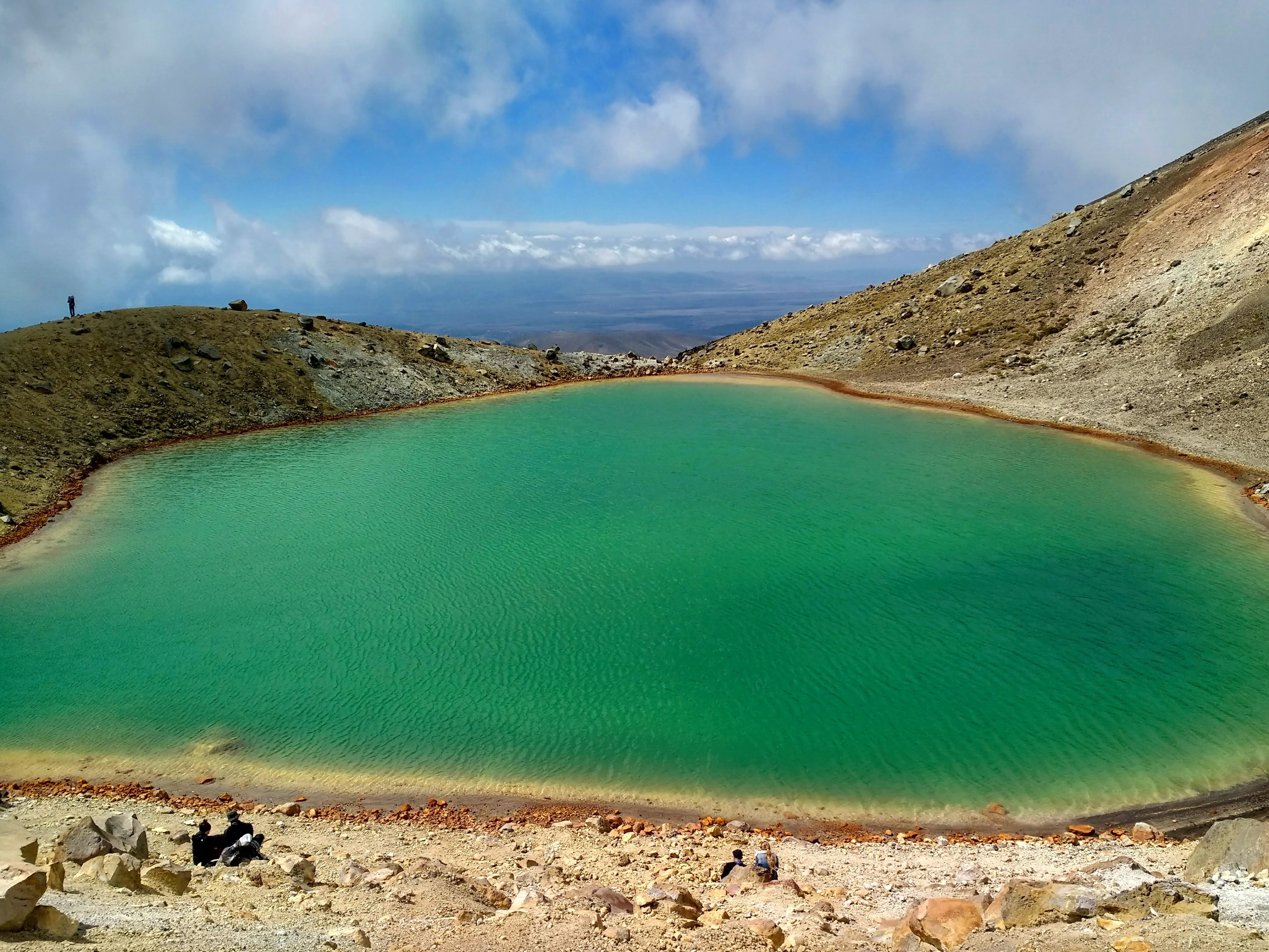
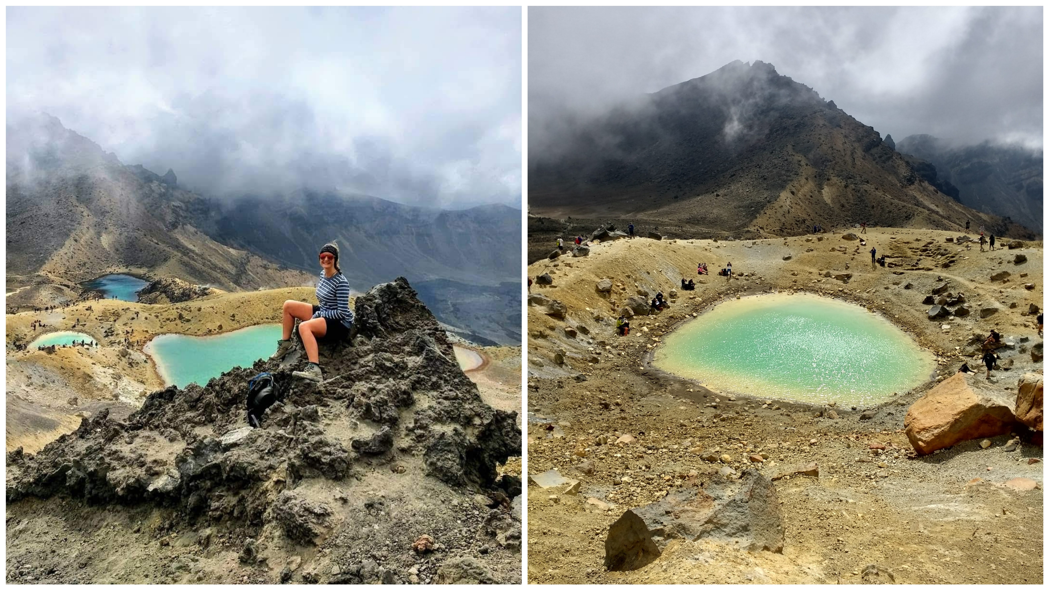
Skidding down the other side, the fog began to break, revealing the dramatic Red Crater. Clouds rushed over the landscape, thinning more and more until the brilliant Emerald Lakes shone through, patchy sunlight glistening on their surface.
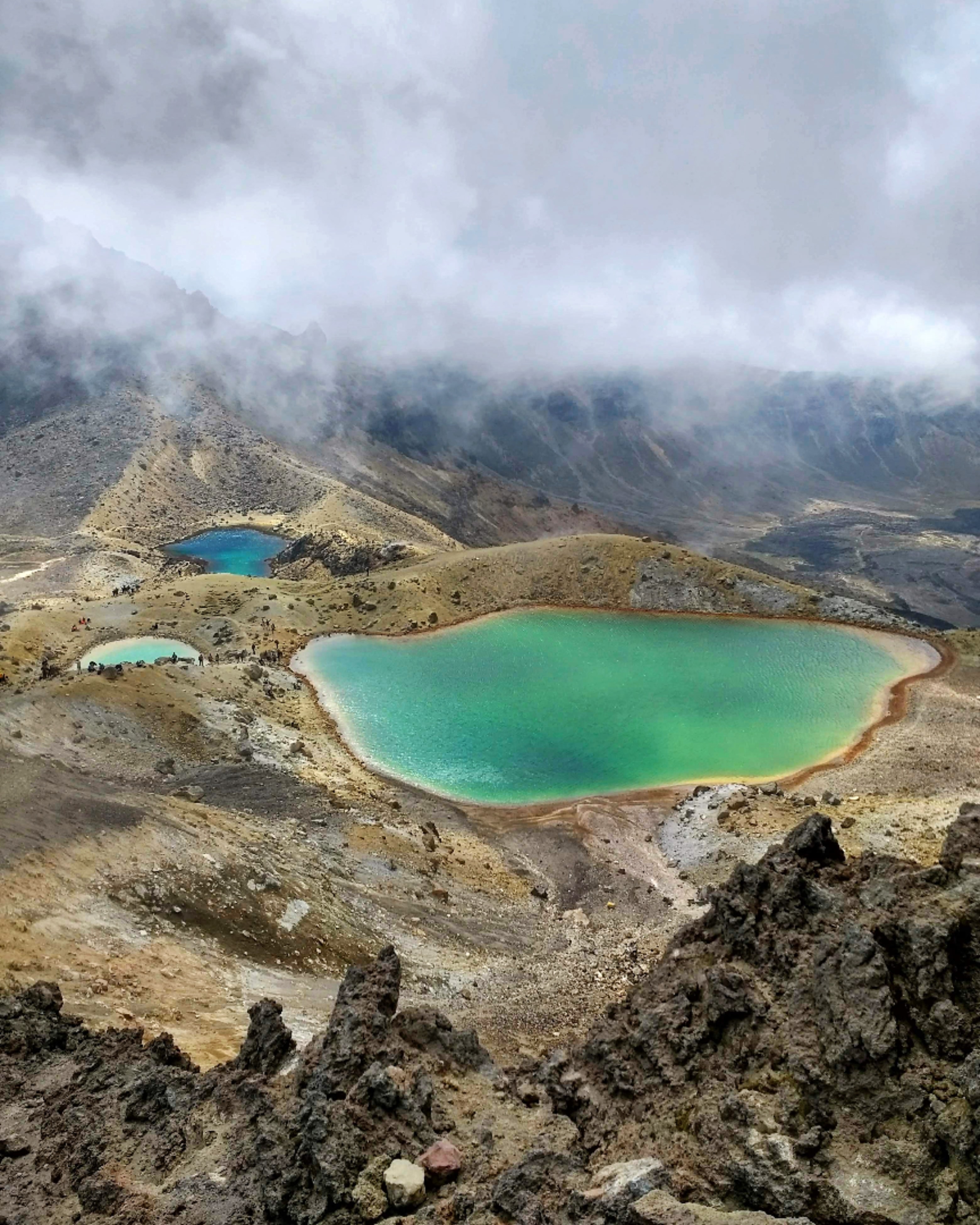
This is it – the iconic view of the Tongariro Crossing. The national park is a stretch of green, far and wide, all the way to the horizon where it meets the blue, fluffy clouded sky. Mountains drop down to hills, rainforests, rivers and vast plains. On the edge of the foreground three emerald and blue lakes stand out from the grey, volcanic rock, regardless of the weather. Curls of steam rise from the rock all around, that rich, boiled egg smell filling your nostrils.
We continued across the next plain, looking back on the three iconic volcanoes lined up like a postcard; Tongariro – jagged and broken at the forefront, Ngauruhoe – the perfect volcano shape in the centre, and snowy Ruapehu peeping out from behind.
The walk down to Ketetahi is a neverending zig-zag, through bushland and rock, which never seems to get closer to the end. Lake Taupo shines on the horizon below, before the path eventually drops into rainforest, and quickly descends down wooden steps, joining a cascading river down to Ketetahi.
2:00pm – 13°c, sunny – Once we reached the Ketetahi end of the Tongariro Crossing, it was another 20min walk along the dusty road to the Long Stay Carpark. The hike back to the car felt long, but far from disappointing! The landscape is marvellous, and there’s plenty of nature to see; we were three satisfied & very happy hikers. Our moving time was about 5 hours, all the photo stops and snack breaks made it much longer, but why rush through an experience like that?
Our Tongariro adventure ended at the car park, where the car wouldn’t start, and the next adventure began – getting home!