Okinawa, Japan – A Series of ‘Not Ideal’ Events

Okinawa is the last place I visited in Japan before flying back to the UK, and therefore the freshest to write about, which is why I have chosen it as my first Japan blog.

It is the biggest and most populated of the Ryukyu Islands, half way between mainland Japan and Taiwan in the East China Sea, and is home to Japan’s most critical American military base. Okinawa is quite different to mainland Japan, and wasn’t altogether what I expected…

I was travelling from Osaka city with two companions from the previous season, Taylor and Mic, and after several weeks of backpacking, all three of us were ready to sit on a sunny beach on a tropical island and relax. We’d planned our routes and times thoroughly, and were feeling pretty confident. Here, it is probably important to note that Osaka has two international airports, and they are nowhere near each other. Kansai Airport is where you’d likely catch a flight to Okinawa from, while Osaka International is the one Google Maps will default to, if you’re not quite specific enough… We went to the wrong airport.

A hair raising, hour-long taxi ride later, (worth more than the cost of our flight), we arrived at the RIGHT airport, about 3 minutes too late. The budget airline were able to put us on the next available flight, which was roughly nine hours later. So our first day in sunny Okinawa was spent in Kansai Airport’s domestic terminal. Not ideal.

Fortunately, nothing went wrong with our flight. The runway staff finished loading the luggage hold, stood in a line beside the plane, and bowed in unison, waving us off in true Japanese fashion as we taxied to take-off. Our flight took about 2 hours, with stunning in-flight views of the sunset, before descending over the twilit islands of Ryukyu. Our plan was to catch the bus into Naha city, near to where our pre-booked Air bnb was located. However, we’d arrived nearly 10 hours later than expected, and the island’s public transport isn’t very forgiving… We’d missed the last bus to Naha by minutes, and had already spent half a week’s budget on taxis that day, so, with a heavy sigh and some uncertain giggling, we adjusted our backpacks and began the two hour trek beneath the stars into the city.

At least it wasn’t raining. In fact, the temperature was noticeably warmer than mainland Japan, and despite the heavy luggage and worn out bodies, the walk was quite pleasant. We eventually reached our Air bnb, (via a supermarket for some instant noodles) and after a fairly disappointing shower, and an even more disappointing “instant” dinner, (which required the miniature kettle to be refilled three times), it was time to call it a day. Taylor went to close the sliding doors dividing the rooms, and found that only one door moved, sliding uselessly in the middle of the large door frame. He peered through the wide open gap, and let out a slightly maniacal laugh.

“That’s not ideal,” Mic said.

PhotoGrid_1525819526921

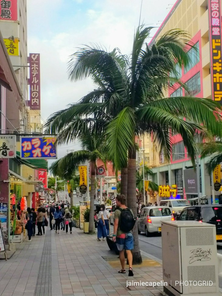
~ Kokusaidori Street ~

Morning came with the sound of birds twittering in the trees, and the shush of traffic a couple of blocks away. There was a bit of blue in the sky, and it was bright and warm. We drank the free coffee provided by the Air bnb, and took off down the road to the main international strip, about 10 minutes away on foot.

Kokusaidori Street – noise; both visual and audio – sales men and women attempt to catch your attention at every shop entrance, ornamental dragons in multi-coloured pairs line the displays in all shapes and sizes. Novelty toys, mugs, T-shirts, and generic holiday paraphernalia fill your peripherals as far as the eye can see. Enormous jars of habu sake, (rattle snakes drowned in Japanese liquor) stand in stacks, going for 400,000 yen a pop, the snakes inside hissing silently at by-passers. Fiberglass fronted restaurants boast of rare delicacies; puffa fish gawp out from tanks. We even saw a very small tank outside a seafood restaurant, with a live turtle in it – I quickly walked on and tried not to ask too many questions.

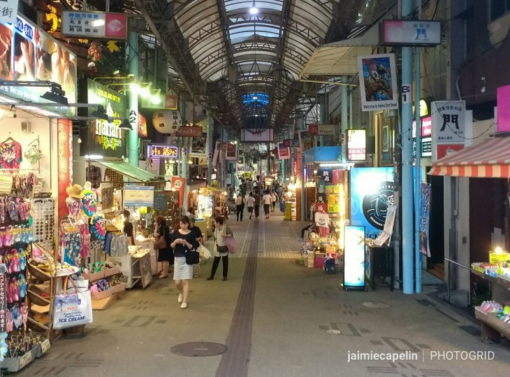
Following the street up, we turned off beneath the canopied Heiwa dori Street, through a network of arcades and alleys lined with street sellers, leading into the wonders of Makishi Market, where Okinawa’s strangest delicacies can be found. We stumbled upon the seafood hall by meer accident, filled with stalls and restaurants of all kinds. A grid of long tables laid out like an enormous canteen, played host to hungry punters, while lobster, squid, fresh fish, shellfish, everything you could imagine, was served on platters shaped like small boats!

PhotoGrid_1525819601886

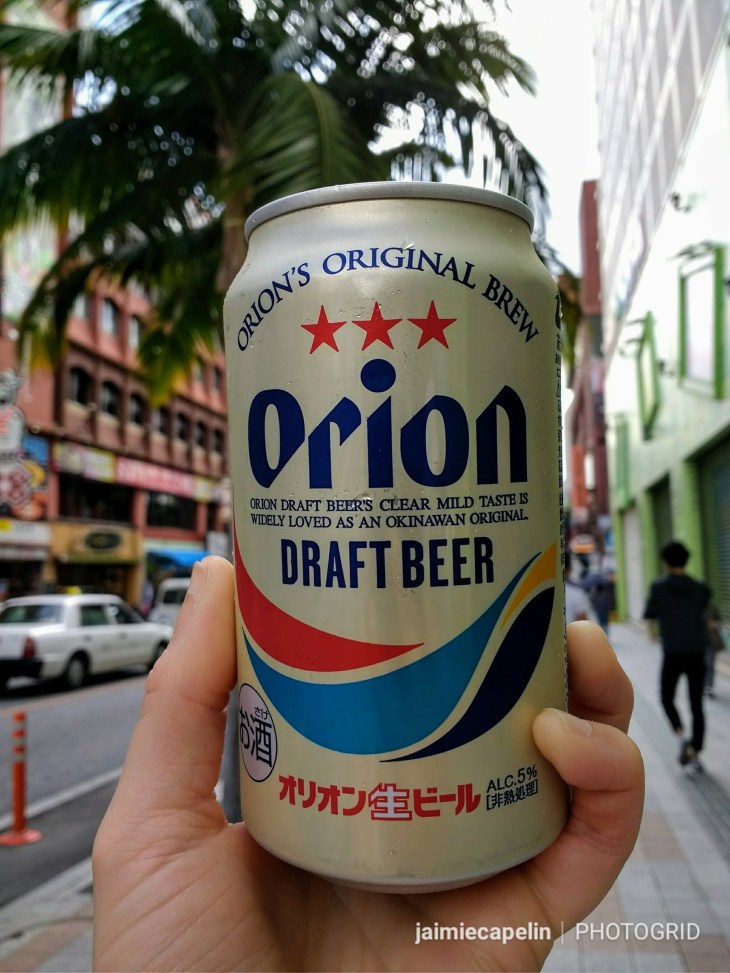
At the intersection marking the end of Kokusaidori Street, we discovered an underground food hall in the basement level of the Ryubo building. We browsed the deli counters, bakeries, fish mongers, and enjoyed a varied lunch, accompanied by special blend coffee, and topped off with some delicious Japanese beer from the world craft beer counter. Happily satisfied after a good feed, we headed back outside, eyes directed at the sky in hope of beach weather! Unfortunately it was windy and grey, (though we had no idea what was in store for us) so we continued to browse Kokusaidori street, soaking up the bustling atmosphere with a local ‘Orion’ beer in hand from one of the many Lawson’s convenience stores.
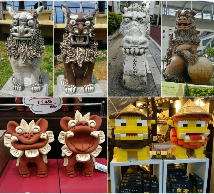
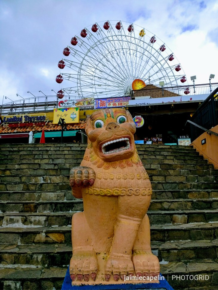
PhotoGrid_1525817480981

~ Shisa Dogs ~

These goofy looking statues are everywhere, bearing similarities to Chinese Dragons, they are somewhere between a lion and a dog, and these are the little trinkets that fill every souvenir shop. Shisa Dogs are a Ryukyuan tradition from Okinawan folklore, believed to protect places from evil, and are often seen on rooftops, or guarding the entrance to most buildings. They always come in pairs; the right-hand Shisa Dog has its mouth open to ward off evil spirits, while the left-hand one’s mouth is closed to keep good spirits in. Often the pairs have cheeky facial expressions, and are depicted to be cheerful and amusing, sometimes painted in vibrant colours, reminding me of Disney’s ‘Stitch.’ The Shisa Dogs were one of my favourite things about Okinawa, giving the place a little touch of character.
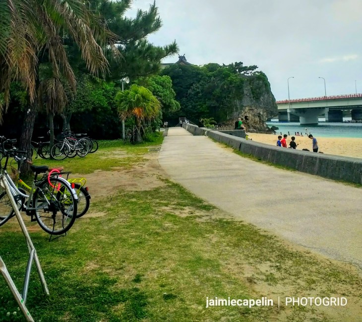
PhotoGrid_1526156957197

~ Naha Beach ~

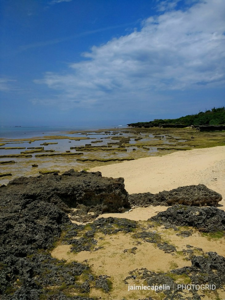
Advertised up and down the main strip as one of Naha’s hot-spots, it was quite amusing how unspectacular it was when we arrived! However, despite the small radius of beach, surrounded by concrete walls, and the noisy highway bridge crossing the water, the sand is clean and white, and the water is crystal clear. A sectioned off lido protects swimmers from box jellyfish, and a lifeguard patrols the beach. Trees fill the park behind, where dozens of stray cats frolic in the grass, prowling on picnics. The facilities also include toilets, showers, and even a hire shop for all your seaside needs, from parasols to inflatable tyres. Apart from sunshine, what more can you really ask for?

PhotoGrid_1525819483307

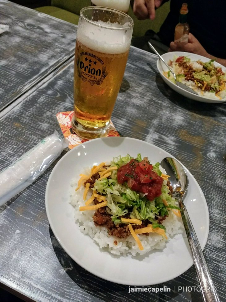
For dinner we found a pub serving Taco Rice – an Okinawan dish coining taco filling, and Japanese rice. Finished with a big dollop of salsa, it is a blander version of chilli con carne; a sort of Japanese/American compromise, washed down with a refreshing glass of Orion.

PhotoGrid_1525817300790

The night took us to a penthouse bar, where we couldn’t figure out what language to order our drinks in. With the only other customers being American, and the bar girl responding to my broken Japanese in English, I felt like a proper tourist! The boys smashed out a game of Foos ball, I destroyed a game of jenga way too early on, and we all found out the hard way that you should never strawpedo Guinness!

~ The American Village ~

It’s super easy to hire a car, as long as you have your international driver’s license, passport, and a better sense of direction than us. We went to the airport on the monorail – which loops Naha city on a regular basis throughout the day time – to find the best selection of car hire. After walking around the terminal, looking in all the wrong places, we couldn’t for the life of us find a car hire desk! Of course, it was really easy, slap bang in the middle, impossible to miss, and once we got there, we simply picked our price range, chose our insurance policy, and hopped on a shuttle to the depot. After a quick exchange of details and money, we were given our car – a little white cube on wheels. These little Japanese cars don’t have much of a kick, and the top speed limit in Okinawa is 60kmph, which makes driving very economical and cheap. As there are no trains around the island, and buses can be irregular and expensive, hiring a car is definitely the best value for money.

PhotoGrid_1525817518881

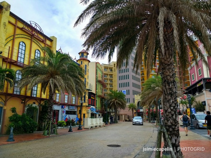
Heading north, we joined the highway out of the city. The landscape rose and fell, every inch littered with white and grey tower blocks, as though several boxes of starwars lego had been emptied across the land. As we approached the American Village, fast food restaurants began to pop up by the dozen alongside the highway; McDonalds, KFC, Dominoes, Denny’s, and so on and so forth. Pulling up in the village, it was like stepping out into one of those replica towns at Disney World – each building with a brightly painted facade, and palm trees spaced neatly between perfect paving slabs.

Making a bee line for coffee, we entered an arcade of cafes and restaurants along the waterfront promenade. We were welcomed at the door and shown to our seats in American fashion, by a smiley, English speaking waitress, where we enjoyed perfectly rosetta’d lattes, watching the moody weather roll in off the East China Sea, and quietly wondering whether we were supposed to leave a tip, or if like the rest of Japan, it was considered rude…

PhotoGrid_1525819360922

The village is a jumble of American style burger shops, cafes, and tack shops selling American souvenirs. There is a ferris wheel on top of a building filled with arcades and novelty shops. White sand bays surround the village, where we dipped our feet in the warm water beneath an ominous black sky.

Driving out of the American Village, we passed ‘Round One’ – a chain of indoor arcades and sports activities. An entire level is packed with arcade machines, pinging and popping and singing, lights flashing, enormous cuddly Pokémon willing you to defeat the impossible and win them! We decided to stick with the day’s American theme, and played ten pin bowling. Not until we’d begun our game did we realise we were supposed to hire bowling shoes from a vending machine. Yes, a vending machine! Oh well, that saved a thousand yen – Gaijin card well played… Oops!

~ Island Hopping ~

There are tonnes of little islands off the coast of Okinawa that you can take day trips to via ferry or plane, and they are said to be stunning. Unfortunately, we were on a budget, and the weather forecast was looking a bit temperamental – the ferries are known to stop running if there are any signs of bad weather. So for fear of being trapped on a desert island in a storm with no money, (and the way our luck was going, the chances were high) we made a mutual decision to go and explore some closer islands, accessible by bridge.

We headed north-west, the sun behind us, and eventually came to countryside! The concrete jungle fizzled out, and we could see the sparkling ocean ahead, our hopes alive for finally getting our tropical island swim! We even stopped at a Lawson’s and got a picnic for our glorious beach day, and could already smell the salty air and sun cream in anticipation.

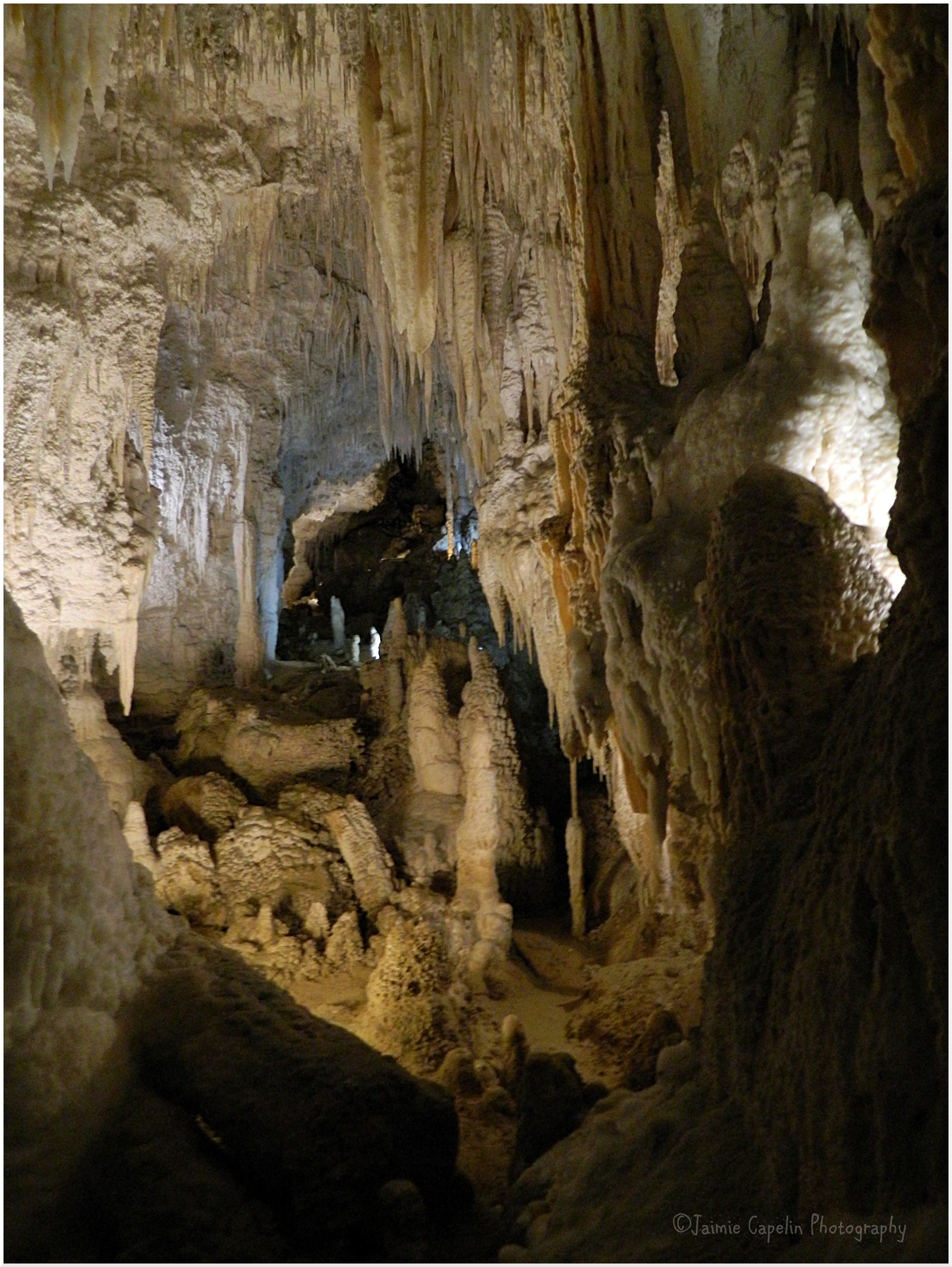
Crossing our first bridge onto the tiny Yabuchi Island in the Uruma district, the road narrowed into a winding dirt track, leading seemingly to a dead end. Parking up, we continued on foot, and just through the trees we found the entrance to Janeh Cave. 6500 year old arrow heads made of shell were excavated here in 1960, along with claw-shaped pottery. These finds suggested that sea routes between Southern China and the islands were extensive much earlier than first thought.

PhotoGrid_1525859797187

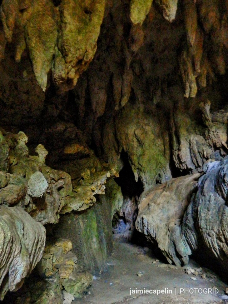
We entered the cave, stalactites looming down on us; fossils jutting out of the rock. You can see gaping squares in the ground, strewn with tarpaulin, where archaeologists have scarred the ancient rock. Deeper into the cave and the temperature dropped. Cool moisture clung to my skin, and that eerie feeling came over that makes the hairs stand up on the back of your neck. We tried to hold our ground, egging each other on to peek around the next pitch-black corner, but it got too narrow; the shadows too surreal, and so we went back to the light.

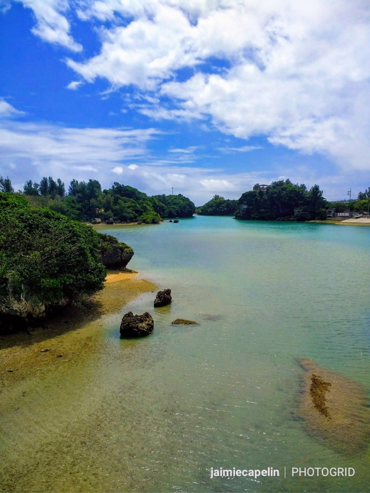
Pretty coves surround Yabuchi island, with volcanic rock formations jutting out the edges of the turquoise sea, where bridges stretch off in different directions. Though it was beautiful, the spikey rock made the water inaccessible.

PhotoGrid_1526138548515

Then, all of a sudden, it was raining. Fine, wet rain, which had the three of us sheltering under an arch of rock, rolling our eyes. Certainly not ideal. We ran back to the car, and searching for a rainbow as the sun burned through again, we made our way to the next island.

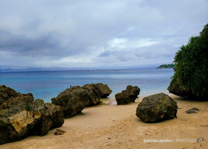
A long bridge takes you to Henza island, which is mostly industrial land, belonging to the Idetsu oil company. Henza leads on to Miyagi and Ikei, which are home to many tourist beaches, the first being Tonnaha Beach, in the north-most cove of Miyagi Island. A track leads down to a seawall, beyond which is more white sand and clear sea, decorated with coral and picturesque rocks. We watched hermit crabs scurry about on the sand, playing peek-a-boo from their colourful shells. An oil rig sits off-shore of Tonnaha Beach, obscuring the silhouette of Okinawa main island across the sea in the distance.

Another bridge and another beach – Ikei Beach – which we had to access through a building. A lady came out and welcomed us, asking for 500 yen per person to enter the beach… many of the tourist beaches in Okinawa are pay-on-entry; a concept we couldn’t get our heads around, growing up with the freedom of having beaches on our doorsteps. The sky wasn’t making any promises, and it was beginning to drizzle, so onwards we went! Every beach on Ikei Island was asking for money just to enter, and with the weather on the turn again, and most of our picnic already eaten, Mic suggested finding a seaside coffee shop and watching the rain.

PhotoGrid_1526228033075.jpg

On our drive around the islands, we saw many impressive tombs, unlike the burial sites in mainland Japan. Often randomly placed, like on the edge of a crop field, or next to a convenience store, they are grand and haunting. ‘Haka’ tombs are unique to Okinawa, though their origins have been traced back to ancient Southern China; designed to be like houses for the departed, sometimes we’d see an enormous cluster of tombs, where an entire family is laid to rest, little offerings like bundles of herbs or flowers laid down at their doors.

The final island – Hamahiga – linked off the south of Henza Island, had so much potential, had we been there a month or two later. The coffee shop we’d aimed for was still closed for the down season, and the only other people we saw were a group of workmen, who all stopped and waved enthusiastically as though they hadn’t seen anyone for days either! At the end of the island we came across a salt factory, with a beautiful hidden bay beyond. We even considered going for a swim in the rain, but agreed that we’d only be doing it for the sake of it, so, feeling quite fed up, we hopped back in the car and drove back towards Lawson’s for a cold coffee out of the chiller and wifi.

Then the monsoon came. It hammered the windscreen so we could no longer hear the music. The wipers flailed manically, but couldn’t clear the view. Traffic had slowed down significantly, the road spray preventing anyone from seeing the vehicle in front, or the road for that matter. Tyre-deep flash floods appeared from nowhere, and all vision was a wet, monochrome blur. Beach day was cancelled.

We took ourselves back to Naha, where we waited for the rain to ease off before going to a local ramen restaurant for dinner, but by the time we’d finished eating, the storm was back with a vengeance. Floor-length skirts and flip-flops in ankle-deep water is definitely not ideal, I was trying to say beneath the drumming on my umbrella, while cars splashed by causing mini tsunamis. It was time to go back to the apartment and drink wine, while the crack of forked lightning echoed across the night sky outside.

~ Zanpa Beach & Maeda Point ~

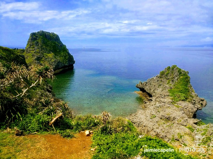
Morning began late, with a heavy head from a glass too-many of wine, but the sun was shining fresh after last night’s storm, and I was feeling like a weight had been lifted from my shoulders. We were on the road to Cape Zanpa, and Maeda Point – I volunteered not to drive, so Mic took the wheel while Taylor and I kept ourselves quiet with a cheeky McDonalds, like two happy children. We passed The American Village around halfway, and continued up the coast, past large American bases; their big, white bungalows fenced in with barbed wire. At first, we continued past Zanpa Beach, assuming it was another pay-to-enter resort, and found ourselves in the neighbouring bay, looking at an array of coral reef formations, like the foundations of ancient building remains.

PhotoGrid_1525819431567

Mic made the journey across the reef to test the water, and in the meantime, Taylor and I sussed out Zanpa Beach, realising that we could access it easily without any sign of having to pay. So there we went. The grasslands above the beach were laden with public BBQs, probably thriving with off-duty military men and their families in the summer months. The beach itself hosted a number of water activities – you could hire paddle boards, kayaks, jet skis; have a go at tubing or even try one of their jet packs. It had a swimming lido, as most tourist beaches do, to protect from dangerous jelly fish, and the lifeguard sat on his plinth, observing under blue skies. It seemed too good to be true – the sun was gleaming down; the sand was hot and the sea was cool. Towels laid out ready, the three of us ran into the ocean, (you can almost hear the slow-running music playing in the background) and we swam and floated about, while fish darted about our legs. Drying in the sun, I laid on my towel, hangover washed away by the ocean, and finally felt like I was on holiday. It was ideal!

Once dry and crispy from the sun, we got back in the car and made a point of going to Maeda Point… (sorry). Cape Maeda was exactly what we’d been looking for, with quirky little coffee shops and authentic restaurants. There were little beach-town houses rather than tower blocks, and pretty, natural bays with no expensive resorts or lines of parasols. Following Mic’s satnav instructions, I drove along a track to a car park, where we got out and followed a line of scuba divers down the footpath to Maeda Point. A viewing podium leered on the edge of the cliff, protected by two Shisa Dogs, looking out onto a most stunning cove, smothered in reef.

PhotoGrid_1525819460008

Below, groups of divers and snorkelers explored the sea life at the water-logged entrance to the renown Blue Cave. I think the three of us could have stayed there all day, but the hire car had to be back at the depot by 5pm, so we made our way reluctantly back to the city.

Dinner was a treat. It was Taylor’s last night in Japan, and he chose Okinawan seafood down in Heiwa dori Street market. We went for some of the tamer dishes on the menu, (as opposed to boiled fish eyes and tuna gizzards) which were freshly and expertly prepared to order within the shop. I was pleasantly surprised, tasting the rubbery squid tentacle, salmon sashimi, and tasty tempura tuna, and we ended up getting seconds of the delicious grilled tuna! That was definitely worth making our wallets lighter.

The remainder of my time in Okinawa was mostly reserved for packing, and after bidding Taylor farewell, we prepared for our individual onward journeys. Mic and I shared a last meal on the island, at one of the Okinawan restaurants along Kokusaidori Street, where we tasted some classic local produce. It is very similar to Japanese food, but with an island twist – egg and tofu with bitter melon – a kind of peppery celery that looks like a snozzcumber, but adds a lot of flavour and crunch to a dish. We had Okinawan dry soba, which was enriched with chicken and vegetables, and a side of pork fat potatoes.

Despite many ‘not ideal’ moments, Okinawa was an enjoyable experience – certainly different, and quite amusing in hindsight! If I found myself there again, I would hire a car from start to end, and consider staying in a few different locations, leaving space to go to some of the other off-shore islands… And stock up on Orion beer for when the monsoons roll in!


A Tent with a View – Camping New Zealand

“Most folks are tourists – they bumble around NZ hoping to ‘see the sights’ without expending much effort to find the truly unique uncommercialized spots. Travellers, on the other hand, are fewer. Travellers attempt to find good info about wonderful spots and experiences.” (Cook. S, NZ Frenzy Guidebook, p.91)

In March 2014, while I was living in Wanaka, New Zealand, I was invited on a roadie.

The trip was planned for 10 weeks, and we would mostly be camping.

Our crew was Jonny from Edinburgh, Scotland, Yogi from Bayern, Germany, Gian from Saronno, Italy, and myself, from the Isle of Wight, England.

IMG_1688

We packed:

3 tents

4 sleeping bags

4 backpacks

2 tarps

a box of cooking equipment

a gas canister

a chair

a fishing rod

climbing gear

4 cameras of various description & a GoPro

a library of Travel Guides, leaflets and maps

and a Nissan Bluebird with a flat battery.

It was cosy to say the least.

It’s difficult to estimate how much money to take on an unplanned journey like this one, but calculating the costs of fuel, food and accommodation is the best place to start. Department of Conservation (DOC) campsites are pretty much everywhere on South Island, and are usually $6 per head, if not free; the fuel for the Nissan was about $100 between the four of us every 2-3 days; and food was mostly budget stuff we could share and cook easily on the camp-stove. All in all, Jonny recommended taking about $3000 (£1500) for a 10 week trip. I managed to save about half that, and travelled for a month, but it depends on your personal itinerary.

Although the majority of this journey was unplanned, some extent of planning is essential. Having a Plan A and Plan B and a Backup is a good way of planning without actually planning! We were always checking out alternatives in our DOC campsite guide and Lonely Planet books.

The journey began on Tuesday 18th March.

A strange mist started to engulf Wanaka’s Mt Iron, as if erasing it from the horizon of my future. But I would be back.

Milford Sound

Milford Sound is one of New Zealand’s most iconic locations. We camped in the wet and humid fiordland, where there was nothing but rain and sandflies, and a sense of uncertain magic in the air. Steamy mist engulfed the green sea mountains, and the four of us sheltered in the car beneath a tree, relying on a bag of wine to keep us warm! This place is also known as Ata Whenua, (Shadowland), where between the boggy planes are rushing rivers and twisted goblin forests.

DSCN6776(2)

The 120km drive from Te Anau to Milford Sound is “a visual cornucopia of delight,” (Cook, S. NZ Frenzy Guidebook, p.196). The mountains begin to approach you on the horizon through the Eglinton Valley, rising up around you, craggy and piercing and belittlingly big. Then you go through damp woodland, passing glacial rivers and pools, finally breaking out at the entrance to Homer’s Tunnel. We simply had to pull over and get out. 360degrees of rocky mountain faces, with fresh waterfalls cascading from sheer mile high drops.

Homer’s Tunnel itself was eerie and quiet. It goes right through the heart of the mountain, and you can see each chisel and pickaxe mark in the walls from when it was dug in the late 1930s; the signatures of over a decade of hard labour.

We emerged out the other side, suspended high up among mountains on a road that winds down to sea level. All around are glistening rocks and dramatic peaks and even New Zealand’s only mountain parrot – the Kea – came out to play, terrorising family picnics at the viewpoints.

On arrival at the gateway to Milford Sound, we celebrated with a compulsory cider from the pub, and then went on the foreshore walk. This is well worth it – especially if you’re on a budget and want to avoid tourists! The walk loops around the shore line, not even 20 minutes, with perfect unspoilt views. The sun hovered over Mitre Peak, casting a dense haze over the seascape with a golden tinge, and The Bowen Falls projected water off the side of the mountain as the spectacular sailing ships drifted across the foreground.

DSCN6814(2)

We made our way back from Milford Sound in neutral, clenching our buttocks every time we went up hill, as we’d all forgotten that Te Anau is the last place to fill up the petrol tank!

That night, we found a beautiful campground in The Hollyford Valley, with wood-burner powered shower huts and a crystal river running right through. It was here that Jonny befriended a character called Ludwig – a French fisherman with a bottle of cognac… but that story’s for another time…

DSCN6828(2)

The Lost Gypsy Gallery

In The Catlins Forest, New Zealand’s far south, we camped at a place called Curio Bay, where we spent the morning of a crimson sunrise surfing with Hector Dolphins. Our surf instructor, a local man called Nick, advised us to go to The Lost Gypsy Gallery, just up the road in Papatowai.

A small group of artists and inventors have put together a compilation of strange, interactive works, mainly made out of recycled junk. An old gypsy caravan, which appears to have grown into the bushland, is choc full of gadgets, experiments and puzzles, while the garden behind – “The Winding Thoughts Theatre” – which you can enter for a donation of $5, is a cornucopia of clever, tactile mechanisms that make you feel like you’re back at the water tray in kinder garten!

DSCN7012(2)

Dunedin

This topsy turvy old city is twinned with Edinburgh, and while Jonny ceremoniously wore his kilt the whole time we were there, the only real likeness to Scotland was the weather! It was however, a fantastic place to meet people and enjoy the Gaelic bar culture, with real pints on pump, and of course, New Zealand’s very own Speights Brewery.

Moeraki Boulders

North of Dunedin, along the East Coast highway, lie the science phenomenon, the Moeraki Boulders. Huge round dinosaur eggs of rocks, all clustered together on the beach with waves crashing against them. Maori legend has it that the ancient canoe, Arai-te-uru, sailing from Hawaiki, was wrecked, and the boulders are the fossilized eel baskets and kumara washed up from the wreck. Scientists say that they are concretion formations eroded from the cliffs.

DSCN7119(2)

West Coast

From the calm and quiet east coast, we cut inland across Mckenzie Country and the Lakes, sleeping mainly in fields hours from any tarmacked roads, where the stars outshone our campfire. Stopping for breaks at the spectacular Lake Tekapo, and Mt Cook – home of Sir Hilary Edmund – we made our way to the wild West Coast.

We got through the bleak village of Haast and headed south along the coast, through rainforest, windy trees, and mountain views, until we reached a little place called Jackson’s Bay. It’s a desolate place with just the ocean and a tiny cabin called The Cray Pot, where fresh fish and crayfish are caught, cooked and served with chips in baskets. Jonny and I enjoyed huge helpings of butterfish, while the boys cowered in the car from the ferocious sandflies.

Making our way north along the hair-raising cliff-edge road, we passed little bays and houses built on the edge of wild beaches. We took the scenic walks to both Fox Glacier and Franz Josef Glacier, which have decreased in size a lot since the last time I saw them in 2007. We passed through the quaint little town of Hokitika, filled with galleries and greenstone factories, and made for Arthur’s Pass.

DSCN7230(2)

Arthur’s Pass

Lush mountains that look like they’re wearing big woolly green fleeces line the horizon; with rivers running in between. The road criss-crosses with the Alpine Train track before winding up the steep ascent into the pass. Through the mountains, the road is a high-raised flyover, cutting right through the scenery. We stopped at the top, where a group of Kea came to investigate our car, picking and pulling at the rubber seals on the doors and tapping on the back window. They are extremely intelligent mountains parrots; curious and tactile, with a beautiful rainbow of colours on the underside of their wings.

DSCN7303(2)

We lost Jonny further up the Pass, at Castle Rocks, a top climbing destination. These formations loom over the dusty grasslands, framed by grey mountains that look oil painted. They are sacred and were once home to Maori tribes, serving as good shelter and protection.

Akaroa

Matt – a good friend Jonny and I know from Cardrona – offered us a place to stay at his home in the little French town of Akaroa. Akaroa is a sheltered harbour on the south of Banks Peninsula near Christchurch. Occupied by the French in 1840, this pretty town has French road names, French shops and cafes, and a generally French look about it, with window boxes and blue, white, red striped flags on the buildings.

DSCN7338(2)

Matt shared a quirky house with a few local lads he worked with. They had a stream filled with eels running through their garden, which they’d feed leftovers, and in the evenings they’d light the BBQ and play darts in their garage where they’d built a little bar, and get up to boyish shenanigans.

Matt took us to the Bay Heads – the southern tip of Akaroa, reached by driving off-road and through private farmland, (we had to stop and ask the farmer). With a couple of friends and a few beersies, we sat on top of the blustery cliff, watching dolphins playing in the ocean below.

DSCN7378(2)

Abel Tasman – Paddling Paradise
Abel Tasman was probably one of the most beautiful and worthwhile adventures. There are many 1-5 day journeys to choose from – we chose to kayak for 2 days and hike for 1. There are even water taxis, which will transport you from bay to bay.
We booked the excursion at the i-Site centre in Motueka, and met at the water taxi base the following morning for instructions. A guide provides you with your kayaks, running you through launching, berthing and safety procedures. You are also provided with a map and instructions on where to leave your kayak while camping, and then you’re off!

DSCN7459(2)

Beautiful blue ocean; lush green mountains; golden bays only accessible by boat; natural rockery smothered with wildlife; unexplored islands dotted along the coastline. Complete serenity, just the salty breeze on your skin, and the ripples of the sea gently lapping the side of the kayak. As you paddle up to various bays, you are overcome by the twittering in the trees; a cornucopia of different sounds, from the Fantail to the Tui to the Bellbird. Shags dive in the shallows, disappearing and then popping up somewhere else. A couple may perch on the rocks, wings outstretched to dry in the sun. If you’re lucky, you’ll see the baby seals, lolloping along the rocks, then slipping into the sea and swimming over to investigate, twisting and dancing in the water.

DSCN7452(2)

We camped by the beach, setting our tents in the shelter of trees, and rising with the sun and the birds to pack up and carry our kayaks down to the water’s edge. On the second night, we stayed at Awaroa Bay, where the beach is only accessible at low tide. Packing up early in the morning, we tied our boots to our backpacks, rolled up our trousers, and made the beach crossing. Even at low tide I was wading through knee deep water, with tiny seashells spiking the soles of my feet. Any later and we’d be swimming!

DSCN7534(2)

The hike crosses from boardwalks, to bushland paths, to soft, sandy beaches. It is challenging terrain, climbing up cliff side mountains, and then sinking in sand, but every step is more than worth it. The colours alone are breath taking, and the only people you see are there for the exact same reason as you.

Barrytown

In a house on the cliffs of Barrytown, on the West Coast near Punakaiki, live Steven and Robyn the blacksmiths. Yogi and I went to the knife making workshop the couple have been running for years, welcoming travellers into their house and teaching them how to make knives! Here we met 3 Canadians; Joe, Justin and Danielle, a Dublin guy called Adam, a Dorset girl called Lucy, and a German called Raphael. We all donned big shirts, (like the paint shirts you have to wear at primary school), heat protective gloves, and a pair of googles.

We forged the steel in the forge fire, hammering the blade into shape on huge anvils before cooling it for 10 seconds in a bucket of water and duck poo! After sawing and essential sanding, we moved onto the handle, which we cut from New Zealand Rimu wood.

Steven took an interest in each of his clients, remembering each one’s name and making jokes all the time. He remembered me as ‘The Mighty Mouse’, and had an association for everyone. Shoes and work shirts off, it was time to break for lunch. Robyn invited us all into her kitchen for a smorgasbord of toastie goodies and tea, where we nattered and played with the dog before going to see the other animals and play on the enormous 30ft swing. It was like being at Grandma’s house!

After lunch, we perfected our individual knives, giving them a mirror shine, and finally protected the handles with Kiwi polish, topping off the day with a glass of homemade “Barrypagne” champagne.

DSCN7585(2)

Our exploration of South Island was complete, so it was time to make the transition to the North Island. We took the Bluebridge ferry from Picton to Wellington; about a 4 hour crossing, and began a week of Autumnal weather in New Zealand’s windy capital. From there we went up the east coast, through Palmerston North, Wanganui, up the Surf Highway to Taranaki, along the Forgotten Highway inland towards Taraunui, Waitomo, and Aroha, and ended in Tauranga.

The North Island has a larger population, less open space (but still heaps), and therefore DOC campsites are hard to come by. Camping is more expensive, and the weather confined us to shelter and so we moved quickly from town to town. Eventually, in Aroha, the main tent was taken down in the night by the monsoon and the camping trip came to a harsh end.

Some of the best moments while travelling are in uninteresting places, and while they stand bold in memory, they are not captivating to an audience. Evenings in strange campgrounds, sometimes infused with wine, sometimes not; or moments of car madness from simply sitting too long. When you’re with a new group of people so diverse, you cherish those moments where you laugh and share little nuggets of togetherness that only those who were there will understand.

One of my favourite spots was Lake Ianthe on the West Coast. It took us a while just to find the D.O.C campground, which was hidden down a track to the water’s edge. There’s only room for about 8 tents there, but the location suggests not many people go there.

DSCN7288(2)

The evening was so serene. Yogi tried his luck fishing, while the sun lowered in the sky, casting some gorgeous colours across the water. Another group of campers built a big fire and cooked their fish and potatoes on it, and I sat on the edge of the little pontoon taking it all in.

Another of my favourite spots was Kakanui on the East Coast, right on the edge of the Pacific ocean. We camped on the cliff just above the beach, which had drift logs strewn across it. The waves were beautifully ferocious, and we watched as people surfed and kayaked them.

There was a little tree in the corner of this camp area, with branches all low and twisted. For some reason I was drawn it, and kept finding myself perched on the overhanging branch, legs swinging, watching the other campers. We sat for ages here, picnic blanket out, music playing, sunshine blazing, Jonny carving driftwood with his penknife. I put my tent up early, so the sun would warm it up. The boys, however, waited until the sun was faded and the wind picked up. It was amusing watching them try and pitch their tent when the canopy kept flying away! After all that, the evening drew in cold, and I ended up sleeping in their tent anyway to keep warm.

That was the night Yogi sat in his fold-up chair with his pipe, and said; “In years to come, we’ll all meet up again, and we’ll bring our kids and they’ll play together, while we try to remember everything about this trip!” We laughed a lot, and Gian made flatbreads on the campstove, and we sang and joked.

The next morning we unzipped the tent onto a glorious scene of crashing blue waves under a yellow sky, and we drove away from the campsite with a light and airy feel of content.

Yet another of my favourite places was Orepuki, down on the south coast between Invercargill and the Catlins. It reminded me of a little village back home on the Isle of Wight called Brooke. The characters we met in the local pub, mixed with the sunset on the beach, and the stargazing, and the French cyclist who let me play his tiny guitar around the campstove, made this tiny place very significant.

DSCN6928(2)

Thanks for reading! You can watch the video documentary I made on this journey at https://www.youtube.com/watch?v=Lqs7xMVCaPY

There and Back Again – A Tramper’s Tale

Image
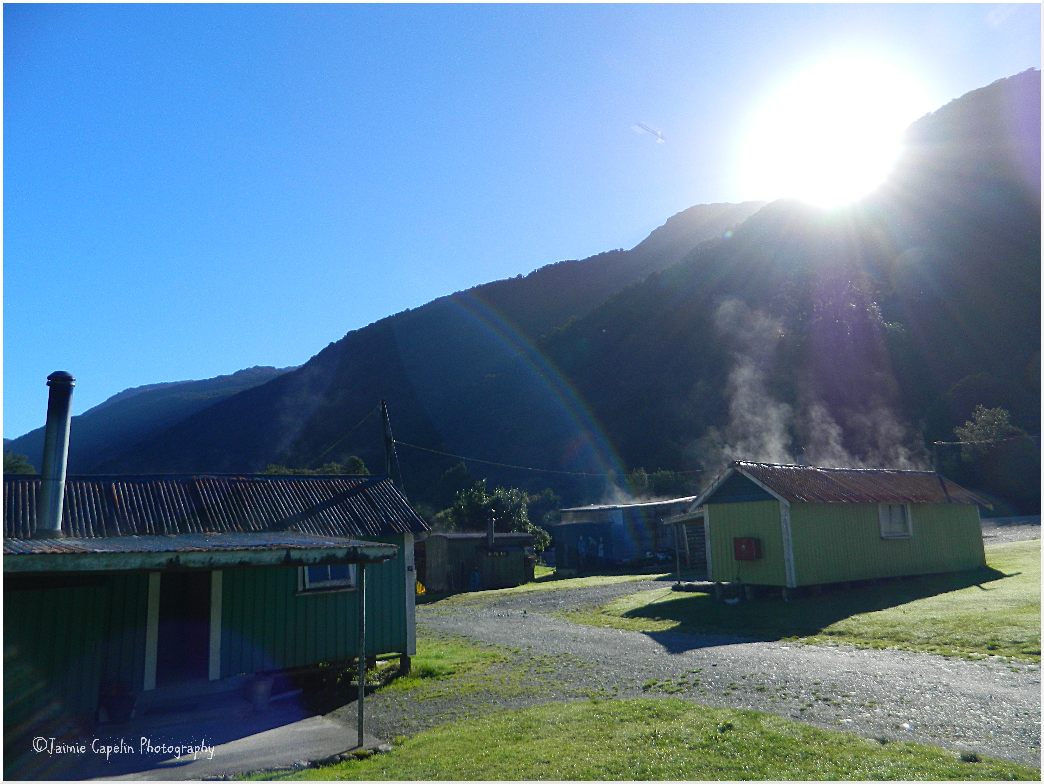
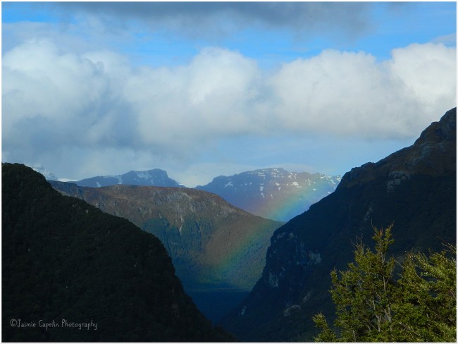
[Rainbow in the eastern valley, from Routeburn Falls Hut – 19/10/13]

In October, I went on my first tramping experience. The Routeburn Track is one of New Zealand’s ‘Great Tracks’ in the Fiordlands on the south/west corner of South Island. It is an estimated 2 – 4 day trek, (32km), which takes you across the Southern Alps with epic views of Mt Aspiring National Park. There are a number of tramping tracks situated in New Zealand’s back country, miles from any roads or civilization, which wind through vast landscapes, of which so much has yet to be discovered.

If you want to go tramping you are required to purchase a back country pass from New Zealand’s Department of Conservation (DOC), which you can do online or in most major towns. This pass entitles you to use any of the huts situated in the back country (which only have power and water supply between November and April), and also ensures you’re supported by the back country wardens should anything go wrong. You should always:

  • Plan your trip
  • Tell someone
  • Be weather conscious
  • Know your personal limits
  • Take sufficient supplies

The DOC recommends the following equipment:

  • Appropriate footwear, clothing and spares
  • Sleeping bag
  • Matches/lighter
  • Torch/flashlight
  • Cooking utensils
  • Toiletries
  • First aid kit
  • 1 – 2L drink container

…And for the winter months, May to October:

  • A mountain radio
  • Whistle
  • Personal locator beacon
  • Ice axe
  • Crampons
  • Snow shovel
  • Avalanche flare

A good friend of mine, Parker, who I can only describe as a loveable ‘quirk’ from Florida, organised the trip with Guillermo, a Chilean snowboard instructor who we befriended while working at Cardrona, and two lovely lady friends of theirs, Hanka from Czech Republic and Anne from Germany.

We left Wanaka early, driving across the Crown Range to Queenstown, (where we deposited a Hitchhiker and picked up a Fergburger) and continued east towards Glenorchy. The road was long and winding as we drove around Lake Wakitipu, stopping once to admire the view of Pigeon Island and Pig Island on the lake, with the Remarkables stretching alongside. 

Log Entry #1

I cannot describe the colour of the water here, but I can try to explain the fierce intensity of it. Like all the shades of turquoise and purple in a paua shell thrown together and turned up. Like the sky has fallen into a pot of poster paint.
            “A blueclear bomb,” – Parker.
The mountains are dramatic here too, a monochrome divide between the powder sky and aquamarine lake. There is still a lot of snow on the top, speckled with black rock and dappled yellow sunlight. 

Image
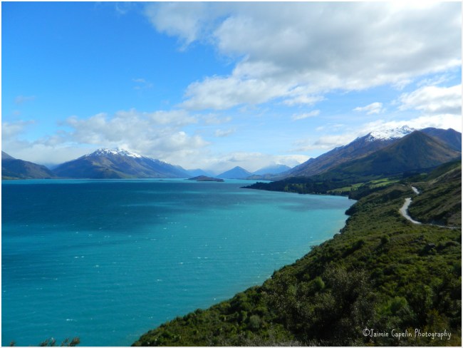
[Pigeon & Pig Island, Lake Wakitipu – 19/10/13]

Eventually we reached the tiny farming town of Glenorchy, at the other end of Lake Wakitipu. Here we joined a dirt track that wound through glorious green farmland, where hundreds of lambs were learning to skip.

The road ended at a car park, overlooked by a looming snowy peak, and we spent a little while preparing, double-checking, stretching and using the facilities, before leaving civilization and setting foot into the forest at the bottom of the mountains.Image

Log Entry #2

The track winds deep into dense, green woodland, where enormous felled trees look like the feet of fallen Ents. Moss and fungi grow on everything and you half expect a fairy castle to emerge around the next bend. The moist floor glistens with hints of blue slate and greenstone, but like any shell you find at the beach, they lose their sparkle as soon as you pick them up and dry them off. Eventually, the track joins up with one of the many gorges, and follows it up to a great gushing river. 

We crossed several rope-suspension bridges, following signs that read “Maximum capacity, 2 people”, jumping and swaying them dangerously as we walked over the raging rapids and rocks below. We reached a dry, rocky flat, where we climbed a huge tree that had fallen neatly across it, and a passer-by told us that it had been a raging river just the day before, which reminded us how unpredictable the backcountry can be.   Image

Hours passed as we trekked through advancing landscapes and terrain. An enormous clearing opened itself up, with panoramic views of the river snaking down in the valley between the mountains, so close and so clear that the perspective was lost in their vast reality. Gazing at the view made me feel dizzy, as though everything was moving like the focussing of a camera lens – maybe it was from walking and gaining altitude, or maybe it was the sheer scale of untouched World that was literally at my toe-tips.Image

We climbed over fallen trees and through complex networks of bush, feeling the incline growing steeper as we went. Waterfalls tumbled out of the cliffs onto the path, and sheer drops and landslides threatened us round each corner. We puffed and paced ourselves as the climb grew steep and uneven, each footstep placed with care on the crumbling rocks. Rainfall had caused a light waterfall running down the steep climb towards us, and we hauled ourselves up against the rushing water, until suddenly we looked up and saw buildings among the trees – The Routeburn Falls hut.  

It looked more like a fort than a hut; set around 1000 metres high in the Mt Aspiring range, with enormous corrugated iron rooftops stretching over huge wooden lodges, scattered up the mountain side on gigantean stilted decks. At first I felt relief, then disappointment that it wasn’t going to be the cosy little wooden hut in the wilderness that I’d imagined. But once we explored and greeted the crowds of others who’d be spending the night there, I was glad it was so big!

There are three large huts at Routeburn Falls. The main one has two dorms, each with 24 bunks, and a common room fitted with a log burner, lots of tables and a handful of cooking areas with sinks. There was no water or power supply at the time we went, as the wardens only maintain during the summer months. The second hut is where the wardens stay in the summer, and the third is situated further up the hill and is reserved for private groups.  

After claiming our bunks and setting down our backpacks; unrolling the sleeping bag I borrowed from my partner, and attempting to make our lodgings cosy, we walked out into the rain and discovered the Routeburn Falls. We heard it before we saw it – roaring somewhere just behind the hut, and after a short climb up the rock, we saw it, pouring down into a beautiful spring and overlooking the never ending view of the valley.

Parker and I ate a meal of 2 minute noodles, cooked on a stove he’d handcrafted out of beer cans, and we spent the evening sitting in a mossy green tree at the bottom of the waterfall, talking of home and history and meeting new people. Back at the hut, I sat down to sketch the view, while a French man sat beside me and watched, proclaiming that he wished he could put pen to paper and produce more than a stick man.

Log Entry #3

It is so still here. Nothing but the gentle rain and the mountains and his sleeping bag. The sky changed at least four times this evening; dusted with cloud wisps that obscured the mountain tops… patched up with blue that lightened the snow… striped with raincloud while a fat little rainbow peeped into the valley… mountains topped with peach powder puffs just after sunset… Now the grey mist of rain and looming darkness has settled in.

It was lonely and daunting that night, and I discovered that I kind of like home comforts; of having people nearby, and streetlights at the end of the road, and internet and phone signal. I didn’t realise how uncomfortable or scared I felt without those things I believed I could live without. But it was also exciting and challenging, and I was able to embrace the fear and appreciate every second, knowing that all these other strangers were here for the same reason as me.

Log Entry #4

The moon just rose, full and glowing over the valley. Yellow-orange and blurred by mist rain. A circular beacon for only a minute or two before fading behind the blue-black rainclouds of night time. 

Image

Log Entry #5

The morning has awoken us with more pattering rain, hitting the corrugated iron roof and tumbling onto the mountain woodland below. The waterfall rushes in the distance, intense in the foresty wet weather, while a lone Tui calls out over the valley; its sad “ding-dong” a simple melody overlaid on the percussion of the rain. Everything is fresh green with a powder-purple haze between the gaps.

After a breakfast of ‘gawp’ (a name Parker invented for trail mix) we waterproofed our bags and clothes and regrouped outside on the deck. The plan was to trek up to the saddle – the highest point of the track – with Parker and the girls, and then Guillermo and I would bid them farewell and return to the car park. This would add a further 6 hours to our return journey, and the torrential weather was holding out, so unfortunately we were forced to abort this mission. Guillermo and I saw off the others at the waterfall, saying our goodbyes “until next time”, and we set off back the way we came. The weather improved as we descended; the sun shining through the damp rainforest, humid and clammy. We stopped to watch people canyoning in one of the rivers, followed a little nature trail close to the start of the track, and finally arrived back at the car with tired satisfaction and a massive sense of achievement in the afternoon sun.

Waikato Wanderings

With dreams of a long weekend in Wellington shattered at our feet due to fully booked motels, my folks and I decided to take a trip through the Waikato region; west of the Bay of Plenty.

We set off on the morning of Friday 26th April, following a spectacular double rainbow through Rotorua, where it arced over Mt Ngongataha, and led us to the Rainbow Mountain, where the end of the rainbow dipped its colours in the lake, before leading us on to Taupo.

We reached Lake Taupo near Kinloch, where the temperature dropped and the sun and the rain competed for the sky. The rainbow we had followed was now dropping over the headland and falling into the blue of Lake Taupo, and we ditched the car to begin a 4 hour walk to an inlet called Kawakawa Bay.

Trudging along a sandy track, through trees and bushland, with occasional clearings that overlook the secret bays of Lake Taupo, we witnessed rare native birds: Silver Eyes; a couple of Bell Birds; some common Fantails and a little white Pōpokotea, or Whitehead.

With the sun burning off the threat of rain, we came to a clearing high on the headland before descending down to the bay. Standing upon the rock, looking over a vast stretch of Lake Taupo, with the jagged highlands, hazy in the distance.

Image

The descent to the bay took us down into damp, rocky woodland, with gigantic ferns and exotic trees lining our way. It felt as though we’d entered a rainforest, and then the path flattened out as the sound of the water lapping the beach kissed our ears, and we emerged into a clearing and onto Kawakawa Bay.

The pebbly beach curved around either side of us, disappearing around headlands on one side, and off into the distance on the other, while the lake itself splashed up against the shore like a choppy ocean. There was no chance of strolling into the water for a paddle, as the shore line drops a hundred meters or so beneath the water surface. It is a volcanic lake after all.

Another two hours later, we’d made our way back along the winding bushland path and back to the RVR, and headed into town to find our digs.

Taupo is a beautiful town, but the temperature is considerably cooler, being a lot higher up than Tauranga. Our motel was called ‘Mountain View’, but unfortunately, the Tongariro mountains were obscured by haze that day. But our balcony didn’t go to waste. We spent the evening strolling about the town, enjoying Irish pub grub in Finn’s, and topped the evening off with a Kahlua nightcap in The Shed.

Saturday 27th April
Bidding farewell to Taupo once again, we headed northwest through rolling green hills and little towns, past sheep and pigs and endless fields of cows. We passed through, Tirau, a small town littered with corrugated iron artwork. The i-site centre was made of two corrugated iron buildings in the shape of a sheep and a dog, and big corrugated Pukekos sat atop one of the shops. We stopped briefly in Cambridge to pick up a bite to eat and stretch our legs, and then continued west towards Raglan.

In the midst of the countryside, on a quiet road somewhere near Karamu, outside of Hamilton, we came across the toothbrush fence, which is, exactly as it sounds, a fence covered in toothbrushes!

Image

We reached Raglan on the west coast, and took a short detour south to Bridal Veil Falls, where the Pakoka river leaps from a 55 metre high clifftop, creating a spectacular waterfall. A short walk alongside the river, beneath a tropical canopy, leads down over 200 steps, passing various viewpoints, until you reach the bottom, where you stand on a bridge over the river, looking up at the waterfall and getting considerably damp!

Image

On to Raglan – a little coastal town, known for its surf, which swells up from the Tasman Sea. We stopped in the town – just a few shops and cafes on the main street – and ventured into a little place called The Shack, where I was greeted at the door by an old friend from university back in London, Grai. The Shack was a busy little cafe, with quirks like all the sides were served in miniature milk bottles. We ordered some teas and coffees and Grai took the order, as we kept looking at each other, open mouthed, in awe at how small the world is! We arranged to meet up for some drinks in the pub later on.

A cup of caffeine later, we left Grai at The Shack and wandered up a little dead-end street, lined with two craft shops, a coffee roasters, and a surf shop. We browsed the intricate bits-and-bobs in the craft shops – jewellery; pinbadges; bags; pictures; paua shell; greenstone; etc, then had a mosey at the clothes in the surf shop. From there we cut through between buildings and found ourselves walking down towards the estuary.

To the right, a boardwalk led off around the corner, while on the left a bridge crossed over the water to a headland. Mt. Karioi loomed ahead, while kite surfers scattered the horizon on the sea in the distance.

DSCN3538

Our accommodation lay on Upper Wainui road, about 5 minutes out of Raglan town, and was called ‘Our Beach House’. We sat in the garden next to the orange tree, (though the oranges were technically greens), before heading back into to town to the Harbour Hotel. One of the great things about Raglan is the small community feel – everyone seems to know one another and are happy to help you out. The Harbour Hotel run a free pick-up and drop-off service, as long as you eat or drink at their pub, and it’s the same with the local bar as well. So we gave the hotel a ring, and shortly afterwards, a lady in a people carrier came and picked us up. We had a yummy tapas dinner and chilled in the sports bar section of the pub to watch the rugby – Chiefs v. Sharks.

Grai arrived with her sister and some mates, and they took me to the The Yot Club – the only bar in town, where everyone ‘goes to dance’. A live instrumental band called ‘Funky’ played, and I got acquainted with the locals; a couple of Americans on holiday, and several English people from Mount Maunganui. They all had the same agenda – to surf.

At the end of the night, the bar staff drove everyone home!

Sunday 28th April
Bright and early, we said goodbye to Raglan and headed south to the Waitomo Caves. We arrived just before 11, and it was already a belting hot day, and it appeared to be the home to some very interested wasps. We waited in a large greenhouse style structure, where the gift shop and cafe were located, until a mini bus arrived to take us and a small group to the first cave – Ruakuri.

The spiral entrance to the Ruakuri caves was built as an alternative way in, as the original entrance was discovered to be a sacred Maori burial site. Inside, the caves were vast, with a river running through complete with a mini waterfall, where people can partake in black-water-rafting. Glowworms speckled the rock like stars, and stalactites and stalagmites spiked each cavern and tunnel, with a unique limestone formation around each corner. The cave walk took about 2 hours and covered 1.6km underground.

With some time to spare, we found a cafe/dairy to stop for lunch, before heading to the second cave – Aranui. Set in the forest of the Ruakuri Reserve, the Aranui cave has a natural entrance, and almost feels as though you are entering the side of a cliff. It is a much smaller cave, and the only life it holds is Cave Wetas – large spider-like insects. Aranui cave was also described as a ‘fairy walk’, as the rock formations are so beautiful and intricate, it is like walking through a fairy palace, or something out of a children’s story.

The third and final cave was Waitomo, where local Maori, Chief Tane Tinorau, discovered the glowworm caves via a boat, with an English surveyor, Fred Mace in 1887. Waitomo caves have remained a part of the family ever since, and the great great great great granddaughter of Chief Tane Tinorau was our tour guide, which made it feel pretty special. We were led down into the caves on foot, through the ‘cathedral’: a huge chamber where the rock formations almost look like a pipe organ, and the acoustics are perfect for singing. The ‘cathedral’ chamber is open every Christmas for a ceremony, where local schools and a band are invited to go down into the cave for a carol service. The ‘cathedral’ is lit by hundreds of candles, and visitors are welcome to join the magical experience. From the ‘cathedral’ chamber, we went into the darkness, face to face with glowworms, and the shining mucus threads that hang down to catch bugs for dinner. We followed the dark passage downwards, onto a jetty, where we climbed into little boats in the pitch dark. The only way I can describe it is like the first time Harry Potter and his friends see Hogwarts from the little boats. Our boat was pulled along by our tour guide, on wires attached to the rock above, and as we gracefully glided through the silent darkness, a thousand fairy lights appeared all around us. It felt like magic, and there is no better name for the glowworms than the Maori one – Titiwai (The stars over the water).

The little boat came out of the cave along the Waitomo river, where the Chief and his English companion had originally entered.

DSCN3653

Time to head back home to Tauranga: not ‘home from home’, but ‘holiday from holiday.’