~ Kyoto – a little history ~
Kyoto was once the Imperial capital city of Japan, for a thousand years, until 1869 when the Imperial court was transferred to Tokyo. The city suffered extensively from the Onin war in the mid 1400s, and wasn’t restored fully until the 1700s – the Edo era – when it flourished as one of Japan’s 3 major cities, along with Edo (now known as Tokyo) and Osaka.
Nowadays, Kyoto is famous for its Buddhist temples, Imperial palaces, Shinto shrines, Geisha culture, and its beautiful sakura spots in spring.
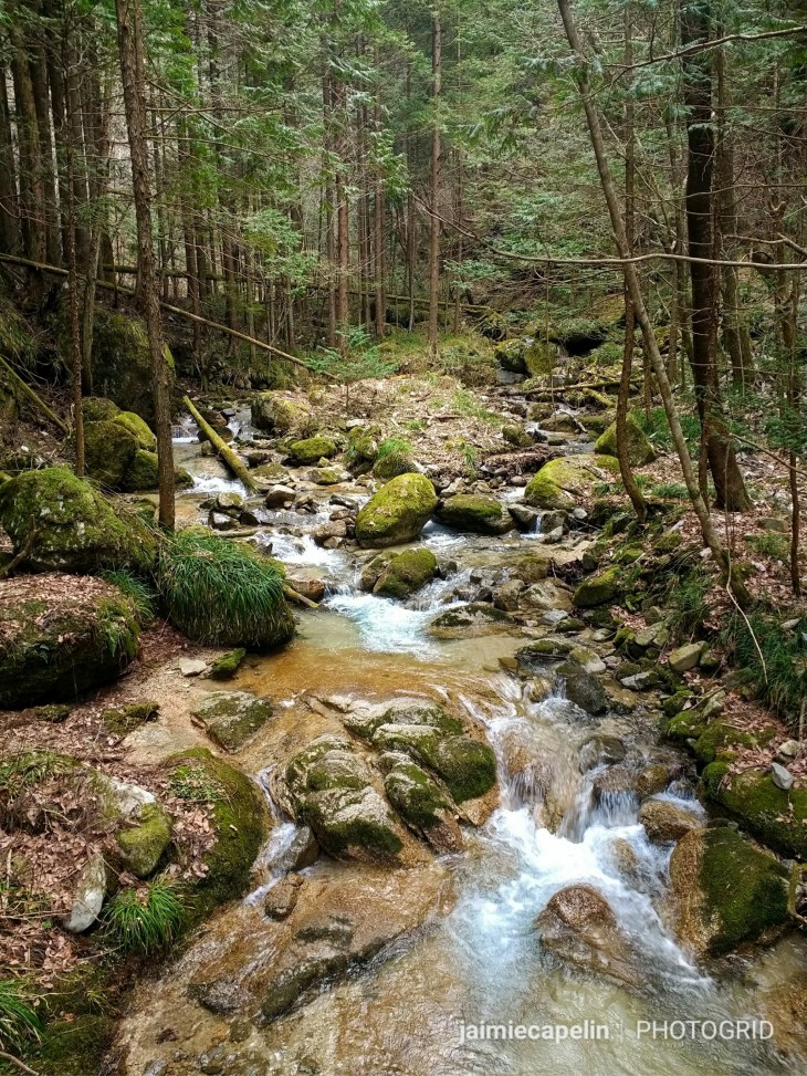
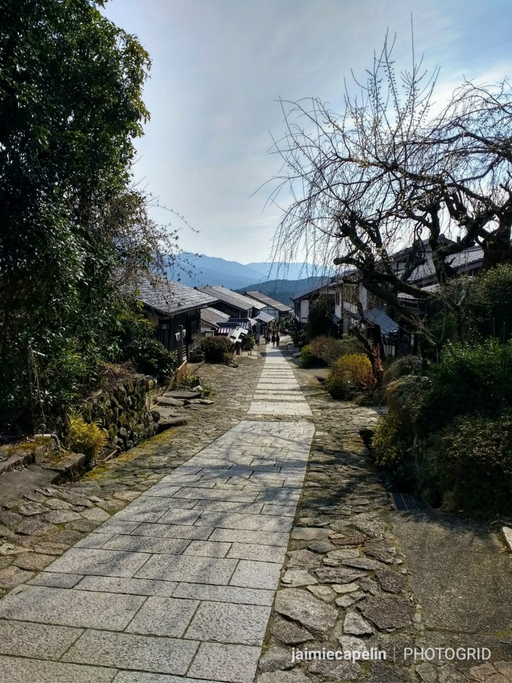
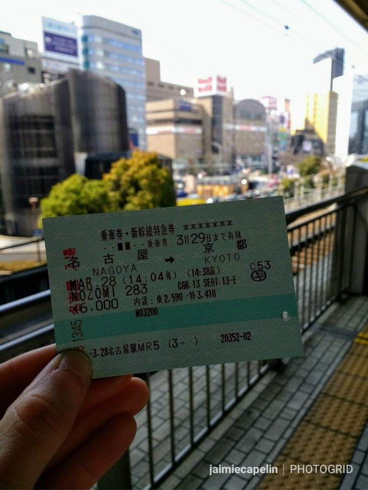
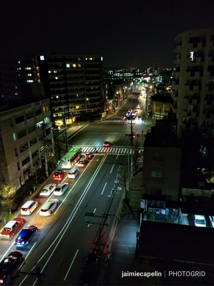
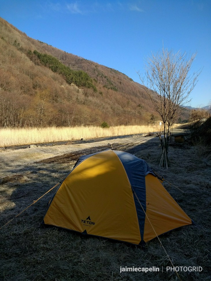
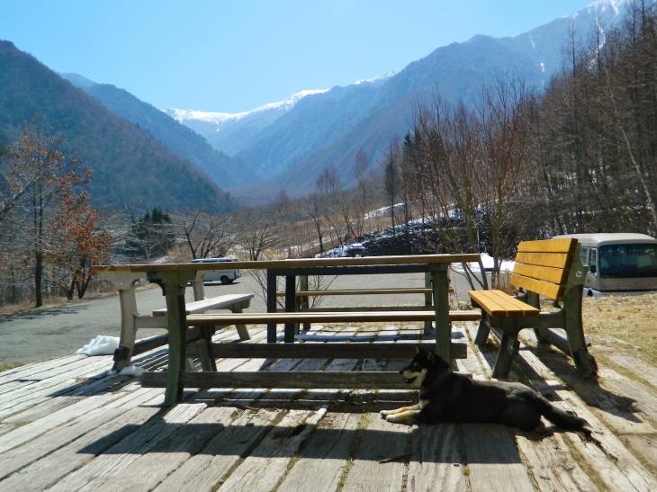
My experience of Kyoto and the nearby prefectures was broken up into hectic pieces, linked together by the inexpensive train network of the Kansai region. Every day was an adventure of finding the next resting place for the night. It was a unique and spectacular way of seeing the region, if not utterly exhausting, but there was always an ideal little camping spot at the end of the road eventually, which made the hard work worthwhile, and meant I got to explore places I would never have seen otherwise!
On the nights I actually stayed in the city, I used Air BnB, which proved very useful and great value for money.
Kyoto put out all the stops while I was there, and I was incredibly lucky to catch the city in its prime, with fantastic weather, at the height of sakura season.
~ Sakura Festival ~
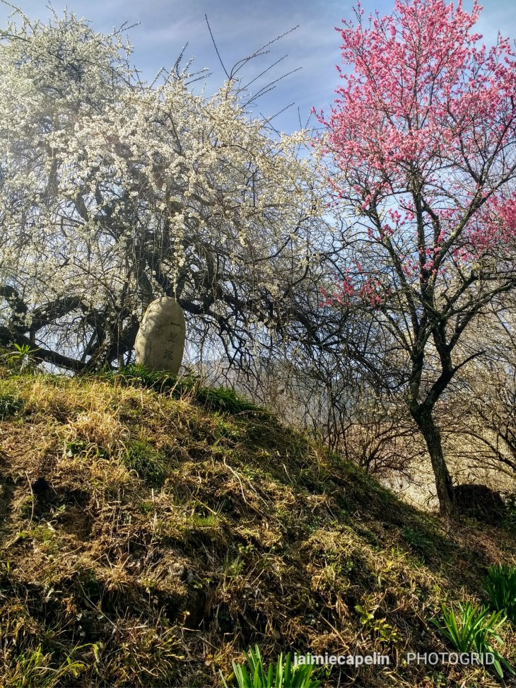
Sakura is the Japanese name for cherry blossom, and Japan is obsessed with it! To the extent of flavouring their chocolate and candy with it, decorating their beer cans with cherry blossom, and having an annual festival, nation wide, dedicated to the dainty blossom. From around March, the weather forecast will include a cherry blossom forecast, and people flock from all over the world just to see the trees in bloom. With this, accommodation becomes high in demand, prices go up, and the public transport becomes very busy, so be prepared and book early!
Why? – The cherry blossom season symbolises the Buddhist concept of mono no aware – ‘the pathos of all things’, and celebrates the constant changing of everything, appreciating its fleeting beauty. There is a humble sadness in this concept, as it is meant to remind us that all beautiful things are passing, much like life itself.
~ Cycling through Sakura ~
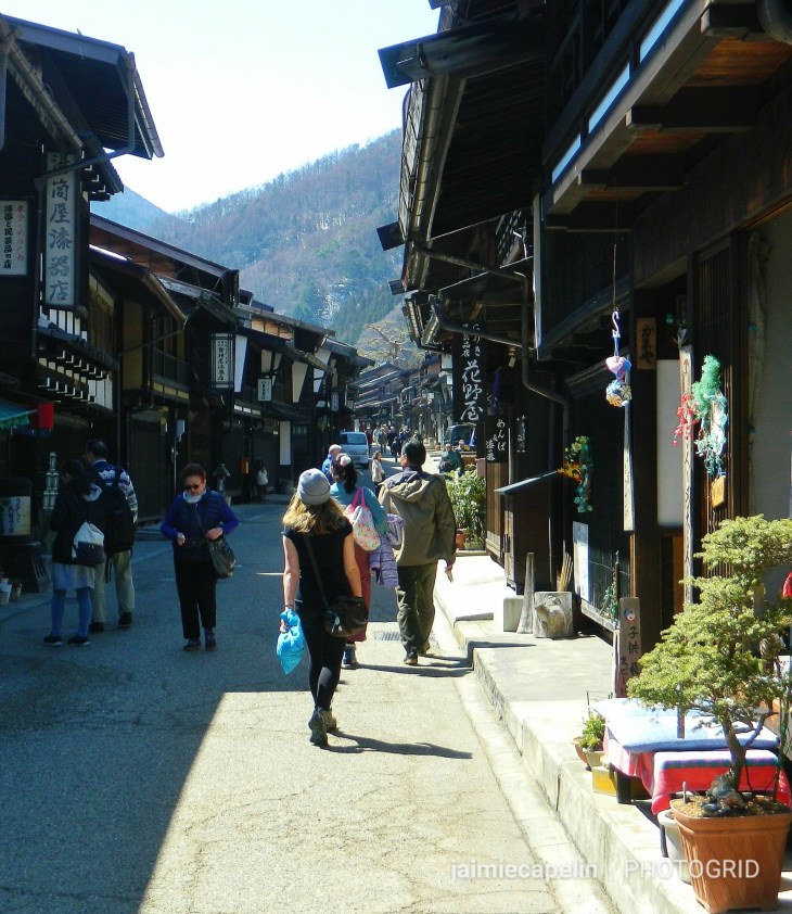
On the first full day in Kyoto, Mic and I hired bicycles. Cycling is a simple and popular way of getting around the city, and there are cycle hire shops dotted around everywhere. We cycled beneath warm blue skies, towards the Kamo River, which runs north to south through the centre of the city. Busy footpaths follow either side of the river, lined with cherry blossoms, where men and women posed for photographs beneath the trees in their unique kimonos.
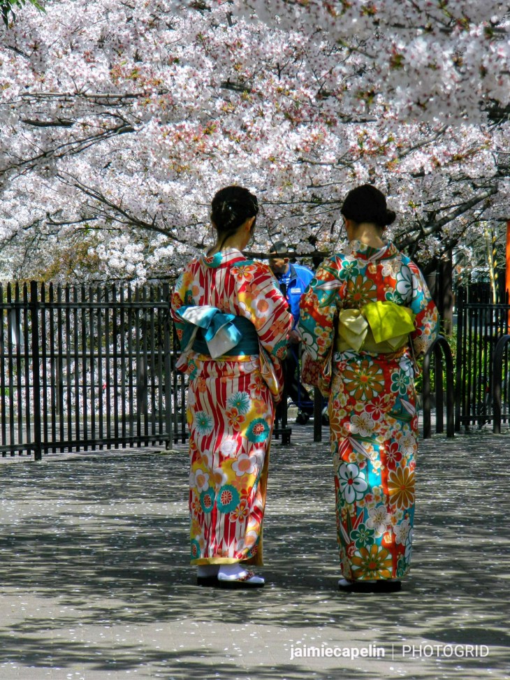
Crossing the river along one of its many busy bridges, we found a popular ‘sakura spot’ – located on Google Maps – an area where the blossoms are at their peak. Every corner you turn, you come across another cluster of pink canopy, with soft flurries falling down like snowflakes, and girls in beautiful kimonos everywhere.
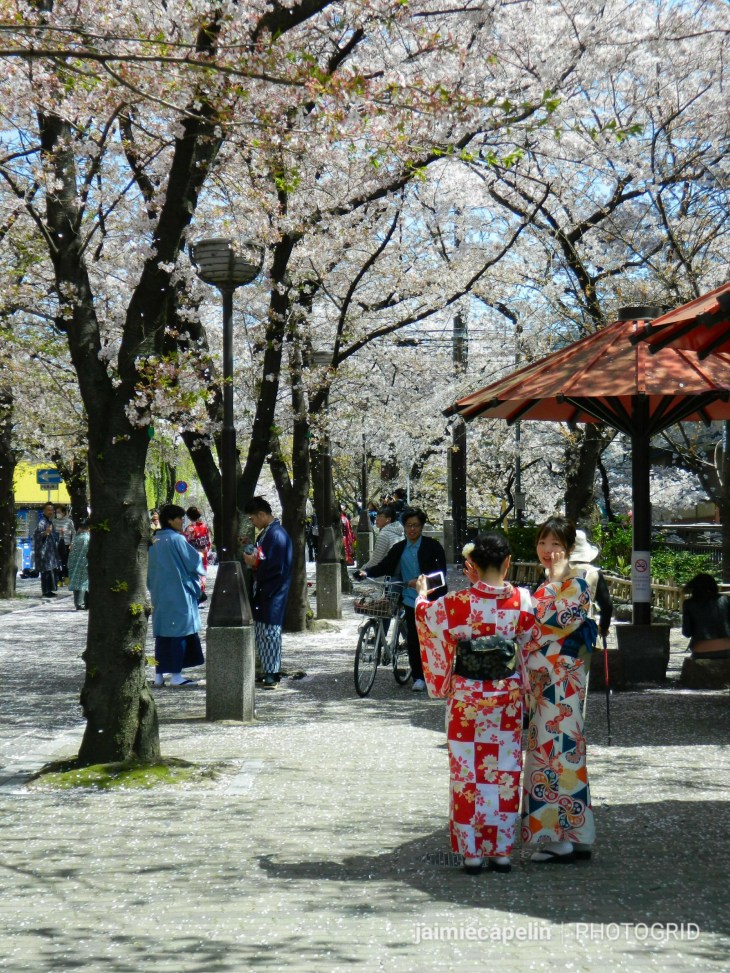
Hiring bikes is usually a really efficient way of getting around the city and seeing the sights, (and a great excuse to indulge in the street foods without feeling guilty!) However, the deeper we got into the city, the harder it was to manoeuvre. The streets were so busy, with cars and pedestrians fighting for space, that even pushing our bicycles was near enough impossible. We finally reasoned with locking our bikes up and going to find lunch on foot.
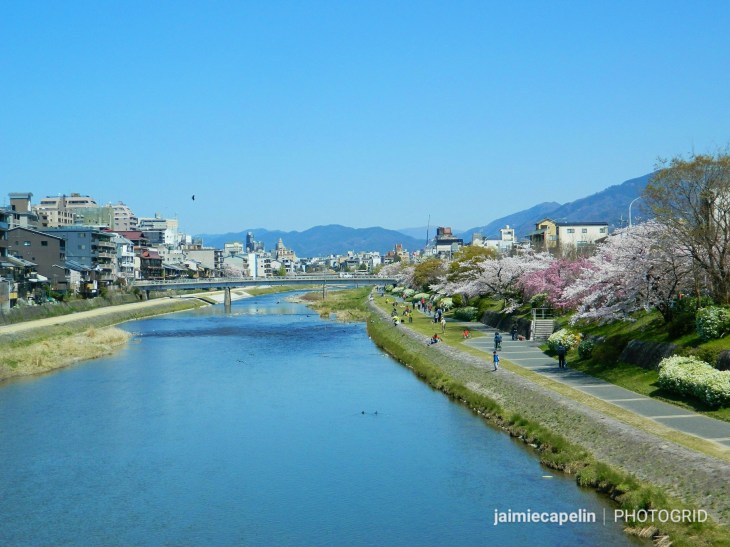
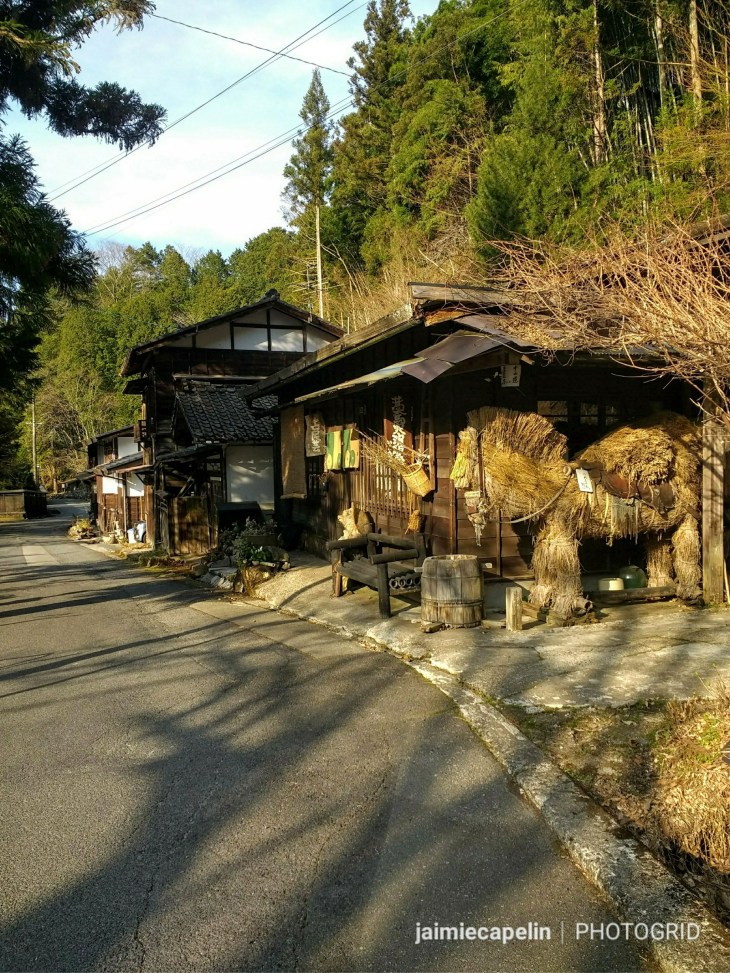
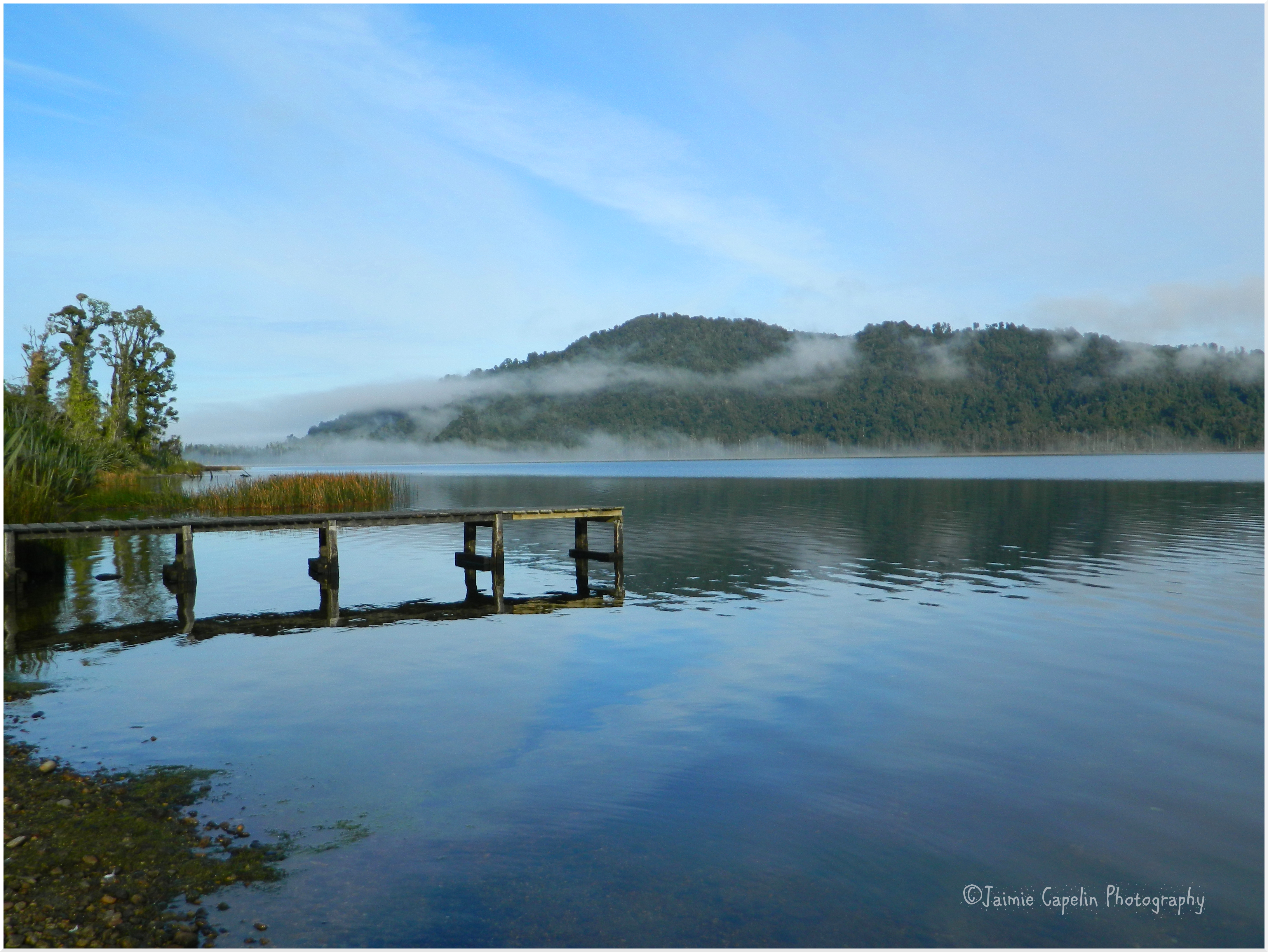
Kamo River
~ Tofu ~
Yumi, a friend and colleague I met in Hakuba, is originally from Kyoto, and she advised that I must try a tofu dish while in Kyoto, as the city is locally known for its variety of tofu specialities. We found a tiny but busy restaurant just across from Gion Corner, and sure enough, it had a special tofu dish: ‘Mapo Tofu’ – a salty tofu soup, with chicken and gyoza on the side.
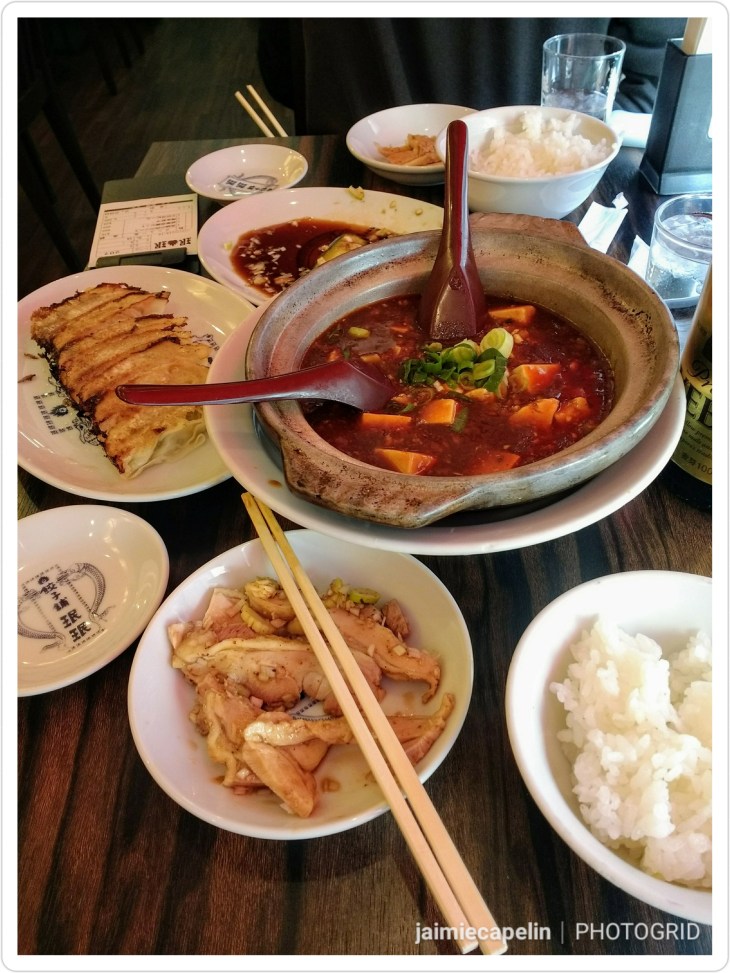
Mapo Tofu
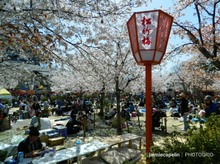
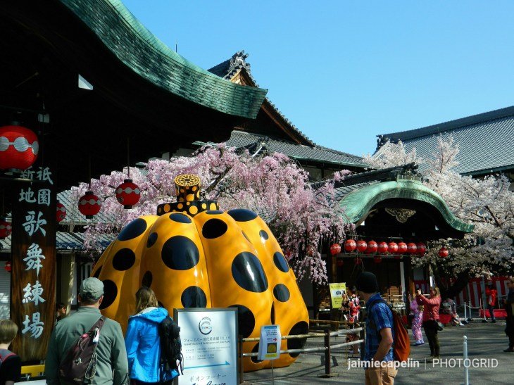
~ Hanami in Mariyama Park ~
Following a dense crowd up the stone steps of the impressive entrance gate to Yasaka Shrine, we went into the gardens of Mariyama Park. Yasaka Shrine stands bold in the main courtyard, hordes of people gather around to ring the giant bell and pray, while the stage covered with hundreds of lanterns makes a wonderful photo opportunity.
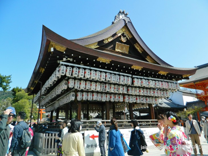
Yasaka Shrine stage
A network of walkways lead through all manner of plant life, but most importantly, cherry blossom. Mariyama Park is a popular Hanami spot at this time of year, and the whole park was decorated with lanterns and picnic areas. Hanami means flower viewing, and this is associated with spending hours beneath the cherry blossom, feasting and drinking sake.
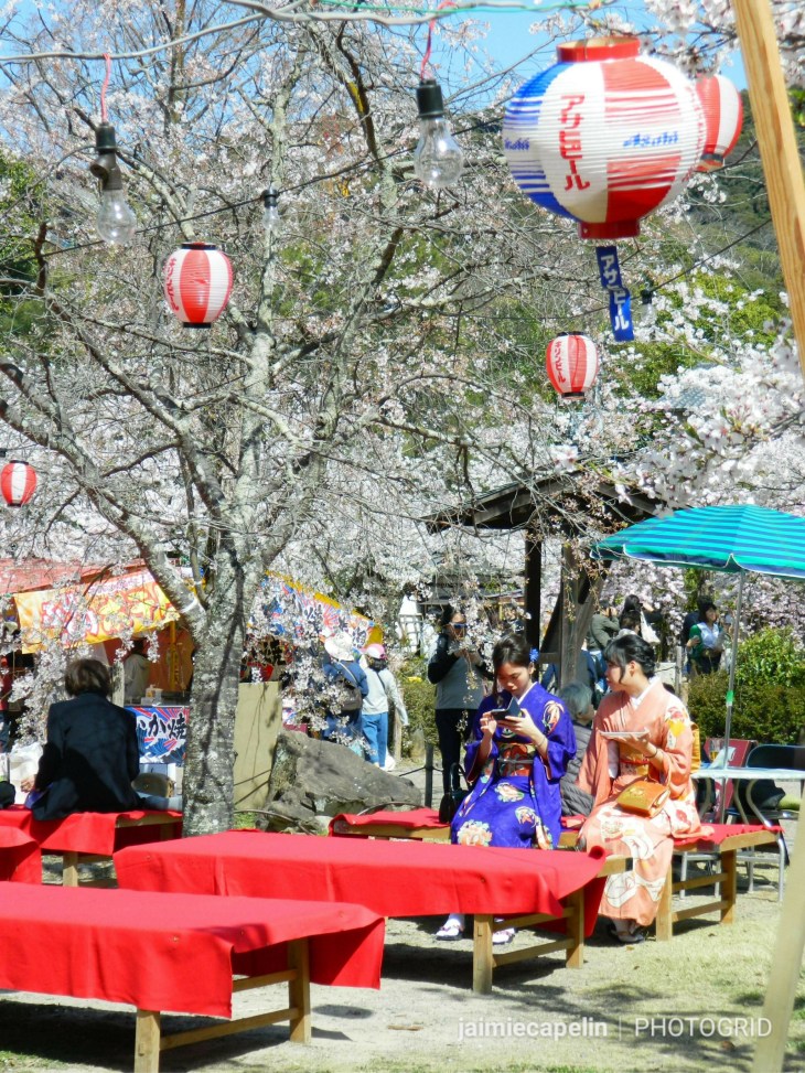
Lunch beneath the Sakura
Throughout the park, food stalls thrived in the sunshine, serving up traditional Japanese street food, from takoyaki, to crab sticks; okonomiyaki to mochi; and many sweet treats like fruit dipped in chocolate and sprinkles.
Hanami in Mariyama Park
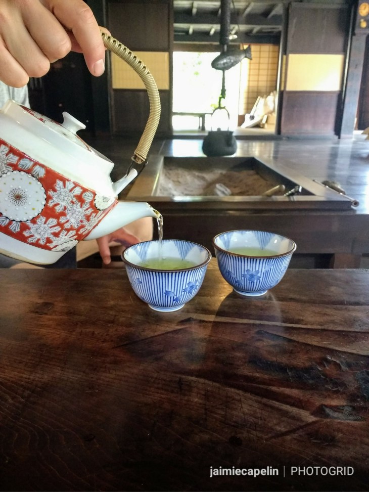
~ Gion Corner ~
Retrieving our bikes, we cycled up to nearby Gion Corner, also known as Geisha Corner. This is a unique theatre, in which you can see seven traditional arts of the Geisha, including dance, comedy and music. You can also experience a genuine tea ceremony, and learn about the etiquette. The Yasaka Hall and surrounding buildings, is where the Maiko (Geisha in training) stay and learn to become a Geiko (Full Geisha), and the area surrounding the Yasaka Hall is quite closed off to the public for their safety and privacy.
Gion Corner
~ Imperial Gardens ~
The sky was pumping out sunshine, and we spent the afternoon cycling along the river, appreciating the colour and the cherry blossoms, coming to rest on its grassy banks to soak up the sun and watch the birds of prey swoop and dive over the water. On the way back through the city, we passed the Imperial Palace and its famous gardens. The palace was home to the Emperor and his family, until 1868 when he moved to Tokyo Imperial Palace.
The Imperial gardens are open to the public throughout the day, and the broad gravel paths stretch through vast lawns and tree groves. Most locals use the gardens as a serene shortcut through the city, and though at first it does appear to be nothing but a gravel path through a fairly plain park, don’t knock it too quickly! As we cycled around, wheels spinning out in the thick gravel, we began to notice hidden gems in the trees: little footpaths sneaking off between the bushes. Tiny water gardens with birds and ducks frollicking, and pretty little shrines in the woodland, so well hidden you would never guess they were there.
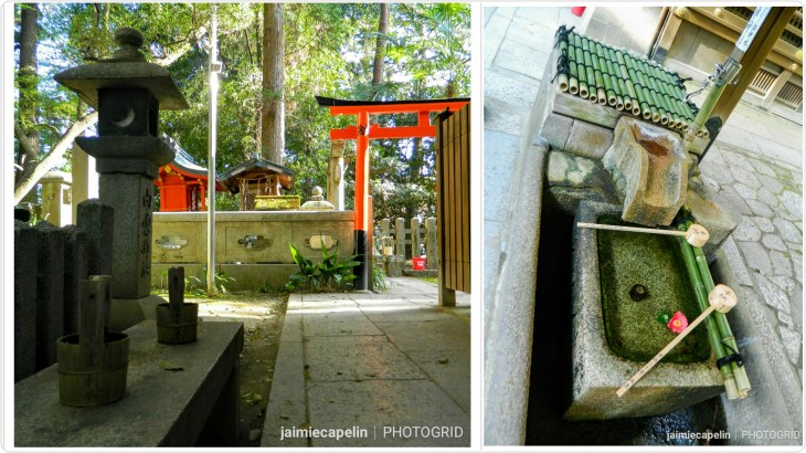
Shrine to Shinto God of Music, Imperial Gardens, Kyoto
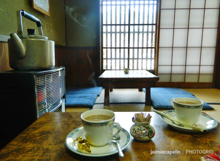
~ Coffee & Curry ~
After a long and exhausting bike ride along the busy city streets, we deposited our bikes back at the hire shop, and followed a blackboard sign for coffee and curry into an alley way, lined with beautiful plants. The tiny homemade curry restaurant at the end of the alley was called Asipai, and was teamed up with Hibi Coffee, and together they made a truly unique and delicious dining experience to end our first busy day in Kyoto.
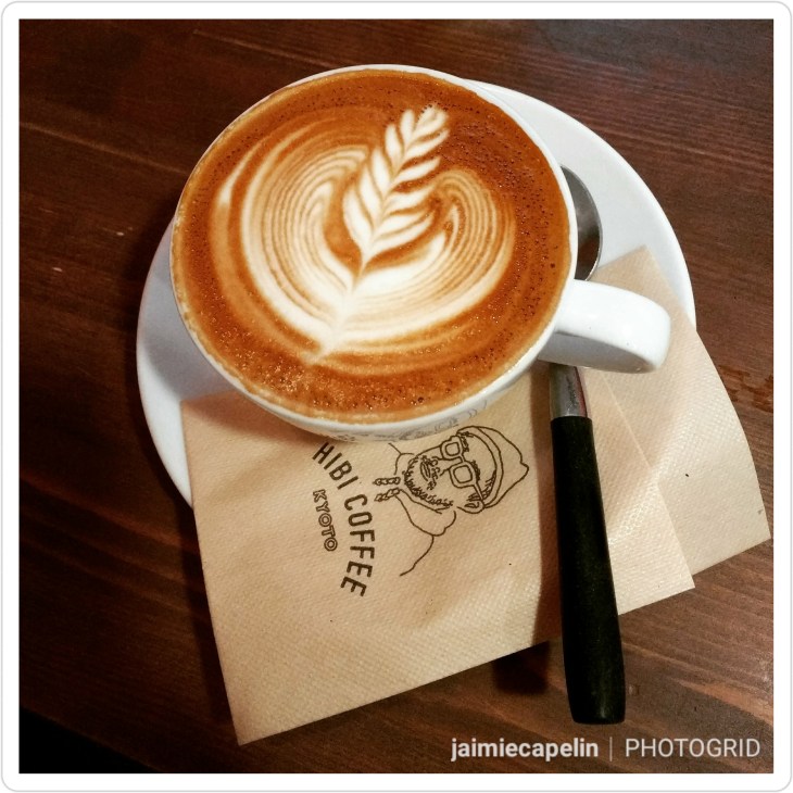
Hibi Flat White
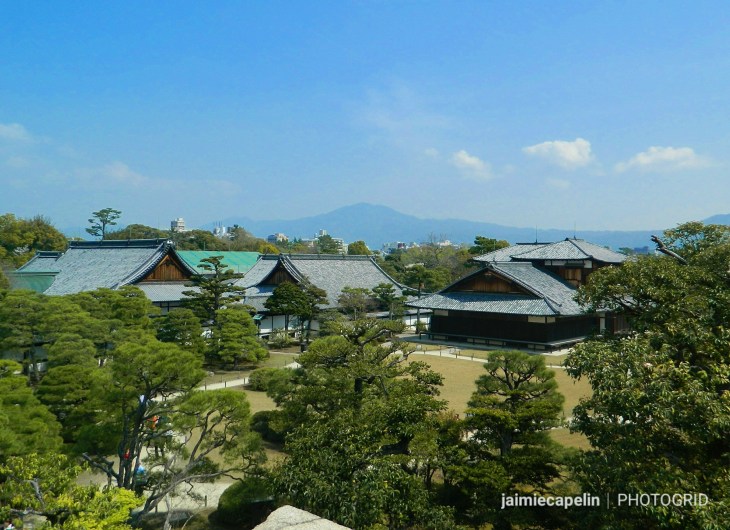
~ Nijo Castle ~
By sheer coincidence, a very good friend from home happened to be visiting Kyoto with her parents at the time I was there, and so with both of us cramming a lot of touristing in to a short amount of time, I suggested we meet at Nijo Castle in the morning. This was on recommendation from ANOTHER friend from home, who’d been to the castle a few weeks before and said it was his favourite sight in the city. (Thank you, Simon, it was a great suggestion!)
There was quite a queue for the ticket booth on the street outside the castle entrance, but in true, organised Japanese fashion, the queue moved very quickly. Tickets were 600yen – £4 / $5US – which is ridiculously good value, when you consider you’d have to pay between £10 and £20 to visit any English Heritage castle! AND you get a nice little paper ticket to keep, with a picture of the castle on it, perfect for sticking in your travel journal! The simple things.
My friend, Abi, met us at the gates, and after doing all the hugging, jumping, giggling things girls do when they meet after a long period of time, we crossed the draw bridge into the castle grounds, pulling faces at the hordes of Koi in the moat below as we went.
The vast gardens are spread with ponds and trickling waterfalls, beautiful plants, and of course, thriving sakura. We breathed in the spring sunshine, catching up on lost time, and having a few ‘extended family’ photos beneath the cherry blossom.
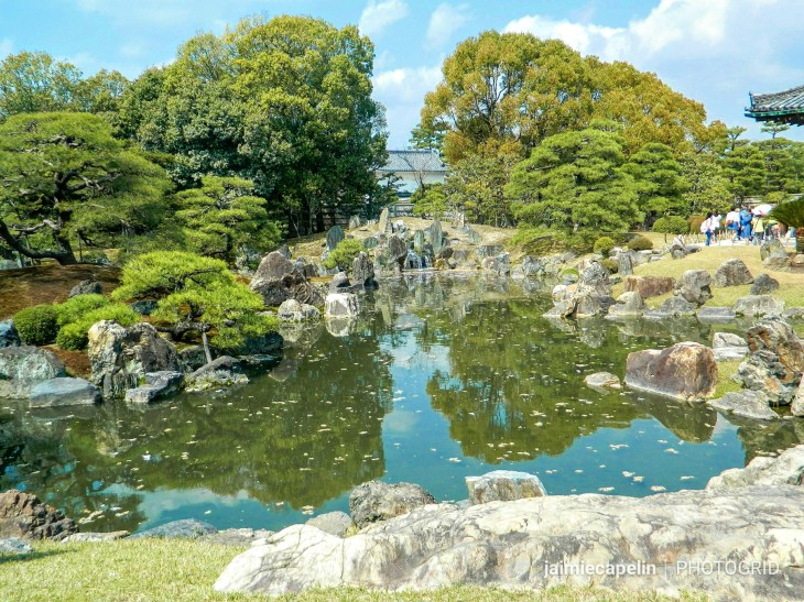
Nijo Castle Gardens
The castle was built in 1679, and its large, wooden Keep was struck by lightning and burned down in 1750. A viewing platform stands in its place, overlooking the palace, and the surrounding gardens and moat.
View of Ninomaru Palace from the Keep, Nijo Castle
Ninomaru Palace stands in the centre of the castle grounds, beyond the spectacular Karamon Gate. The gate is smothered with intricate animal figures, and flowers in rich colours and gold leaf.
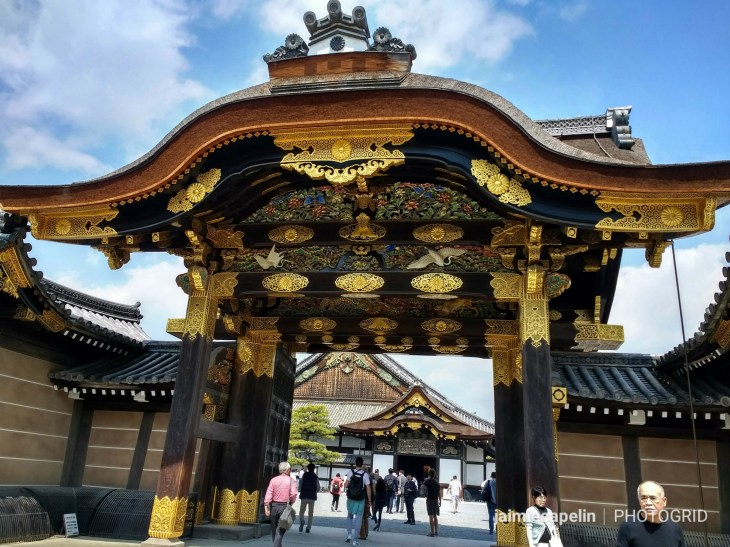
Karamon Gate
Inside the palace, you must remove your shoes and shuffle along the smoothed-through-time floorboards, which squeak and whistle with each step, giving them the name: “The Nightingale Corridors.” The palace rooms are vast tatami rooms, with authentic floors woven from rice straw. Murals cover the walls depicting tigers, leopards and cranes. No one in Japan had seen a tiger in that period, so the paintings are impressions inspired by sketches and hides imported from China. Thus, the tiger paintings have a certain mythical, Eastern-dragon look about their faces. Be sure to look up as you walk the labyrinth of corridors, as even the ceilings are decorated with individually painted flowers and delicate metal fixtures.
No direct light is allowed in the palace, therefore all the blinds are drawn, and photography is banned, to help preserve the colours and richness of the ancient rooms.
Walking around the beautiful grounds some more, enjoying the warm sunshine and the array of flora, we came across a courtyard market; gazebos and stalls selling all kinds of gifts and souvenirs. A man waved us over, offering a taste of lemon sake, which tasted nicer than any sake I’d tried before, so we went away with a bottle to share later!
~ Nishiki Market ~
Bidding farewell to Abi and her family, as they had a tour booked, Mic and I headed south from the castle to find the place famous for street food – Nishiki Market. On the way, we passed some street entertainment drawing a small crowd on a sunny street corner. Everyone was dancing, while a three-piece jazz band played, led by a clarinetist, backed by a jazz guitar and a double bass.
Walking through the busy shopping streets of downtown Kyoto, we followed Google maps to Nishiki Market, joining the hustle and bustle beneath the long strip of stained glass canopy, purchasing and nibbling as we shuffled along in the dense crowd.
We tried salmon sashimi, smoked duck, grilled lemon salmon, sushi, and some peculiar potato balls that had a particularly bouncy texture! Finishing with a refreshing craft beer, we browsed the array of questionable foods, among baby octopus on sticks, loose tentacles, cuttle fish, and some funky looking vegetables – snozzcumber comes to mind – I later learned these were called Bitter Melon.
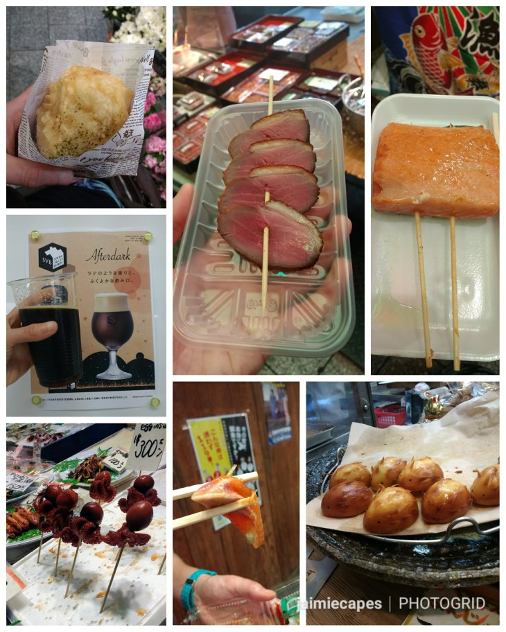
Treats from Nishiki Market
Nishiki Market can get horribly busy, with crowds packing into the narrow space for their fix of delicacies, so be prepared to get hot and sticky! The Japanese are generally a polite and reserved culture, but they are also used to the busy, overpopulated cities, and will happily glide through the crowds. The tourists, however, are likely to get pushy.
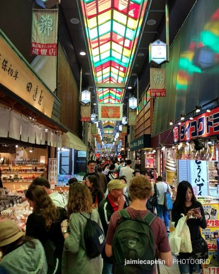
Nishiki Market
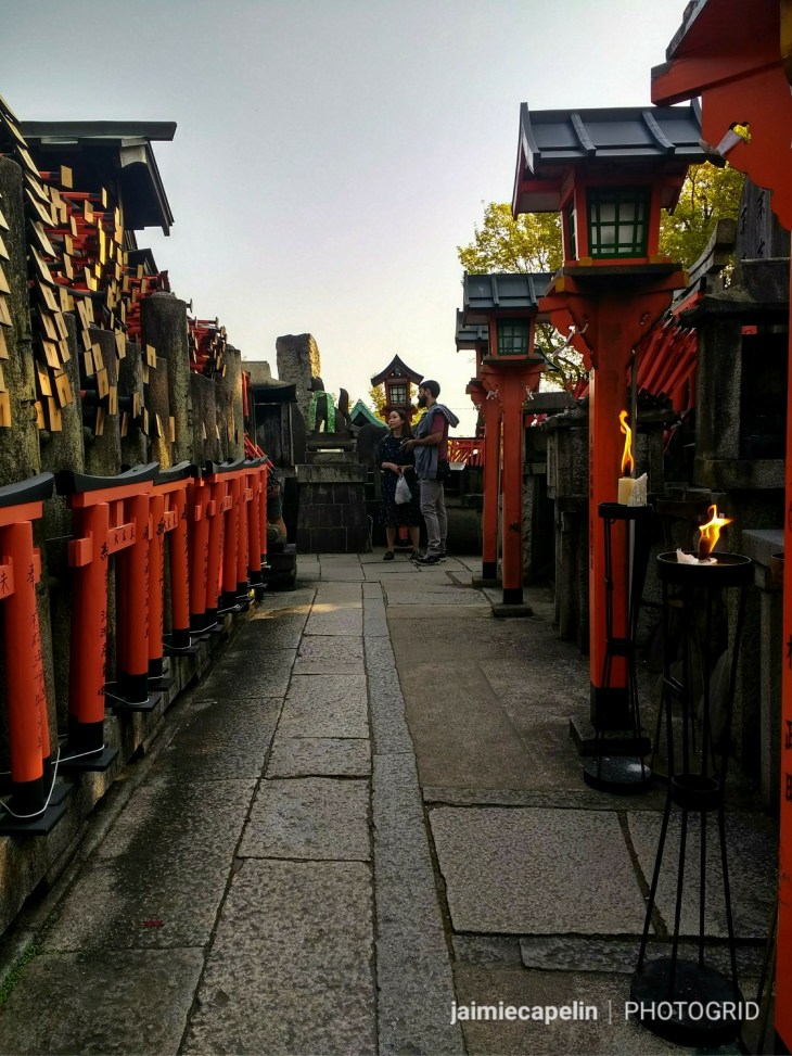
~ Fushimi-Inari Shrine – The Walk of a Thousand Gates ~
Fushimi-Inari, or ‘The Walk of a Thousand Gates’ actually has around 10,000 gates! The total hike can take 2-3 hours, climbing through a tunnel of torii gates to the summit of Mt. Inari-san, at 233m high.
Catching the train to Fushimi station in the South East quarter of main Kyoto, there was no need to find directions, as we just joined the crowd of people moving up the hill.
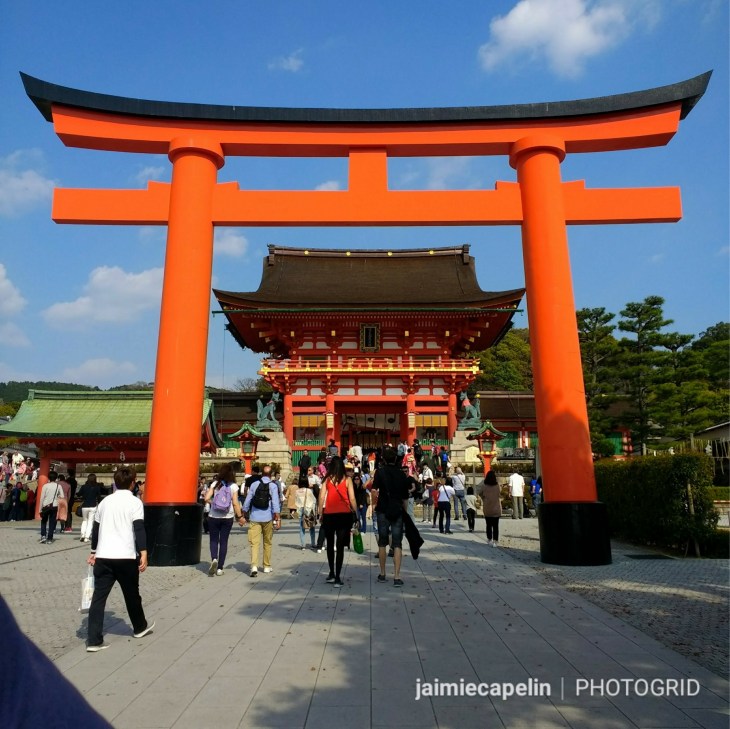
Entrance to the Main Precinct
Beneath one of the impressive entrance torii gates, you will notice that this shrine is guarded not by dragon-dogs, but by foxes. The fox is the messenger of the God Inari, for whom this shrine exists, and Inari is the God of rice harvest and commerce. The fox often holds a key between its teeth, representing its guarding of the rice store.
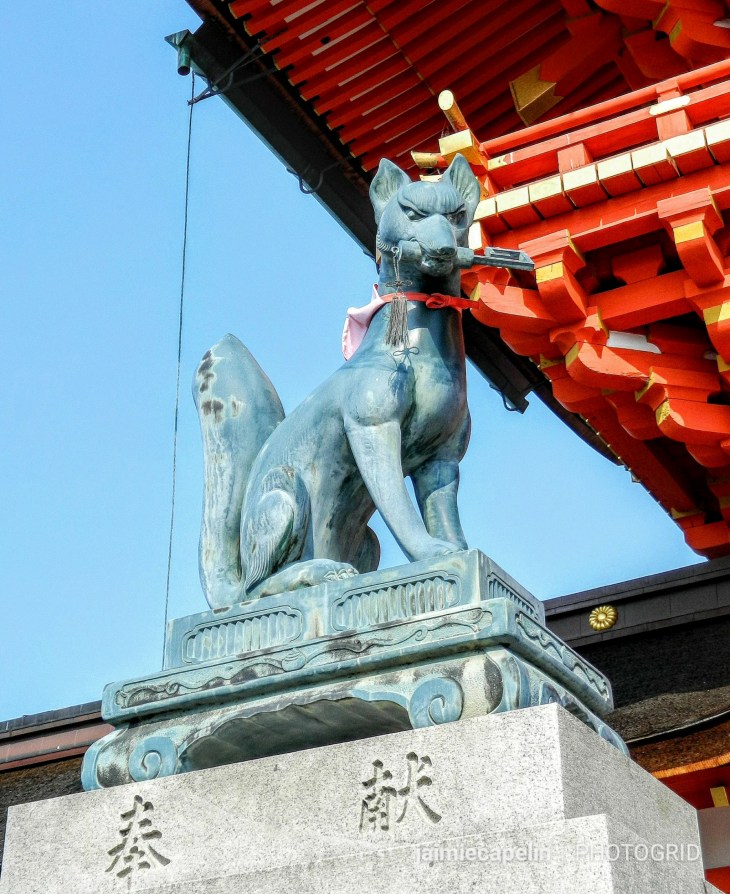
Inari’s Messenger – the Fox
Through the main precinct and around the subshrines and gardens, we noticed the crowd thickening as we climbed the stone steps into the trees, and found the entrance to the inner shrine. The first enormous torii gate is breath taking, framed by trees, and backed by another torii, and another, and on and on as far as you can see.
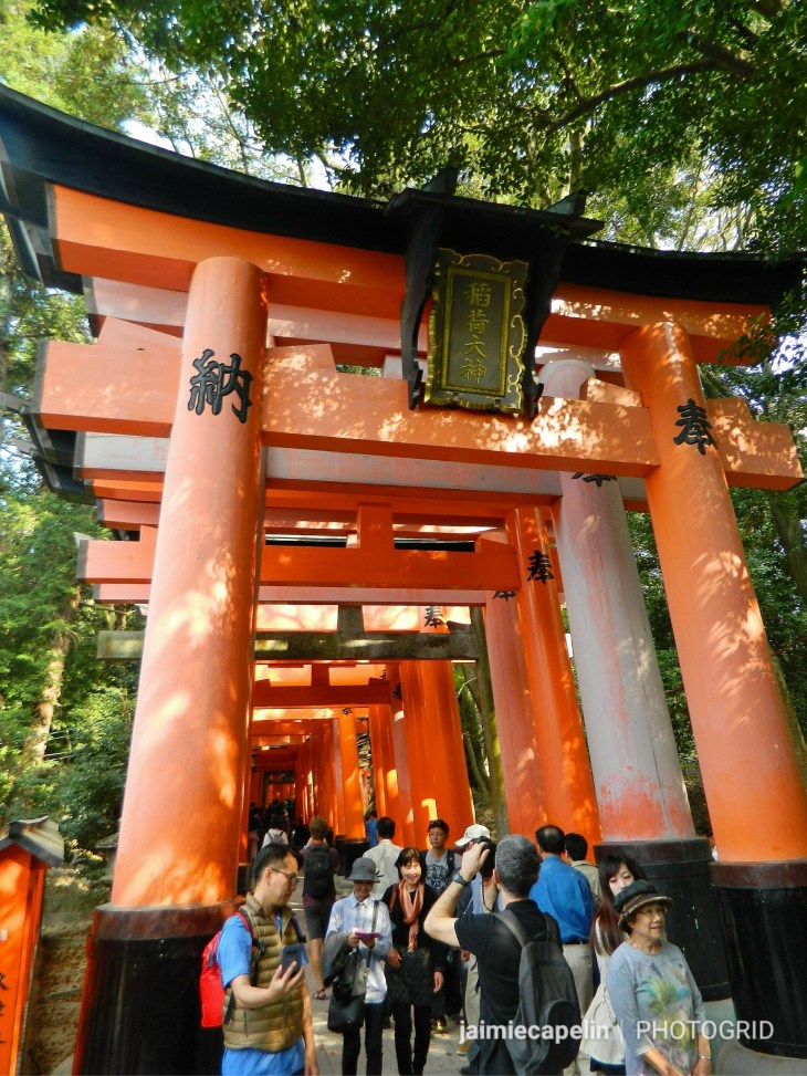
This part of the shrine gets particularly busy, with crowds fighting for that perfect selfie. But get used to it; this is the theme for the next hour or so, as the torii gates transform in shape and size as you climb further up the mount. In fact, we noticed that the further you climb, the less people there are, so save your perfect selfie for somewhere near the top!
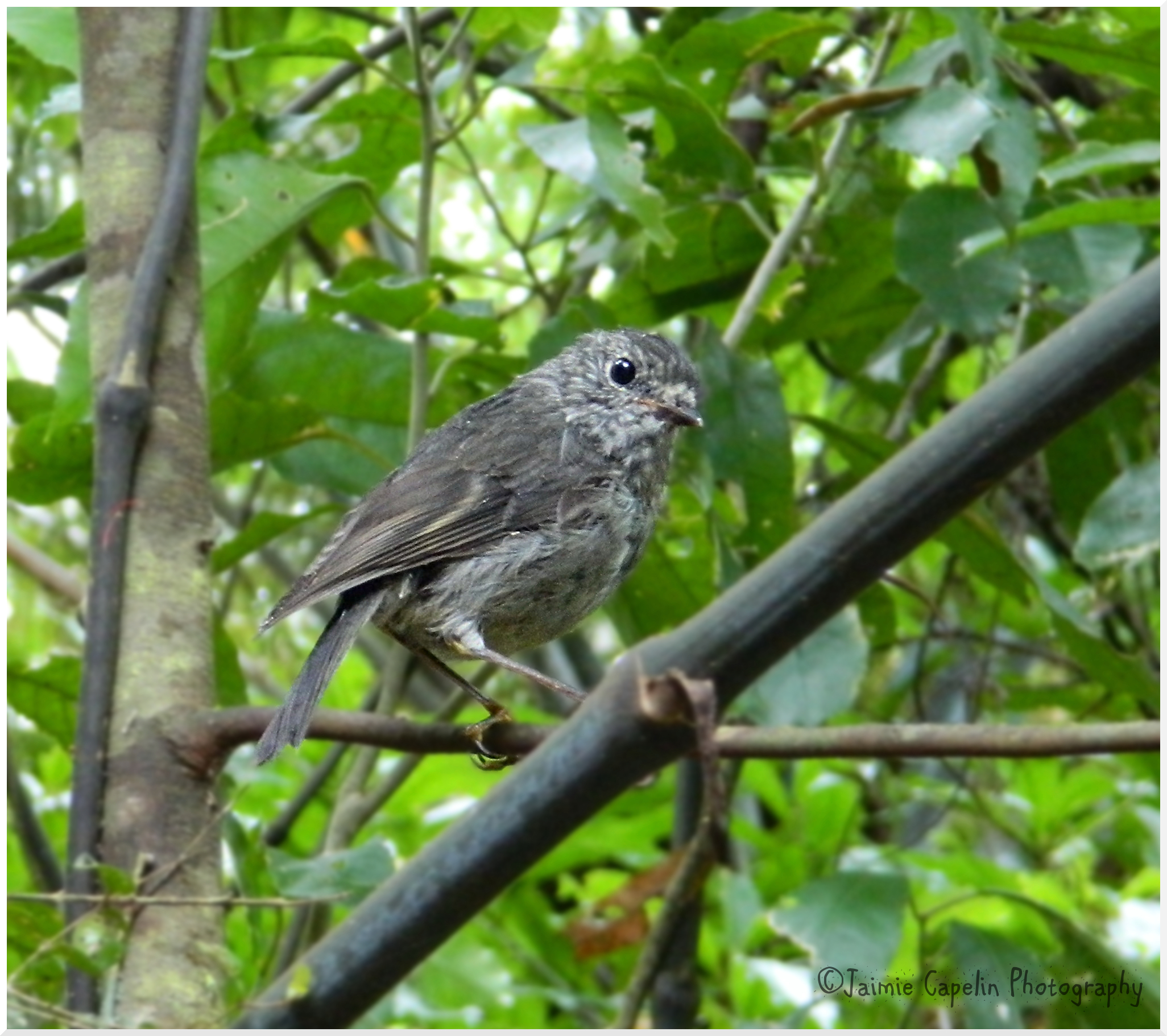
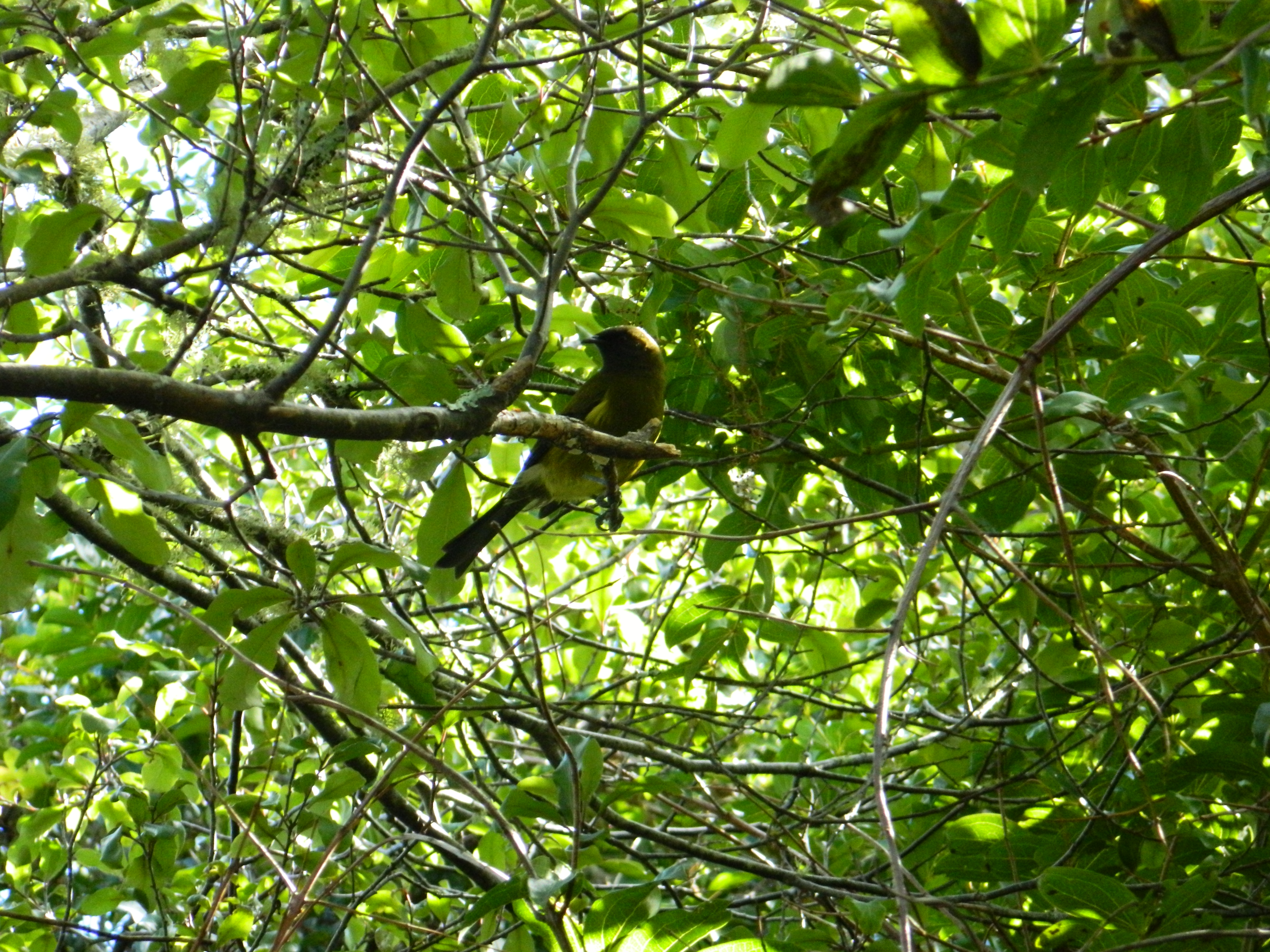
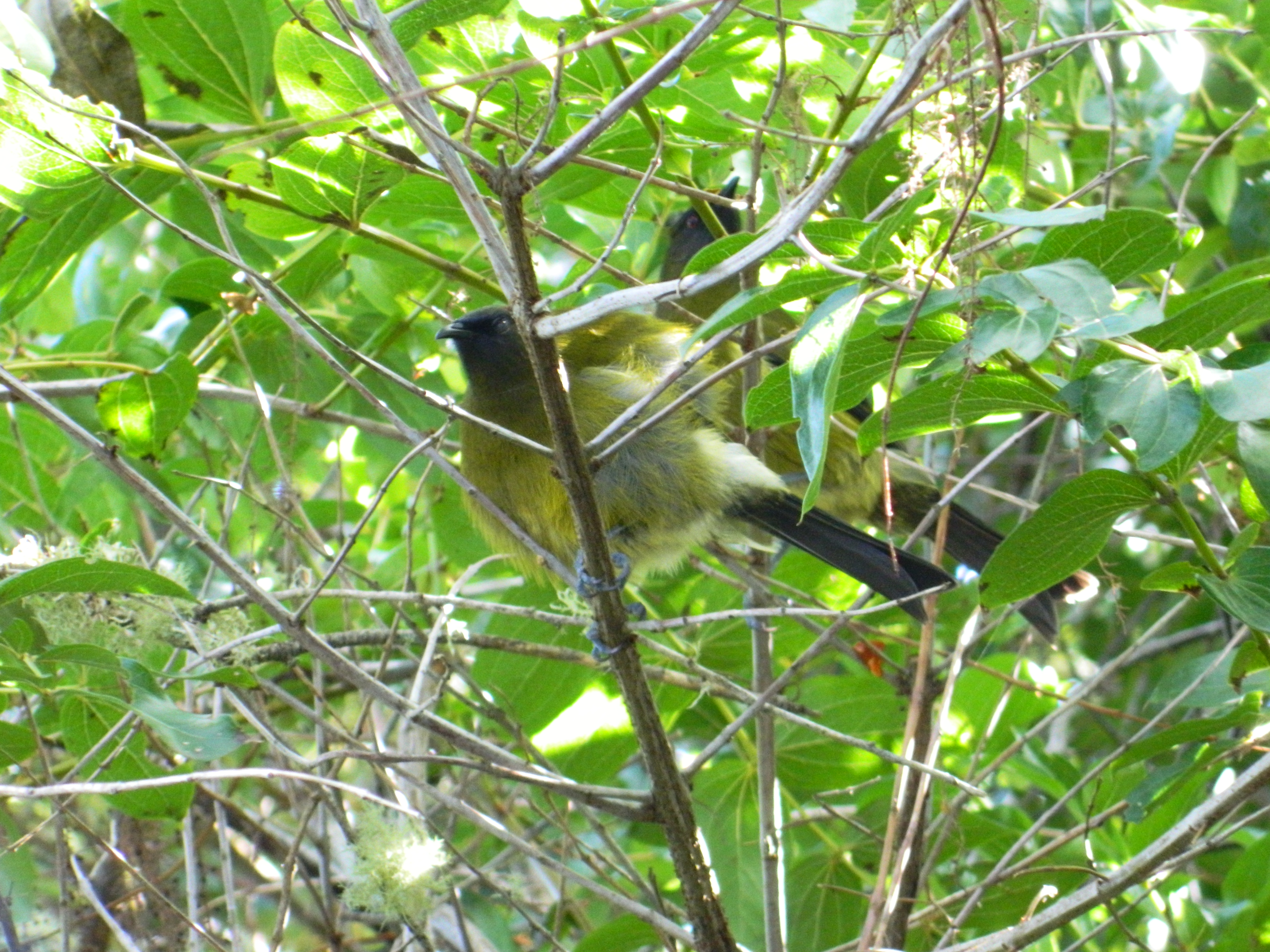
The walkway climbs through beautiful Japanese woodland, with birds fluttering and tweeting above, where sunlight streams through bamboo and sakura, spring flowers bloom, and the red gates cast lines of orange along the ground. There are ponds and streams, and shrines upon shrines in the network of torii gates, which shrink and change, keeping the hike fresh on the eyes. Japanese girls celebrating the Sakura Festival in their best kimonos, were climbing the never ending stone stairs in wooden flip-flops, creating an ambient ‘clopping’ sound.
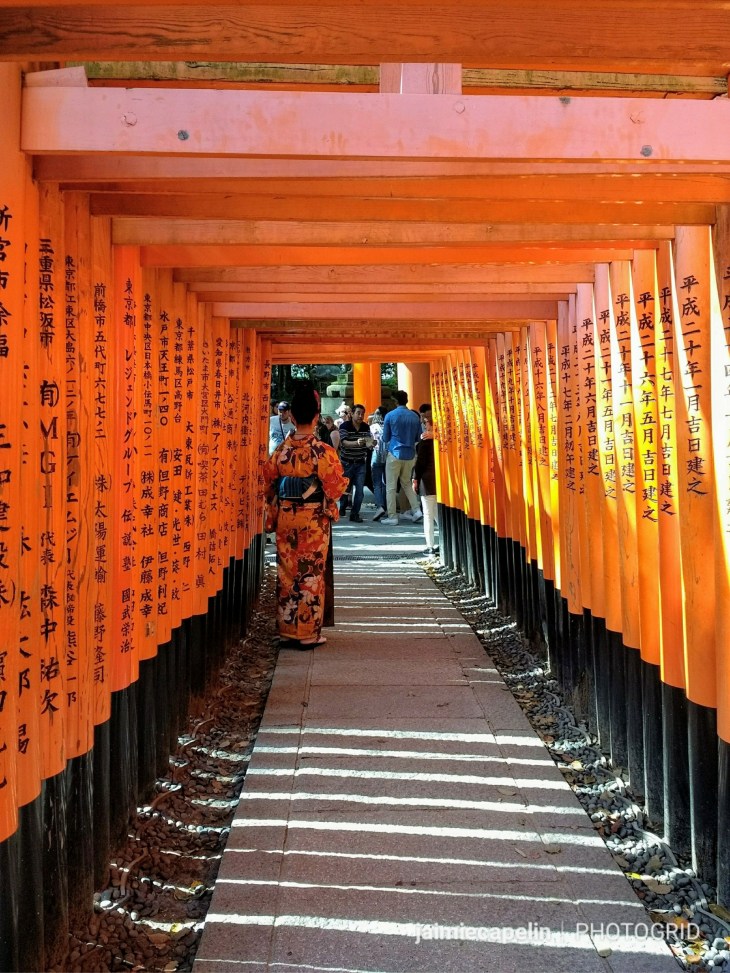
A girl in a kimono looks on quietly at the rush of tourists
Towards the top, you are treated to a grand view of Kyoto, stretching beyond towards Osaka, and then you are just a few more steps away from the main shrine at the top. Signs forbid photography on the stone steps entering the Kami-no-Yashiro shrine, which stands atop the 233m summit of Mt. Inari-san. Miniature replicas of the red torii gates are stacked all around the shrine, filling all available space, and candles dance in the breeze. There is a quiet stillness here, high above the city, surrounded by nature, a perfect opportunity for a moment of zen!
Kami-no-Yashiro Shrine
Continuing in the direction we were travelling, we began the long descent down the other side of the mount. I can’t glaze over the fact it was rather strenuous on the knees, but the magical scenery was enough of a distraction. Woodland grottos filled with shrines, and waterfalls for Shinto worshippers to bathe and pray in, while the paths of torii gates forked in multiple directions through the trees. There are maps at the road-forks if you should need them, but generally you can just follow the crowd all the way down to the exit.
~ Kiyomizudera Temple ~
The final thing on my bucket list for the day, was another recommendation from my Japanese friend, Yumi. This is her favourite temple in Kyoto, and I was keen to see what the fuss was about. With just over an hour before sunset, we hopped on the train, for about 10 minutes northbound from Fushimi station. It was quite a long walk from the train station to the back entrance of Kiyomizudera Temple, (as we wanted to avoid catching a bus in the intense city traffic), and we found ourselves walking through an endless hilltop cemetery, with shrines and temples dotted on either side. Unfortunately, a bypasser kindly warned us that the back entrance to the temple was now closed, and we’d have to walk around to the front, and we passed on the message to others walking in hope of getting to the temple.
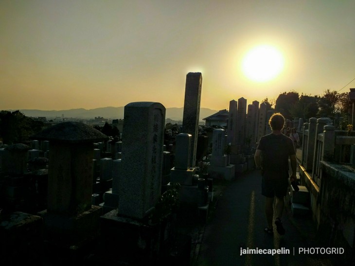
Kyoto Cemetery
Once we finally reached Kiyomizudera Temple, the sun was beginning to set, and they’d begun the ‘night time viewing’, for which you have to pay an entry fee. It was at this point we realised we’d crammed far too much into one day, and with throbbing feet and tired eyes, we decided we didn’t have the energy to get our money’s worth!
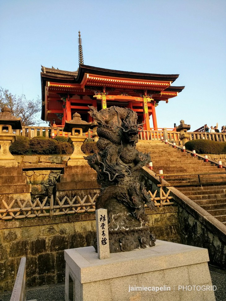
Dragons guard the entrance to Kiyomizudera Temple
So, with the setting sun twinkling through the sakura, and illuminating the temple’s red and gold exterior, we took a moment to appreciate the view, (after all it was stunning) and made our way back down the hill, across the city to our accommodation, to drink our well earned lemon sake we’d almost forgotten about!
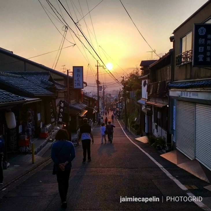
Homeward Bound after Walking 30km around Kyoto
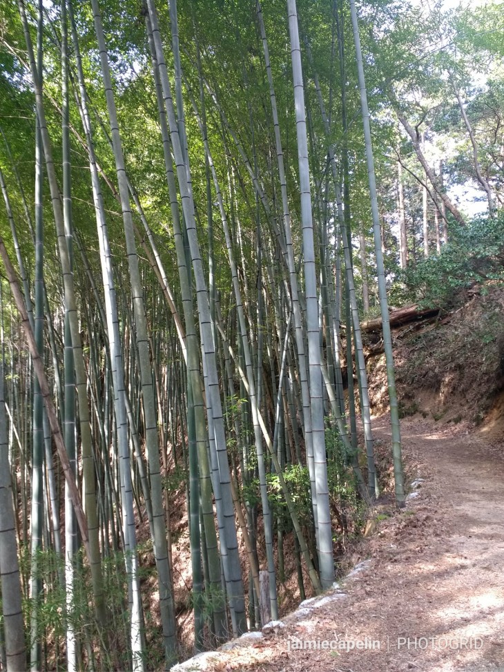
~ Arashiyama and the Bamboo Forest ~
About a 30 minute train ride out of Kyoto is Arashiyama, where you can see snow monkeys, go hiking in the mountains, boating on the river, and walk through the famous bamboo forest. In hindsight, I would have liked to have spent a lot more time in Arashiyama, as every corner we turned there was another wonder to explore. As is the theme with this trip, there were hordes of people in Arashiyama, mostly heading for the bamboo grove, but if you switch off from the tourists and their selfie sticks, and just look up and around you, it is possible to fully appreciate the vast nature and serenity of the bamboo forest. Listen carefully to the gentle knocking and creaking of the wood, as it sways and rustles in the breeze, catching the sunlight through its sprouting canopy.
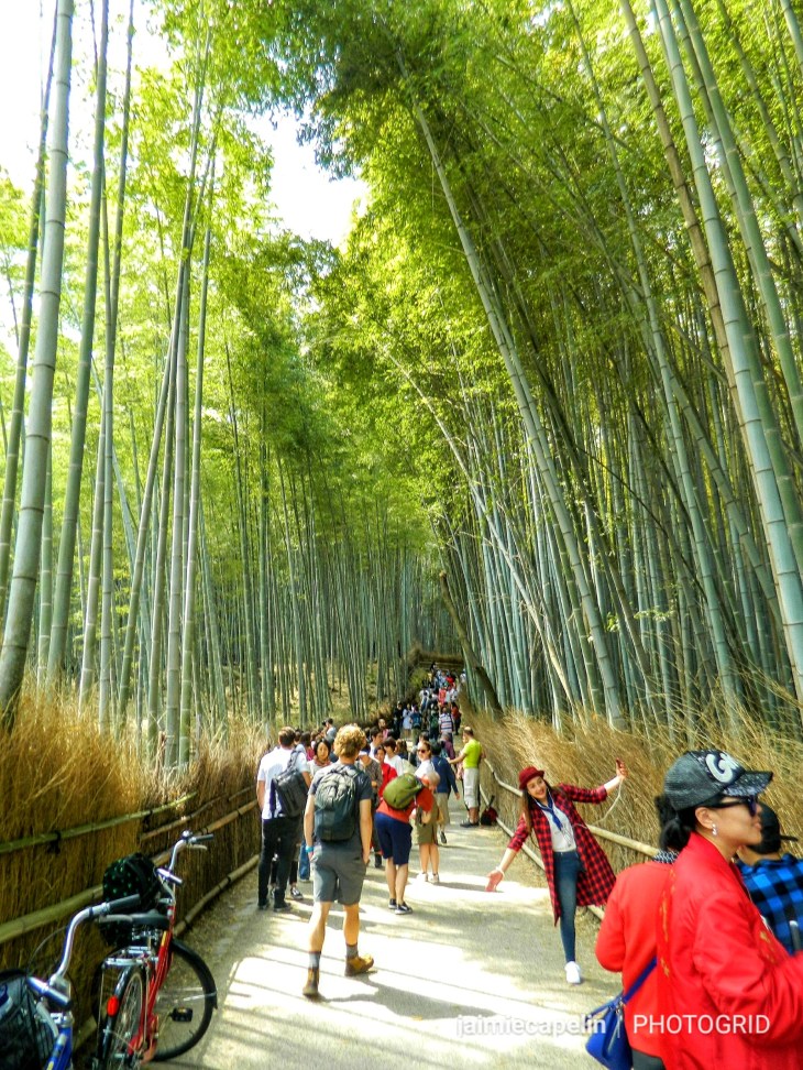
Sagano Bamboo Grove, Arashiyama
The forest leads into a huge park, where you might encounter a snow monkey or two if you’re lucky. The park climbs into the hillside, giving a spectacular view down into the gorge and the mountains beyond.
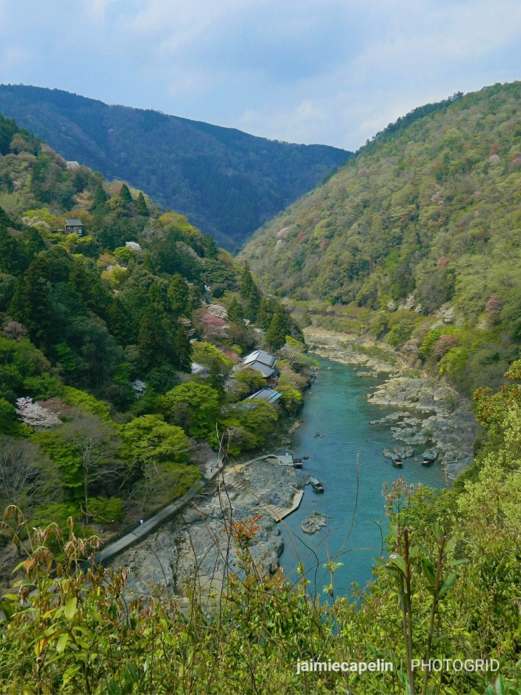
Õi River, Arashiyama
Following the steps down through the gardens, we came out on the river bank, which was dotted with fancy cafes and restaurants, while punting tour boats floated along the turquoise water.
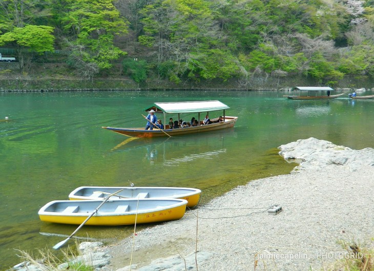
Punting on the River, Arashiyama
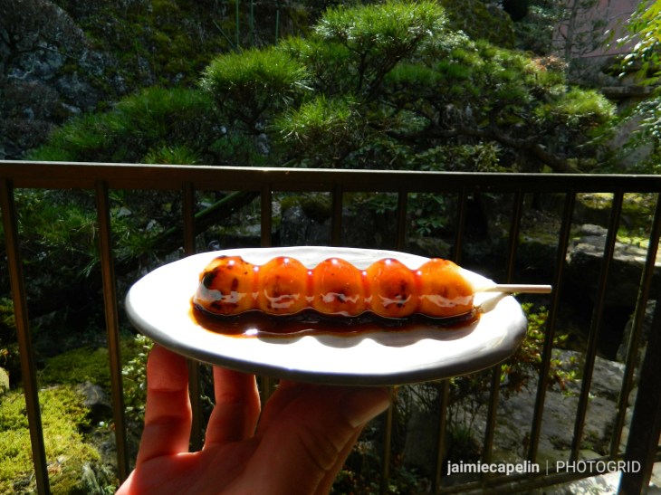
Strolling back through the town, I browsed the traditional kimono style clothes shops, marvelling at the array of rich and unique fabrics. Before getting back to the station, we went to a street vendor and tried some matcha ice cream – a Japanese favourite – bitter sweet green tea flavoured.
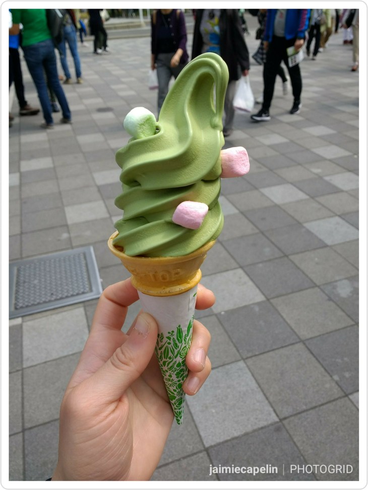
Matcha Ice Cream
Our time in Kyoto was up, and it was time to join our friends in Osaka. It was exhausting, but Kyoto was easily my favourite city. Maybe it was the Sakura festival, the glorious weather, and the fact everything was buzzing, but if you can get past the crowds, I’d fully recommend visiting at this time of year.
If I can give any kind of advice, it would be don’t rush to see everything! Kyoto is huge, and there is so much to see, I don’t know how you are supposed to choose. But with over 1600 temples and 400 shrines, you’ll find it difficult to miss out!


 [The Women’s Half Pipe World Cup Finals, Winter Games]