Volunteering with Elephants – Chiang Mai, Thailand

A scorching sun rolls skyward into the haze as we leave our hostel (and its resident mosquitoes) in the "Haiya" subdistrict of Chiang Mai city. It's 8:30 am, on an October Saturday in 2018. The 12 seater shuttle bus we board is clammy, and stuffed with tourists, our mutual excitement is thick in the air. We chug north bound for an hour, finally stopping at the edge of the jungle, in a village in San Pa Yang.   
ERP image
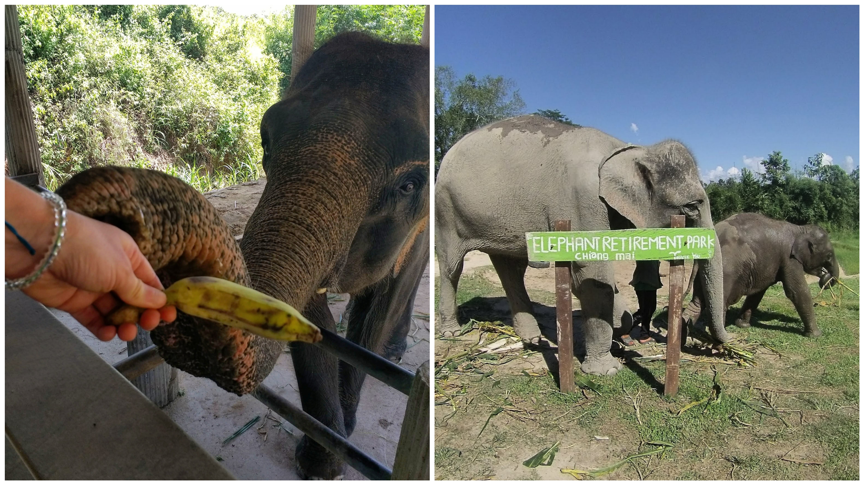
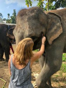
One by one, we step out of the mini van onto the dusty driveway, and there they are, beautiful, gentle giants. A few of the elephants come plodding quickly over to our van, swinging their trunks as they come - they know our arrival means feeding time!   

Meet The Elephants

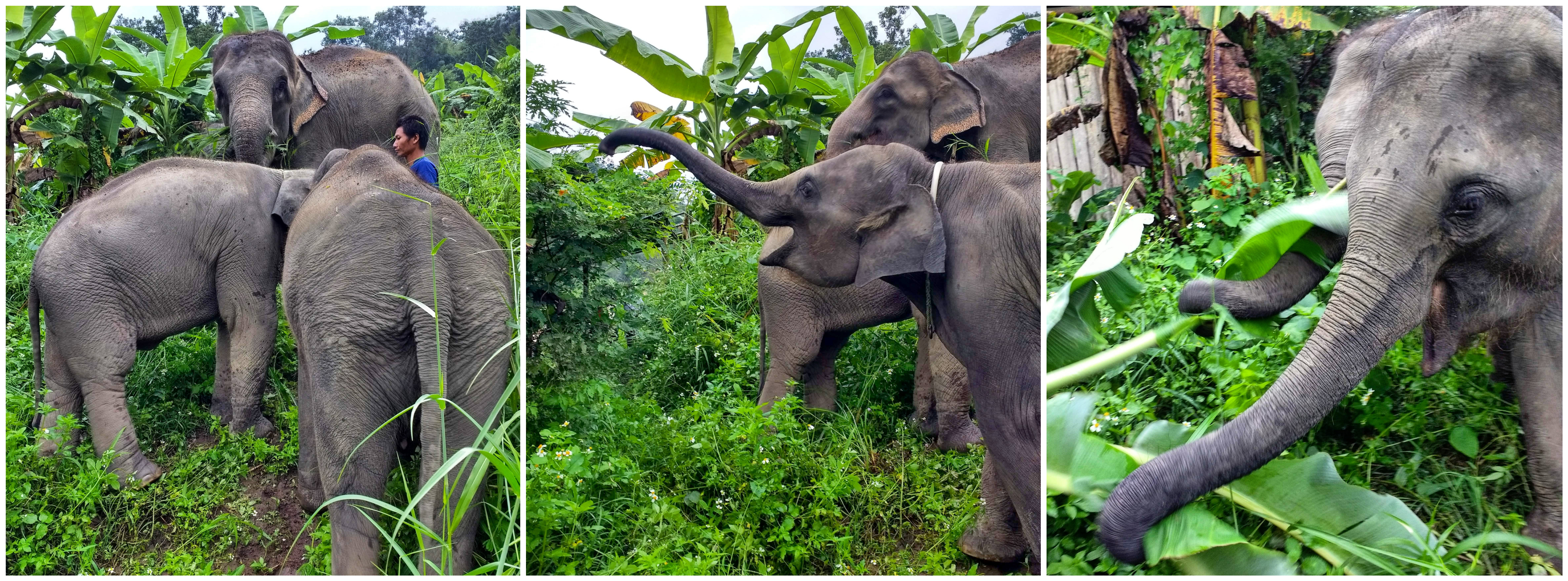
When I was there in October 2018, there were 6 elephants living at the park, all female, with a lot of history between them.

Bella – 20 years old

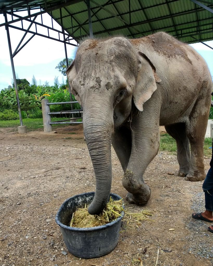
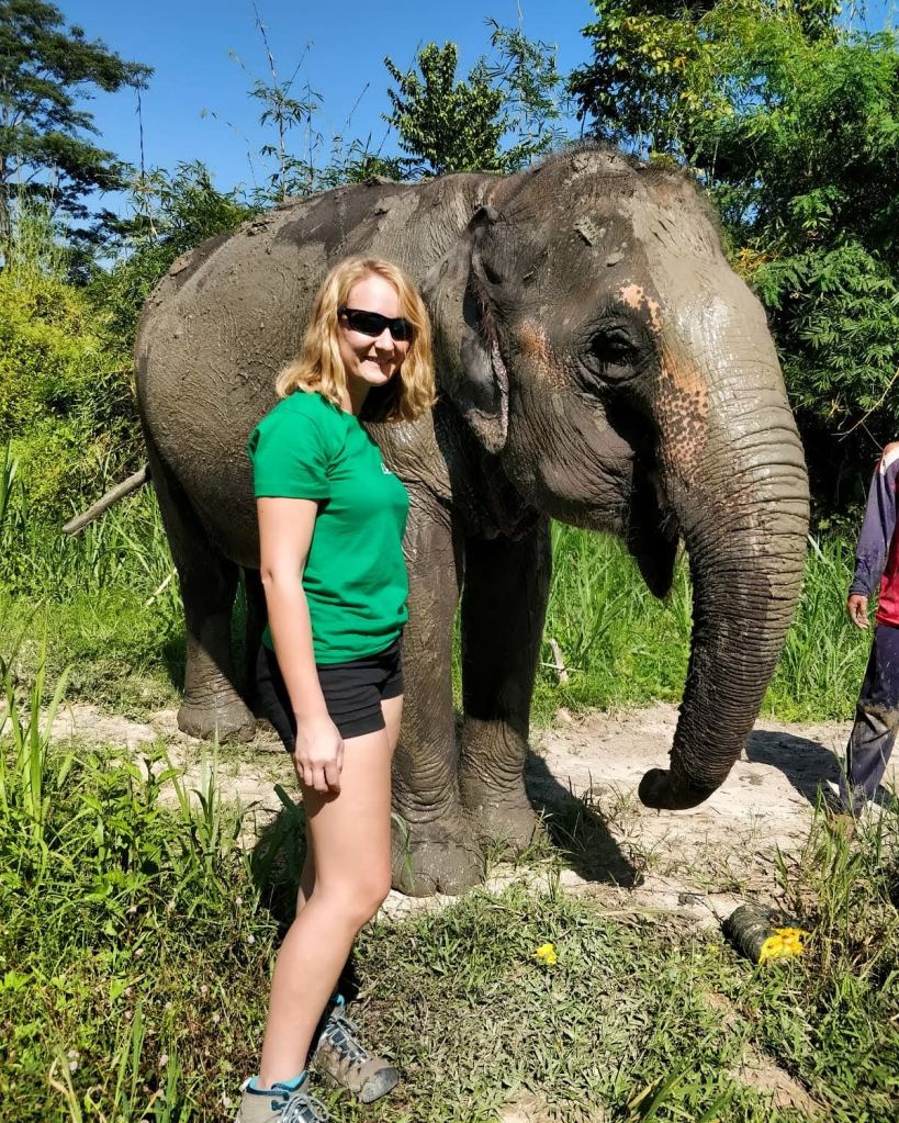
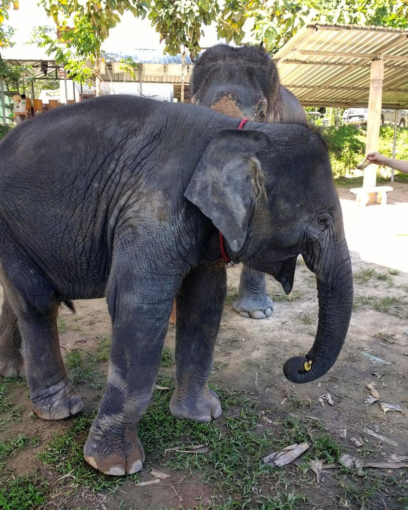
The park’s longest member, Bella had been living there for 4 years. She’d been rescued from a show where she’d play ball games like golf and football, and performed dances and tricks like sitting on chairs. This resulted in her left leg being damaged. A happy retirement was the safest option for Bella, over a complicated procedure that could cause more unnecessary trauma and be extremely costly. Bella could still walk on her leg, but the disfigurement caused her to limp, which put stress on her spine and shoulders. There are plenty of shaded areas built in the park, like this one, where Bella could rest at her will.

Bella had a calm and mothering nature, and was the adoptive mother of Lanna, one of the park’s baby elephants. Bella sadly passed away in June 2021.

Jao-nang – 31 years old

Born in 1987, Jao-nang is a beautiful elephant in the prime of her life. She was rescued from 20 years in the riding industry for tourism. At the time I was there in October 2018, she was 6 months pregnant, after entering a breeding program with one of E.R.P’s sister park’s bulls. Jao-nang had her baby in 2020, that’s right, elephant pregnancies last 18-22 months!

Jao-ying – 36 years old

Born in 1982, Jao-ying was the park’s oldest elephant, but she isn’t old at all, as an average Asian elephant’s life span is 60-80 years.
She worked for 20 years in the logging industry, before being sold for riding, and was rescued by E.R.P in 2016.

Lanna – 3 years old

A clear favourite among tourists, Lanna is sociable, curious, and a fast learner. She was born at the Elephant Retirement Park in 2015, and when she was 2, her mother was moved to a sister park in the south for further breeding. Her and Bella developed a mother-daughter like connection.

Ping & Tong – 2 years old

These cheeky twin sisters moved into E.R.P in 2018 from a nearby camp who did not have the means to support two calfs. They are bright and playful, and have been known to be quite naughty!

The Staff

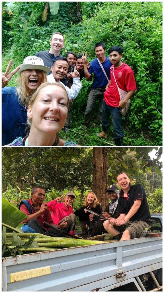
The Elephant Retirement Park is not only home to elephants. It is also home to the mahouts and their families, who live onsite, close to the elephants at all times. These mahouts have a close bond and special understanding with the elephants – they do not ride them, or control them using sticks or chains; they oversee the safety of everyone. The staff onsite all help out with gathering food for the animals, cooking, cleaning and maintenance at the park, building new additions to the park, and also helping out in the local community.


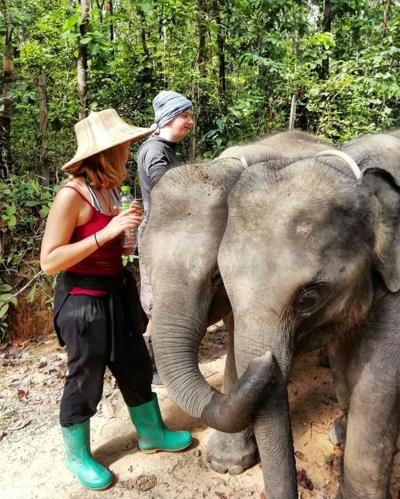
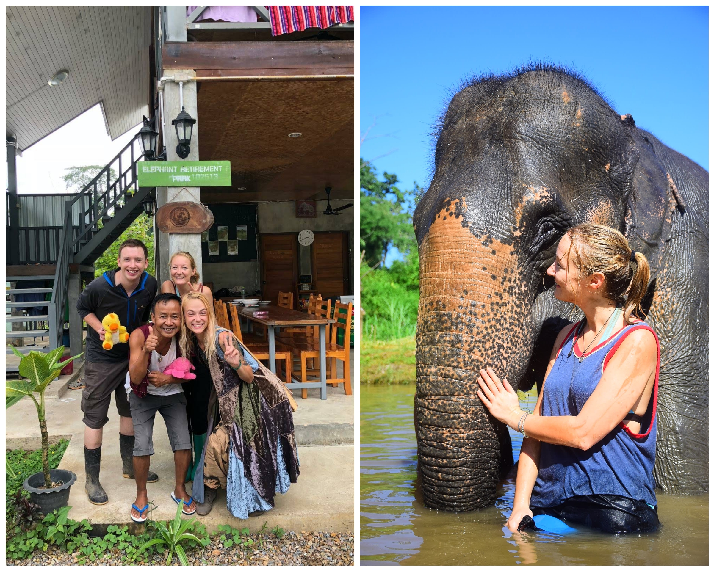
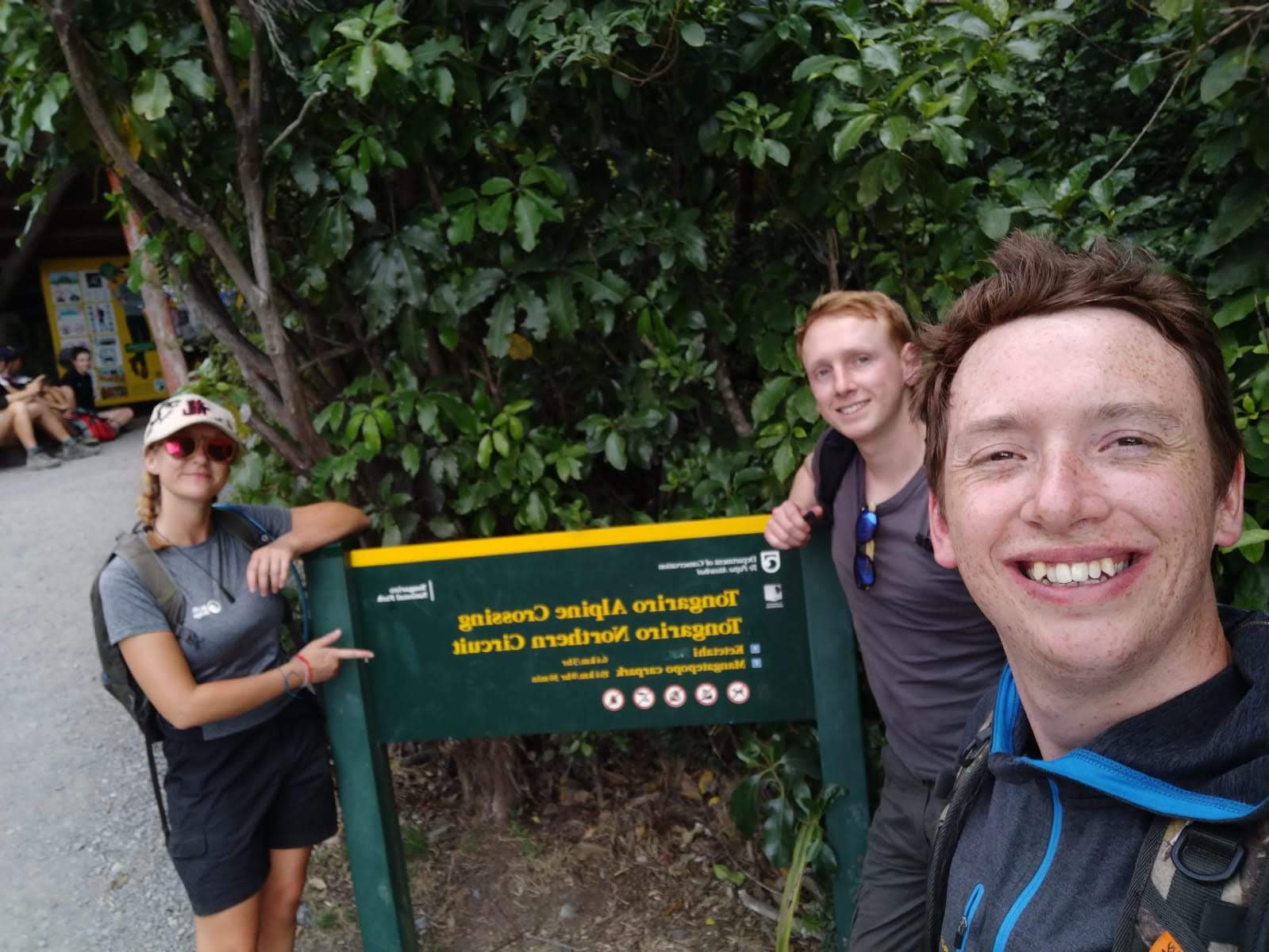
And then of course there are the volunteers. Pictured are Meli, Simon and me.

Alex was our fantastic host, he managed the park and all the volunteering tasks for us. He looked after us well, and once the working part of the day was done, he loved taking us out for dinner, showing us the sights, and introducing us to his friends. He showed us how to party once or twice too!

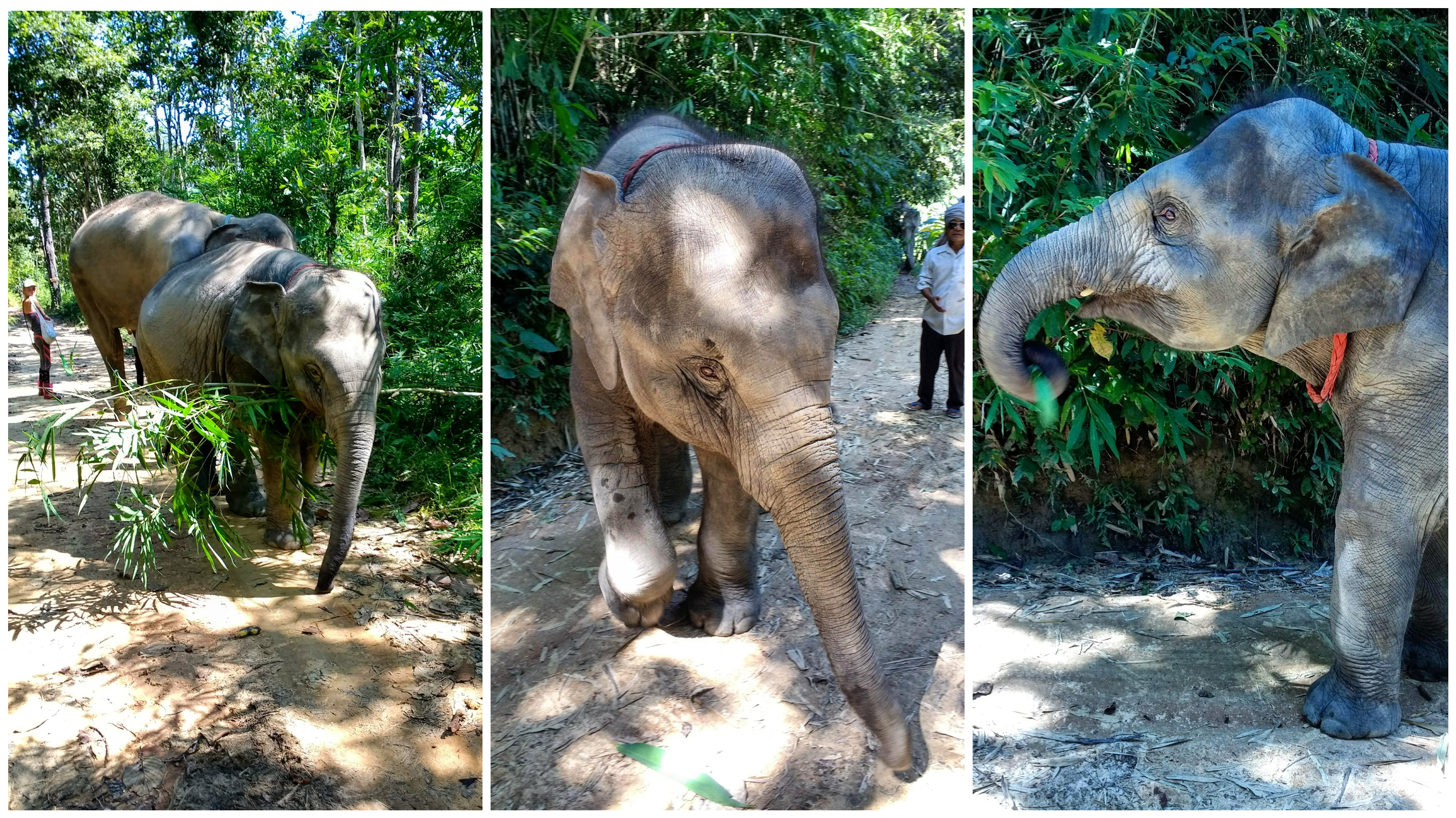
First thing first – we needed to meet the elephants! Simon and I arrived with a half-day tour group, so we got to experience the tour and get a good introduction to the park and its residents. The elephants knew the schedule by heart, and yep, it was feeding time!

The food store was stocked chock-a-block with bananas, sugar cane, and banana leaves. Each of us was given a tote bag to fill, and a couple of people were given bottles of milk for the babies. As we emerged from the food store, the elephants were waiting, holding their trunks out! At first, they took anything we gave them, often trying a cheeky trunk dip in our bags, (we were instructed to keep the tote bags firmly under our arms, as they would try and take the whole thing) but it wasn’t long before they started rejecting sugar cane, throwing it on the floor and asking for bananas instead!

Feeding Time

Once all the food was gone, we were taken further down into the park, towards the mud bath and pool, and that’s where the real fun began! Elephants like to roll in mud, or throw it over themselves with their trunks. Mud baths help cool them down, and protect them from common ticks. The mahouts started a mud fight, and we all ended up throwing clumps of wet mud at each other, laughing, slipping and sliding, so by the end of it everyone and everything was a monochrome of mud!

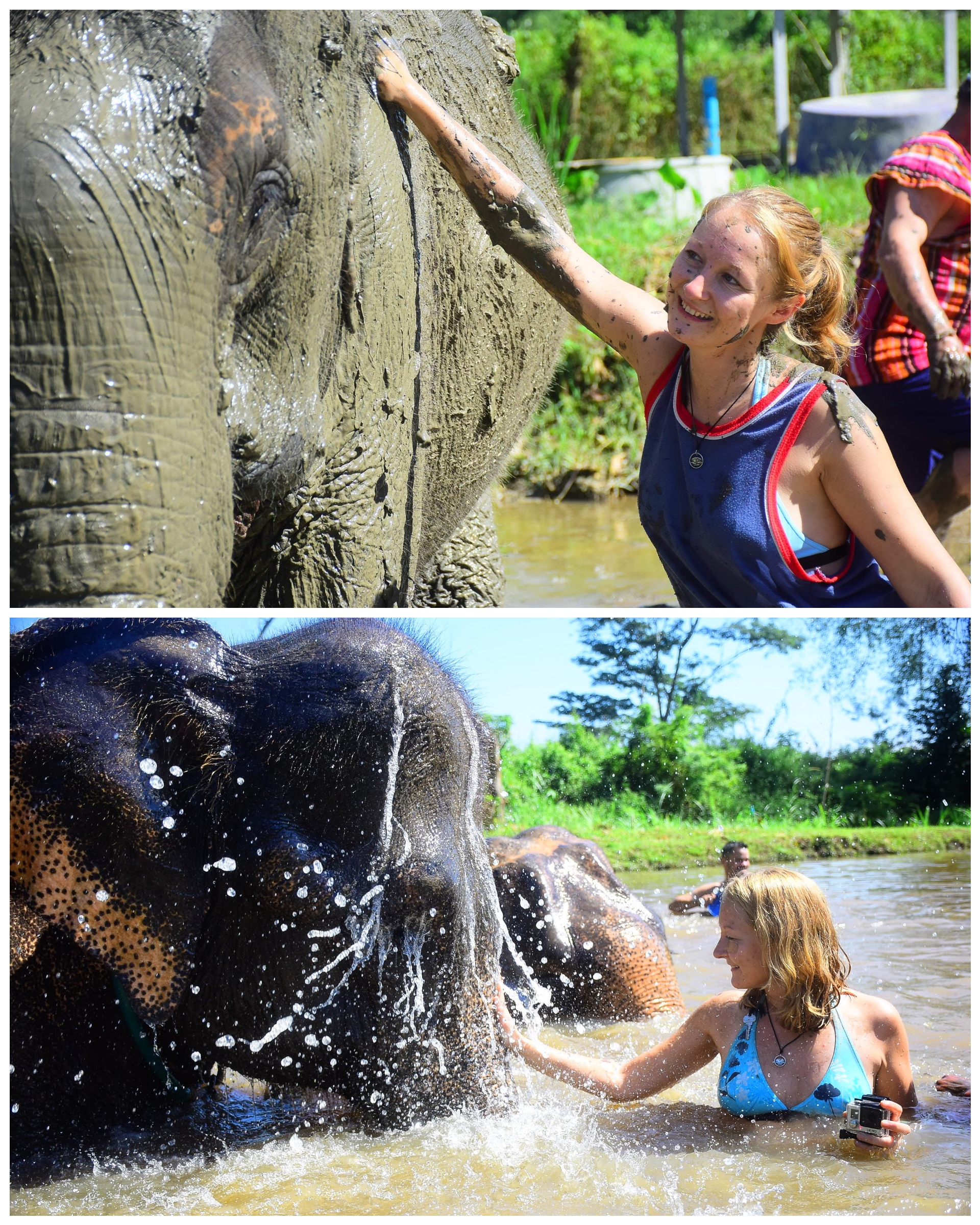
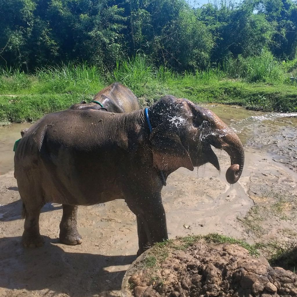
Time for a wash! The elephants had already wandered off to the pool, seemingly rolling their eyes at the silly humans, and we followed, splashing water with little plastic dishes we were given to wash the elephants.

One of the Mahout huts next to the elephant pool
Our Dorm – bottom right window

Once everyone was washed, dried and fed, the mini-bus was ready to leave, and it was time to wave off the half-day tour group, and get settled in our dorm. The room was a cosy twin, right in the heart of the sanctuary, with a big ceiling fan, and geckos on the windows to eat the mosquitoes.
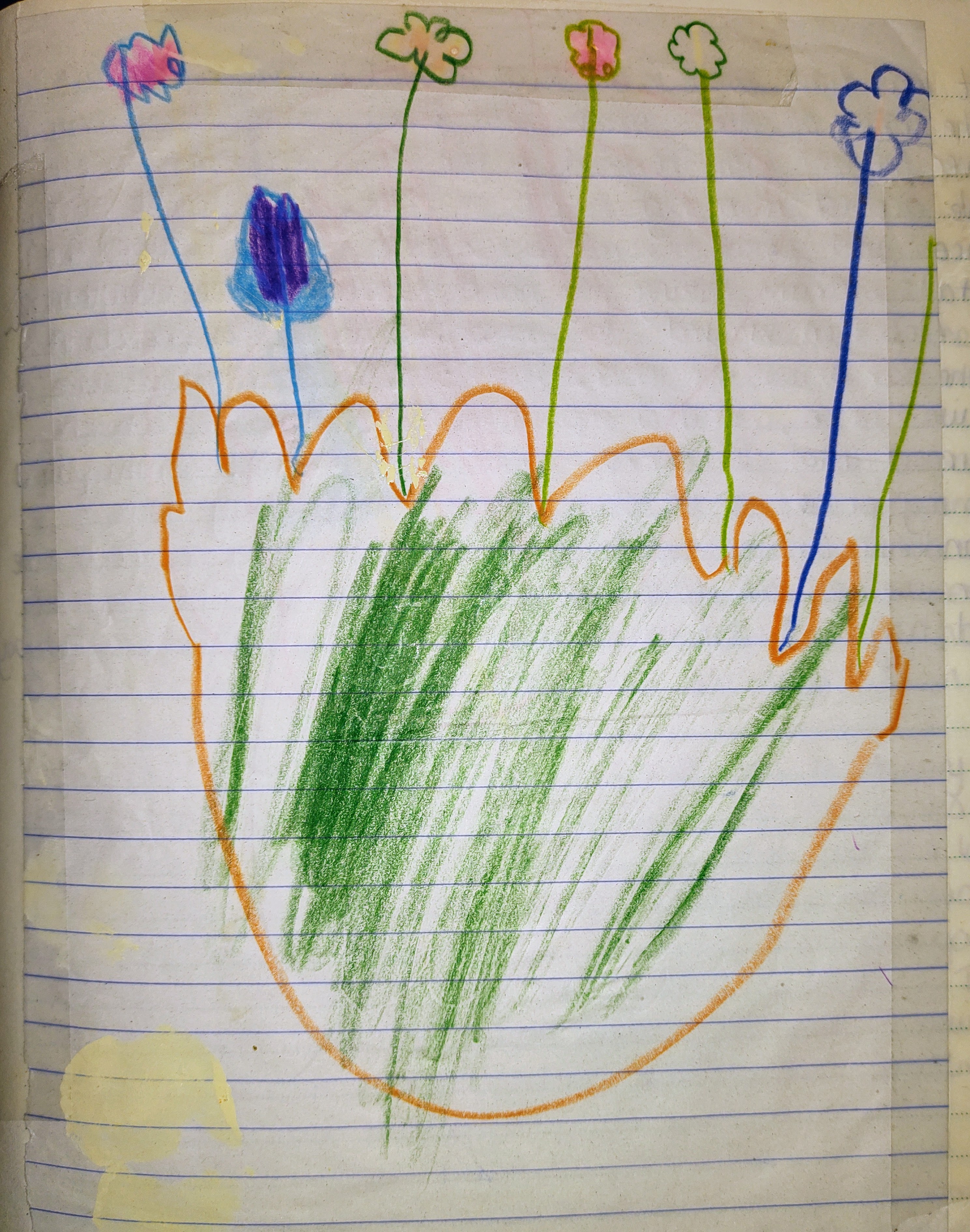
Aruni’s Flowers

Peace. Simon and I finally find a moment to sit down on the communal veranda and breathe in our surroundings with a Chang beer from the vending machine. Afternoon sunshine paints the trees with licks of gold. Through the gentle breeze, we hear a little "hello!" and a small girl appears from the mezzanine deck, an inquisitive grin on her face, and she repeats, "hello!" Quite confidently, she pulls up a chair beside me, produces a drawing book, and the three of us proceed to draw and colour flowers together! She's the daughter of a mahout, and is home from school for the weekend. She's learning English, and is able to tell us her name is Aruni, and she's four years old.  
Aruni’s Flowers

I had an unfortunate accident on my first evening, through no fault but my own, and I can only sing the praises of Alex and the others who helped. I managed to cut open my cheek, just under my eye, on some very large barbed wire – elephant sized, you might say. Alex quickly sourced some “Lemon Bush Grass” from his herb garden, he chewed it into a pulp and told me to press it on the cut for about 3 minutes. Amazingly it stopped the bleeding, and bought time for Aruni’s mum to find the first aid kit. She washed it with iodine and redressed it every day for a week, refusing to let me look at the damage! I still have a small scar, barely visible now, and a surprisingly fond memory to go with it!

A Day in the Life of a Volunteer

A typical day at the Elephant Retirement Park on the volunteer program looked something like this:

6:30amClean the elephants’ night enclosures
7:30amGather elephant food: typically cutting down banana trees in the park’s nearby plantations
8:30amBreakfast
9:30amElephant care / Community volunteering
12:30pmLunch
1:30pmPark maintenance and upkeep
2:30pmHottest part of the day – time to rest
6pmFeed the elephants
6:30pmDinner – cooking with Alex or going to village for food with the locals

Early Morning Duties

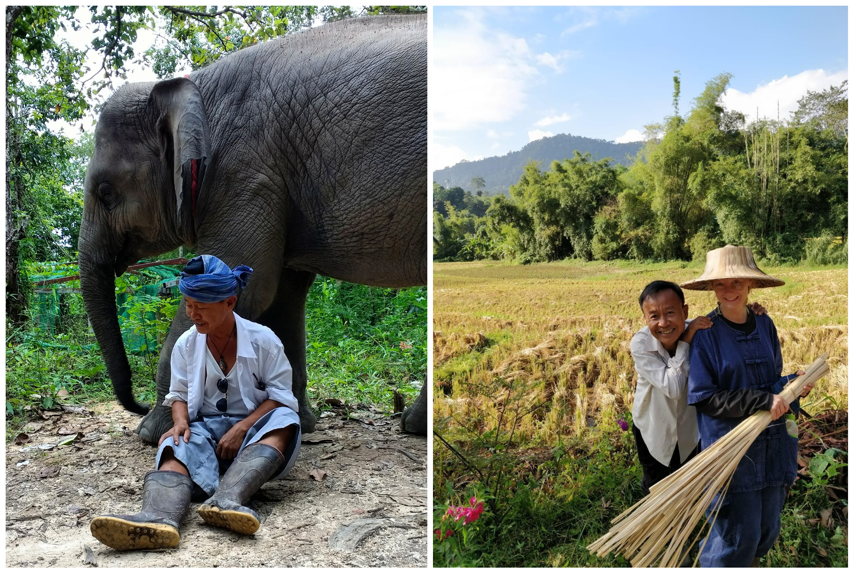
Each morning we’d rise with the sun, waking with the soft trumpets of the nearby elephants, singing for their breakfast. Pulling on our baggy work clothes, we’d step outside into the rising sun, and into our one-size-fits-all wellington boots. It’s a refined look, one that I embraced, with my scarred cheek and borrowed wicker hat… There was a coffee station in the common area outside, and some mornings the mahouts and workers would gather there before the sky was lit, and we would sip quietly until work began.

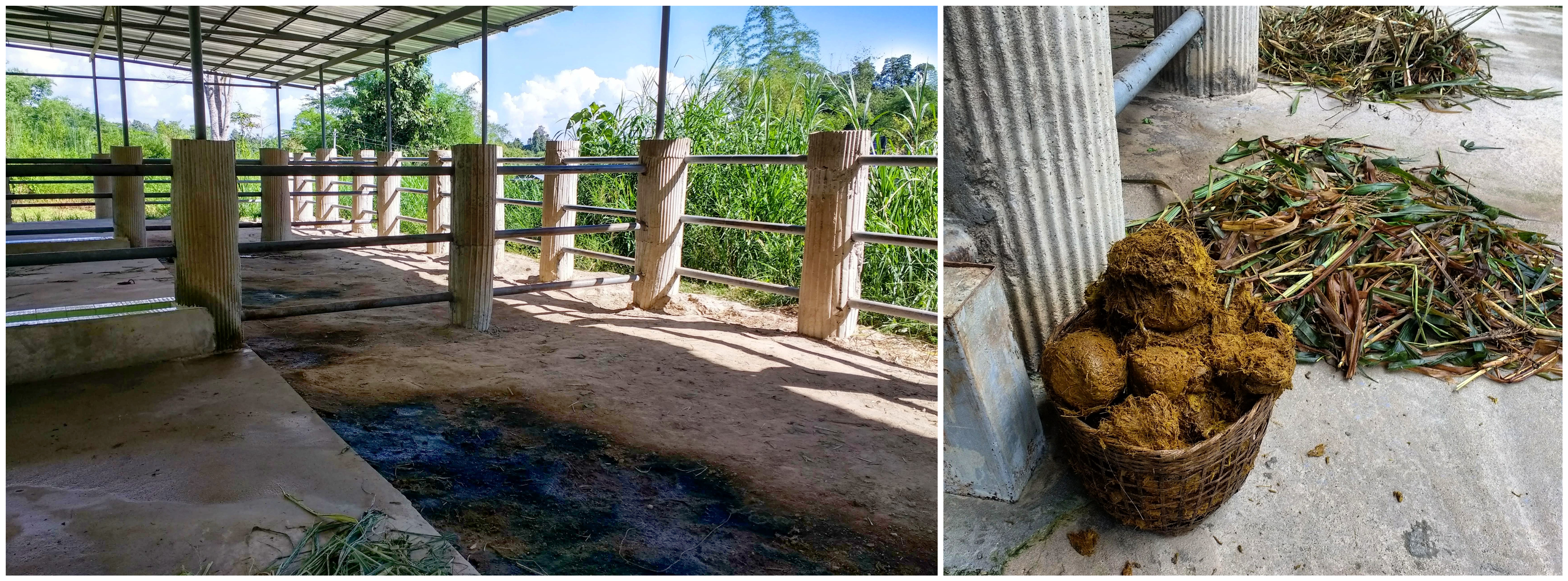
It is essential for the night enclosures to be cleaned every morning. At 6:30am we’d go around with a giant basket, filling it with elephant dung (really heavy, like grassy, brown bowling balls!) We’d sweep all the old leaves and bits of food away, hose down the floors, and clean and refill the water trough – often with the help of Lanna!

Night Enclosure / Elephant Dung

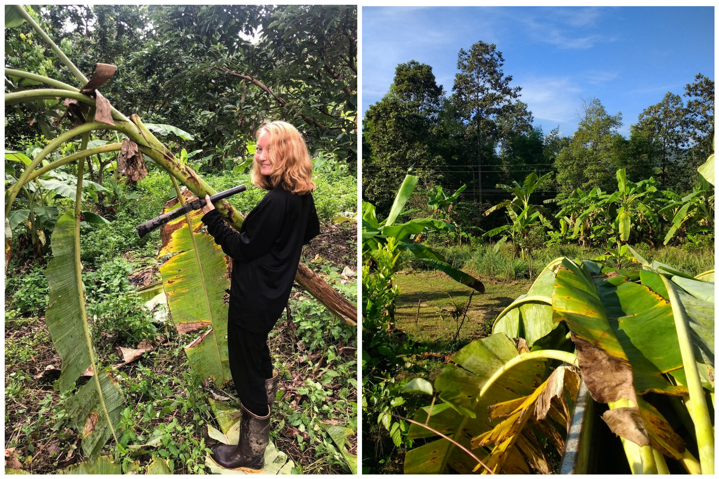
Then the Utility Truck would start up, the mahouts would beckon “come, come,” and we’d all jump into the open trailer of the Ute. Rumbling along the narrow, uneven road, skirting the jungle, with wind buffering our ears, we made our way to one of the park’s nearby banana tree plantations to harvest food for the elephants.

On arrival, it was straight to work. The mahouts showed us that banana trees grow back super quickly, producing baby green shoots straight out of the stump, which makes them a perfect renewable food source for the elephants. We were told to leave any trees with bananas growing on them, and any young trees, watching for snakes and spiders all the while. The mahouts taught us how to use a machete to cut the tall trees down – a two-handed swing, angled into the lower part of the trunk. They made it look extremely easy, felling trees in a single swipe, while I seemed to be hacking away ungracefully for hours! But I got my trees, and we carried them back to the Ute, loading them in and climbing on top of our loot for the journey home for breakfast.

Banana Tree Harvest

Community Volunteering

Everyday was different after breakfast. Somedays we’d help around the park, or go to another location to help out in the local farming scene. These are some of the tasks we took part in:

Unloading Deliveries

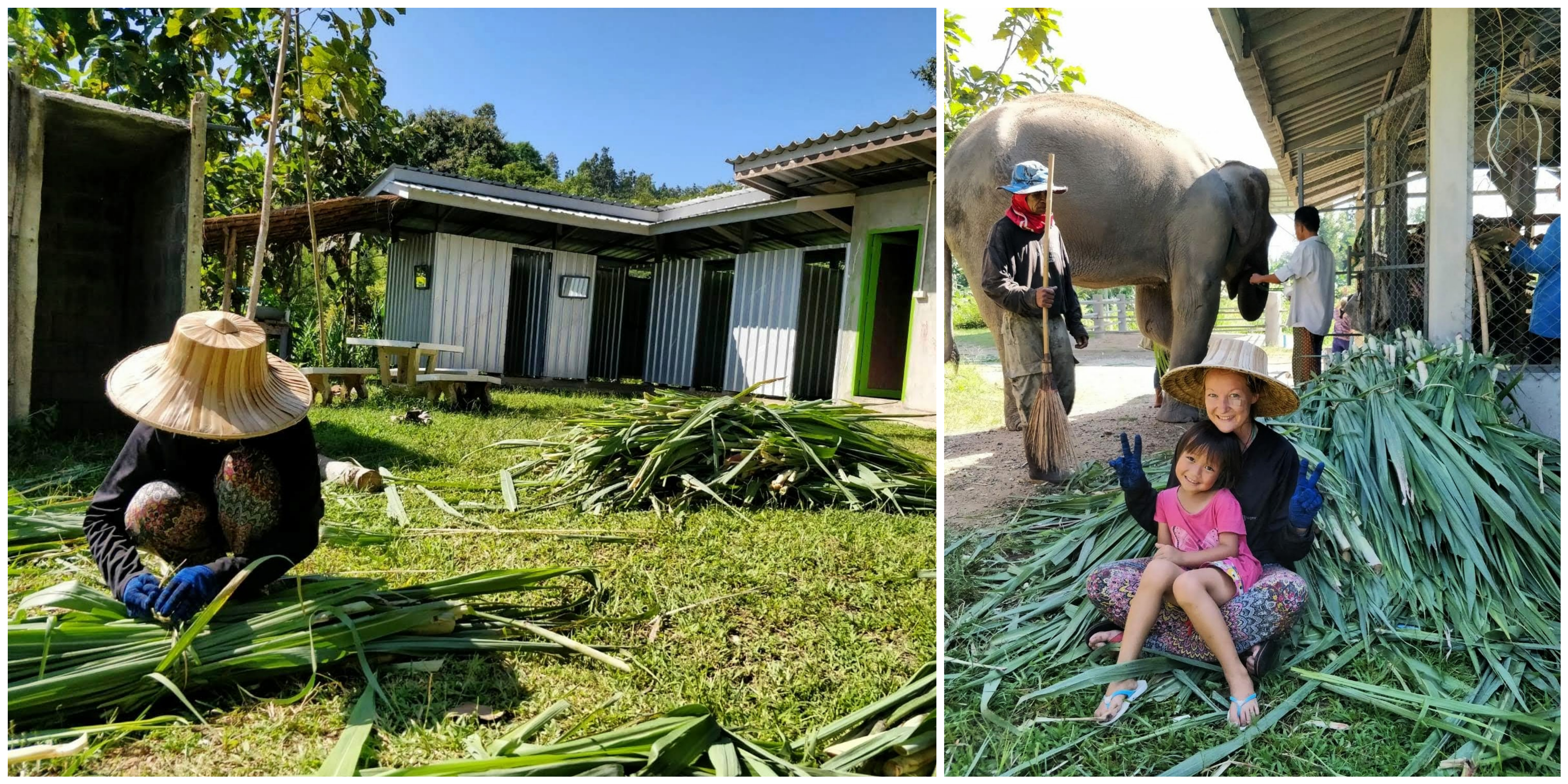
A large delivery of Sugar Cane arrived on the back of a ute, and we had to strip all the leaves, and bind it in bunches with bamboo ties to pack into the food store.

Tying bundles of sugar cane

Elephant Healthcare

We learned how to make vitamin balls for the elephants, by crushing dried papaya and salt crystals in a pestle and mortar. We then squished the pulp together, placing deworming tablets and essential vitamins inside, and rolled them into balls, ready to feed the elephants.

Making elephant medicine

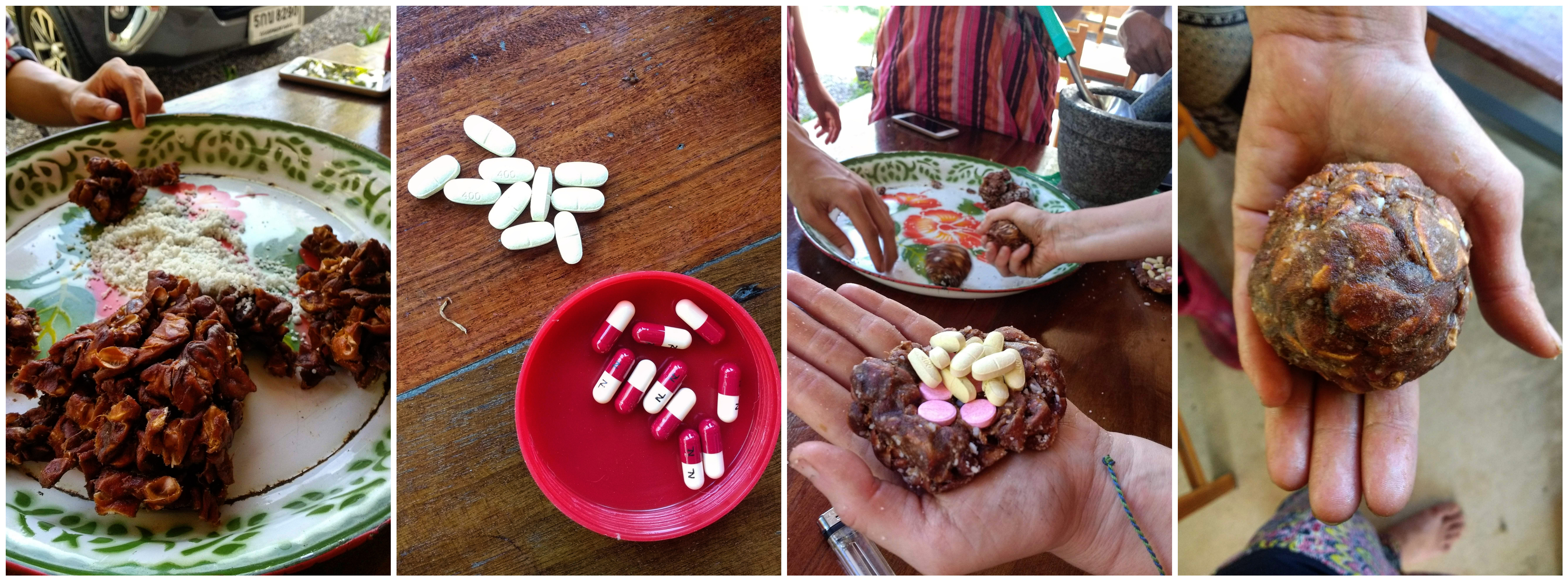
I was tasked with treating a tick wound on Bella’s cheek. Ticks are a common problem for elephants, and can leave big wounds, vulnerable to infection. I took a giant cotton tip, dipped in iodine, and Bella and I had a little bonding session over our matching cheek wounds!

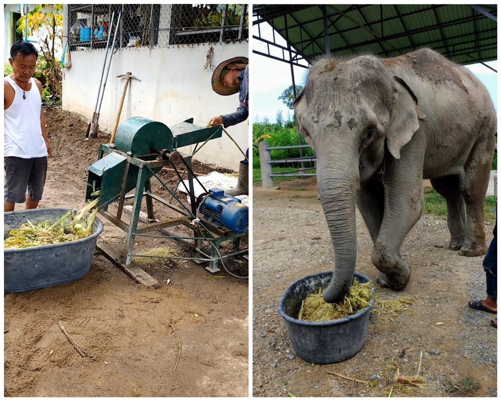
Elephants eat for up to 16 hours a day, but they have an inefficient digestive system, and are prone to digestive issues, so it’s essential their diet is balanced and full of fibre. We used an old shredding machine to make a fibrous mulch, with sugar cane, papaya, banana, salt water, and medicinal herbs. Bella was our taste tester; she took a mouthful with her trunk, and then threw the next trunkful on the floor and flapped her ears! I’m still unsure whether that meant she hated it or loved it!

Deep Cleaning

The enclosure area had a concrete floor, which had become covered in moss over time, making it dangerously slippery for the elephants. We spent two mornings scrubbing it clean with caustic soda, with Alex’s help, and were rewarded with pancakes from the village later!

Working in Rice Fields

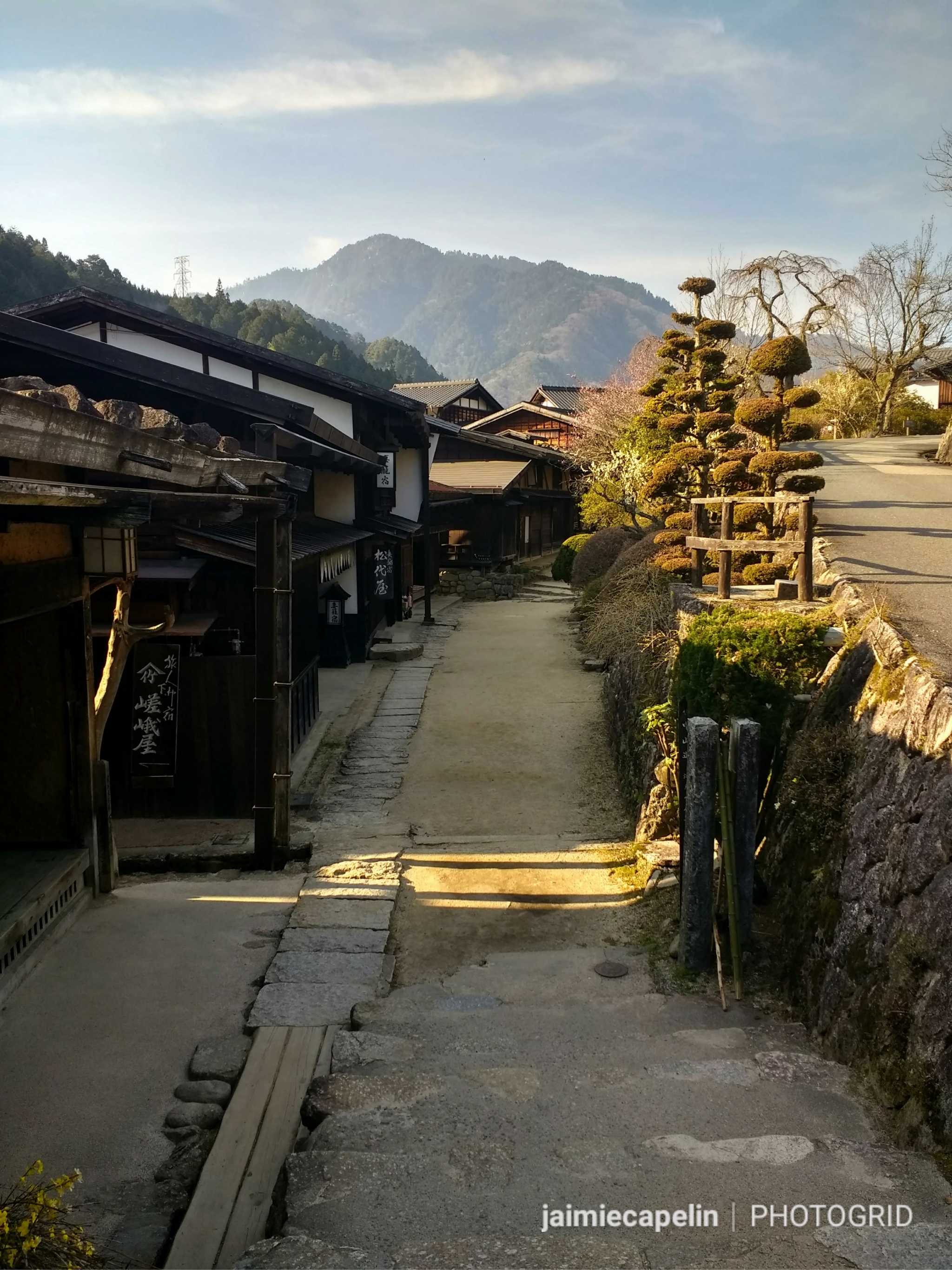
One morning after breakfast, we piled into the trailer and Alex drove us to the nearby village “Ban Iek”. The jungle thinned out, and we crossed a bridge lined with Thai flags, until we saw dozens of people all working in the rice fields, on a green back drop of mountains.

Ban Iek Village, San Pa Yang

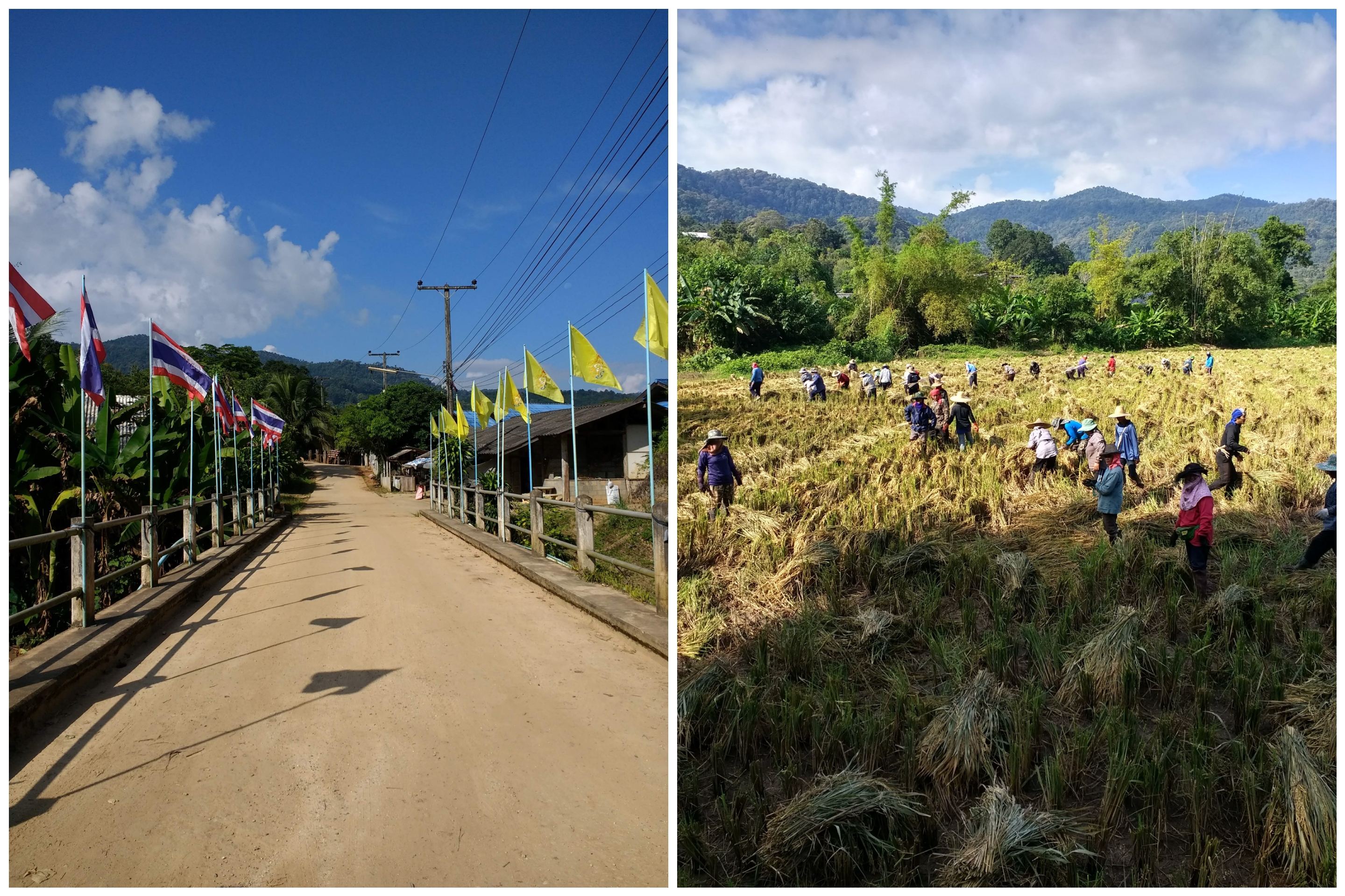
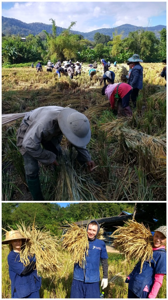
We were each given a bunch of long bamboo ties, and shown how to gather the pre-cut rice bundles and tie them efficiently, though I’m not sure we were very efficient or helpful to the cause! Everyone was friendly and good humoured, keen to help teach us, and laughing at us every time we got a boot stuck in the thick, wet mud! They taught us to stomp down on the rice stalks and use them as a foundation to stop ourselves sinking.

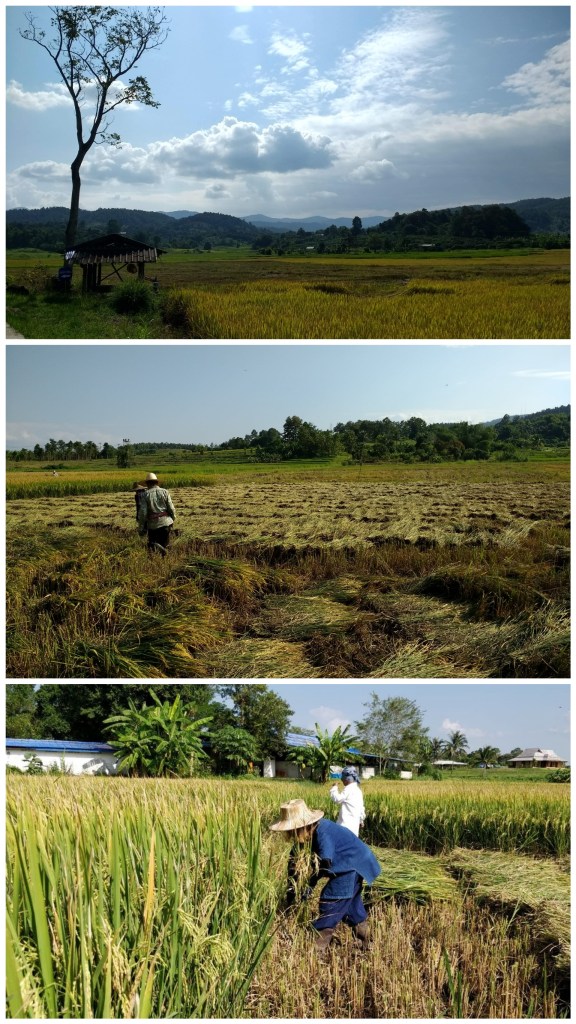
Another day, Alex brought us to another beautiful location, an independent rice farm, where we helped a couple cut the rice from their fields, using traditional long scythes. It was very hot work, but between the 5 of us, we got the job done.
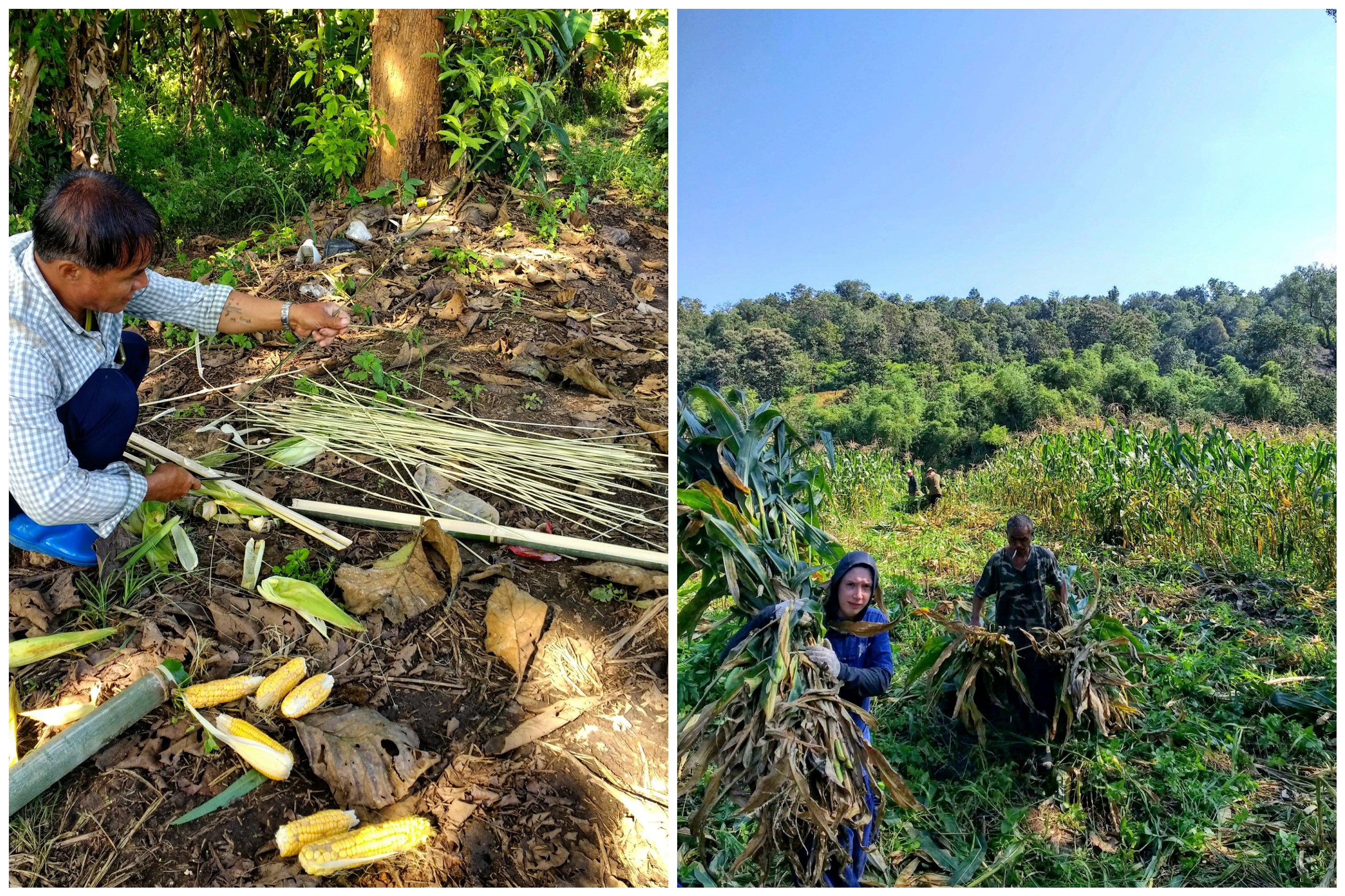
Harvesting Corn

Making bamboo ties / harvesting corn for food

Landscaping the Park

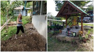
The Elephant Retirement Park is a constant work in progress, and one of the things they were raising money for was extending the food store. We helped in levelling the ground by hand, preparing it for laying foundations. We also planted herbs and shrubs, for decoration & to expand their renewable resources onsite.

Elephant Walkies

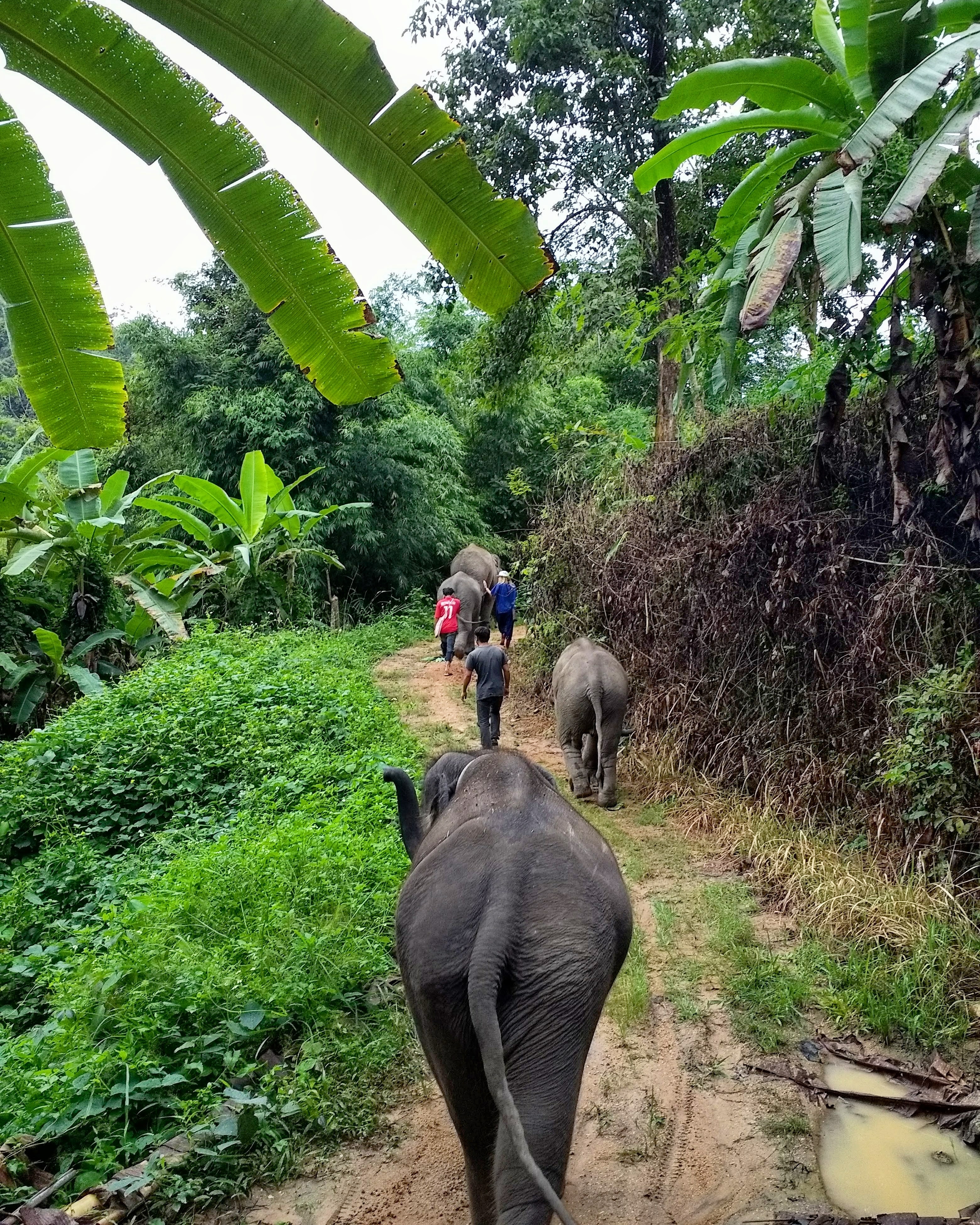
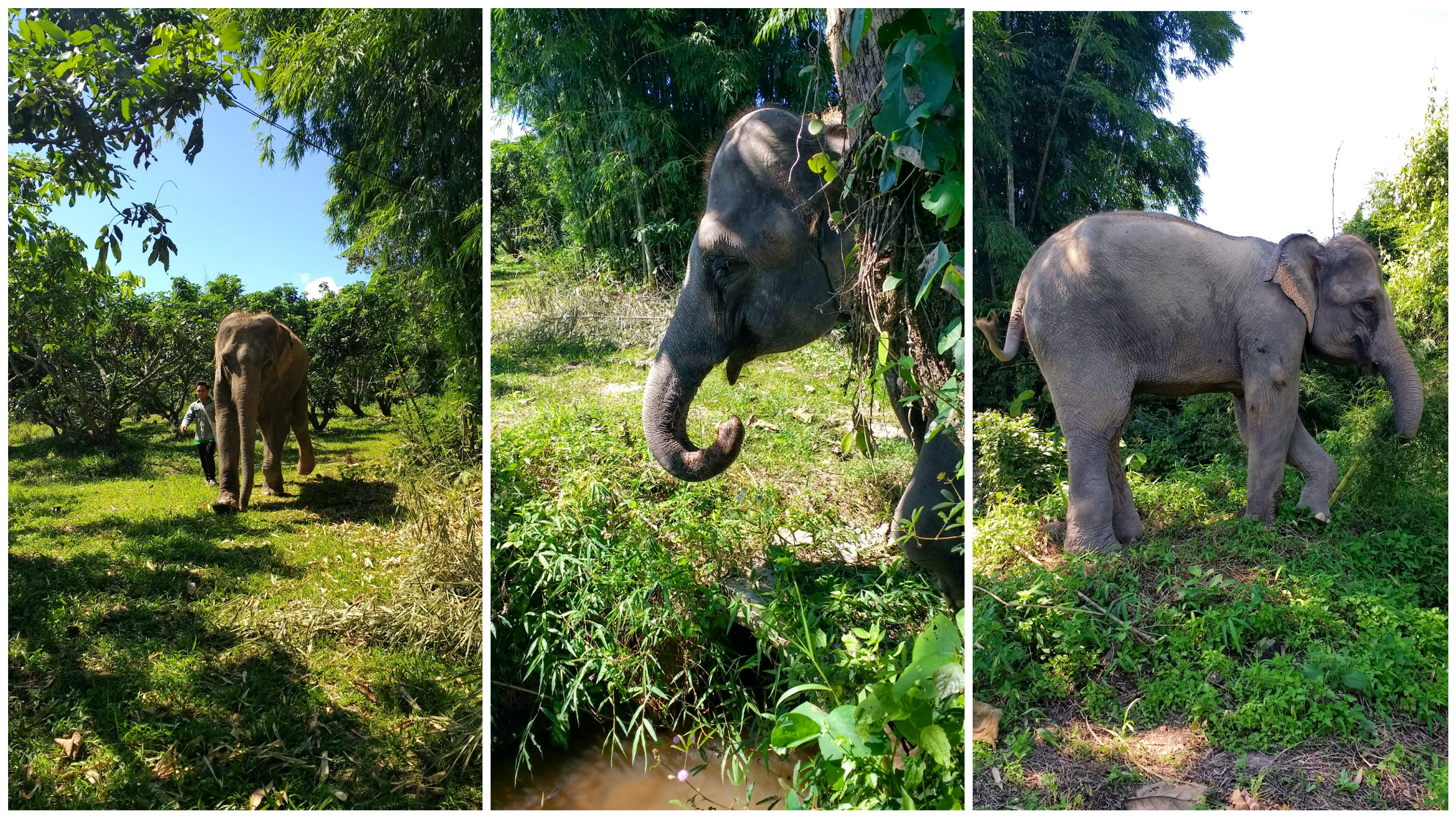
The elephants know, just like dogs when it's time for walkies. They lift up their trunks and frolic up the driveway to the front gates. The first part of the walk follows the dusty road, so we surround the elephants & make ourselves visible to any traffic. We are reminded that you mustn't stand behind an elephant as they don't have good peripheral vision, and if you startle them you'll suffer a hefty kick or a whip from their wiry tail. 
The road leads into the jungle. The woodland is immediately thick and humid - the elephants know the way, and help themselves to the vegetation. There are farmers who live on the outskirts of the jungle, their crops backing onto the footpath where the elephants walk. The mahouts have their work cut out, trying to distract the elephants from the fields of corn, but they are intelligent creatures, and of course, they never forget. The mahouts break off an ear of corn to try and entice the elephants away from the crops, but the distraction doesn't last for long, and there's a five minute pandemonium with a group of naughty, stubborn elephants. Despite the fact it's a public path, Alex tells us it's a worry for them, and is a growing difficulty all over Thailand, since humans are occupying more and more space, encroaching on the elephants' wild habitat. The farmers here have already complained, and if there are more complaints they run the risk of turning it into private land, taking away a lot of freedom for the elephants here.  
   
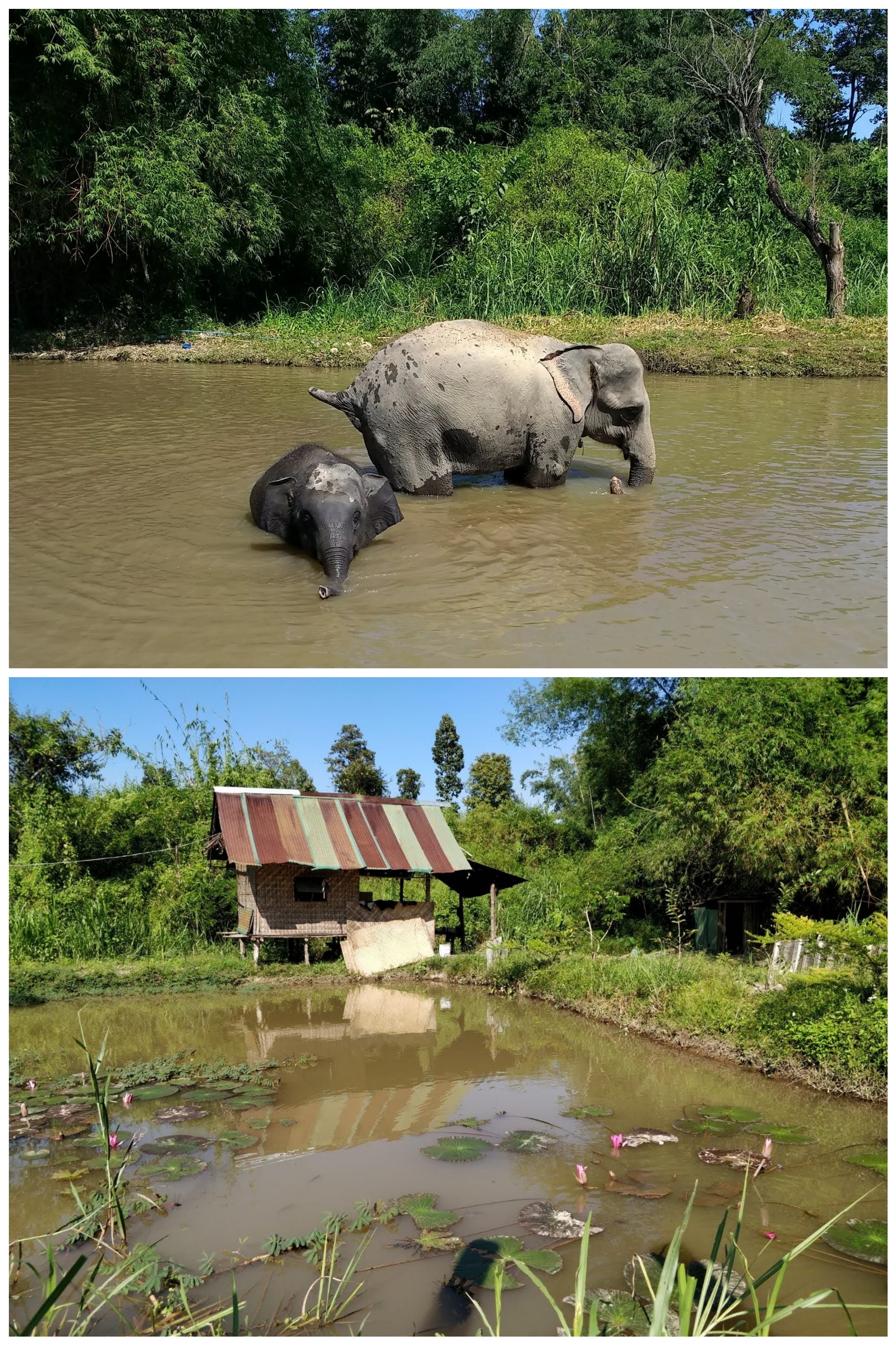
The jungle path grows wilder and less inhabited, with banana trees dotted around that the elephants love to munch. The path winds upwards and comes out on the high banks of an enormous river, with cascades the colour of chocolate tumbling down from the jungle beyond. Usually the elephants will swim in the river, but heavy rain has made it full and roaring, and so the elephants stay clear of it, seeking out bananas instead. 
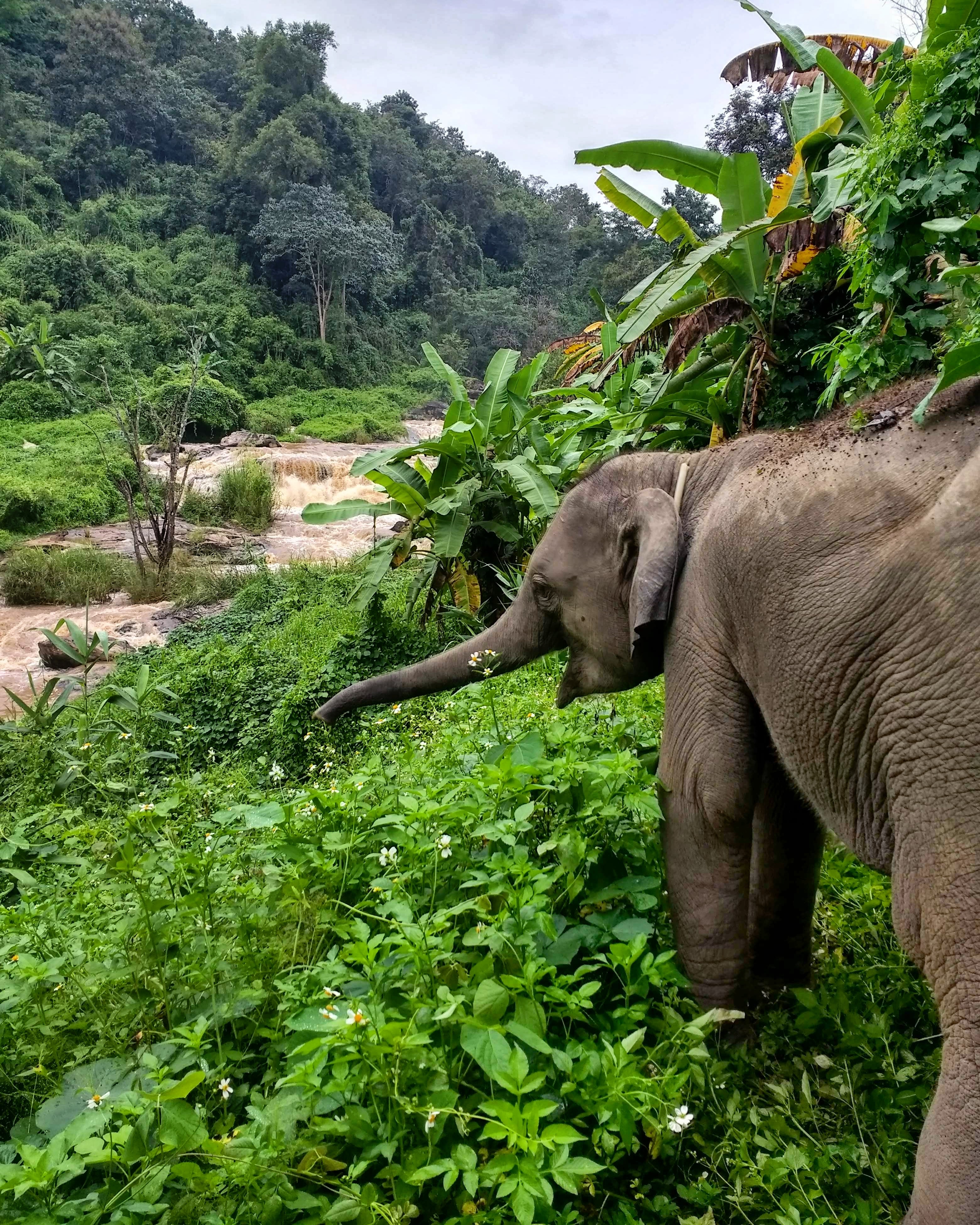
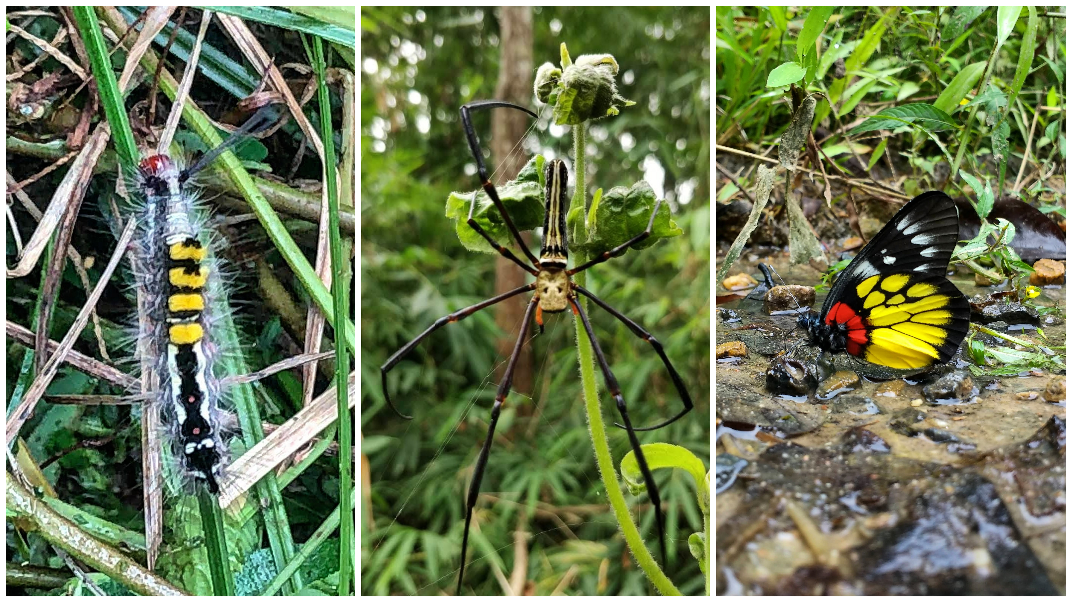
Continuing, the path loops, re-entering the sanctuary through the back. We see some impressive bugs - dung beetles, butterflies, and a giant spider strung up in the tall grasses. I spend a lot of the walk dodging the cheeky twins, Ping & Tong, who keep trying to make me into an elephant sandwich! We come to a stream, which Bella decides she wants to drink from, and when an elephant decides something, you can't argue with her! She slurps water through her trunk like a giant bendy straw, framed by ancient trees and bamboo. 

Time to Relax

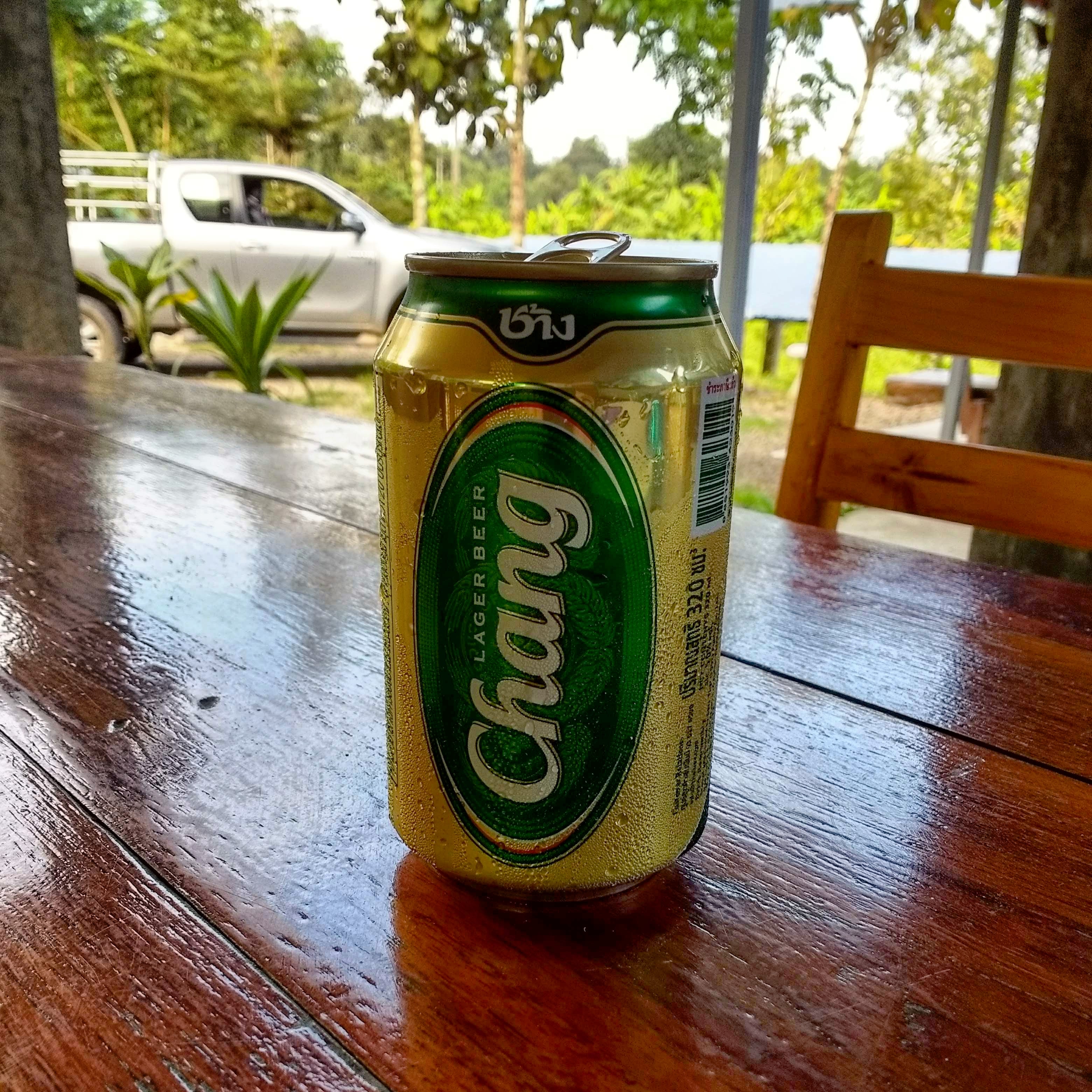
After a big day of learning and working hard, it was a luxury to have a hot shower, kick back on the veranda under the heat of the mid-afternoon sun, and crack open a can of Chang beer from the vending machine.

Chang means Elephant in Thai

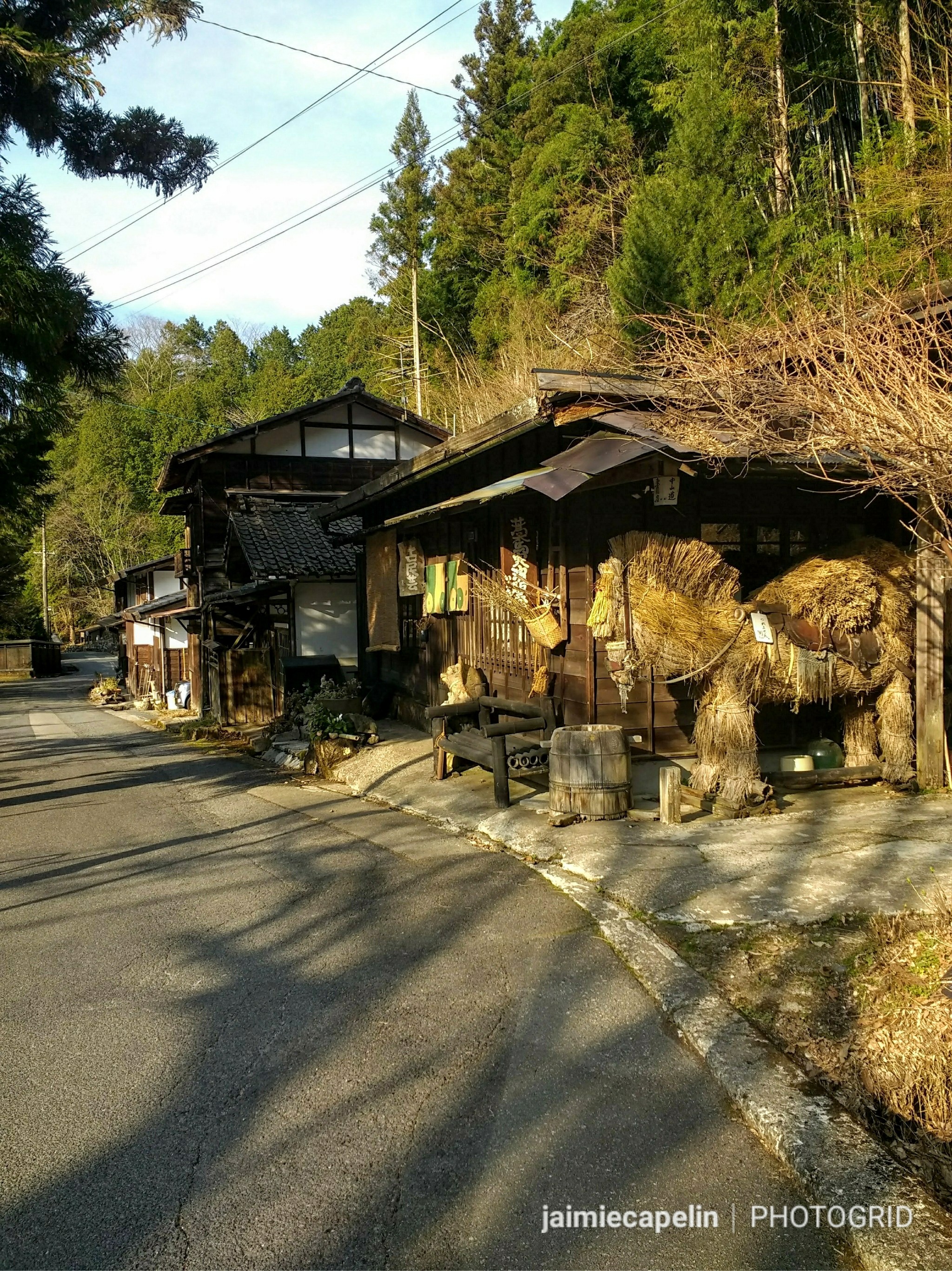
The Temple in the Mountains

One particularly warm afternoon, Simon, Meli and I had just sat down, when Alex said, “Let’s go, I want to take you to the temple!” We quickly made sure we were dressed respectfully, (covering our knees and shoulders) and we piled into the trailer, beers in hand. It was about a 40 minute drive, climbing narrow mountain roads, winding through old villages, beneath the deafening hum of cicadas. Panoramic views and waterfalls passed by on each hairpin bend, until we reached the mountain-top village. A pack of stray dogs chased us through the enormous entrance archway into the precinct, and as we passed, a local monk in an orange robe shouted, “where are you from?” Meli, Simon and I all responded with our respective countries, and then Alex shouted “Thailand!” from the driver’s window, making the monk laugh.

Wat Phra Phutthabat Si RoiUbosot (Ordination Hall)

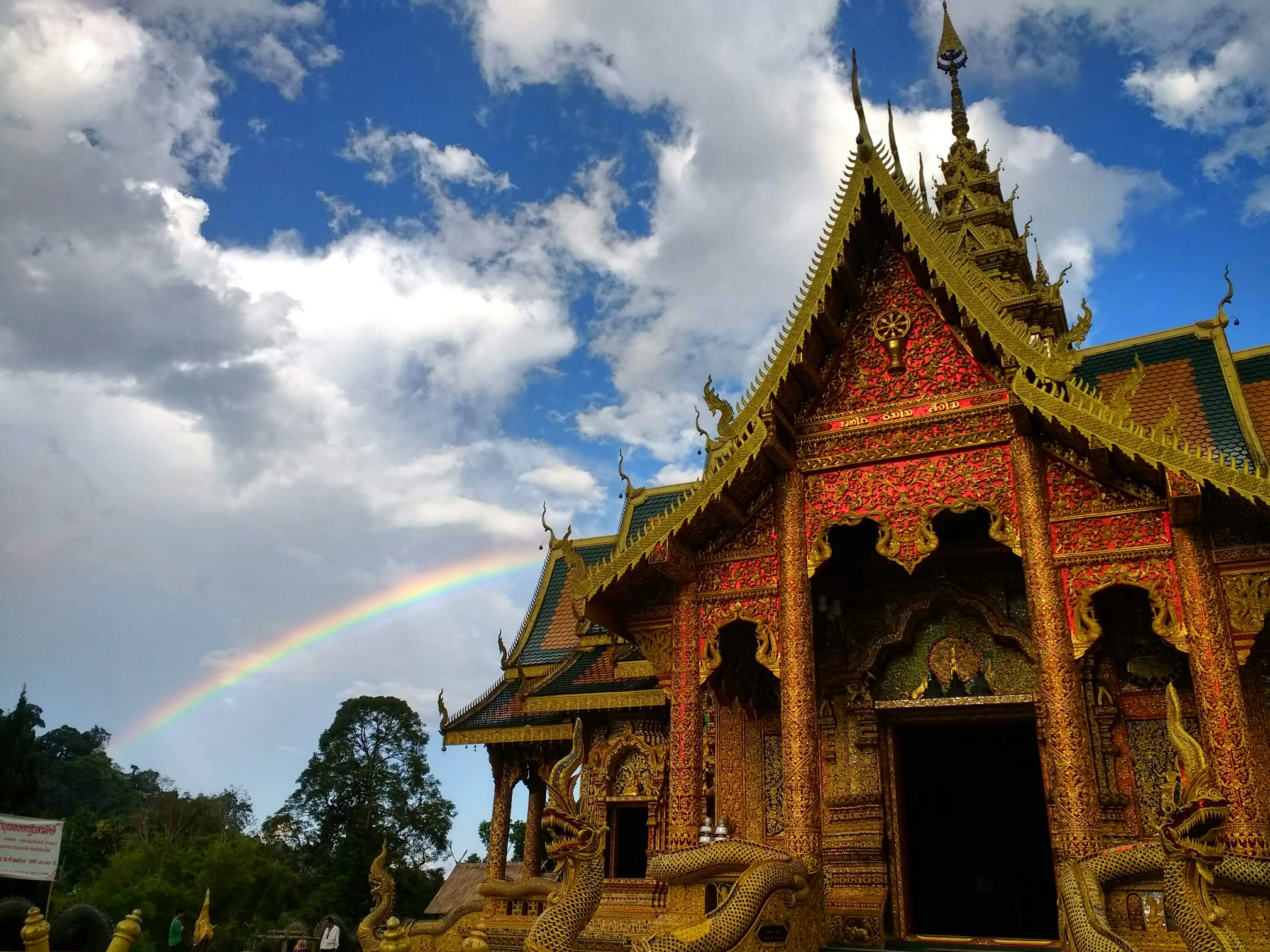
“Wat Phra Phutthabat Si Roi” is dedicated to the four sacred footprints of Buddha, and is said to be a perfect example of a Thai temple. We visited the ‘Ubosot’ or Ordination Hall, (place of mass worship and ritual ceremonies.) The architecture is incredible, with multiple tiers, smothered in jewels, and guarded by enormous, shimmering basilisks at every corner. It was very quiet, just the cicadas in the distance; the forest swaying gently, and a rainbow streaked the sky behind as we pulled up, adding to the atmosphere.

The Ubosot exterior

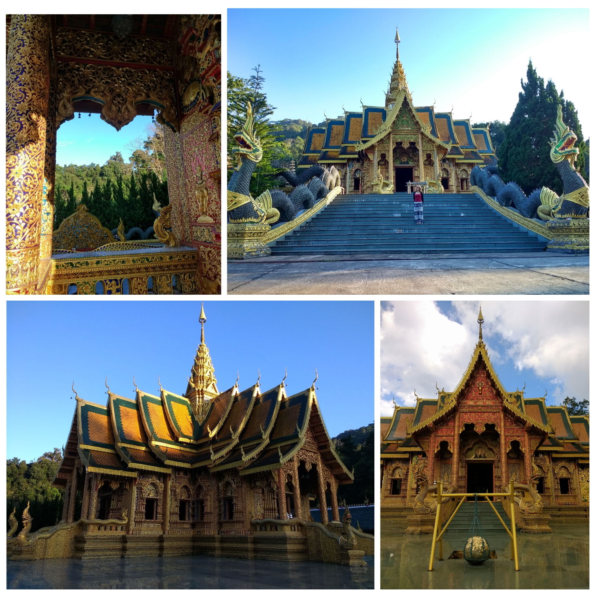
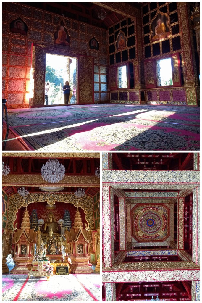
Inside was just as impressive, everywhere you looked, a thousand more intricate details. There were golden carvings on each of the windows of Buddhist figures, and Alex had brought us here to show us one in particular…

Nalagiri the Elephant

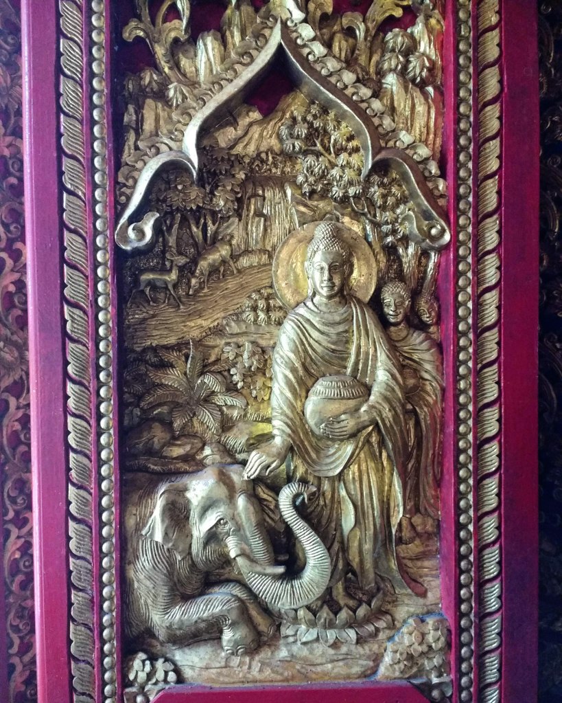
Nalagiri was a fierce elephant, deliberately angered & used as a weapon by jealous people. He was sent to kill the Buddha but when the elephant charged, he was stopped in his tracks by the Buddha’s belief in kindness and ability to suffuse all beings. Nalagiri the elephant lowered his trunk and fell at the Buddha’s feet, released of his anger. Alex told us of a later chapter he described as “Buddhist Lent”, when the Buddha spent three months in the jungle. Nalagiri remembered him, and stayed by his side during the Buddha’s exile. After three months the Buddha returned to his temple, and Nalagiri died of a broken heart.

Alex was filled with emotion; the importance of protecting elephants ran so deep and that resonated with us. He showed us how to ring the gong, and said a prayer before we went on our way.

Evenings of Leisure

Aside from making sure the elephants had enough food at dusk, the evenings were all about socialising, eating, drinking and having fun! Some nights Alex would take us to the market to buy ingredients for dinner, and then we’d all cook together back at the park kitchen.

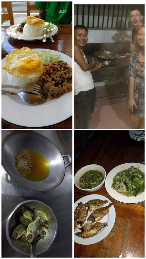
We learned how to cook traditional home dishes: fried black fish, garlic & onion salad, tomato, chilli & fish sauce soup, and rice noodles, using a pestle & mortar and a wok. We toasted our dinner with a tot of Hong Thong Whiskey! Also pictured is a classic Pad Kra Pao (Thai Basil Beef) which we had for lunch.

Other nights we had Pad Thai with the locals in the village, or street food banana pancakes. We were introduced to Alex’s friends and spent an evening drinking Leo & Chang beers in a local bar, with dried fish and chicken feet snacks! We even went to a party with an exquisite buffet, dancing ladies, many drinks, and a strange raffle where everyone won cuddly plush elephants!

Party Food

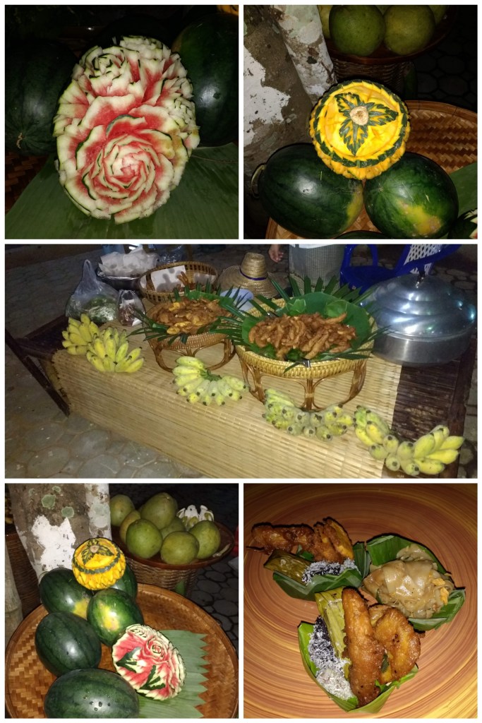
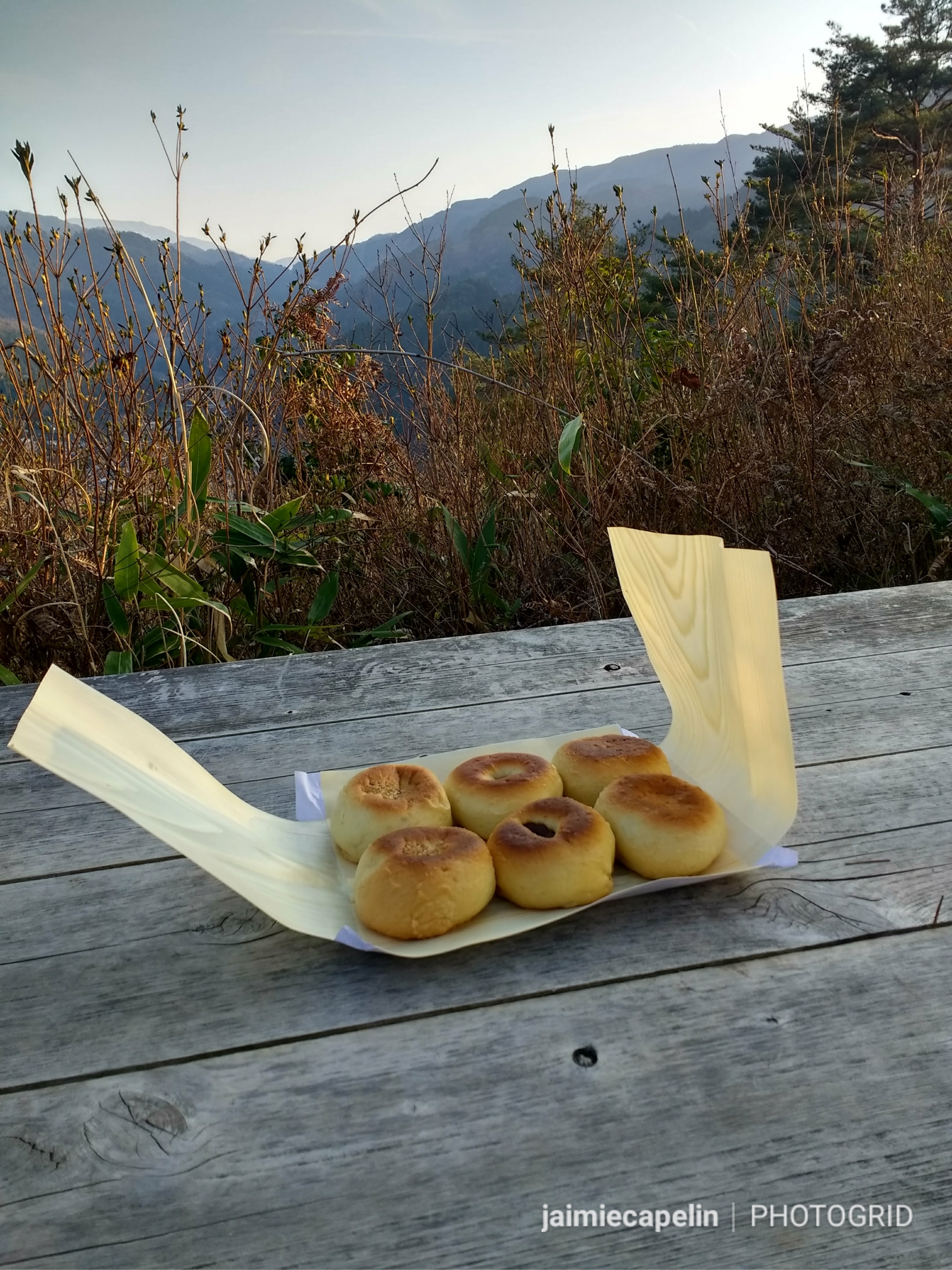
Fruit carving is an ancient Thai tradition, which was once performed exclusively for Royalty, nowadays they can be carved for any special occasion. Other treats are fried banana, Pad Thai, and coconut, sugar & rice starch sweets, served on banana leaves.

Tour Guide for a Day

At the end of our E.R.P experience, myself, Meli and Simon led the half-day tour! We spent the morning touching up on our elephant knowledge, ready for the tour bus to arrive at 8:30 am. We did an introduction, talking about the park and its efforts in protecting elephants, held a little Q&A session, and then took the guests to meet and feed the elephants. We got the group chopping sugar cane with machetes, (demonstrated by one of the real tour guides) fed it to the elephants, then took the guests down to meet Bella who was chilling under the shade. There were a lot more questions about Bella, her injury, and her mothering instincts towards Lanna, which I really enjoyed as I felt I’d bonded well with Bella. It felt terrifying and awesome all at once; we were supervised the whole time, and the staff jumped in whenever we needed help. Then we all went to the mud bath and pool for a play with the elephants.

Leaving was hard. We’d been like a family for a short time, and after going round the park to feed each elephant a pumpkin as a parting gift, Alex blessed us and our families with good luck in Thai. We rode the stuffy mini van back to Chiang Mai old city, feeling a little bit sad, like I’d acquired a lifetime of new knowledge and fond memories, but it was all over in the blink of an eye. Someday, I will visit the elephants again.

In Loving Memory of Bella

Great Barrier Reef – Lady Musgrave Island

A real desert island, complete with a tropical lagoon and reef oasis, sits around 95km off the coast of Bundaberg in Queensland. Lady Musgrave Island. Part of the Bunker Group, this is the southernmost section of the famous Great Barrier Reef and plays host to a magical menagerie of sea life.

Ok, David Attenborough voice aside, this was my favourite Great Barrier Reef experience so far. Taylor and I booked the ‘Lady Musgrave Experience’ Day Tour for late February, and I was not disappointed! Between January and March is turtle hatching season, and many mother turtles are still laying their eggs through February. The tour did get cancelled on the day I’d booked it for due to dangerous offshore wind conditions (went to the Bundaberg Rum Distillery instead – never a bad thing!) The tour was easily rescheduled for the following day, at no extra cost, and went ahead as planned.

6:45am: Checked in at Bundaberg Port Marina
7:00am: Boarded the “Reef Empress” ready for departure

Boarding the “Reef Empress”

The morning was warm, full of promise, with the first blue sky we’d seen in days. All passengers were assigned to a group as we boarded the boat; Turtles, Clownfish and Dolphins – we were Dolphins. This was simply for the rotation of activities once we reached the island. The crossing was a rough 2 hours, the majority of passengers needed paper bags, clutching their heads and holding on for dear life. We took our ginger tablets and sat watching the crew running around cleaning patches on the floor and disposing of used paper bags. They were incredible, remaining upbeat and cheerful the whole time.

A rough crossing

2 hours later, we pulled into a big semi-circular reef lagoon, with the gold and green island in the centre. Firstly, I need to talk about the colour of the sea. You couldn’t even paint it. It was blue, yes, a light, bright blue with stripes of turquoise and green wherever the reef lay below, but it was iridescent, backlit if you will, shining like fluorescent light!

On the Pontoon

Anyway, we stepped off the boat onto the enormous three-storey pontoon, (with an underwater viewing room below deck, and glamping style beds on the top deck for the overnight experience) and the first thing I saw as I gazed out across the reef was a turtle! It was just floating on the surface about 20 metres away, its shell all clean and beautiful.

The Glass-Bottomed Boat

After a brief snorkeling run-through, the 3 groups broke off. The Dolphin group were on the glass-bottomed boat first. Our guide was Tyson, and he floated us over the different types of coral: staghorn, brain, boulder, plated, finger…. As he was explaining that the white tips on the coral is actually regrowth, not bleaching, a Brown Booby Bird swooped low next to the boat, majestically stealing our attention.

Next, Tyson steered us over a ‘turtle cleaning station’, a part of the reef where little fish nibble all the algae off the turtles’ shells. We could see the silhouettes of 4 turtles being cleaned far beneath the surface, and as we drifted over, one swam right up to the glass, giving us all a clear glimpse of its beautiful pristine shell, before popping its head up right beside the boat! Tyson said that was the closest he’d ever seen a wild green turtle and was pretty stoked himself!

Green Turtle under the Glass Bottomed Boat

Lady Musgrave Island

We pulled up on Lady Musgrave Island, where another guide, Jordan, met us for a walk around Capricornia Cays National Park. The sand is white, broken coral, with flecks of pink, and is so sharp you are advised to wear footwear at all times. One of the deadliest creatures of the ocean can be found on this beach – Cone Snails, which might look like a pretty, pink shell to collect, but the creature has a tiny barb that it fires through an opening in its shell, which has the ability to kill a person in half an hour. It wouldn’t be Australia if something wasn’t trying to kill you…

Iridescent Waters
Coral Beach

Behind the beach is a dense canopy of green Pisonian Grandis trees, and then you notice the birds. I’m not sure if the noise or the smell hits you first, but when you notice the sheer amount of little black sea birds nesting in the trees, you really get a sense of the wildness of this island. They have no predators here, and they’re everywhere, diving, swooping, pooping, screaming, and they appear to wear little white hats, hence their name: White Capped Noddy Terns. They inhabit the Pisonian forest, and are part of an intense circle of life, see, the island is basically a pile of coral; the birds nest in the trees, and their poop helps fertilise the trees. The trees also produce these sticky, sappy traps, which capture some of the Terns in a slow and sticky death, essentially using the birds as plant food. Gnarly.

The Edge of the Pisonian Forest
A White Capped Noddy Tern Chick in its nest
Pisonian Forest

But aside from the stench, the forest was beautiful to walk through. I also spotted a couple of Buff Banded Rail birds scratching about on the ground, and some tiny Capricorn Silver Eyes darting about the branches. We came out on the other side of the island, onto the beach, where sun bleached logs litter the coral sand.

A wild beach
A Bridled Tern rests on a log; a White Capped Noddy Tern flies overhead

Then came a turtle, just a dark shape in the shallow water, moving closer to the beach. Then came another, and another! They didn’t leave the water, but one came so close to the shore that Jordan identified that it wasn’t big enough to be of nesting age (30), so she must have just been curious! We strolled back around the island along the beach, and hopped back on the glass-bottomed boat, back to the Pontoon for lunch.

Snorkelling on the Reef

Finally it was our turn to snorkel, the part I’d been looking forward to all day. After a quick lunch of salads and cold meats, we quickly got our gear on and jumped in the reef lagoon. The first thing you see are little groups of little black and white fish, swimming for a close up of your funny goggles. As you get closer to the coral shelf, schools of tiny blue fish shimmer like a glittery curtain as they dart back and forth in unison.

Scissortail Sergeant Fish
Blue Green Chromis & Lemon Damsels
Whitley’s Sergeant Fish around purple coral
Moorish Idol
Butterflyfish

Parrot Fish have beaks that enable them to feed on the coral.

They come in a huge array of colours, you can see the orange one’s teeth-like beak.

Chinese Trumpet Fish
Fox Face Rabbit Fish
Plated, Staghorn and Brain coral

The coral is beautiful here, splashes of colours somehow pop under the water. I was so engrossed in watching interesting fish appearing from the reef that the turtles caught me off guard! Taylor caught my eye, signalling to me under the water, and pointing ahead; there it was, appearing out of the murkiness, coming towards us, so majestic, as though flying beneath the waves. This Green Turtle was about the size of a grown man’s torso. Her tail was barely visible, showing she was female, and she swam right underneath us. I turned and followed her for a short while, before she dived into the depths of the reef.

Female Green Turtle

The second turtle was skimming along a shallow shelf of reef at my eye level, flapping her flippers, and surfacing a few metres away. I popped my head up too and saw her floating on the surface!

Giant Clam
Sea Cucumber
Green Parrot Fish
Blue Parrot Fish

After an hour of solid snorkelling, we sat on the edge of the pontoon sipping on a Gin Mule, dangling our feet in the ocean. On the boat ride back, we saw an Olive Sea Snake wriggle by in the waves, and several dolphins.

Facts of the Day:

  • The Great Barrier Reef is roughly the same size as Japan.
  • You can’t visit the adjacent Fairfax Islands because they were used for target practice by the Australian Military in the 1940s, and there is likely to be live ammunition still scattered on the islands.
  • Without the birds, there would be no trees on Lady Musgrave Island, and without the trees there would be no birds. Without either of these, the island would be a bank of dead coral, and may have been washed or eroded away.
  • Corals are actually living invertebrates related to jellyfish and anemones.
  • Coral relies on its resident algae to survive. Photosynthesis in the algae creates food for the coral.
  • Some corals actually catch small fish and plankton to feed on.
  • The tiny white tips you see on the coral reef is not bleaching; it is in fact regrowth.
  • The colour you see on coral is actually produced by the algae as a form of sun protection. The deeper the coral, the less colour it will have, as it will have less sun exposure.
  • Coral Bleaching is caused by rising temperatures and pollution that kills the coral’s algae. When the algae is gone, the coral dies.

Tongariro Alpine Crossing – New Zealand

The Tongariro Crossing had been on my bucket list for about 6 years, and finally, in January 2019, my opportunity arrived. Friends of mine, Simon & Mike, two brothers from back home, happened to be visiting New Zealand while I was staying with family there, and so we decided to take on the crossing together. According to my Strava app (which may or may not be accurate) it is about 14 miles (22km), with an elevation gain of about 2,762ft (850m), and crosses between 3 of New Zealand’s iconic active volcanoes. It is recommended that you fully plan the journey, with plenty of water, snacks, sun protection, good hiking shoes with support, and layers of clothing. Always check the weather, as whatever the weather is doing at ground level, it changes fast and will be at least 5 degrees colder at the crater.

A January Day, 2019

5:30am – Summer Bellbirds ‘pinged’ outside the Turangi motel, on the south side of Lake Taupo, as my hiking buddies and I awoke to make bacon sarnies. After breakfast, we packed up the car and set off beneath the grapefruit sky to Ketetahi Long Stay Car park, about half an hour’s drive from Turangi.

7:00am – We boarded the shuttle bus from Ketetahi Long Stay Car Park to Mangatepopo Hut – the opposite side of Tongariro National Park, to the start of the Tongariro Crossing.

^Prep & Conditions Board at the start of the track, Mangatepopo^

7:30am – 5°c, clear, light winds – As the sun hid behind the mountains before us, we checked all our gear, stretched our legs and used the facilities. We began hiking, gently climbing the grassy hillside, the sun making its glaring appearance over the crest and quickly raising the temperature to T-shirt weather. Through the sulphurous pumice fields, we hiked, where white daisies sprout from the rough, black earth.

^Pumice Fields^

The path led onto a boardwalk, which crossed the silty plains of strange moss, framed by dark, jagged rock. Mount Ngauruhoe – known for portraying Mt. Doom in Lord of the Rings – loomed over the pathway, puffs of mist unfurling from its craters, casting its long, morning shadow over the landscape.

^Mount Ngauruhoe – the youngest & most active vent in the area – last erupted in 1977^

We began to climb; rock and man-made steps paving the lung-squashing incline. As we did, a panoramic view of the vast national park stretched out behind us.

^Tongariro National Park looking West^

Suddenly we were level and a giant plateau of sandy rock appeared before us, surrounded by an uneven black rim. We followed the trickle of hikers across the plateau, at the foot of impressive Ngauruhoe, and began to scale the lip on the other side.

^View back across the plateau & Mt. Ngauruhoe^

A fast, thick fog was moving over the summit, so we paused on the steep side of the lip for lunch. The air quickly became cool and dark, and it wasn’t long before we, and fellow hikers around us, had donned thermal jackets.

^The skiddy ascent to Red Crater / Mound of lucky stone stacks at the summit^

The route up is a treacherous combination of loose scree and sand, on both sides of the summit of Tongariro’s Red Crater, making footing impossible, and you have to kind of cross country ski your way over. At the top, a huge mound of rocks and pebbles marks the summit, built over the years by each hiker adding a stone. You feel like you’re on the edge of the world, especially when you can’t see through the dense fog!

^The Red Crater, formed around 3000 yrs ago, coloured due to oxidised iron in the rock – last erupted 1926, but Tongariro has many craters, some of which last erupted in 2012^

Skidding down the other side, the fog began to break, revealing the dramatic Red Crater. Clouds rushed over the landscape, thinning more and more until the brilliant Emerald Lakes shone through, patchy sunlight glistening on their surface.

^Emerald Lakes, Tongariro^

This is it – the iconic view of the Tongariro Crossing. The national park is a stretch of green, far and wide, all the way to the horizon where it meets the blue, fluffy clouded sky. Mountains drop down to hills, rainforests, rivers and vast plains. On the edge of the foreground three emerald and blue lakes stand out from the grey, volcanic rock, regardless of the weather. Curls of steam rise from the rock all around, that rich, boiled egg smell filling your nostrils.

^Emerald Lake, Tongariro^
^Emerald & Blue Lakes, Tongariro^
^Descent from the Red Crater / Steam rising from volcanic rock^

We continued across the next plain, looking back on the three iconic volcanoes lined up like a postcard; Tongariro – jagged and broken at the forefront, Ngauruhoe – the perfect volcano shape in the centre, and snowy Ruapehu peeping out from behind.

^Trio of Volcanoes – Ruapehu, Ngauruhoe, and Tongariro^

The walk down to Ketetahi is a neverending zig-zag, through bushland and rock, which never seems to get closer to the end. Lake Taupo shines on the horizon below, before the path eventually drops into rainforest, and quickly descends down wooden steps, joining a cascading river down to Ketetahi.

^Descent to Ketetahi^

2:00pm – 13°c, sunny – Once we reached the Ketetahi end of the Tongariro Crossing, it was another 20min walk along the dusty road to the Long Stay Carpark. The hike back to the car felt long, but far from disappointing! The landscape is marvellous, and there’s plenty of nature to see; we were three satisfied & very happy hikers. Our moving time was about 5 hours, all the photo stops and snack breaks made it much longer, but why rush through an experience like that?

^Reaching the end of the crossing at Ketetahi^

Our Tongariro adventure ended at the car park, where the car wouldn’t start, and the next adventure began – getting home!

^View across Lake Taupo to Tongariro National Park, from Taupo^

Nakasendo Trail pt.2 – Walking the Way of the Water Wheels

Have you ever woken up with a layer of ice on the inside of your tent? It had been another below-freezing night on the Yabuhara river bank, deep in the Kiso Valley in the heart of Japan, and even our sleeping bags were a tad frosty. But we’d slept, and after completing the first leg of the Nakasendo Trail the day before, I don’t think anything would have prevented sleep. The ‘samui’ (cold) nights we’d experienced while camping so far weren’t letting up, but at least the day temperatures were reaching the high-teens.

PhotoGrid_1528927465607.jpg

Frosty Lodgings

~ Breakfast of Champions ~

After thawing out the tent in the rising heat of the morning sun, my travel companion Mic and I washed and drank from the river, packed our backpacks and set off to the nearby Yabuhara train station. Breakfast was a great and unexpected find. I’d remembered seeing a sign in a window for fresh bakes the night before, (Japan has really mastered the art of delicious pastries) and we headed back there on the off-chance it was open. It was, but when we stepped inside, it seemed to be a craft shop, selling unique, handmade trinkets, but no food. We were just about to leave, when I noticed it was connected to what looked like a community centre, where a group of ladies were sitting around a large table doing an origami workshop. They all cheerfully called, “Konnichiwa” as we edged in, spotting a stand at the side of the room, covered in fresh breads and pastries, and also coffee! We paid and took our bag of loot, and our coffee in paper cups, the origami ladies waving goodbye as we left, and ate the lot while waiting for our train.

PhotoGrid_1528843572041.jpg

Breakfast of Champions

~ Nagiso ~

A 50min train ride through pictoresque scenery; window seats; a kindle in Mic’s lap, a notebook in mine, we enjoyed the opportunity of soft chairs, prior to embarking on the second leg of our hike, from Nagiso to Tsumago-juku.

Nagiso was another sleepy little town, a little more equipped for passing hikers and tourists, with a handful of little shops and cafes by the station, their keepers perched outside on fold up chairs, watching the world go by. This is the base for most tourist companies running shuttles between Tsumago and Magome – the two most touristic Post Towns on the Nakasendo Trail, which book-end the last remaining original part of the ancient road. It is also a starting point to the old Nakasendo Pass, which follows closely where the original road would have led to Tsumago – this is what we were doing.

~ Nakasendo ~

We bought lunch in a local grocery store, repacked our backpacks, ensuring the weight was evenly distributed, and began the trek. The Nakasendo Pass to Tsumago begins just metres away from Nagiso station, and ascends beside the river, past a mini shrine on the left, and an old steam engine on the right. Blue skies added enhanced colour to our beautiful surroundings, with the river and gorge fading off into the distance behind us, and the temperature was rising, so we were soon changing into our shorts.

This part of the trail joins up with a country lane, passing through rural residential areas. The incline is small compared to the Torii Pass between Narai and Yabuhara, and the scenery is less dramatic, more serene, with pretty farmland and hills. We passed hillside shrines, which reminded me of the tiny worship houses built into the Catalonian mountains of Spain, and small villages with the authentic Edo era wooden houses, and wooden water wheels turning.

PhotoGrid_1528843601877.jpg

A Working Water Wheel

Every now and then, between the farms and old villages, we’d pass a great big modern new-build, with lots of land and fancy cars parked on the drive, in contrast to the ancient history etched into the landscape. A few cherry and plum blossoms were already in full bloom, dappling pink sunlight on the grass below, and teasing at what the following few weeks in Japan had to offer.

PhotoGrid_1528843617981.jpg

Early Cherry Blossoms


~ Tsumago-jo Castle ~

We reached a fork in the road; the right leading up hill to Tsumago-jo Castle remains, the left leading to Tsumago-juku. Leaving our backpacks trustingly against the sign post, we took the right-hand fork, up a steep incline, passing through dense bamboo forest, from which a wooden bridge once connected the castle grounds, and is now filled with earth. The sound of the birds twittering and echoing through the bamboo was incredible, and Mic was forced to patiently endure my excitement about being in my first bamboo forest! Not another human in sight; just endless bamboo, quietly creaking and making the light fresh and green.

PhotoGrid_1528844189797.jpg

Filled-in-bridge curving round the bamboo forest

We passed the place where the ‘Hori-Kiri’ (moat) once was, and up through the woodland past the ‘Obi Kuru Wa’ (defensive stone wall). The top of the mount was a large, circular plateau, with big rune stones strewn about, commemorating the wooden, Edo era castle that once stood there. It offered 360degree mountain views, leading our eyes down through the valley, with Tsumago-juku ahead. Behind us lay the Central Alps, snow peaks bright in the afternoon sun.

PhotoGrid_1528843643065.jpg

Kiso Valley & Central Alps, from Tsumago-jo ruins

Back down to the road, we collected our backpacks and descended to the little post town of Tsumago-juku – soon to be my favourite place on the Nakasendo Trail.

~ Tsumago-juku ~

PhotoGrid_1528843821921.jpg

Entering Tsumago-juku

Turning the corner leading down along the narrow road, following the stream on the left, and the classic Edo era wooden houses along the right, the view zigzags down the valley before you.

PhotoGrid_1528843844233.jpg

Tsumago Water Wheel

A wooden water wheel turns, splashing the stream part way down, while miniature ornamental gardens decorate the courtyards, with flora and forna filling each available space between. The green mountains surrounding the post town create a lush frame for the picture-perfect foreground.

PhotoGrid_1528843862832.jpg

Ornamental Courtyard

Tsumago was the 42nd of 69 post towns on the original Nakasendo between Kyoto and Tokyo, and is now one of the best preserved Edo era post towns, and a popular tourist destination. You can reach Tsumago by travelling to Nagiso on the Chuo Main Line railway, and catching one of the shuttle buses, or hiking the old Nakasendo. Ironically, it was the building of this railway line that caused Tsumago to fall into poverty, until it was revamped for tourism in the 1970s. I think the best thing about this town is that even though it thrives purely on tourism, none of it is staged. Tsumago is fully inhabited, and therefore completely authentic, as the locals you meet selling their goods actually do live there, and make their living by making and selling traditional products to travellers, just as they would have in the Edo era.

PhotoGrid_1528843695433.jpg

Tsumago-juku

There are lots of Ryokan guest houses in Tsumago, where you can get the full experience, with tatami mat rooms, onsens, and traditional meals. You can also get your luggage shuttled between towns, so you can enjoy a leisurely hike, but if like us, you enjoy a challenge and want to save a bit of money, I’d fully recommend going off the grid!

PhotoGrid_1528843664005.jpg

Tsumago-juku

A beautiful afternoon was spent wandering up and down, exploring the shops with different foods, coffee and tea houses, groceries stores, souvenirs, and of course, bottle shops filled with expensive sake. Beside the last house at the very end of the town, where the road continues onwards along the Nakasendo towards Magome, there is a life-size straw horse, apparently a symbol for good fortune, which is the first thing you’d see if you’re walking to Tsumago from Magome, as most people do.

PhotoGrid_1529259002813.jpg

Straw Horse for Good Fortune

Another little statue we began to notice outside a lot of buildings was the Tanuki – a sort of raccoon – wearing a straw hat and a dappy smile. They seemed to be outside all the ryokans and restaurants, so we guessed they were a symbol of hospitality, and once you notice them, you realise they’re everywhere! On some research I’ve discovered that they were originally Chinese evil spirits; shape shifters and tricksters. The Japanese, with their imaginative compassion, adapted this folklore, and the Tanuki is seen as benevolent and cheeky: a welcoming and wealth-bringing icon.

a_tanuki-transparent-found-on-web-TN_1

Tanuki

With the evening sun turning the wooden houses red, and the shadows growing long on the ground, our stomachs were beginning to rumble. Once again, there was no place in Tsumago to pitch a tent, and a last minute ryokan would have cost the earth, so we decided to back track a little way. We passed an old chap wearing a woven hat, and selling something from authentic bamboo steamers with delicious aromas coming out. Steamed buns! We purchased six with different fillings, which he wrapped in bamboo paper and bid us farewell with a smile, and we hiked back up towards Tsumago-jo ruins.

PhotoGrid_1528844263980.jpg

Traveller’s Supper

~ Camping in the Castle Ruins ~

The sun was setting, painting the valley with vivid colour, and we ate our steamed buns while they were still hot and delicious – my favourite had a walnut filling; Mic’s was eggplant. We pitched the tent on some nearby scrubland with valley views – previous campers had used this spot, and their was a ready-made fire pit. The sun set, and the flames rose, and the temperature didn’t drop! Finally, spring breathed in the night sky, and it was going to be the first comfortable night’s sleep in a long time.


Okinawa, Japan – A Series of ‘Not Ideal’ Events

Okinawa is the last place I visited in Japan before flying back to the UK, and therefore the freshest to write about, which is why I have chosen it as my first Japan blog.

It is the biggest and most populated of the Ryukyu Islands, half way between mainland Japan and Taiwan in the East China Sea, and is home to Japan’s most critical American military base. Okinawa is quite different to mainland Japan, and wasn’t altogether what I expected…

I was travelling from Osaka city with two companions from the previous season, Taylor and Mic, and after several weeks of backpacking, all three of us were ready to sit on a sunny beach on a tropical island and relax. We’d planned our routes and times thoroughly, and were feeling pretty confident. Here, it is probably important to note that Osaka has two international airports, and they are nowhere near each other. Kansai Airport is where you’d likely catch a flight to Okinawa from, while Osaka International is the one Google Maps will default to, if you’re not quite specific enough… We went to the wrong airport.

A hair raising, hour-long taxi ride later, (worth more than the cost of our flight), we arrived at the RIGHT airport, about 3 minutes too late. The budget airline were able to put us on the next available flight, which was roughly nine hours later. So our first day in sunny Okinawa was spent in Kansai Airport’s domestic terminal. Not ideal.

Fortunately, nothing went wrong with our flight. The runway staff finished loading the luggage hold, stood in a line beside the plane, and bowed in unison, waving us off in true Japanese fashion as we taxied to take-off. Our flight took about 2 hours, with stunning in-flight views of the sunset, before descending over the twilit islands of Ryukyu. Our plan was to catch the bus into Naha city, near to where our pre-booked Air bnb was located. However, we’d arrived nearly 10 hours later than expected, and the island’s public transport isn’t very forgiving… We’d missed the last bus to Naha by minutes, and had already spent half a week’s budget on taxis that day, so, with a heavy sigh and some uncertain giggling, we adjusted our backpacks and began the two hour trek beneath the stars into the city.

At least it wasn’t raining. In fact, the temperature was noticeably warmer than mainland Japan, and despite the heavy luggage and worn out bodies, the walk was quite pleasant. We eventually reached our Air bnb, (via a supermarket for some instant noodles) and after a fairly disappointing shower, and an even more disappointing “instant” dinner, (which required the miniature kettle to be refilled three times), it was time to call it a day. Taylor went to close the sliding doors dividing the rooms, and found that only one door moved, sliding uselessly in the middle of the large door frame. He peered through the wide open gap, and let out a slightly maniacal laugh.

“That’s not ideal,” Mic said.

PhotoGrid_1525819526921

~ Kokusaidori Street ~

Morning came with the sound of birds twittering in the trees, and the shush of traffic a couple of blocks away. There was a bit of blue in the sky, and it was bright and warm. We drank the free coffee provided by the Air bnb, and took off down the road to the main international strip, about 10 minutes away on foot.

Kokusaidori Street – noise; both visual and audio – sales men and women attempt to catch your attention at every shop entrance, ornamental dragons in multi-coloured pairs line the displays in all shapes and sizes. Novelty toys, mugs, T-shirts, and generic holiday paraphernalia fill your peripherals as far as the eye can see. Enormous jars of habu sake, (rattle snakes drowned in Japanese liquor) stand in stacks, going for 400,000 yen a pop, the snakes inside hissing silently at by-passers. Fiberglass fronted restaurants boast of rare delicacies; puffa fish gawp out from tanks. We even saw a very small tank outside a seafood restaurant, with a live turtle in it – I quickly walked on and tried not to ask too many questions.

Following the street up, we turned off beneath the canopied Heiwa dori Street, through a network of arcades and alleys lined with street sellers, leading into the wonders of Makishi Market, where Okinawa’s strangest delicacies can be found. We stumbled upon the seafood hall by meer accident, filled with stalls and restaurants of all kinds. A grid of long tables laid out like an enormous canteen, played host to hungry punters, while lobster, squid, fresh fish, shellfish, everything you could imagine, was served on platters shaped like small boats!

PhotoGrid_1525819601886

At the intersection marking the end of Kokusaidori Street, we discovered an underground food hall in the basement level of the Ryubo building. We browsed the deli counters, bakeries, fish mongers, and enjoyed a varied lunch, accompanied by special blend coffee, and topped off with some delicious Japanese beer from the world craft beer counter. Happily satisfied after a good feed, we headed back outside, eyes directed at the sky in hope of beach weather! Unfortunately it was windy and grey, (though we had no idea what was in store for us) so we continued to browse Kokusaidori street, soaking up the bustling atmosphere with a local ‘Orion’ beer in hand from one of the many Lawson’s convenience stores.

PhotoGrid_1525817480981

~ Shisa Dogs ~

These goofy looking statues are everywhere, bearing similarities to Chinese Dragons, they are somewhere between a lion and a dog, and these are the little trinkets that fill every souvenir shop. Shisa Dogs are a Ryukyuan tradition from Okinawan folklore, believed to protect places from evil, and are often seen on rooftops, or guarding the entrance to most buildings. They always come in pairs; the right-hand Shisa Dog has its mouth open to ward off evil spirits, while the left-hand one’s mouth is closed to keep good spirits in. Often the pairs have cheeky facial expressions, and are depicted to be cheerful and amusing, sometimes painted in vibrant colours, reminding me of Disney’s ‘Stitch.’ The Shisa Dogs were one of my favourite things about Okinawa, giving the place a little touch of character.

PhotoGrid_1526156957197

~ Naha Beach ~

Advertised up and down the main strip as one of Naha’s hot-spots, it was quite amusing how unspectacular it was when we arrived! However, despite the small radius of beach, surrounded by concrete walls, and the noisy highway bridge crossing the water, the sand is clean and white, and the water is crystal clear. A sectioned off lido protects swimmers from box jellyfish, and a lifeguard patrols the beach. Trees fill the park behind, where dozens of stray cats frolic in the grass, prowling on picnics. The facilities also include toilets, showers, and even a hire shop for all your seaside needs, from parasols to inflatable tyres. Apart from sunshine, what more can you really ask for?

PhotoGrid_1525819483307

For dinner we found a pub serving Taco Rice – an Okinawan dish coining taco filling, and Japanese rice. Finished with a big dollop of salsa, it is a blander version of chilli con carne; a sort of Japanese/American compromise, washed down with a refreshing glass of Orion.

PhotoGrid_1525817300790

The night took us to a penthouse bar, where we couldn’t figure out what language to order our drinks in. With the only other customers being American, and the bar girl responding to my broken Japanese in English, I felt like a proper tourist! The boys smashed out a game of Foos ball, I destroyed a game of jenga way too early on, and we all found out the hard way that you should never strawpedo Guinness!

~ The American Village ~

It’s super easy to hire a car, as long as you have your international driver’s license, passport, and a better sense of direction than us. We went to the airport on the monorail – which loops Naha city on a regular basis throughout the day time – to find the best selection of car hire. After walking around the terminal, looking in all the wrong places, we couldn’t for the life of us find a car hire desk! Of course, it was really easy, slap bang in the middle, impossible to miss, and once we got there, we simply picked our price range, chose our insurance policy, and hopped on a shuttle to the depot. After a quick exchange of details and money, we were given our car – a little white cube on wheels. These little Japanese cars don’t have much of a kick, and the top speed limit in Okinawa is 60kmph, which makes driving very economical and cheap. As there are no trains around the island, and buses can be irregular and expensive, hiring a car is definitely the best value for money.

PhotoGrid_1525817518881

Heading north, we joined the highway out of the city. The landscape rose and fell, every inch littered with white and grey tower blocks, as though several boxes of starwars lego had been emptied across the land. As we approached the American Village, fast food restaurants began to pop up by the dozen alongside the highway; McDonalds, KFC, Dominoes, Denny’s, and so on and so forth. Pulling up in the village, it was like stepping out into one of those replica towns at Disney World – each building with a brightly painted facade, and palm trees spaced neatly between perfect paving slabs.

Making a bee line for coffee, we entered an arcade of cafes and restaurants along the waterfront promenade. We were welcomed at the door and shown to our seats in American fashion, by a smiley, English speaking waitress, where we enjoyed perfectly rosetta’d lattes, watching the moody weather roll in off the East China Sea, and quietly wondering whether we were supposed to leave a tip, or if like the rest of Japan, it was considered rude…

PhotoGrid_1525819360922

The village is a jumble of American style burger shops, cafes, and tack shops selling American souvenirs. There is a ferris wheel on top of a building filled with arcades and novelty shops. White sand bays surround the village, where we dipped our feet in the warm water beneath an ominous black sky.

Driving out of the American Village, we passed ‘Round One’ – a chain of indoor arcades and sports activities. An entire level is packed with arcade machines, pinging and popping and singing, lights flashing, enormous cuddly Pokémon willing you to defeat the impossible and win them! We decided to stick with the day’s American theme, and played ten pin bowling. Not until we’d begun our game did we realise we were supposed to hire bowling shoes from a vending machine. Yes, a vending machine! Oh well, that saved a thousand yen – Gaijin card well played… Oops!

~ Island Hopping ~

There are tonnes of little islands off the coast of Okinawa that you can take day trips to via ferry or plane, and they are said to be stunning. Unfortunately, we were on a budget, and the weather forecast was looking a bit temperamental – the ferries are known to stop running if there are any signs of bad weather. So for fear of being trapped on a desert island in a storm with no money, (and the way our luck was going, the chances were high) we made a mutual decision to go and explore some closer islands, accessible by bridge.

We headed north-west, the sun behind us, and eventually came to countryside! The concrete jungle fizzled out, and we could see the sparkling ocean ahead, our hopes alive for finally getting our tropical island swim! We even stopped at a Lawson’s and got a picnic for our glorious beach day, and could already smell the salty air and sun cream in anticipation.

Crossing our first bridge onto the tiny Yabuchi Island in the Uruma district, the road narrowed into a winding dirt track, leading seemingly to a dead end. Parking up, we continued on foot, and just through the trees we found the entrance to Janeh Cave. 6500 year old arrow heads made of shell were excavated here in 1960, along with claw-shaped pottery. These finds suggested that sea routes between Southern China and the islands were extensive much earlier than first thought.

PhotoGrid_1525859797187

We entered the cave, stalactites looming down on us; fossils jutting out of the rock. You can see gaping squares in the ground, strewn with tarpaulin, where archaeologists have scarred the ancient rock. Deeper into the cave and the temperature dropped. Cool moisture clung to my skin, and that eerie feeling came over that makes the hairs stand up on the back of your neck. We tried to hold our ground, egging each other on to peek around the next pitch-black corner, but it got too narrow; the shadows too surreal, and so we went back to the light.

Pretty coves surround Yabuchi island, with volcanic rock formations jutting out the edges of the turquoise sea, where bridges stretch off in different directions. Though it was beautiful, the spikey rock made the water inaccessible.

PhotoGrid_1526138548515

Then, all of a sudden, it was raining. Fine, wet rain, which had the three of us sheltering under an arch of rock, rolling our eyes. Certainly not ideal. We ran back to the car, and searching for a rainbow as the sun burned through again, we made our way to the next island.

A long bridge takes you to Henza island, which is mostly industrial land, belonging to the Idetsu oil company. Henza leads on to Miyagi and Ikei, which are home to many tourist beaches, the first being Tonnaha Beach, in the north-most cove of Miyagi Island. A track leads down to a seawall, beyond which is more white sand and clear sea, decorated with coral and picturesque rocks. We watched hermit crabs scurry about on the sand, playing peek-a-boo from their colourful shells. An oil rig sits off-shore of Tonnaha Beach, obscuring the silhouette of Okinawa main island across the sea in the distance.

Another bridge and another beach – Ikei Beach – which we had to access through a building. A lady came out and welcomed us, asking for 500 yen per person to enter the beach… many of the tourist beaches in Okinawa are pay-on-entry; a concept we couldn’t get our heads around, growing up with the freedom of having beaches on our doorsteps. The sky wasn’t making any promises, and it was beginning to drizzle, so onwards we went! Every beach on Ikei Island was asking for money just to enter, and with the weather on the turn again, and most of our picnic already eaten, Mic suggested finding a seaside coffee shop and watching the rain.

PhotoGrid_1526228033075.jpg

On our drive around the islands, we saw many impressive tombs, unlike the burial sites in mainland Japan. Often randomly placed, like on the edge of a crop field, or next to a convenience store, they are grand and haunting. ‘Haka’ tombs are unique to Okinawa, though their origins have been traced back to ancient Southern China; designed to be like houses for the departed, sometimes we’d see an enormous cluster of tombs, where an entire family is laid to rest, little offerings like bundles of herbs or flowers laid down at their doors.

The final island – Hamahiga – linked off the south of Henza Island, had so much potential, had we been there a month or two later. The coffee shop we’d aimed for was still closed for the down season, and the only other people we saw were a group of workmen, who all stopped and waved enthusiastically as though they hadn’t seen anyone for days either! At the end of the island we came across a salt factory, with a beautiful hidden bay beyond. We even considered going for a swim in the rain, but agreed that we’d only be doing it for the sake of it, so, feeling quite fed up, we hopped back in the car and drove back towards Lawson’s for a cold coffee out of the chiller and wifi.

Then the monsoon came. It hammered the windscreen so we could no longer hear the music. The wipers flailed manically, but couldn’t clear the view. Traffic had slowed down significantly, the road spray preventing anyone from seeing the vehicle in front, or the road for that matter. Tyre-deep flash floods appeared from nowhere, and all vision was a wet, monochrome blur. Beach day was cancelled.

We took ourselves back to Naha, where we waited for the rain to ease off before going to a local ramen restaurant for dinner, but by the time we’d finished eating, the storm was back with a vengeance. Floor-length skirts and flip-flops in ankle-deep water is definitely not ideal, I was trying to say beneath the drumming on my umbrella, while cars splashed by causing mini tsunamis. It was time to go back to the apartment and drink wine, while the crack of forked lightning echoed across the night sky outside.

~ Zanpa Beach & Maeda Point ~

Morning began late, with a heavy head from a glass too-many of wine, but the sun was shining fresh after last night’s storm, and I was feeling like a weight had been lifted from my shoulders. We were on the road to Cape Zanpa, and Maeda Point – I volunteered not to drive, so Mic took the wheel while Taylor and I kept ourselves quiet with a cheeky McDonalds, like two happy children. We passed The American Village around halfway, and continued up the coast, past large American bases; their big, white bungalows fenced in with barbed wire. At first, we continued past Zanpa Beach, assuming it was another pay-to-enter resort, and found ourselves in the neighbouring bay, looking at an array of coral reef formations, like the foundations of ancient building remains.

PhotoGrid_1525819431567

Mic made the journey across the reef to test the water, and in the meantime, Taylor and I sussed out Zanpa Beach, realising that we could access it easily without any sign of having to pay. So there we went. The grasslands above the beach were laden with public BBQs, probably thriving with off-duty military men and their families in the summer months. The beach itself hosted a number of water activities – you could hire paddle boards, kayaks, jet skis; have a go at tubing or even try one of their jet packs. It had a swimming lido, as most tourist beaches do, to protect from dangerous jelly fish, and the lifeguard sat on his plinth, observing under blue skies. It seemed too good to be true – the sun was gleaming down; the sand was hot and the sea was cool. Towels laid out ready, the three of us ran into the ocean, (you can almost hear the slow-running music playing in the background) and we swam and floated about, while fish darted about our legs. Drying in the sun, I laid on my towel, hangover washed away by the ocean, and finally felt like I was on holiday. It was ideal!

Once dry and crispy from the sun, we got back in the car and made a point of going to Maeda Point… (sorry). Cape Maeda was exactly what we’d been looking for, with quirky little coffee shops and authentic restaurants. There were little beach-town houses rather than tower blocks, and pretty, natural bays with no expensive resorts or lines of parasols. Following Mic’s satnav instructions, I drove along a track to a car park, where we got out and followed a line of scuba divers down the footpath to Maeda Point. A viewing podium leered on the edge of the cliff, protected by two Shisa Dogs, looking out onto a most stunning cove, smothered in reef.

PhotoGrid_1525819460008

Below, groups of divers and snorkelers explored the sea life at the water-logged entrance to the renown Blue Cave. I think the three of us could have stayed there all day, but the hire car had to be back at the depot by 5pm, so we made our way reluctantly back to the city.

Dinner was a treat. It was Taylor’s last night in Japan, and he chose Okinawan seafood down in Heiwa dori Street market. We went for some of the tamer dishes on the menu, (as opposed to boiled fish eyes and tuna gizzards) which were freshly and expertly prepared to order within the shop. I was pleasantly surprised, tasting the rubbery squid tentacle, salmon sashimi, and tasty tempura tuna, and we ended up getting seconds of the delicious grilled tuna! That was definitely worth making our wallets lighter.

The remainder of my time in Okinawa was mostly reserved for packing, and after bidding Taylor farewell, we prepared for our individual onward journeys. Mic and I shared a last meal on the island, at one of the Okinawan restaurants along Kokusaidori Street, where we tasted some classic local produce. It is very similar to Japanese food, but with an island twist – egg and tofu with bitter melon – a kind of peppery celery that looks like a snozzcumber, but adds a lot of flavour and crunch to a dish. We had Okinawan dry soba, which was enriched with chicken and vegetables, and a side of pork fat potatoes.

Despite many ‘not ideal’ moments, Okinawa was an enjoyable experience – certainly different, and quite amusing in hindsight! If I found myself there again, I would hire a car from start to end, and consider staying in a few different locations, leaving space to go to some of the other off-shore islands… And stock up on Orion beer for when the monsoons roll in!


A Tent with a View – Camping New Zealand

“Most folks are tourists – they bumble around NZ hoping to ‘see the sights’ without expending much effort to find the truly unique uncommercialized spots. Travellers, on the other hand, are fewer. Travellers attempt to find good info about wonderful spots and experiences.” (Cook. S, NZ Frenzy Guidebook, p.91)

In March 2014, while I was living in Wanaka, New Zealand, I was invited on a roadie.

The trip was planned for 10 weeks, and we would mostly be camping.

Our crew was Jonny from Edinburgh, Scotland, Yogi from Bayern, Germany, Gian from Saronno, Italy, and myself, from the Isle of Wight, England.

IMG_1688

We packed:

3 tents

4 sleeping bags

4 backpacks

2 tarps

a box of cooking equipment

a gas canister

a chair

a fishing rod

climbing gear

4 cameras of various description & a GoPro

a library of Travel Guides, leaflets and maps

and a Nissan Bluebird with a flat battery.

It was cosy to say the least.

It’s difficult to estimate how much money to take on an unplanned journey like this one, but calculating the costs of fuel, food and accommodation is the best place to start. Department of Conservation (DOC) campsites are pretty much everywhere on South Island, and are usually $6 per head, if not free; the fuel for the Nissan was about $100 between the four of us every 2-3 days; and food was mostly budget stuff we could share and cook easily on the camp-stove. All in all, Jonny recommended taking about $3000 (£1500) for a 10 week trip. I managed to save about half that, and travelled for a month, but it depends on your personal itinerary.

Although the majority of this journey was unplanned, some extent of planning is essential. Having a Plan A and Plan B and a Backup is a good way of planning without actually planning! We were always checking out alternatives in our DOC campsite guide and Lonely Planet books.

The journey began on Tuesday 18th March.

A strange mist started to engulf Wanaka’s Mt Iron, as if erasing it from the horizon of my future. But I would be back.

Milford Sound

Milford Sound is one of New Zealand’s most iconic locations. We camped in the wet and humid fiordland, where there was nothing but rain and sandflies, and a sense of uncertain magic in the air. Steamy mist engulfed the green sea mountains, and the four of us sheltered in the car beneath a tree, relying on a bag of wine to keep us warm! This place is also known as Ata Whenua, (Shadowland), where between the boggy planes are rushing rivers and twisted goblin forests.

DSCN6776(2)

The 120km drive from Te Anau to Milford Sound is “a visual cornucopia of delight,” (Cook, S. NZ Frenzy Guidebook, p.196). The mountains begin to approach you on the horizon through the Eglinton Valley, rising up around you, craggy and piercing and belittlingly big. Then you go through damp woodland, passing glacial rivers and pools, finally breaking out at the entrance to Homer’s Tunnel. We simply had to pull over and get out. 360degrees of rocky mountain faces, with fresh waterfalls cascading from sheer mile high drops.

Homer’s Tunnel itself was eerie and quiet. It goes right through the heart of the mountain, and you can see each chisel and pickaxe mark in the walls from when it was dug in the late 1930s; the signatures of over a decade of hard labour.

We emerged out the other side, suspended high up among mountains on a road that winds down to sea level. All around are glistening rocks and dramatic peaks and even New Zealand’s only mountain parrot – the Kea – came out to play, terrorising family picnics at the viewpoints.

On arrival at the gateway to Milford Sound, we celebrated with a compulsory cider from the pub, and then went on the foreshore walk. This is well worth it – especially if you’re on a budget and want to avoid tourists! The walk loops around the shore line, not even 20 minutes, with perfect unspoilt views. The sun hovered over Mitre Peak, casting a dense haze over the seascape with a golden tinge, and The Bowen Falls projected water off the side of the mountain as the spectacular sailing ships drifted across the foreground.

DSCN6814(2)

We made our way back from Milford Sound in neutral, clenching our buttocks every time we went up hill, as we’d all forgotten that Te Anau is the last place to fill up the petrol tank!

That night, we found a beautiful campground in The Hollyford Valley, with wood-burner powered shower huts and a crystal river running right through. It was here that Jonny befriended a character called Ludwig – a French fisherman with a bottle of cognac… but that story’s for another time…

DSCN6828(2)

The Lost Gypsy Gallery

In The Catlins Forest, New Zealand’s far south, we camped at a place called Curio Bay, where we spent the morning of a crimson sunrise surfing with Hector Dolphins. Our surf instructor, a local man called Nick, advised us to go to The Lost Gypsy Gallery, just up the road in Papatowai.

A small group of artists and inventors have put together a compilation of strange, interactive works, mainly made out of recycled junk. An old gypsy caravan, which appears to have grown into the bushland, is choc full of gadgets, experiments and puzzles, while the garden behind – “The Winding Thoughts Theatre” – which you can enter for a donation of $5, is a cornucopia of clever, tactile mechanisms that make you feel like you’re back at the water tray in kinder garten!

DSCN7012(2)

Dunedin

This topsy turvy old city is twinned with Edinburgh, and while Jonny ceremoniously wore his kilt the whole time we were there, the only real likeness to Scotland was the weather! It was however, a fantastic place to meet people and enjoy the Gaelic bar culture, with real pints on pump, and of course, New Zealand’s very own Speights Brewery.

Moeraki Boulders

North of Dunedin, along the East Coast highway, lie the science phenomenon, the Moeraki Boulders. Huge round dinosaur eggs of rocks, all clustered together on the beach with waves crashing against them. Maori legend has it that the ancient canoe, Arai-te-uru, sailing from Hawaiki, was wrecked, and the boulders are the fossilized eel baskets and kumara washed up from the wreck. Scientists say that they are concretion formations eroded from the cliffs.

DSCN7119(2)

West Coast

From the calm and quiet east coast, we cut inland across Mckenzie Country and the Lakes, sleeping mainly in fields hours from any tarmacked roads, where the stars outshone our campfire. Stopping for breaks at the spectacular Lake Tekapo, and Mt Cook – home of Sir Hilary Edmund – we made our way to the wild West Coast.

We got through the bleak village of Haast and headed south along the coast, through rainforest, windy trees, and mountain views, until we reached a little place called Jackson’s Bay. It’s a desolate place with just the ocean and a tiny cabin called The Cray Pot, where fresh fish and crayfish are caught, cooked and served with chips in baskets. Jonny and I enjoyed huge helpings of butterfish, while the boys cowered in the car from the ferocious sandflies.

Making our way north along the hair-raising cliff-edge road, we passed little bays and houses built on the edge of wild beaches. We took the scenic walks to both Fox Glacier and Franz Josef Glacier, which have decreased in size a lot since the last time I saw them in 2007. We passed through the quaint little town of Hokitika, filled with galleries and greenstone factories, and made for Arthur’s Pass.

DSCN7230(2)

Arthur’s Pass

Lush mountains that look like they’re wearing big woolly green fleeces line the horizon; with rivers running in between. The road criss-crosses with the Alpine Train track before winding up the steep ascent into the pass. Through the mountains, the road is a high-raised flyover, cutting right through the scenery. We stopped at the top, where a group of Kea came to investigate our car, picking and pulling at the rubber seals on the doors and tapping on the back window. They are extremely intelligent mountains parrots; curious and tactile, with a beautiful rainbow of colours on the underside of their wings.

DSCN7303(2)

We lost Jonny further up the Pass, at Castle Rocks, a top climbing destination. These formations loom over the dusty grasslands, framed by grey mountains that look oil painted. They are sacred and were once home to Maori tribes, serving as good shelter and protection.

Akaroa

Matt – a good friend Jonny and I know from Cardrona – offered us a place to stay at his home in the little French town of Akaroa. Akaroa is a sheltered harbour on the south of Banks Peninsula near Christchurch. Occupied by the French in 1840, this pretty town has French road names, French shops and cafes, and a generally French look about it, with window boxes and blue, white, red striped flags on the buildings.

DSCN7338(2)

Matt shared a quirky house with a few local lads he worked with. They had a stream filled with eels running through their garden, which they’d feed leftovers, and in the evenings they’d light the BBQ and play darts in their garage where they’d built a little bar, and get up to boyish shenanigans.

Matt took us to the Bay Heads – the southern tip of Akaroa, reached by driving off-road and through private farmland, (we had to stop and ask the farmer). With a couple of friends and a few beersies, we sat on top of the blustery cliff, watching dolphins playing in the ocean below.

DSCN7378(2)

Abel Tasman – Paddling Paradise
Abel Tasman was probably one of the most beautiful and worthwhile adventures. There are many 1-5 day journeys to choose from – we chose to kayak for 2 days and hike for 1. There are even water taxis, which will transport you from bay to bay.
We booked the excursion at the i-Site centre in Motueka, and met at the water taxi base the following morning for instructions. A guide provides you with your kayaks, running you through launching, berthing and safety procedures. You are also provided with a map and instructions on where to leave your kayak while camping, and then you’re off!

DSCN7459(2)

Beautiful blue ocean; lush green mountains; golden bays only accessible by boat; natural rockery smothered with wildlife; unexplored islands dotted along the coastline. Complete serenity, just the salty breeze on your skin, and the ripples of the sea gently lapping the side of the kayak. As you paddle up to various bays, you are overcome by the twittering in the trees; a cornucopia of different sounds, from the Fantail to the Tui to the Bellbird. Shags dive in the shallows, disappearing and then popping up somewhere else. A couple may perch on the rocks, wings outstretched to dry in the sun. If you’re lucky, you’ll see the baby seals, lolloping along the rocks, then slipping into the sea and swimming over to investigate, twisting and dancing in the water.

DSCN7452(2)

We camped by the beach, setting our tents in the shelter of trees, and rising with the sun and the birds to pack up and carry our kayaks down to the water’s edge. On the second night, we stayed at Awaroa Bay, where the beach is only accessible at low tide. Packing up early in the morning, we tied our boots to our backpacks, rolled up our trousers, and made the beach crossing. Even at low tide I was wading through knee deep water, with tiny seashells spiking the soles of my feet. Any later and we’d be swimming!

DSCN7534(2)

The hike crosses from boardwalks, to bushland paths, to soft, sandy beaches. It is challenging terrain, climbing up cliff side mountains, and then sinking in sand, but every step is more than worth it. The colours alone are breath taking, and the only people you see are there for the exact same reason as you.

Barrytown

In a house on the cliffs of Barrytown, on the West Coast near Punakaiki, live Steven and Robyn the blacksmiths. Yogi and I went to the knife making workshop the couple have been running for years, welcoming travellers into their house and teaching them how to make knives! Here we met 3 Canadians; Joe, Justin and Danielle, a Dublin guy called Adam, a Dorset girl called Lucy, and a German called Raphael. We all donned big shirts, (like the paint shirts you have to wear at primary school), heat protective gloves, and a pair of googles.

We forged the steel in the forge fire, hammering the blade into shape on huge anvils before cooling it for 10 seconds in a bucket of water and duck poo! After sawing and essential sanding, we moved onto the handle, which we cut from New Zealand Rimu wood.

Steven took an interest in each of his clients, remembering each one’s name and making jokes all the time. He remembered me as ‘The Mighty Mouse’, and had an association for everyone. Shoes and work shirts off, it was time to break for lunch. Robyn invited us all into her kitchen for a smorgasbord of toastie goodies and tea, where we nattered and played with the dog before going to see the other animals and play on the enormous 30ft swing. It was like being at Grandma’s house!

After lunch, we perfected our individual knives, giving them a mirror shine, and finally protected the handles with Kiwi polish, topping off the day with a glass of homemade “Barrypagne” champagne.

DSCN7585(2)

Our exploration of South Island was complete, so it was time to make the transition to the North Island. We took the Bluebridge ferry from Picton to Wellington; about a 4 hour crossing, and began a week of Autumnal weather in New Zealand’s windy capital. From there we went up the east coast, through Palmerston North, Wanganui, up the Surf Highway to Taranaki, along the Forgotten Highway inland towards Taraunui, Waitomo, and Aroha, and ended in Tauranga.

The North Island has a larger population, less open space (but still heaps), and therefore DOC campsites are hard to come by. Camping is more expensive, and the weather confined us to shelter and so we moved quickly from town to town. Eventually, in Aroha, the main tent was taken down in the night by the monsoon and the camping trip came to a harsh end.

Some of the best moments while travelling are in uninteresting places, and while they stand bold in memory, they are not captivating to an audience. Evenings in strange campgrounds, sometimes infused with wine, sometimes not; or moments of car madness from simply sitting too long. When you’re with a new group of people so diverse, you cherish those moments where you laugh and share little nuggets of togetherness that only those who were there will understand.

One of my favourite spots was Lake Ianthe on the West Coast. It took us a while just to find the D.O.C campground, which was hidden down a track to the water’s edge. There’s only room for about 8 tents there, but the location suggests not many people go there.

DSCN7288(2)

The evening was so serene. Yogi tried his luck fishing, while the sun lowered in the sky, casting some gorgeous colours across the water. Another group of campers built a big fire and cooked their fish and potatoes on it, and I sat on the edge of the little pontoon taking it all in.

Another of my favourite spots was Kakanui on the East Coast, right on the edge of the Pacific ocean. We camped on the cliff just above the beach, which had drift logs strewn across it. The waves were beautifully ferocious, and we watched as people surfed and kayaked them.

There was a little tree in the corner of this camp area, with branches all low and twisted. For some reason I was drawn it, and kept finding myself perched on the overhanging branch, legs swinging, watching the other campers. We sat for ages here, picnic blanket out, music playing, sunshine blazing, Jonny carving driftwood with his penknife. I put my tent up early, so the sun would warm it up. The boys, however, waited until the sun was faded and the wind picked up. It was amusing watching them try and pitch their tent when the canopy kept flying away! After all that, the evening drew in cold, and I ended up sleeping in their tent anyway to keep warm.

That was the night Yogi sat in his fold-up chair with his pipe, and said; “In years to come, we’ll all meet up again, and we’ll bring our kids and they’ll play together, while we try to remember everything about this trip!” We laughed a lot, and Gian made flatbreads on the campstove, and we sang and joked.

The next morning we unzipped the tent onto a glorious scene of crashing blue waves under a yellow sky, and we drove away from the campsite with a light and airy feel of content.

Yet another of my favourite places was Orepuki, down on the south coast between Invercargill and the Catlins. It reminded me of a little village back home on the Isle of Wight called Brooke. The characters we met in the local pub, mixed with the sunset on the beach, and the stargazing, and the French cyclist who let me play his tiny guitar around the campstove, made this tiny place very significant.

DSCN6928(2)

Thanks for reading! You can watch the video documentary I made on this journey at https://www.youtube.com/watch?v=Lqs7xMVCaPY

Wanaka in Winter

DSCN5321(2)

“Far over the misty mountains cold…”

Down on South Island, nestled on the lip of the lake in the Mt Aspiring Range, is a little town called Wanaka…

~The Sweet Smell of Wood Smoke~

            Back roads of Wanaka.
            Snow peaks, fog faded
            Rooftop scuds of chimney smoke
            Pine trees, winter leaves
            Logs piled up to the windowsill
            Icy fingers, frozen toes
            Pompom hats, rosy nose
            Streetlights glimmer, Pavements shimmer
            Frost bites
            Breath spirals rising
            Precious moments round the burner 

When I first arrived in Wanaka, I stayed with Grainne (an old friend from uni) and her friend Jess, in a cosy little house, stacked up to the windowsills with firewood, tucked in on the top road by the BMX track. We stayed with a handful of other travelers, where we spent a week drinking tea; circling room ads in ‘The Messenger’, and taking Jake (the slightly crazy resident chocolate Labrador) for walks. It was Corey – a Canadian friend of Jess’s – who picked us up from Queenstown airport on the 10th of June in his white converted camper van, and drove us to Wanaka along the Crown Range. Grainne and I sprawled on the bed he’d installed in the back of the van, watching the clouds and mountain tops float by the draped back windows.

We arrived at the snug little house at 4pm, where we met Corey’s girlfriend and lady of the house – Britney; Nick, a quiet fitness fanatic who quickly became everyone’s personal trainer, and Matt (Jake the dog’s dad) a hard working businessman from Auckland. They were an unrelated family unit, and some of the loveliest people I’ve met. A little later, two more arrived: an arty Canadian surfer chick – Janelle, and her Finnish travelling companion, Anna. We got the wood burner going, (which Jake the dog hogged like a hearth rug) and sat around drinking earl tea. Later, we filled the living area with duvets and pillows and watched one of Janelle’s films called ‘Like Crazy’, which taught us we shouldn’t fall in love on a holiday visa…

The clouds didn’t lift for the entire first week we were there, leaving us in some vague belief that our plane had never left Auckland and we were living in some ‘Truman Show’ parody with an unfinished set. But then one day, Grainne and I were strolling by the park, and up in the sky before us appeared a cut out of mountain peaks through a gap in the cloud – eerily faint as though covered with a sheet of tracing paper. The Mount Aspiring Range are some of the most spectacular mountains I’ve ever seen. They look how mountains should look – pointy and jagged and covered in snow, filling up the sky.

~Family Values~

1294518_10151586376345800_254982647_o
Cardrona Alpine Resort has been feeding Wanaka’s snow-lust for 35 years, with a terrain of 345 hectares, ranging from 1670m to 1860m high. People travel from all over the world to play in the snow at Cardrona, and the field plays host to many national events, which this year included the Winter Games; Snowsports International Paralympic World Cup; Snowsports NZ Freeski; Snowboard Junior Nationals, and Winter Olympics Spring Camp.

 DSCN4442(2)    
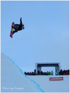
[The Women’s Half Pipe World Cup Finals, Winter Games]

In the beginning a string of headlights would snake up the mountain track against a moody backdrop of the mountain silhouettes. The peaks would glow in the morning moonlight as the convoy of rental vans drove us to work, reaching the top in time for the bloody-Mary sunrise. Now that spring is approaching the sun has already bleached the landscape before we’ve left our front doors, and it seems the hills are always on fire.

Back in June – about a week before the mountain opened to the public – it all started. The 2013 Cardrona F&B team spent the week getting acquainted and building ‘the family’. We did lots of paperwork, learnt to fit chains, gave mouth-to-mouth to a plastic dummy, got shown around the mountain, did more paperwork, had various training sessions, did more paperwork, played in the snow and partied hard. The work vans picked us up from the town office at 7am every morning, and we’d be back in town at around 5, just in time for happy hour at Water Bar.

Eventually, I was able to quit my couch-surfing career. Kai, Sean and Christian – lads from work – moved into a motel with an Australian called Tom, and shortly the neighbouring motel became free. I moved in with a ‘Despicable Me’ German called Bastian; a Michael Jackson obsessed Malaysian called Tze, and a small Welsh sci-fi artist called Rhys (who quickly adopted me as his sister and liked to bully me in a very brotherly manner). Within weeks the whole block of motels became a Cardrona staff hotel!

There is a series of snapshot images on the road I go along everyday between Cardrona and Wanaka. A scattering of bee boxes littered on the grass beneath a tree. Behind runs a babbling stream, coursing over miniature rockery with the mountains rising on the backdrop. Sheep dabble in the grass lands around, grazing lazily as we gaze out of the van windows, hardly noticing each other. Usually, a brilliant blue sky canopies the view, leaving a crystal tint every unique colour. The second snapshot is of little wooden fences and neatly cropped copse – possibly an orchard, but there’s no fruit at this time of year to clarify that. The icy, silver-yellow sunlight falls dappled on the ground between the leaves and twigs, and the little wooden fences cast criss-cross shadows. The drive back towards Wanaka presents you with sun-stricken panoramas of countryside, which pans out onto snowy peaks beyond. Before you reach the town, you glimpse a vast stretch of Lake Wanaka drenched with golden light and framed with the jagged mountainous horizon, a different shade of sky everyday.

~Snowboarding~

SAM_5252(2)
The heart of winter. Not what you normally think about at home, in the middle of August, when you’re clinging on to every last ray of summer, and each last grain of sand that sticks between your toes. But here it’s winter. Not damp, shivery, grey winter, but crisp, colourful winter, in which every sunset paints the lake a different story. If you’ve ever been on a ski holiday, you will appreciate the sheer thrill of zooming down a mountain side with nothing but bluebird skies and crystal views, spraying up waves of fresh powder around you with every turn; cool speed brushing your face… If, like me, you grew up on a small island on the edge of a country corrupt with money and politics, you may not have even seen a ski field, and learning is the most challenging fun you can have.

Waste Busters is a recycling centre on the outskirts of town, which funnily enough recycles things. You can buy practically anything for under $10, so, naturally, I got my first snowboard gear there. My actual snowboard came from Will and Esther, a lovely couple who lived next door to Corey and Britney. Grainne and I surfed on their couch a couple of nights and Esther happened to be selling her old board – a little Rossignol, red and blue, with a hooded creature holding a lantern on the tail end, which always reminded me of a Ra’zac out of Christopher Paolini’s ‘Eragon’. It served me well all season, until it mysteriously vanished on the last day…

Adrenaline pumped through me, getting on that chairlift for the first time. Nervously sliding up to it and letting it take control, for I knew that once I was on that chair, that was it, there was no going back. At first it felt like trying to ride a tea tray downhill over ice cubes, but with a touch of practice and encouragement from friends (a hard shove and endless amounts of laughter) I learnt to control my board.

The first time I got stuck in a whiteout was fairly early on in the season; one of the first times I went over the other side of the mountain to Captains. The mist came in while we were having coffee in Captain’s Cafe ($2.50 with staff discount!) By the time we’d realised how bad it was, they’d already closed the lifts, so we were forced to take the lower cat track back across the Whitestar lift. Now, I wasn’t very confident, especially on cat tracks. People were zooming past me, vanishing into the fog, and my friends were long gone. (You can’t stop to wait for people on a cat track, as they are flat, if you stop you can’t start again). The wind was pushing me back, slowing me down and blowing me off course. I couldn’t see the edge of the track where the sheer drop would surely kill me, and no matter how low I got, I couldn’t pick up any speed. Frustrated, I took off my bindings and attempted to walk, but with sheet ice beneath my feet and my board under my arm acting as a wind-sail, I was simply blown backwards with ever step I took. It ended with me sitting on the bank, arms folded, refusing to move, while Greg tried to coax me along from a few meters ahead. But at least I know I’m not the only one who had a cat track tantrum… (Miss Stokes!)

But snowboarding wasn’t all hardwork and horror. On the whole it is the most exhilarating sport I’ve tried so far. You’re out there in this beautiful landscape with brilliant people who just want to have fun. You skate up to the chairlift, do the barrier dance (a kind of gyrating motion against the barrier so it can detect your lift pass in your pocket), sit on the chair anticipating where you’ll ride, chatting with others on the lift and watching the pros in the park below. You weave down the slopes, racing your mates (or just trying to keep up), bunny hopping over mogles left by skiers, carving edges up the sides and stopping occasionally to throw a snowball or two. At the end of the season, we had to take a snowboarding assessment, and now I am an intermediate snowboarder!

(Thanks to Bez who gave me that first push at the top of McDougals and never failed to catch me all the way down my first run. Thanks to “Dutch” Sam for teaching me to turn and giving me that kick of confidence. Thanks to Wilko for taking me over the kickers in McDougals Park and being my witness for my first air. Thanks to TimTam and Lauren for giving me heaps of ride breaks. And thanks to Greg for believing I was better than I was.)

~Living For The Weekend~

DSCN4302(2)

The drive up the Cardrona track is hairy at the best of times, but when you’re in the passenger seat of your friend’s well-loved, well-used Ford Escort, with no chains and no brake pads, you can do nothing but laugh and hope. Greg and I would meet on our days off and drive up the mountain, teeth clenched, buttocks tensed, swerving away from the cliff edge on globules of mud and ice, or spinning out on fresh, unplanned snow. I think of cold, sunny drives and loud hip-hop and rock; singing along to the likes of Will Smith, Slim Shady and Foo Fighters to drown out the sound of the wheel bearings shaking to pieces. I think of sunglasses and laughing at nothing and all those threats of handbrake turns.

Occassionally, we would give the mountain a miss, and spend our day off in town eating gellato icecream by the lake and chilling on the deck, go for lunch and shopping in Queenstown, or go for a drive in the countryside…

~A Picnic at Glendhu Bay~

Blues of oceans, far out in the midst of clear-sky-nowhere. Sunshine breathes through the silent chill of winter. Spring on the horizon. A curve of sand stretches around the lake, curling into the distance where the leafless trees merge into the carvings of the mountain. White peaks brightly shard the sky, dazzling like new knives. The water laps my ears between songs of Muse and Metallica, while little yellow-faced birds scamper about the stones. A twist of smoke rises up and licks the cold while the car bonnet toasts our bottoms. White puff-ball clouds on the sky; avocado and strawberries on our lips.

DSCN4501(2)


Out in the depths of Lake Wanaka lies Ruby Island – a tiny nature reserve, which you can only reach by boat, or in our case, one kayak, one punctured dinghy and a blow-up bed… a good group of us made it over, Bez, Stokes, Sean, Paul, Olivia, Greg and myself. We walked around the island, jumped off the jetty into the lake, and had a BBQ feast before the paddling mission back to land.

The season is over now and I have begun spring work in a vineyard just outside of town. But I’ve learnt a lot, achieved more and made friends for life. See you next year Cardrona!  
DSCN5226(3)


Waikato Wanderings

With dreams of a long weekend in Wellington shattered at our feet due to fully booked motels, my folks and I decided to take a trip through the Waikato region; west of the Bay of Plenty.

We set off on the morning of Friday 26th April, following a spectacular double rainbow through Rotorua, where it arced over Mt Ngongataha, and led us to the Rainbow Mountain, where the end of the rainbow dipped its colours in the lake, before leading us on to Taupo.

We reached Lake Taupo near Kinloch, where the temperature dropped and the sun and the rain competed for the sky. The rainbow we had followed was now dropping over the headland and falling into the blue of Lake Taupo, and we ditched the car to begin a 4 hour walk to an inlet called Kawakawa Bay.

Trudging along a sandy track, through trees and bushland, with occasional clearings that overlook the secret bays of Lake Taupo, we witnessed rare native birds: Silver Eyes; a couple of Bell Birds; some common Fantails and a little white Pōpokotea, or Whitehead.

With the sun burning off the threat of rain, we came to a clearing high on the headland before descending down to the bay. Standing upon the rock, looking over a vast stretch of Lake Taupo, with the jagged highlands, hazy in the distance.

Image

The descent to the bay took us down into damp, rocky woodland, with gigantic ferns and exotic trees lining our way. It felt as though we’d entered a rainforest, and then the path flattened out as the sound of the water lapping the beach kissed our ears, and we emerged into a clearing and onto Kawakawa Bay.

The pebbly beach curved around either side of us, disappearing around headlands on one side, and off into the distance on the other, while the lake itself splashed up against the shore like a choppy ocean. There was no chance of strolling into the water for a paddle, as the shore line drops a hundred meters or so beneath the water surface. It is a volcanic lake after all.

Another two hours later, we’d made our way back along the winding bushland path and back to the RVR, and headed into town to find our digs.

Taupo is a beautiful town, but the temperature is considerably cooler, being a lot higher up than Tauranga. Our motel was called ‘Mountain View’, but unfortunately, the Tongariro mountains were obscured by haze that day. But our balcony didn’t go to waste. We spent the evening strolling about the town, enjoying Irish pub grub in Finn’s, and topped the evening off with a Kahlua nightcap in The Shed.

Saturday 27th April
Bidding farewell to Taupo once again, we headed northwest through rolling green hills and little towns, past sheep and pigs and endless fields of cows. We passed through, Tirau, a small town littered with corrugated iron artwork. The i-site centre was made of two corrugated iron buildings in the shape of a sheep and a dog, and big corrugated Pukekos sat atop one of the shops. We stopped briefly in Cambridge to pick up a bite to eat and stretch our legs, and then continued west towards Raglan.

In the midst of the countryside, on a quiet road somewhere near Karamu, outside of Hamilton, we came across the toothbrush fence, which is, exactly as it sounds, a fence covered in toothbrushes!

Image

We reached Raglan on the west coast, and took a short detour south to Bridal Veil Falls, where the Pakoka river leaps from a 55 metre high clifftop, creating a spectacular waterfall. A short walk alongside the river, beneath a tropical canopy, leads down over 200 steps, passing various viewpoints, until you reach the bottom, where you stand on a bridge over the river, looking up at the waterfall and getting considerably damp!

Image

On to Raglan – a little coastal town, known for its surf, which swells up from the Tasman Sea. We stopped in the town – just a few shops and cafes on the main street – and ventured into a little place called The Shack, where I was greeted at the door by an old friend from university back in London, Grai. The Shack was a busy little cafe, with quirks like all the sides were served in miniature milk bottles. We ordered some teas and coffees and Grai took the order, as we kept looking at each other, open mouthed, in awe at how small the world is! We arranged to meet up for some drinks in the pub later on.

A cup of caffeine later, we left Grai at The Shack and wandered up a little dead-end street, lined with two craft shops, a coffee roasters, and a surf shop. We browsed the intricate bits-and-bobs in the craft shops – jewellery; pinbadges; bags; pictures; paua shell; greenstone; etc, then had a mosey at the clothes in the surf shop. From there we cut through between buildings and found ourselves walking down towards the estuary.

To the right, a boardwalk led off around the corner, while on the left a bridge crossed over the water to a headland. Mt. Karioi loomed ahead, while kite surfers scattered the horizon on the sea in the distance.

DSCN3538

Our accommodation lay on Upper Wainui road, about 5 minutes out of Raglan town, and was called ‘Our Beach House’. We sat in the garden next to the orange tree, (though the oranges were technically greens), before heading back into to town to the Harbour Hotel. One of the great things about Raglan is the small community feel – everyone seems to know one another and are happy to help you out. The Harbour Hotel run a free pick-up and drop-off service, as long as you eat or drink at their pub, and it’s the same with the local bar as well. So we gave the hotel a ring, and shortly afterwards, a lady in a people carrier came and picked us up. We had a yummy tapas dinner and chilled in the sports bar section of the pub to watch the rugby – Chiefs v. Sharks.

Grai arrived with her sister and some mates, and they took me to the The Yot Club – the only bar in town, where everyone ‘goes to dance’. A live instrumental band called ‘Funky’ played, and I got acquainted with the locals; a couple of Americans on holiday, and several English people from Mount Maunganui. They all had the same agenda – to surf.

At the end of the night, the bar staff drove everyone home!

Sunday 28th April
Bright and early, we said goodbye to Raglan and headed south to the Waitomo Caves. We arrived just before 11, and it was already a belting hot day, and it appeared to be the home to some very interested wasps. We waited in a large greenhouse style structure, where the gift shop and cafe were located, until a mini bus arrived to take us and a small group to the first cave – Ruakuri.

The spiral entrance to the Ruakuri caves was built as an alternative way in, as the original entrance was discovered to be a sacred Maori burial site. Inside, the caves were vast, with a river running through complete with a mini waterfall, where people can partake in black-water-rafting. Glowworms speckled the rock like stars, and stalactites and stalagmites spiked each cavern and tunnel, with a unique limestone formation around each corner. The cave walk took about 2 hours and covered 1.6km underground.

With some time to spare, we found a cafe/dairy to stop for lunch, before heading to the second cave – Aranui. Set in the forest of the Ruakuri Reserve, the Aranui cave has a natural entrance, and almost feels as though you are entering the side of a cliff. It is a much smaller cave, and the only life it holds is Cave Wetas – large spider-like insects. Aranui cave was also described as a ‘fairy walk’, as the rock formations are so beautiful and intricate, it is like walking through a fairy palace, or something out of a children’s story.

The third and final cave was Waitomo, where local Maori, Chief Tane Tinorau, discovered the glowworm caves via a boat, with an English surveyor, Fred Mace in 1887. Waitomo caves have remained a part of the family ever since, and the great great great great granddaughter of Chief Tane Tinorau was our tour guide, which made it feel pretty special. We were led down into the caves on foot, through the ‘cathedral’: a huge chamber where the rock formations almost look like a pipe organ, and the acoustics are perfect for singing. The ‘cathedral’ chamber is open every Christmas for a ceremony, where local schools and a band are invited to go down into the cave for a carol service. The ‘cathedral’ is lit by hundreds of candles, and visitors are welcome to join the magical experience. From the ‘cathedral’ chamber, we went into the darkness, face to face with glowworms, and the shining mucus threads that hang down to catch bugs for dinner. We followed the dark passage downwards, onto a jetty, where we climbed into little boats in the pitch dark. The only way I can describe it is like the first time Harry Potter and his friends see Hogwarts from the little boats. Our boat was pulled along by our tour guide, on wires attached to the rock above, and as we gracefully glided through the silent darkness, a thousand fairy lights appeared all around us. It felt like magic, and there is no better name for the glowworms than the Maori one – Titiwai (The stars over the water).

The little boat came out of the cave along the Waitomo river, where the Chief and his English companion had originally entered.

DSCN3653

Time to head back home to Tauranga: not ‘home from home’, but ‘holiday from holiday.’