The Roof of Africa: Climbing Kilimanjaro

24–36 minutes

This blog is best viewed in Desktop format.

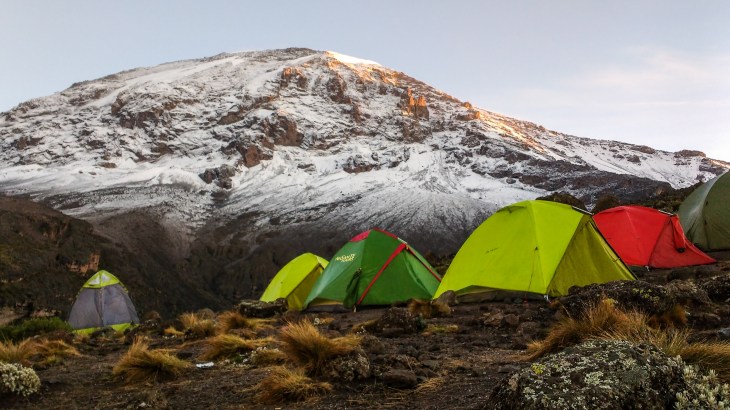
Mount Kilimanjaro (for the fact lovers):

  • LOCATION: Tanzania, Africa
  • ELEVATION: 5,895m
  • MOUNTAIN TYPE: Stratovolcano
  • VOLCANIC ACTIVITY: Dormant
  • AGE: 3 million years
  • LAST ERUPTION: 150,000 – 200,000 years ago
  • VOLCANIC CONES: Shira, Kibo, Mawenzi
  • SUMMIT: Uhuru Peak (Kibo Cone)
  • FIRST ASCENT: 6 October 1889 by Hans Meyer & Ludwig Purtscheller
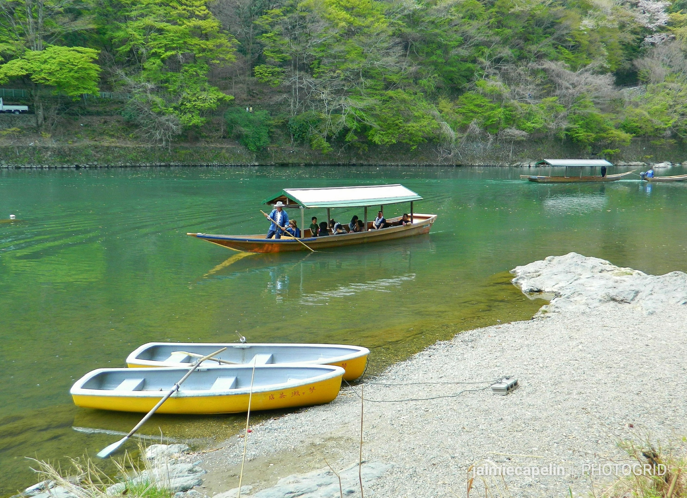
Welcome to Tanzania

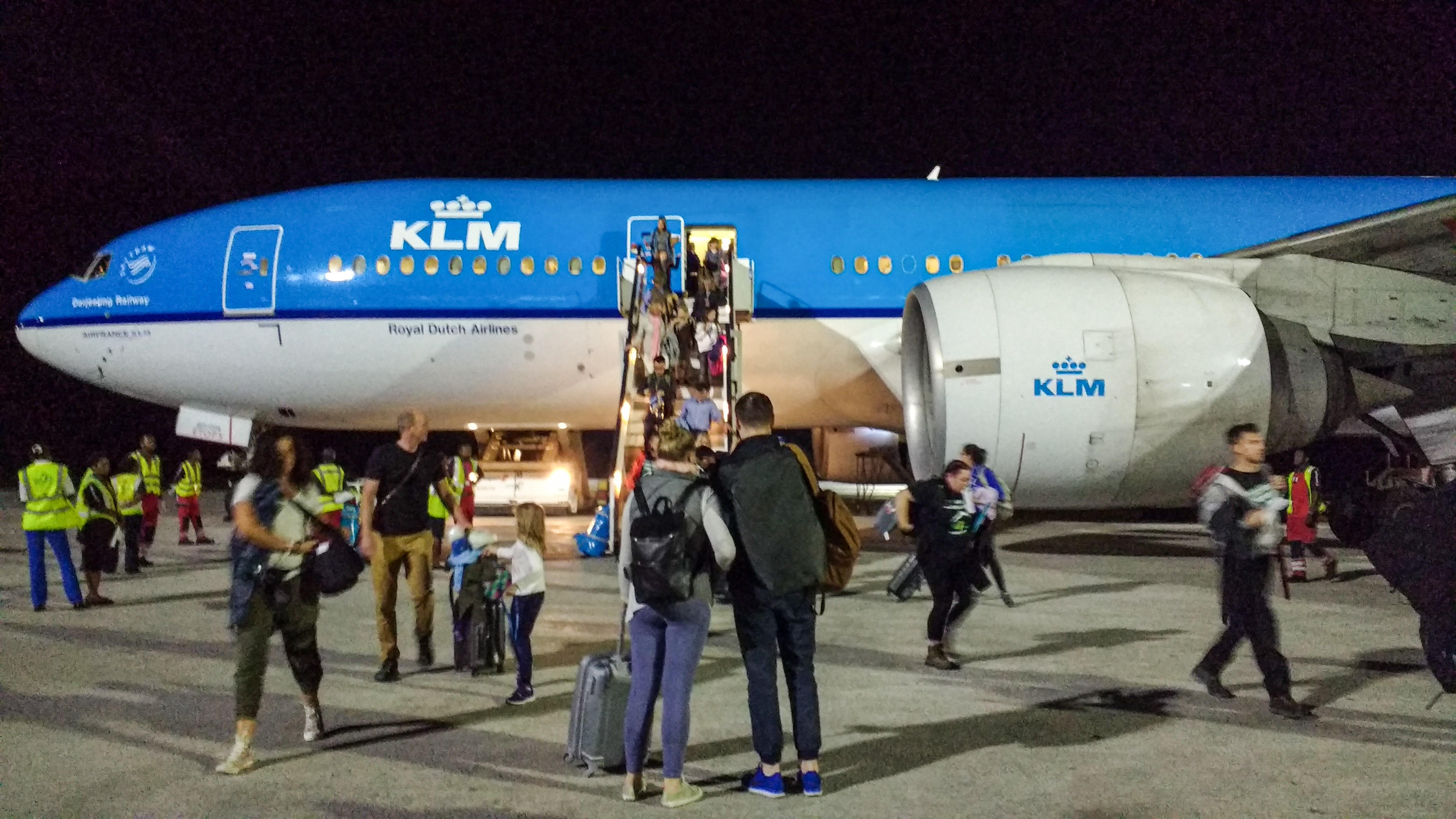
It was the evening of my Birthday, and the plane touched down blowing brown dust clouds around Kilimanjaro International Airport. Stepping off the plane onto the tarmac, I followed my group across the runway, through the doors into the little airport.

It had been a busy year, training and fundraising for my local charity, The Hampshire & Isle of Wight Air Ambulance, for which I was climbing Mount Kilimanjaro. The initial part of the challenge; the part I found most difficult (talking myself up, running public events, being ‘outgoing,’ persuading people to donate their money) was complete, and it was time for the part I was most excited about – climbing the mountain! I was part of a group of 23 British strangers, including the Air Ambulance representatives, Ian, Sophie and Tim the medic who were leading the event, but we had all become friends through months of training exercises and fundraising events. Now we’d finally arrived in Africa, and warmth greeted us beneath the night sky as we were transferred to our base at the Weru Weru River Lodge.

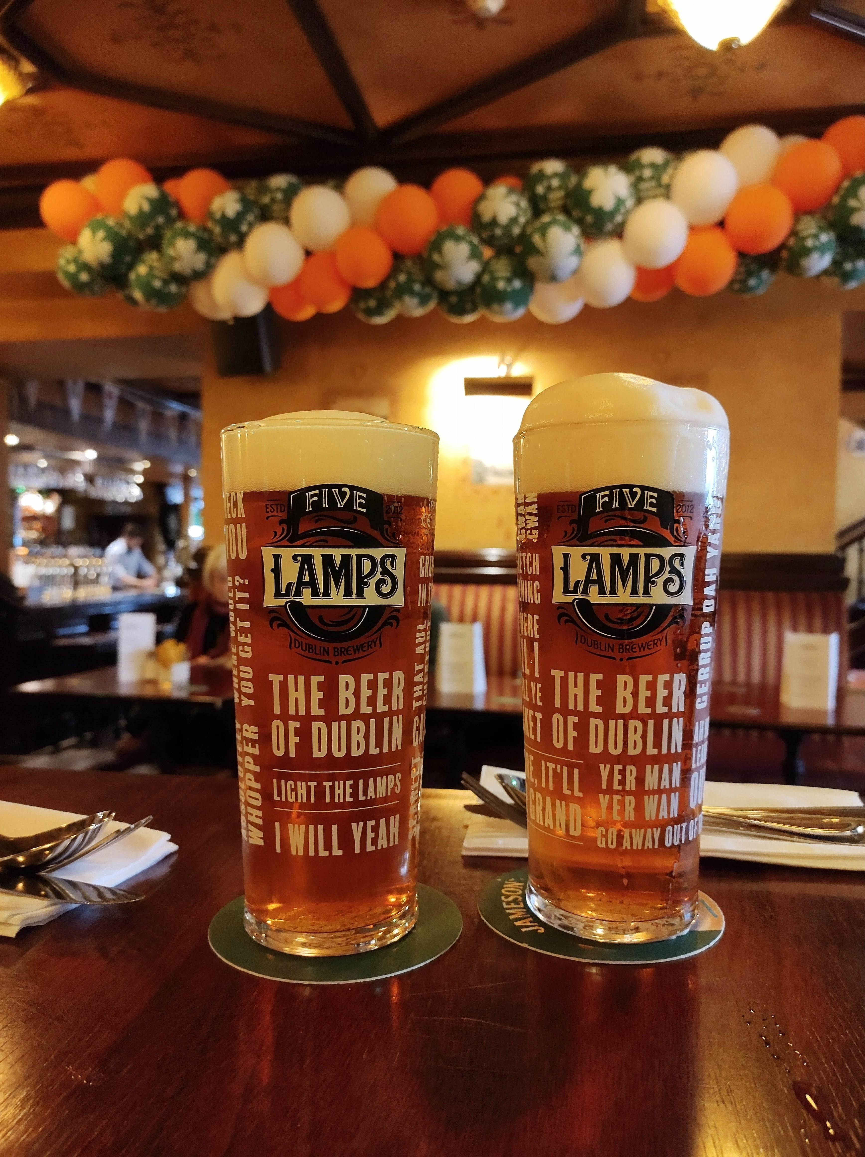
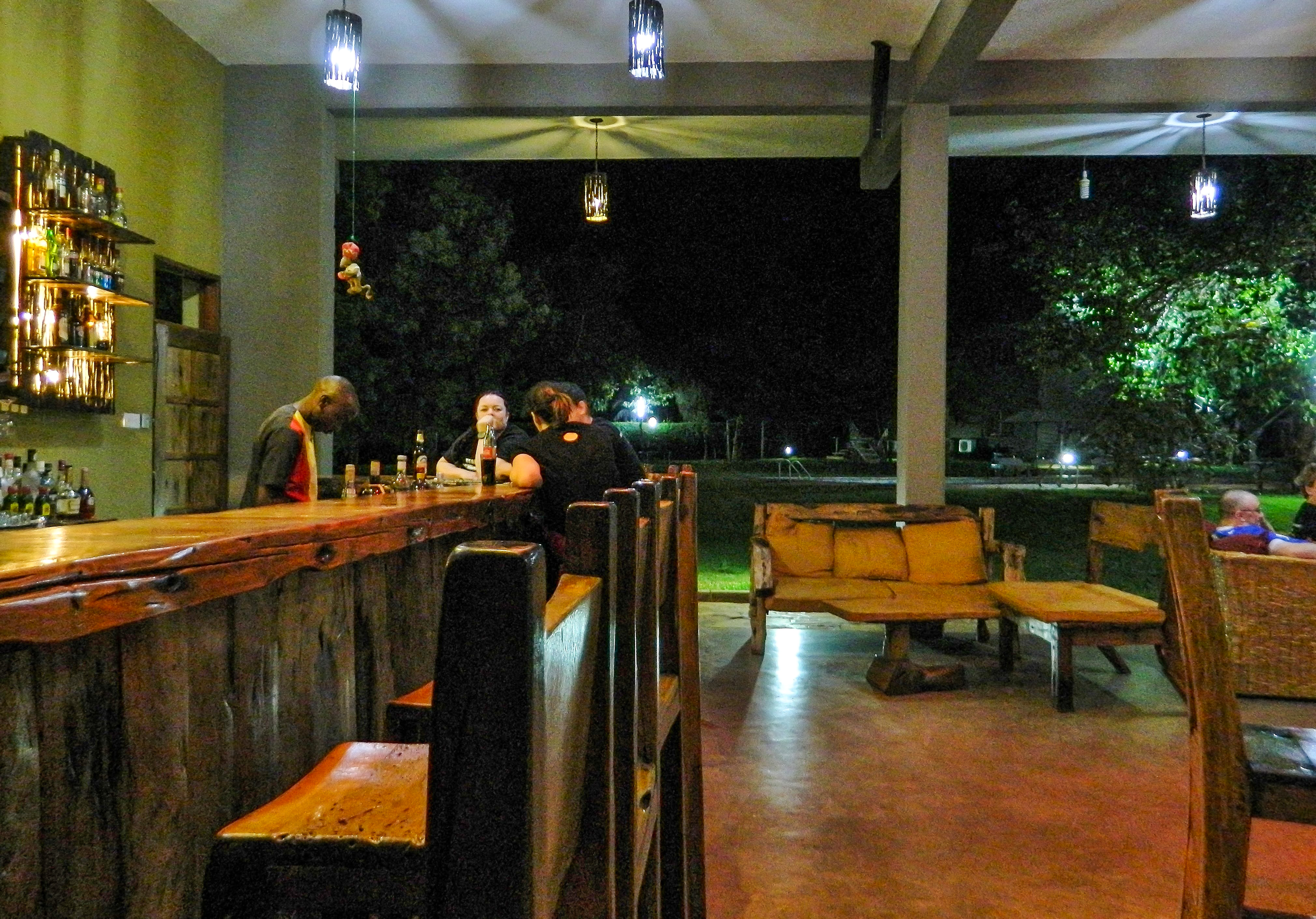
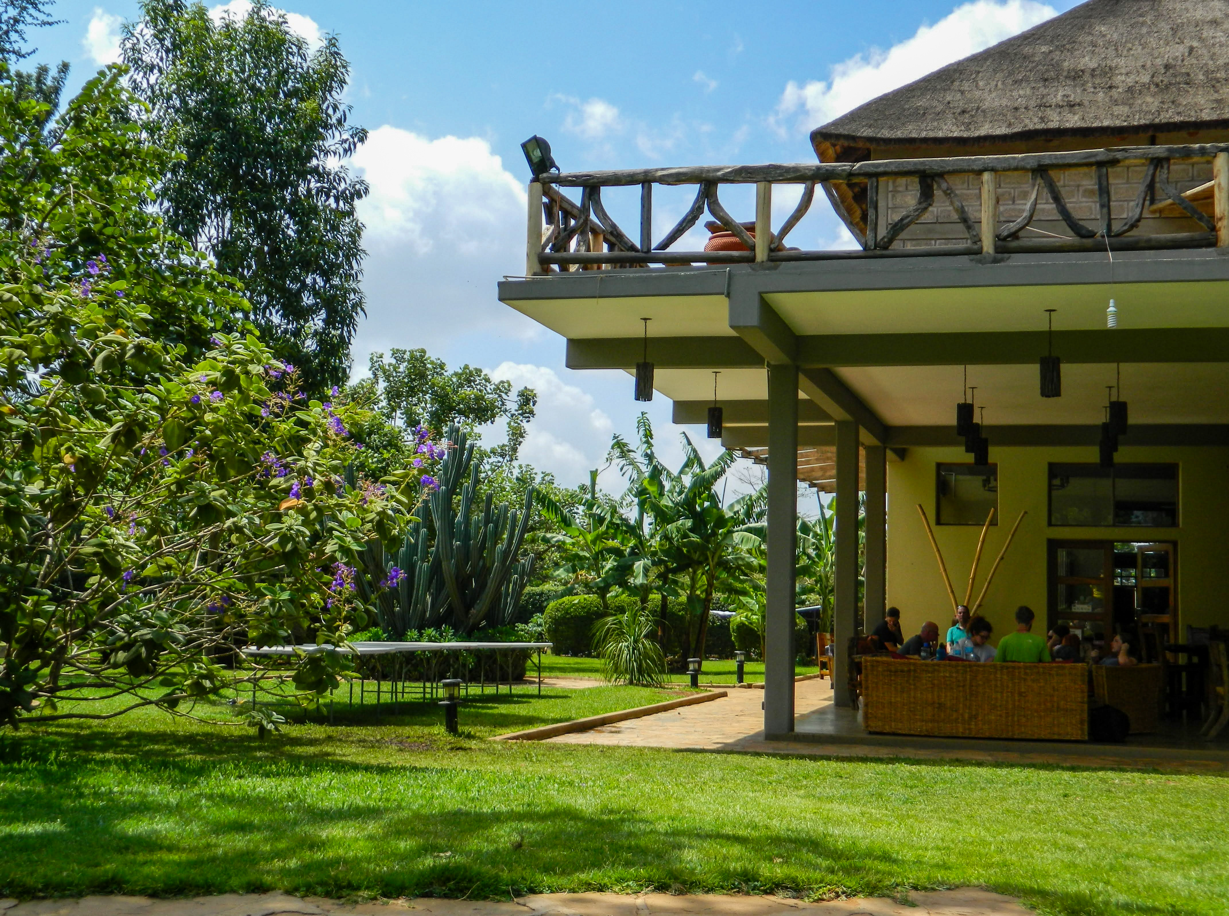
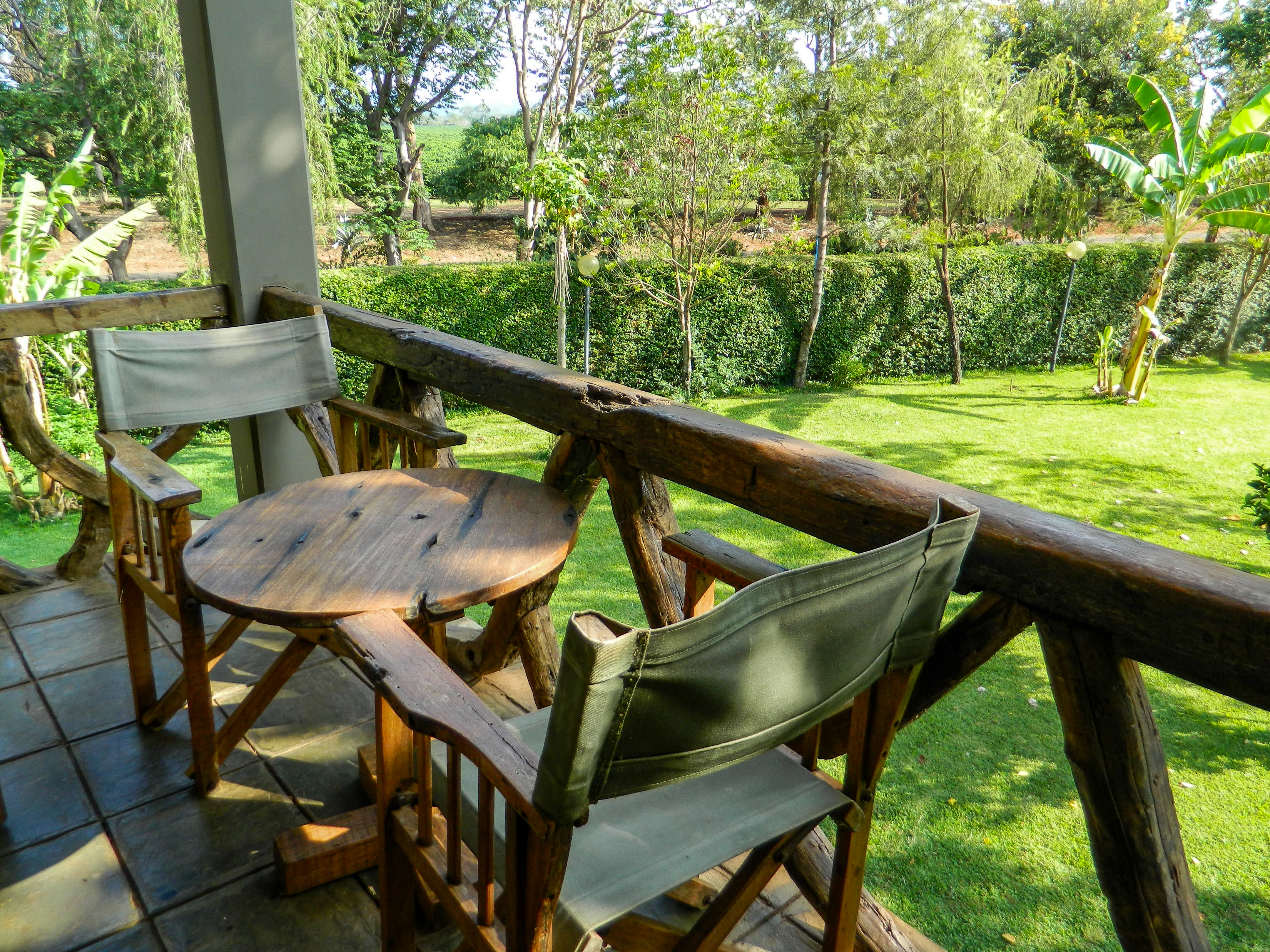
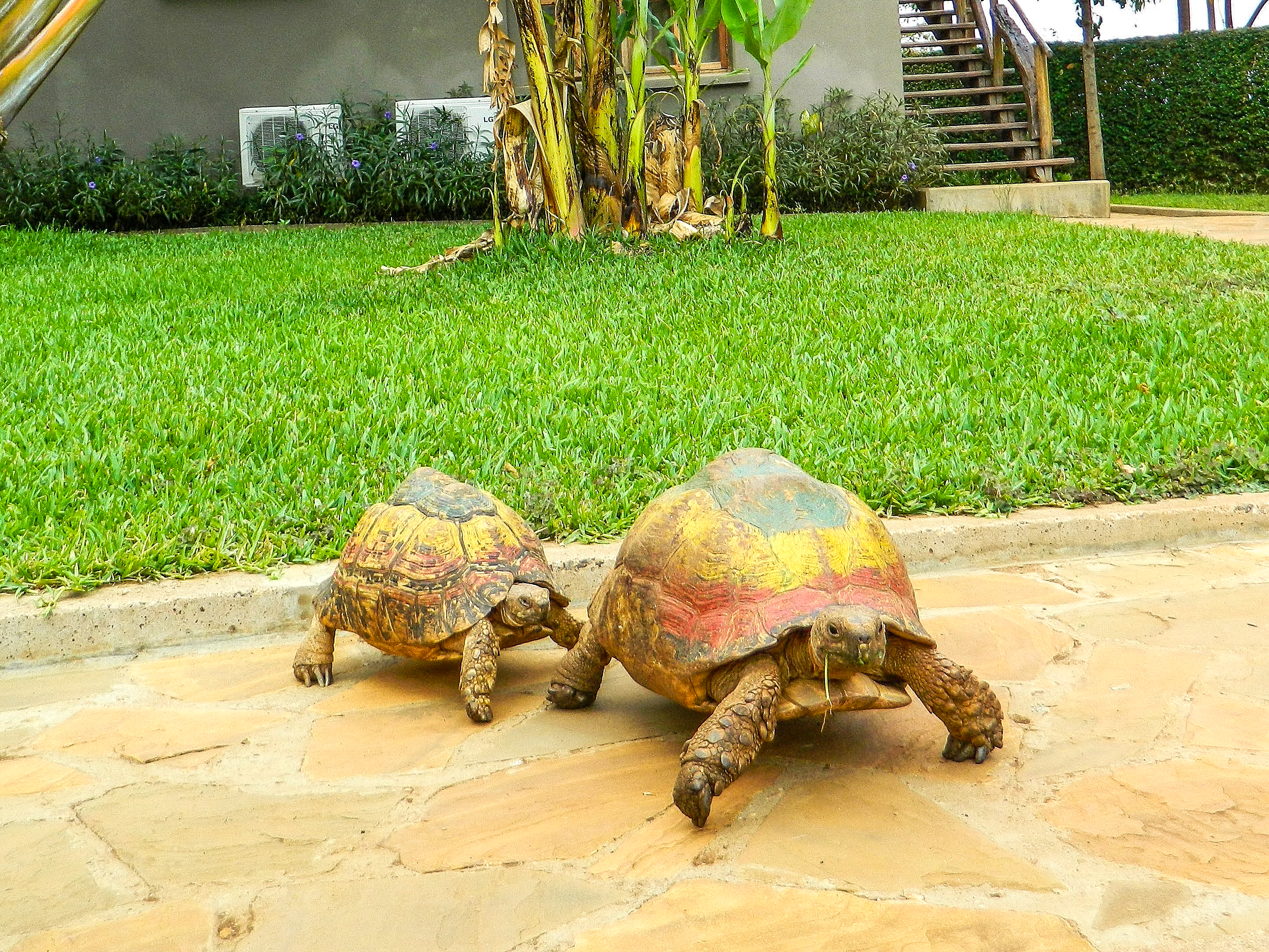
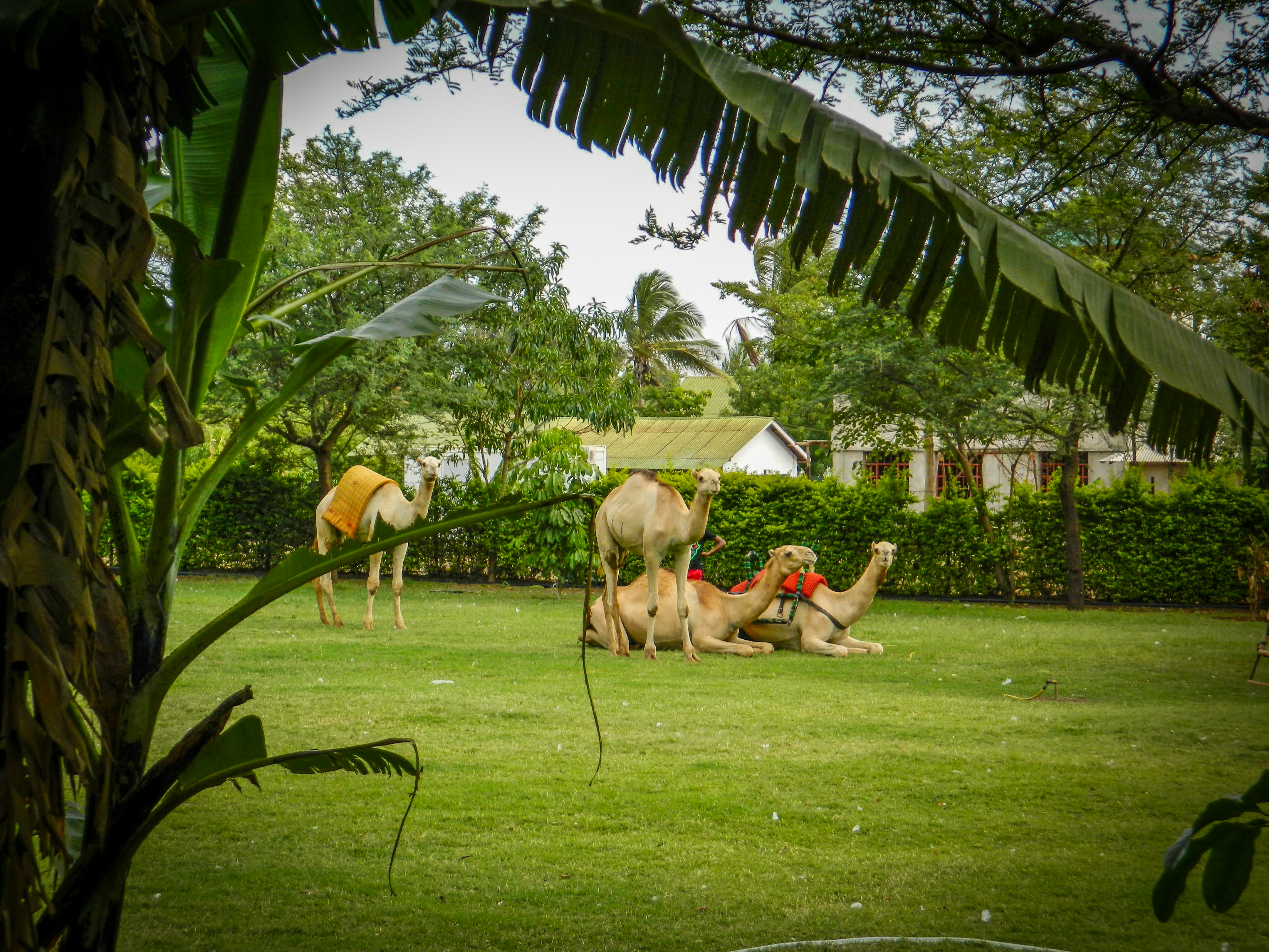
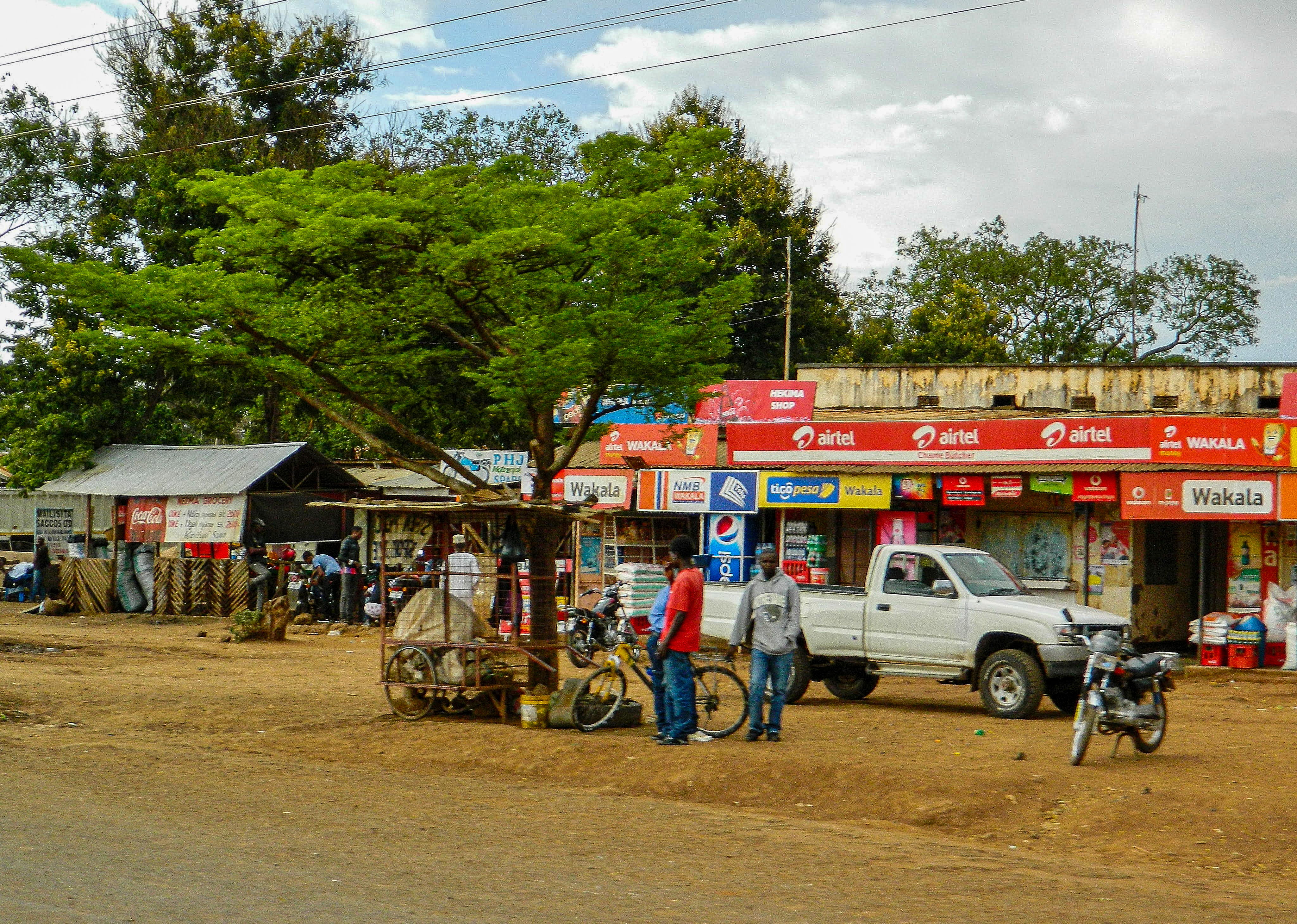
Corrugated iron shop fronts whirred past the windows, clustered between little trees on the roadside. Dogs sniffed around outside a petrol station, and people gathered on benches outside little bars, sharing a drink or evening meal. Bonfires were lit on sandy scrubland, as mopeds with 2 or 3 people on the back sped by, and occasionally a shape in the shadow turned out to be someone sitting on the verge sticking his thumb up as we drove by. The Weru Weru River Lodge was amazing – luxury I was not used to! They had resident tortoises and camels roaming about the grounds, and trees full of native birds. We were greeted by the staff with handshakes, and we enjoyed a local Kilimanjaro beer before turning in to our ensuite rooms with stylish wooden furniture and balconies overlooking the national park. A welcome bit of comfort before spending the next seven nights in a tent!

(Click on the photos to enlarge them.)

Prep Day

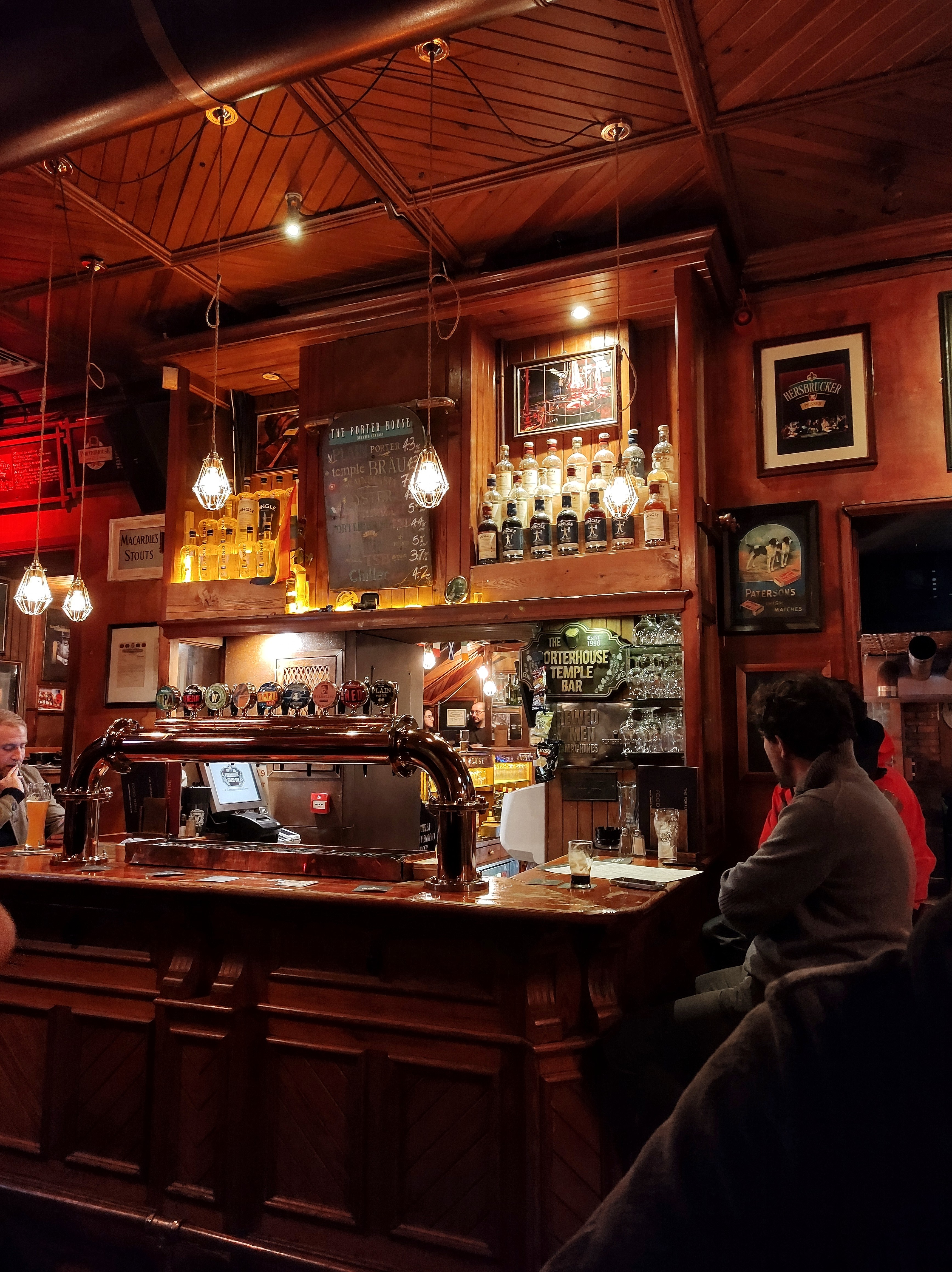
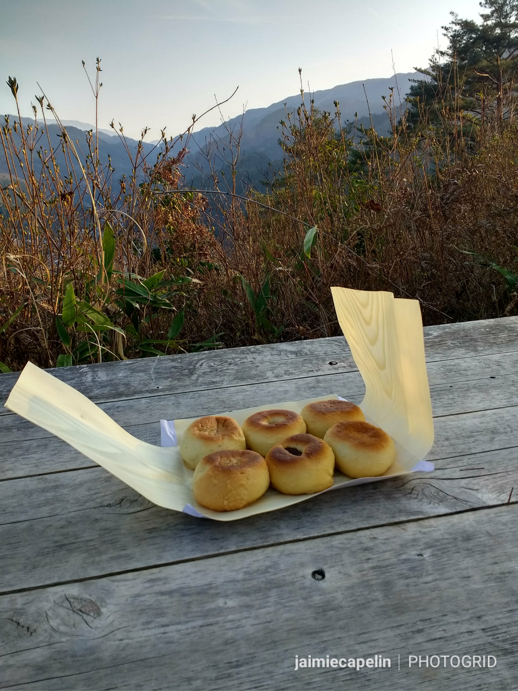
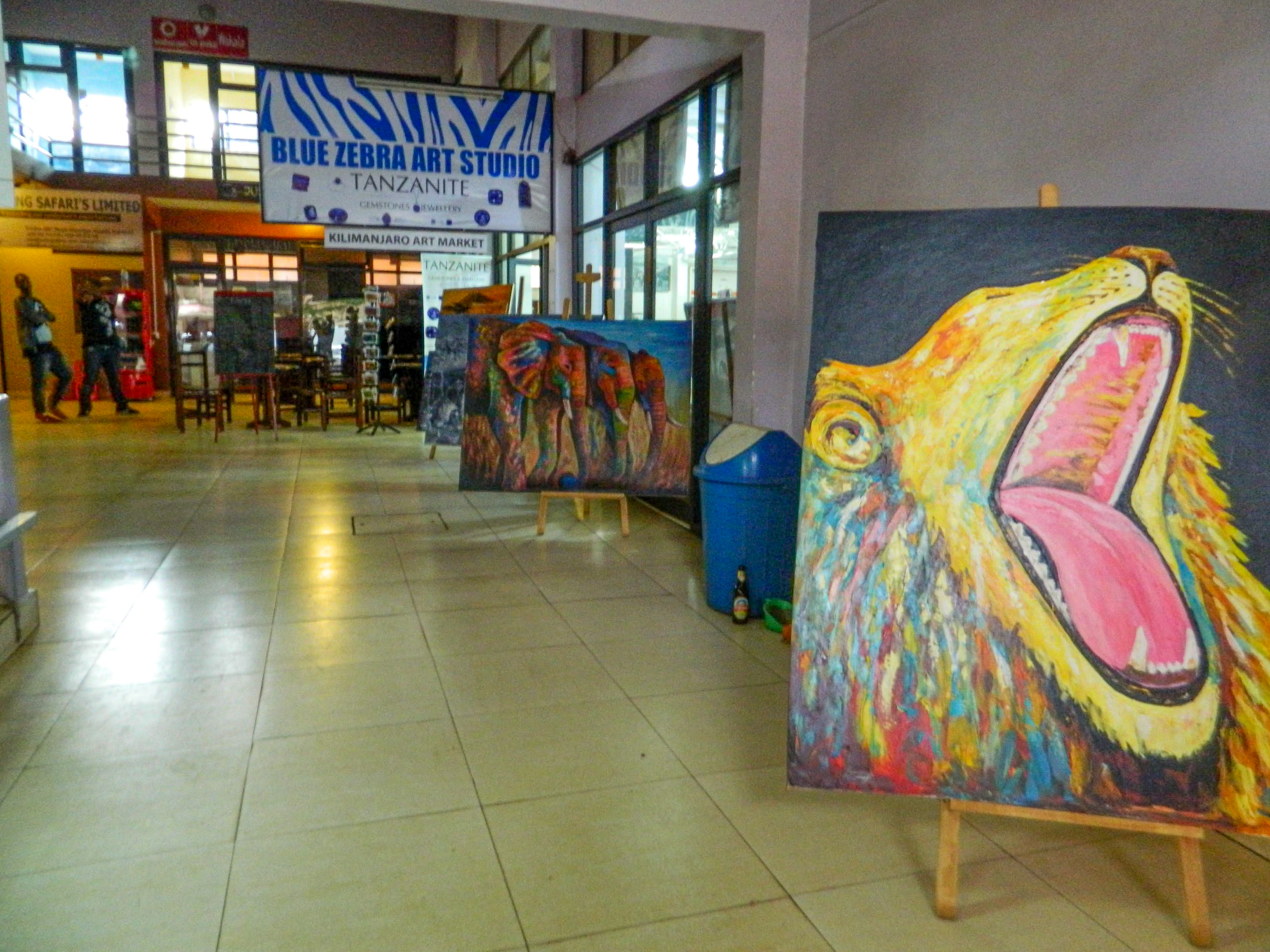
Anticipation running high, our group met with our head guide, Julio, an incredible Tanzanian man with a tonne of local experience, knowledge and wisdom. He briefed us with the itinerary, all the safety measures, and put some of our worries at ease, before individually inspecting each of our kit. Julio’s most important lesson was to ‘Respect The Mountain,’ because you can’t win when you argue with nature. Once we were all set, the guides took us into Moshi to look around a local arts market – to help take our minds off the impending Kilimanjaro challenge. There was a tremendous thunderstorm with torrential rain that tattooed the tin roof so loudly we couldn’t hear each other speak. The shop’s power went out in the storm, and we were introduced to some street vendors who were selling the classic Kilimanjaro safari hats, for which we bartered playfully while we waited for the storm to pass: “$8, come on sister!” (I wasn’t very good at bartering, but I got one for $6!)

Day One – “Polē Polē”

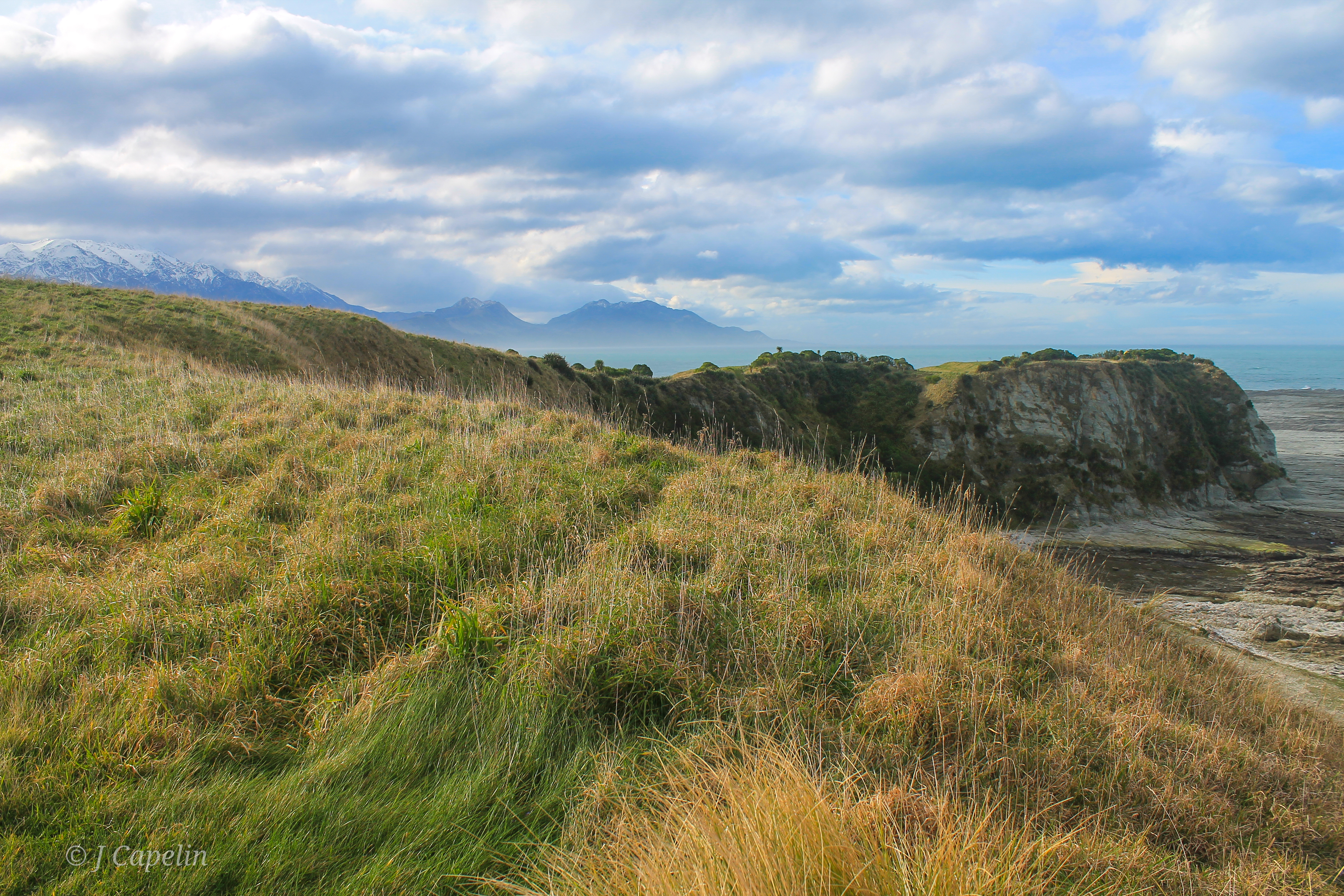
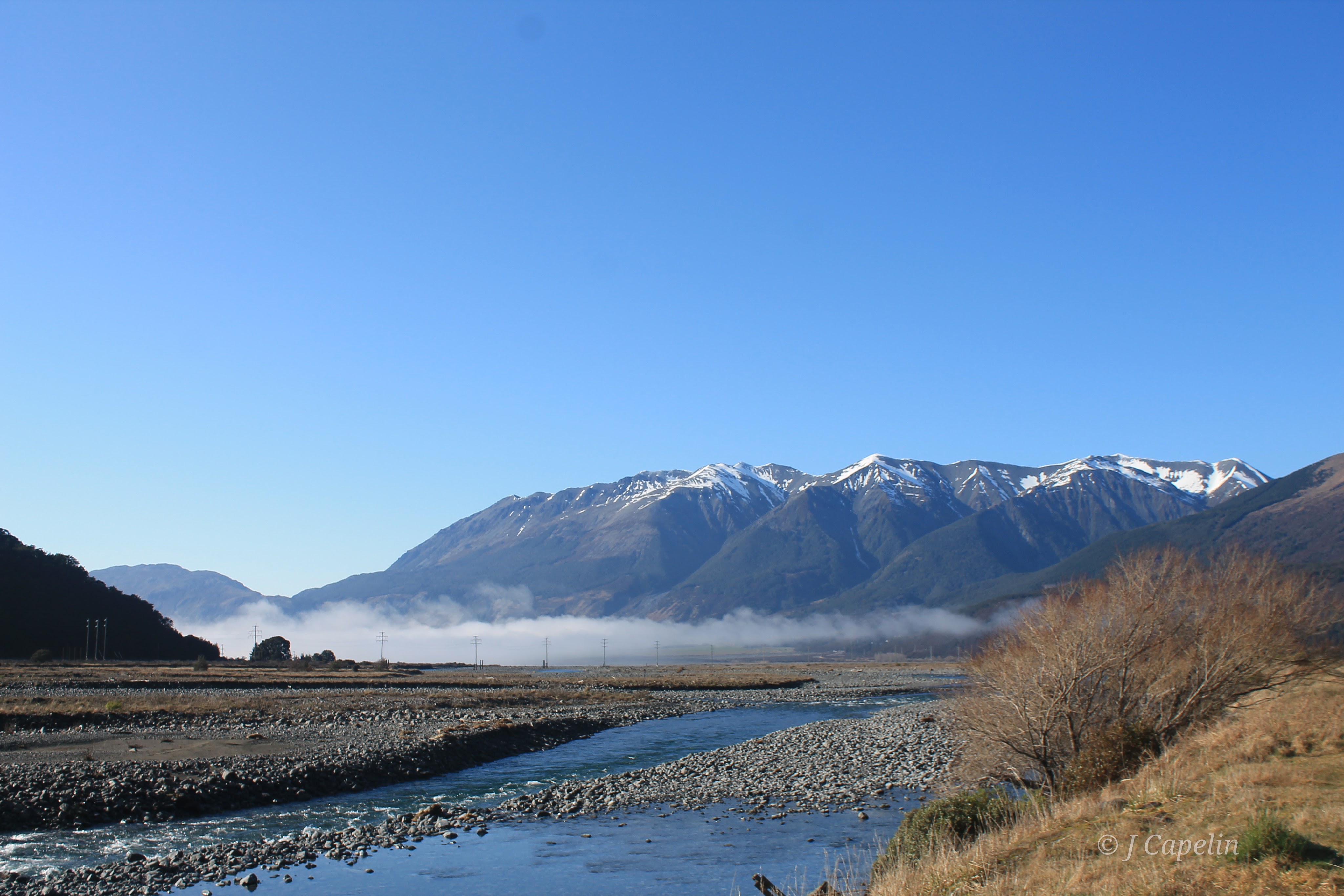
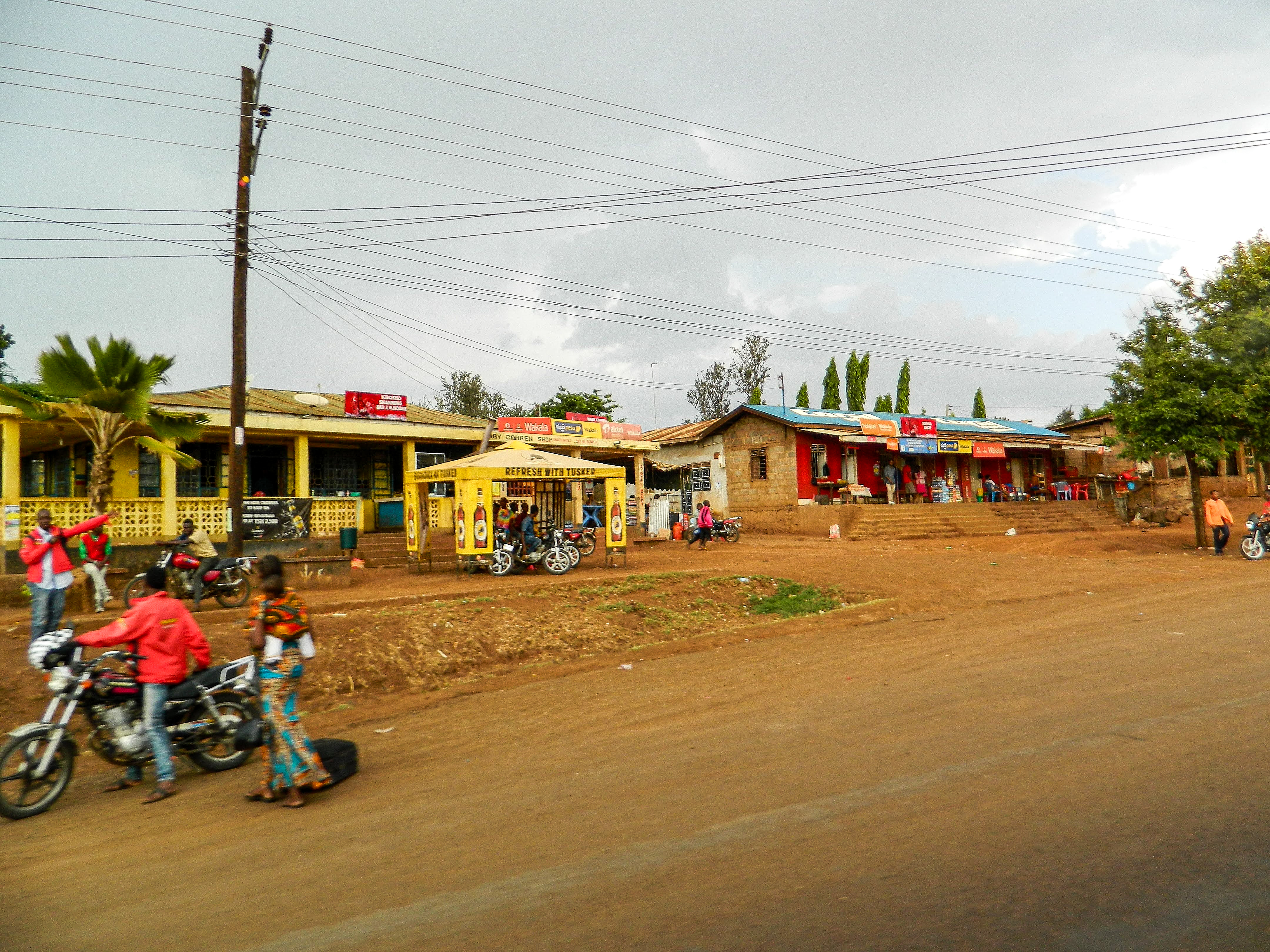
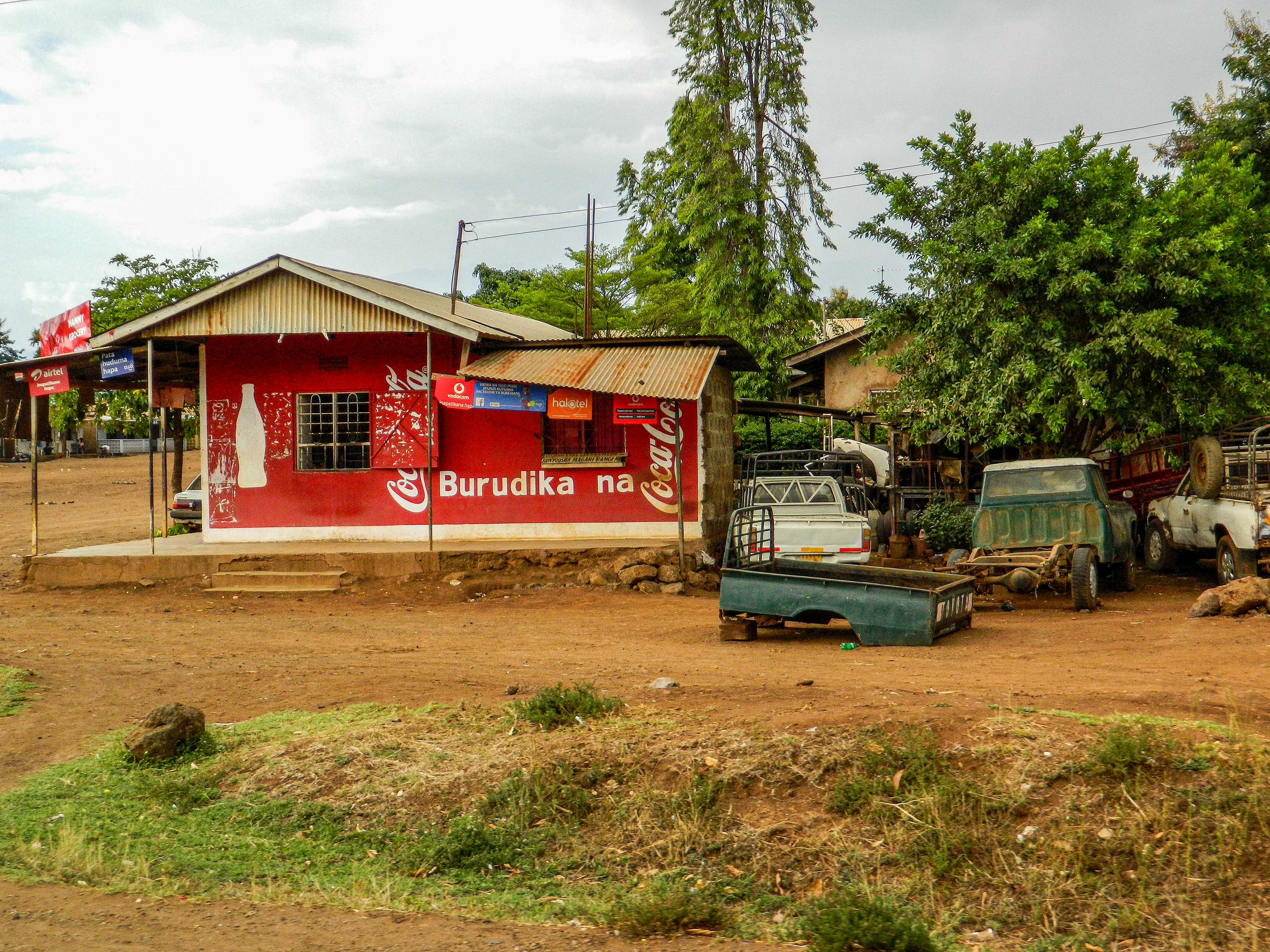
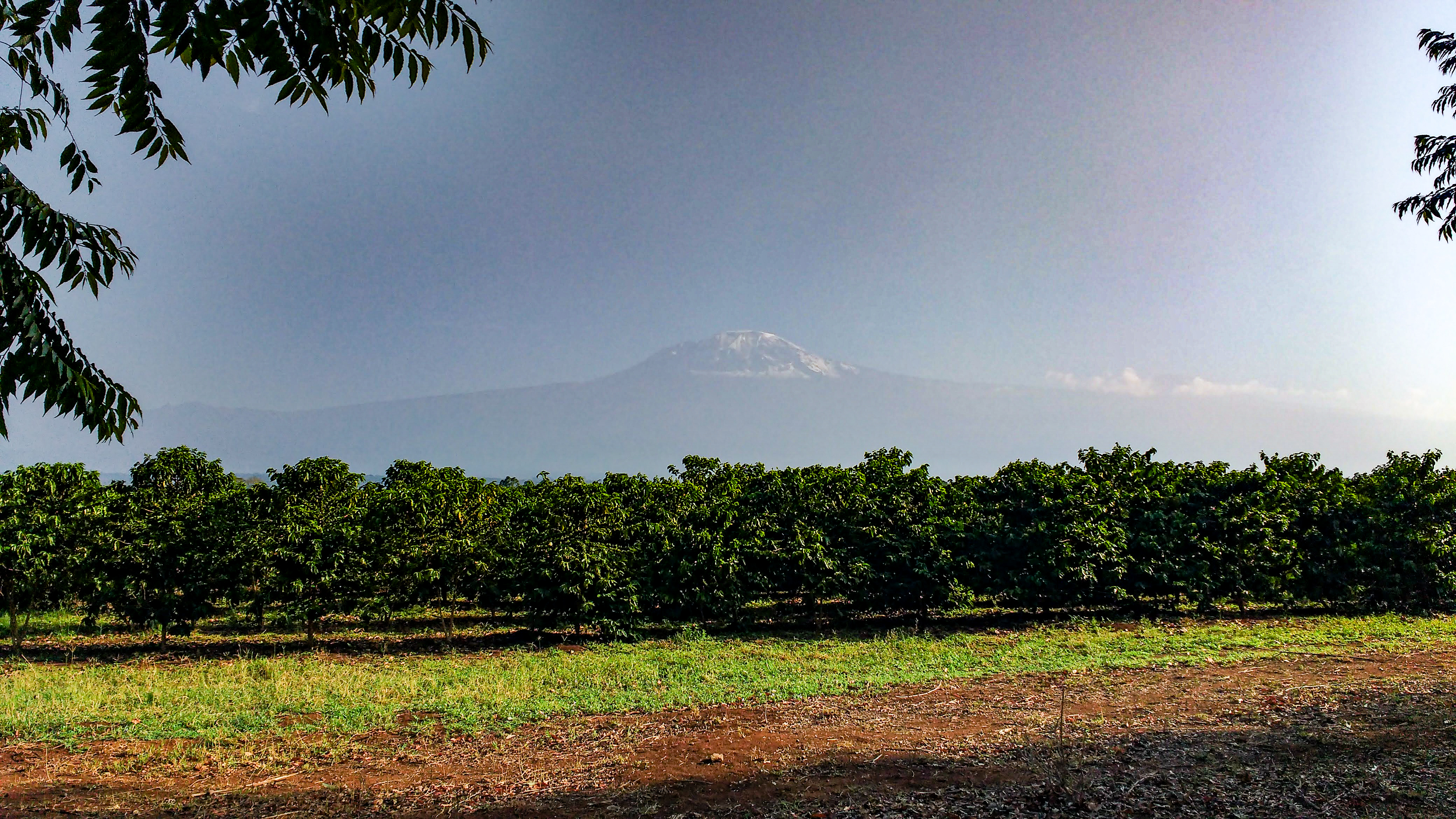
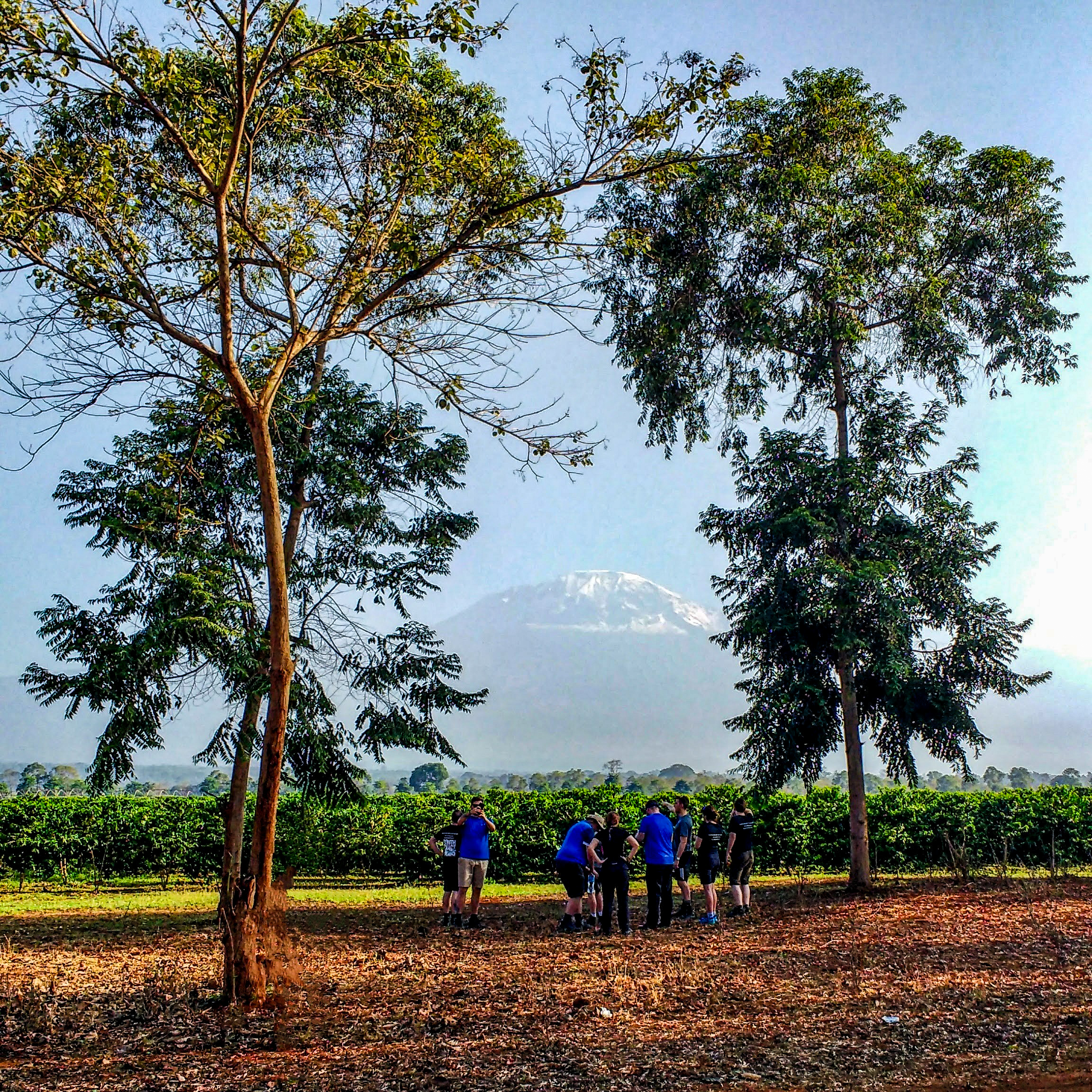
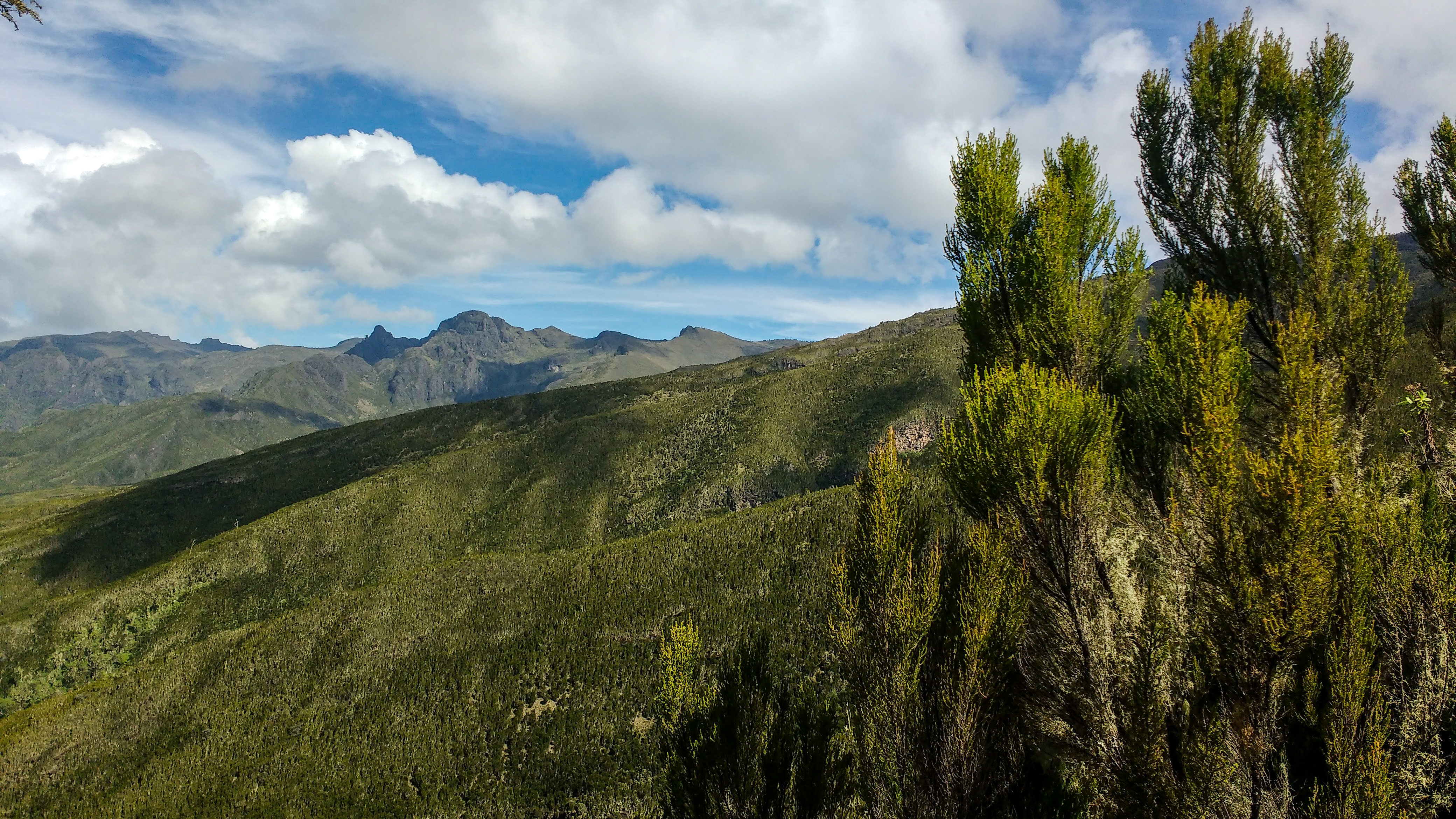
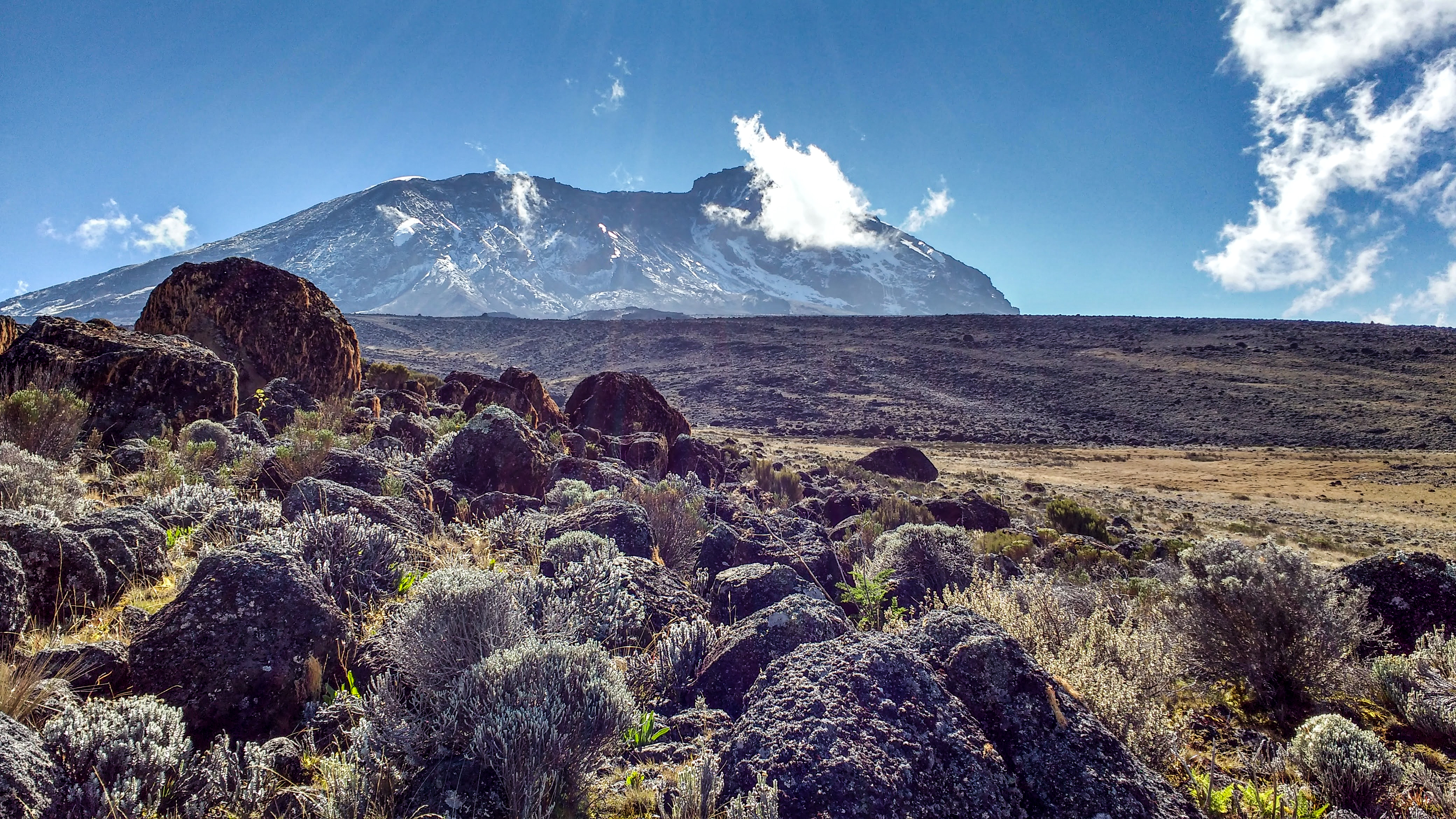
Mount Kilimanjaro made its first appearance in the morning, looming hazily over the coffee plantations surrounding the lodge. Its top was dipped in snow, bright against the blue sky. We were transferred from the lodge at 9am on a minibus, passing through bustling villages, where the locals smiled and waved, sometimes high fiving us through the bus’s open windows. Big yellow dogs lay asleep outside shops adorned with giant coca cola adverts, and workers strolled along the roadside with machetes and baskets of bananas balanced on their heads.

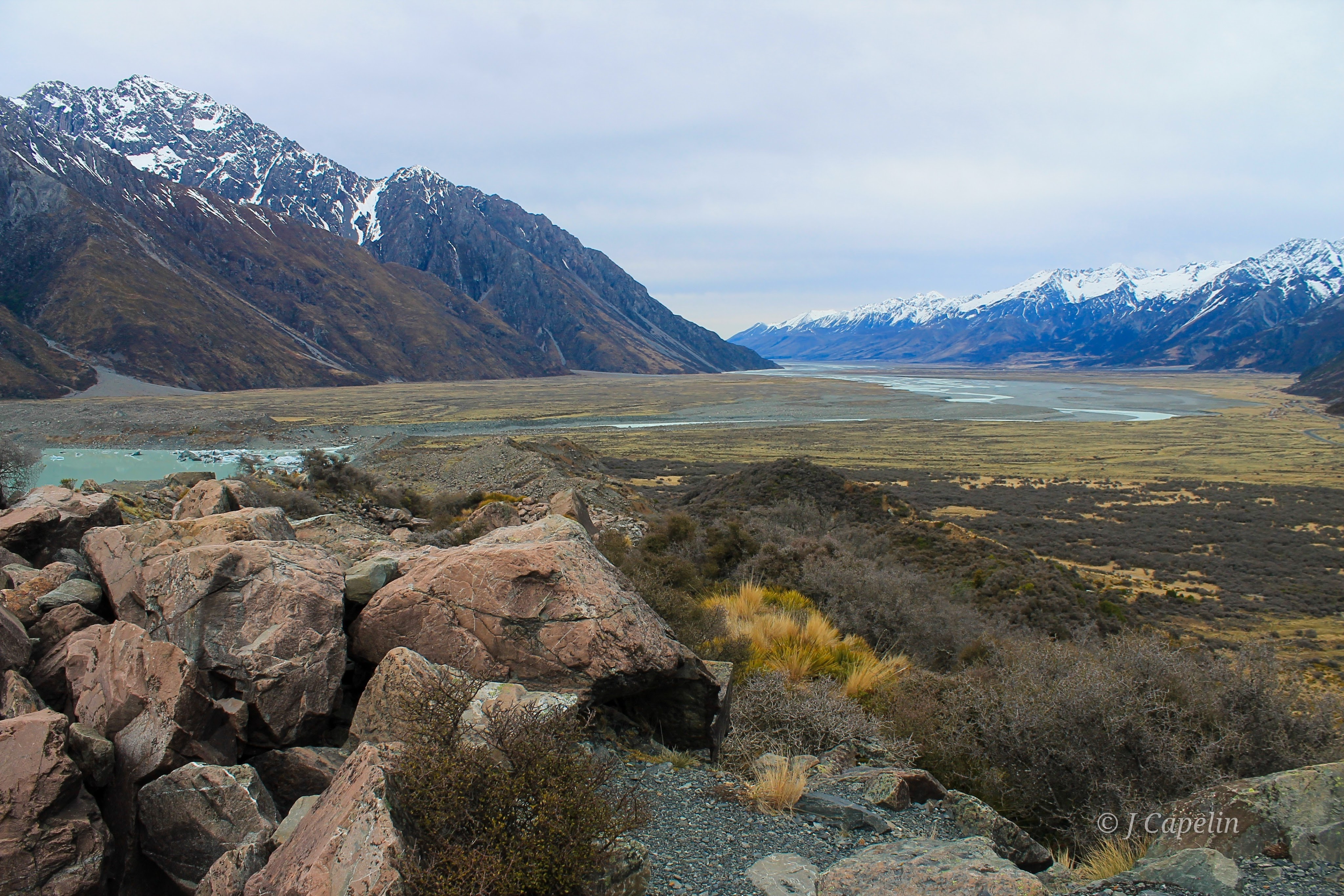
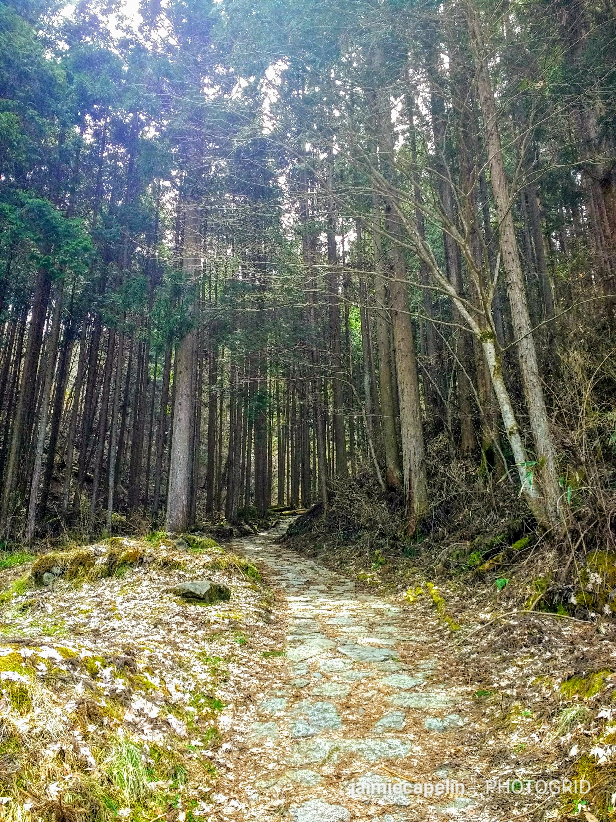
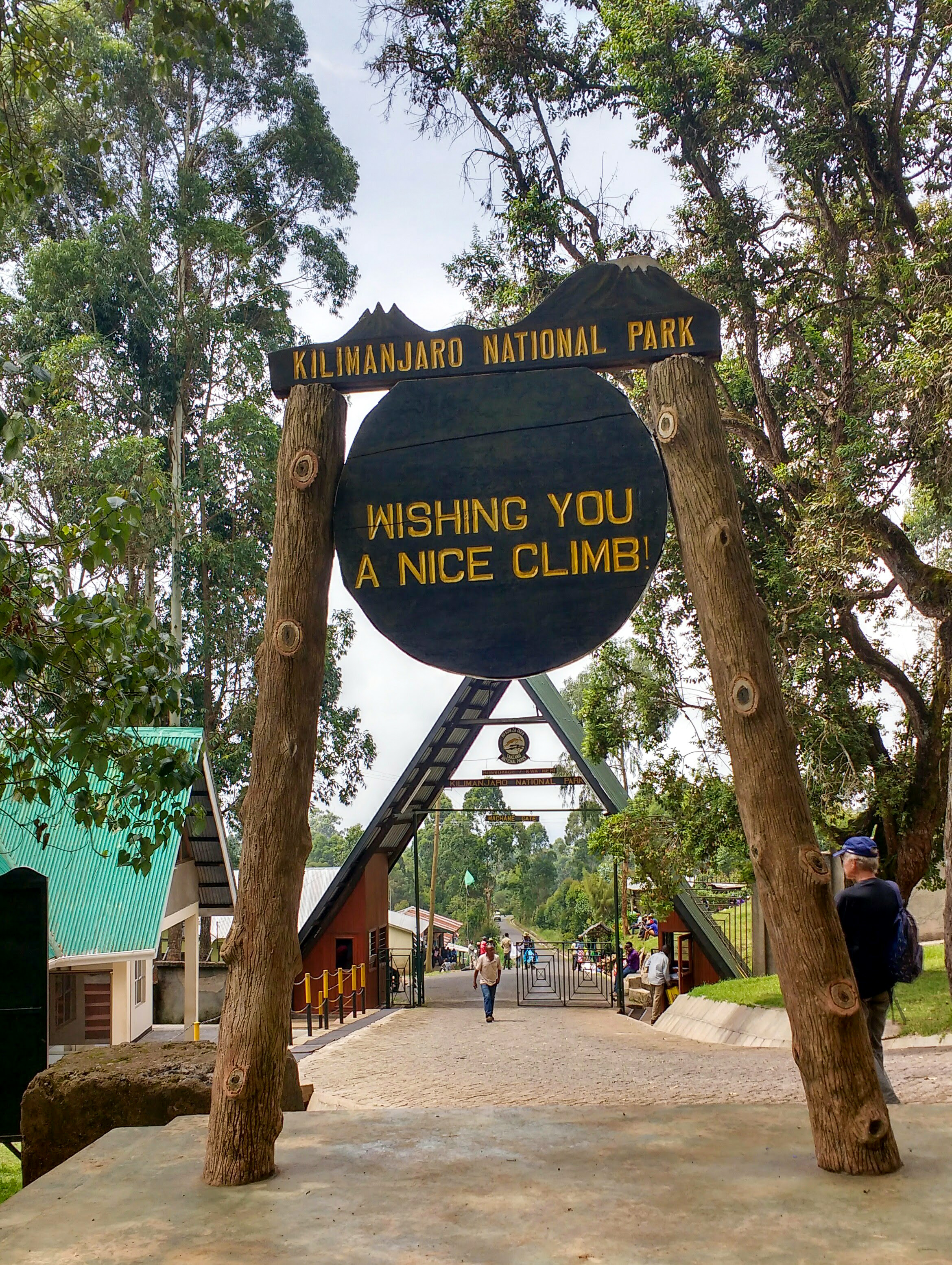
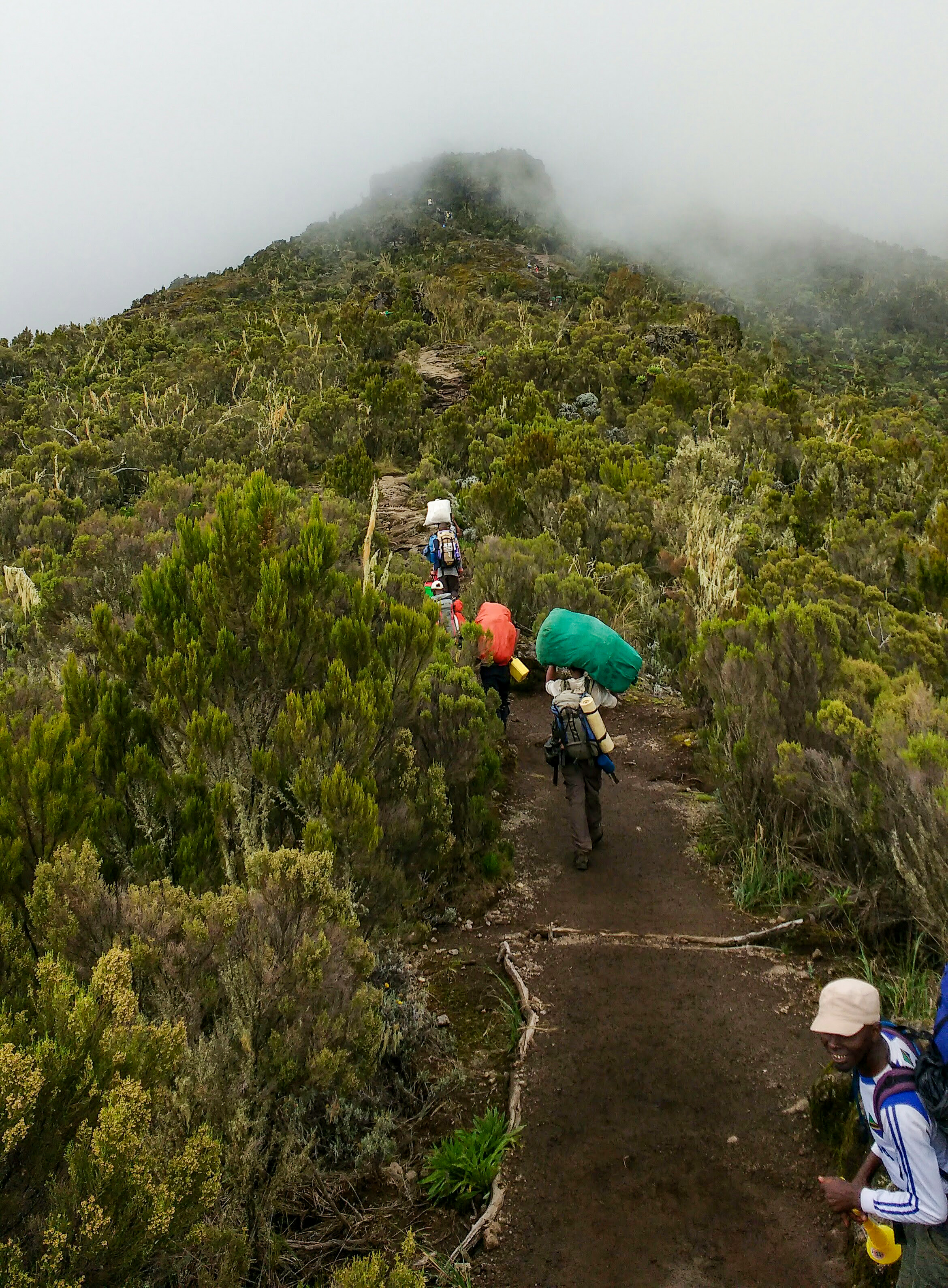
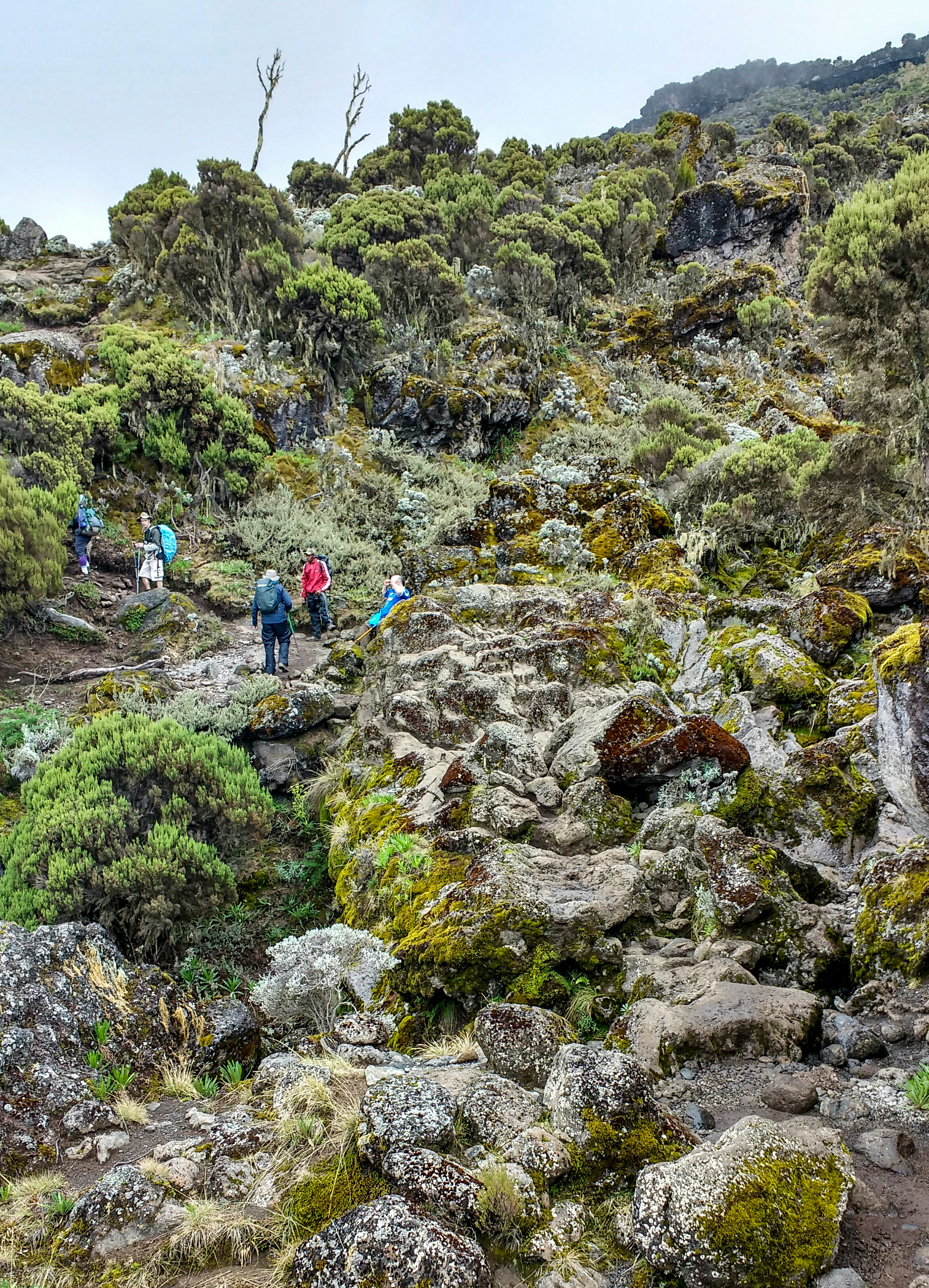
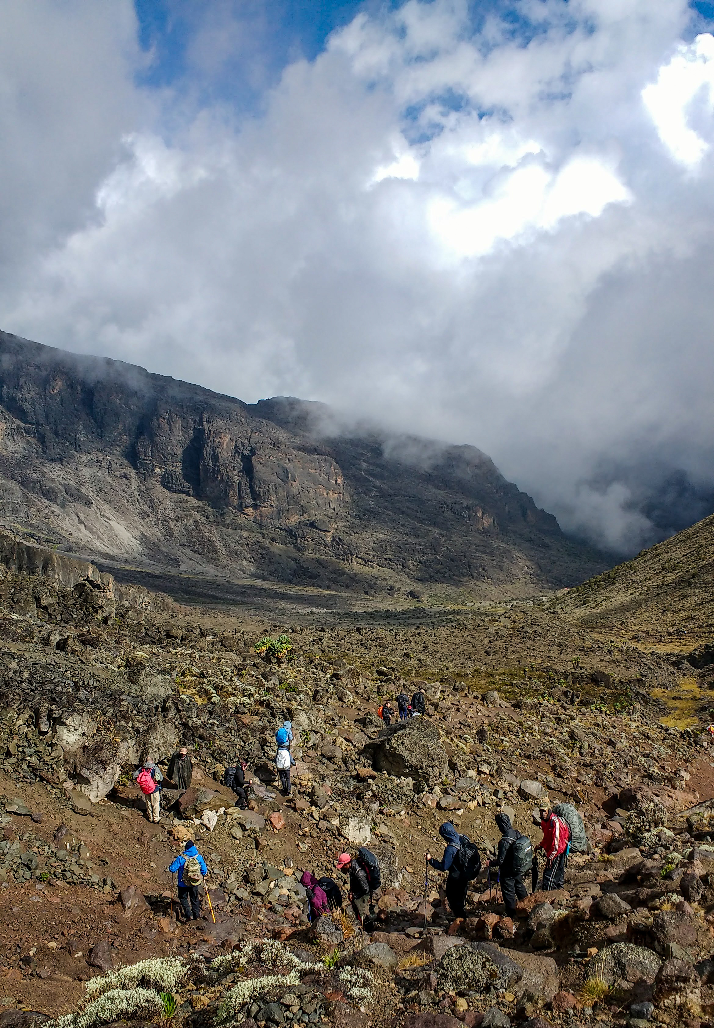
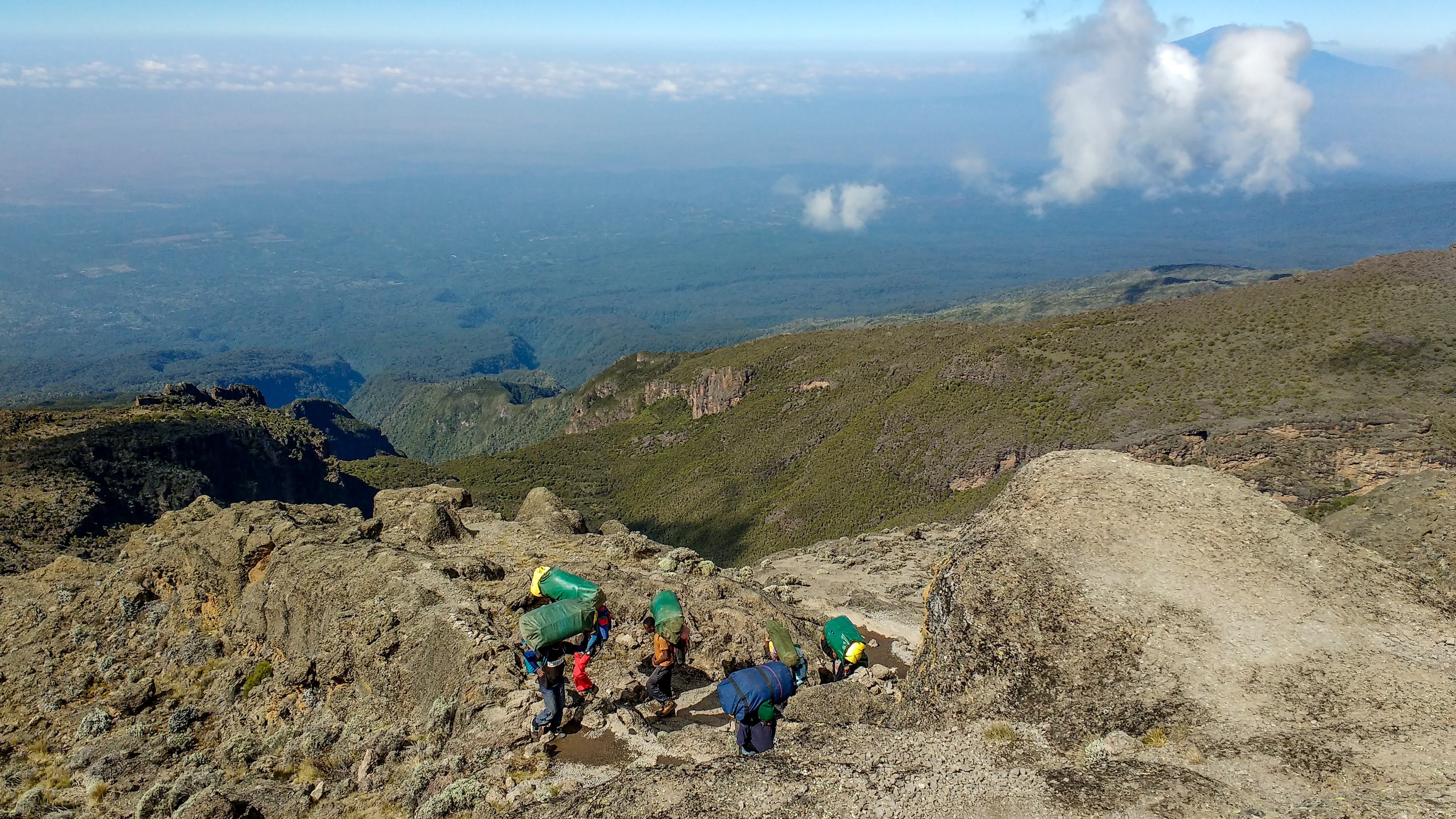
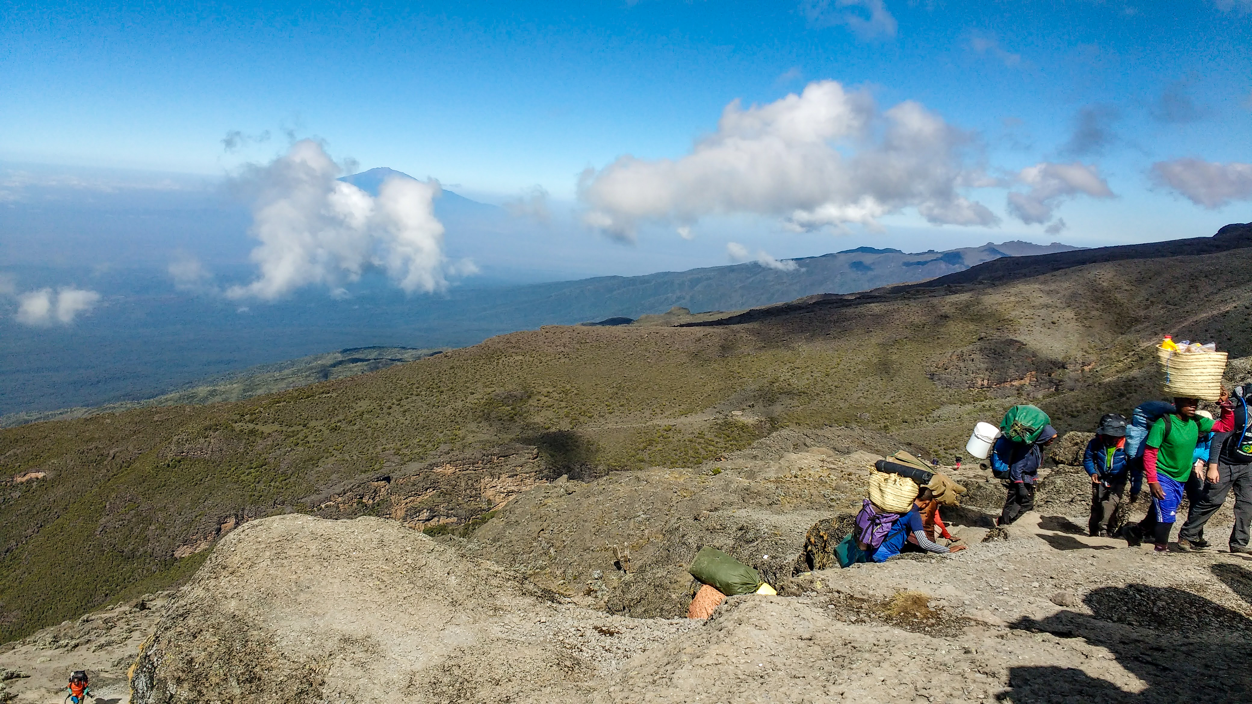
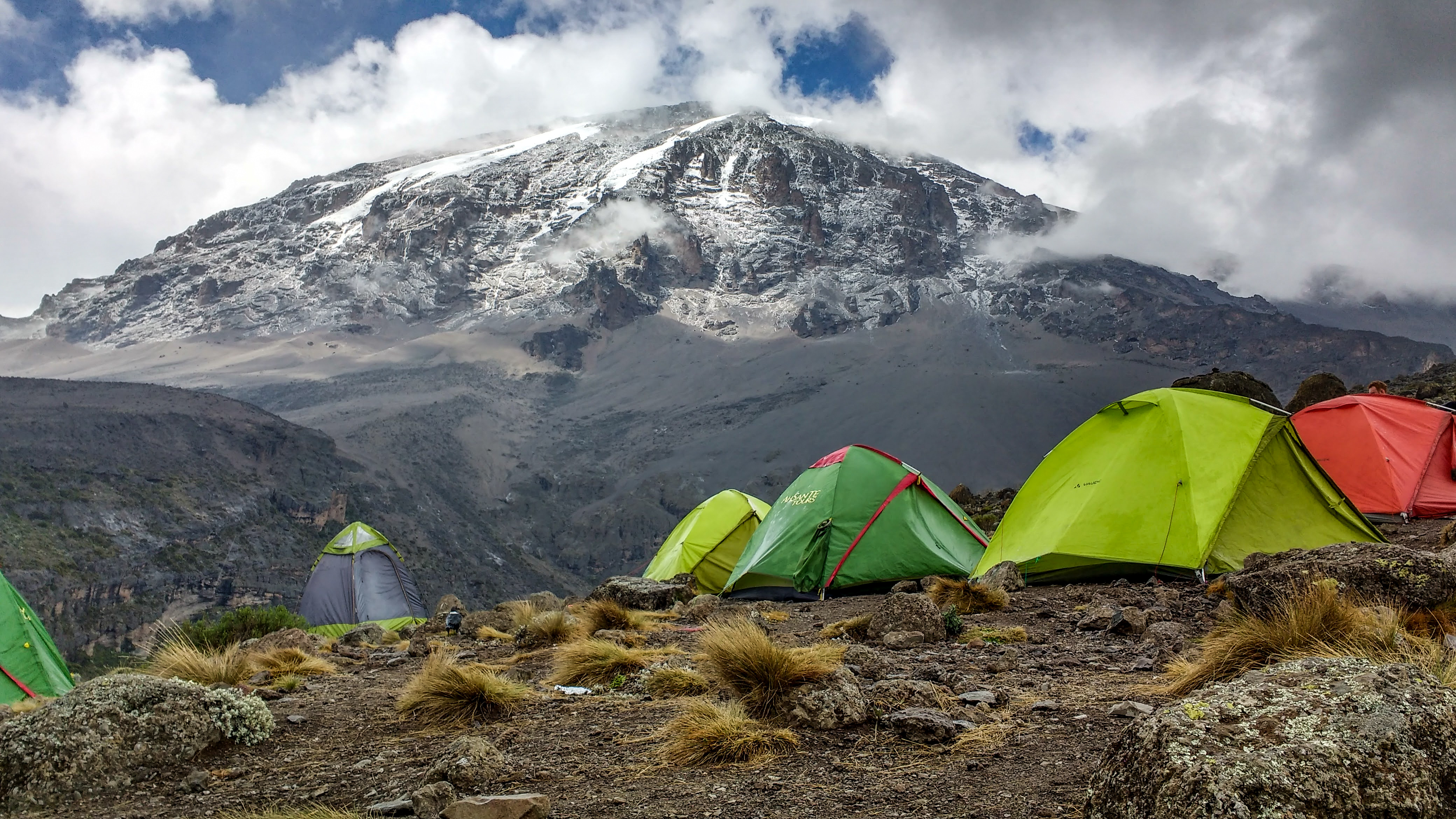
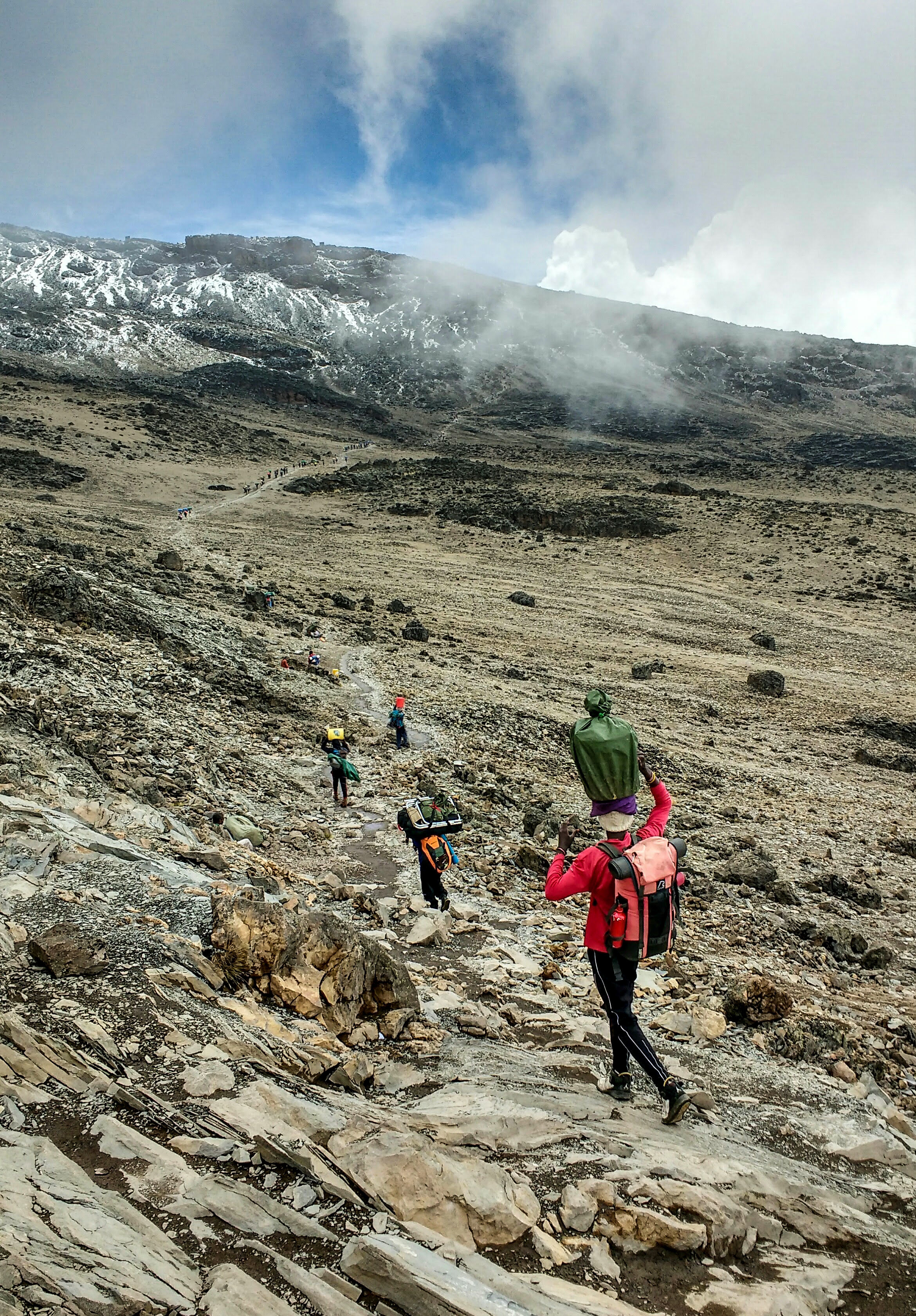
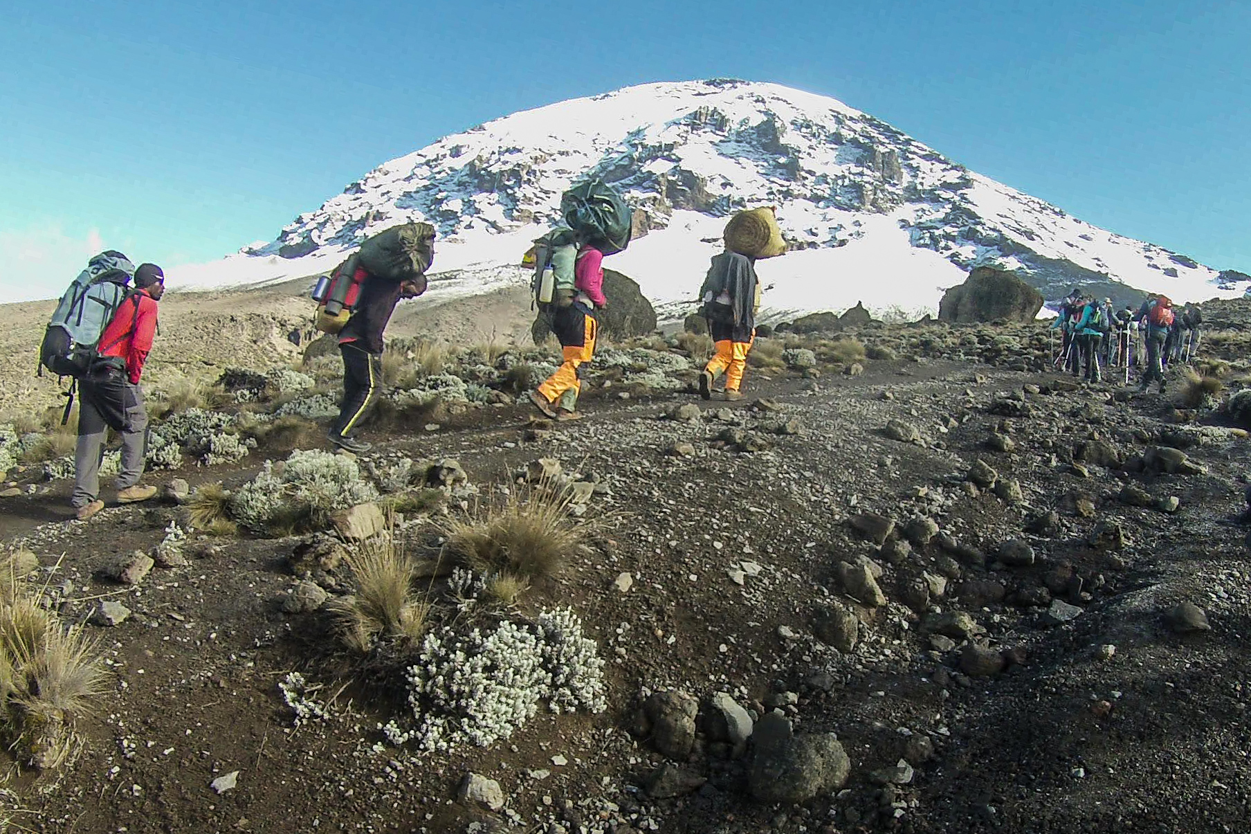
We piled out of the mini bus at Machame Gate – one of eight trailhead gates at the base of Kilimanjaro. After signing a register, we did some final kit checks and gathered with our team of local guides for a sort of pre-game huddle. Ian made sure to check in with everyone individually, despite his own nerves. Finally, we got the ‘go-ahead’, and we ceremoniously passed through the gates onto the mountain trail, the guides repeating “Polē Polē,” (Swahili for slowly slowly.) The pace felt too slow at this stage, but it was essential to acclimatise. Meanwhile, a huge team of porters – our ‘Rafiki’ (friends) – gathered all the luggage; tents, mess tents, food, kitchen equipment, chairs, tables, anything else you can think of, and carried the large packs over their heads while they traversed the mountain on foot, overtaking us at three times our speed! I found this a bit controversial at first, but the tour groups’ main priority is to have everyone back down the mountain in one piece, so they go to great lengths to look after you, so you can focus on completing your challenge safely. A tip for the porters was also included in the price of the excursion. We were extremely thankful for them!

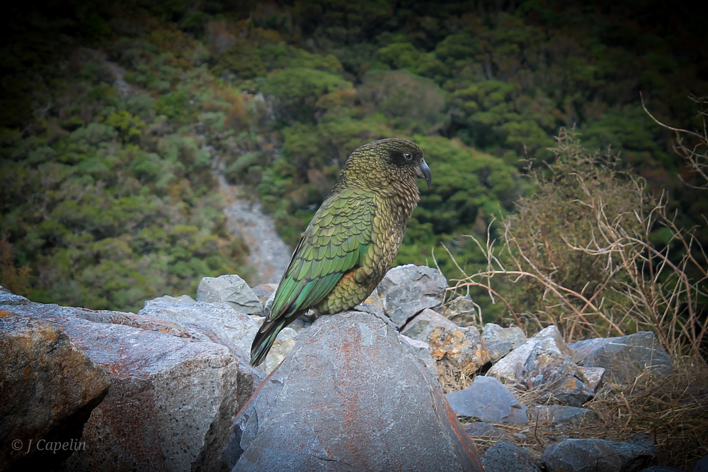
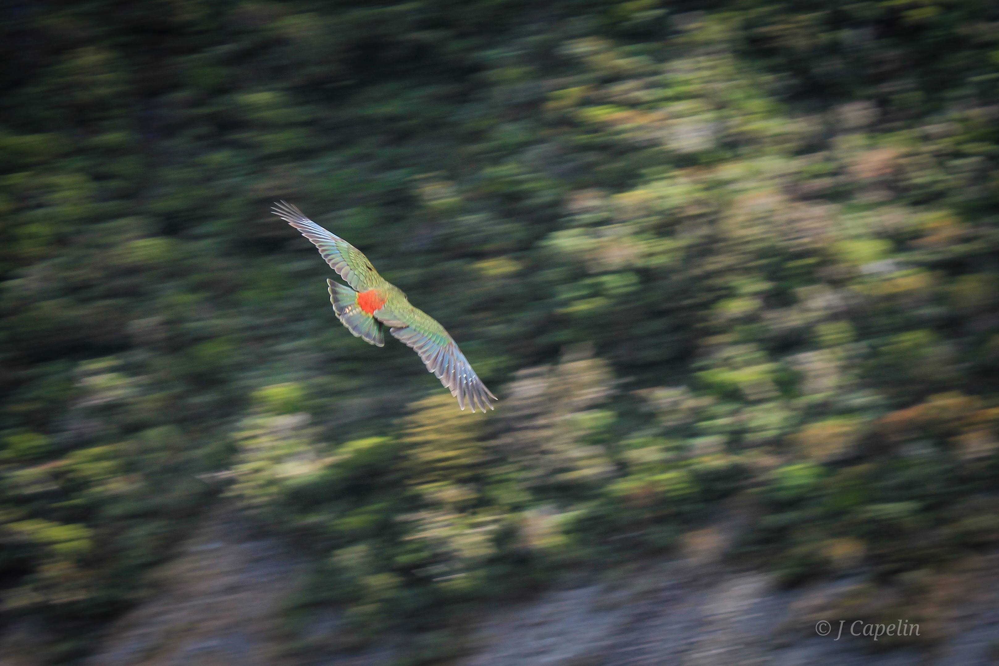
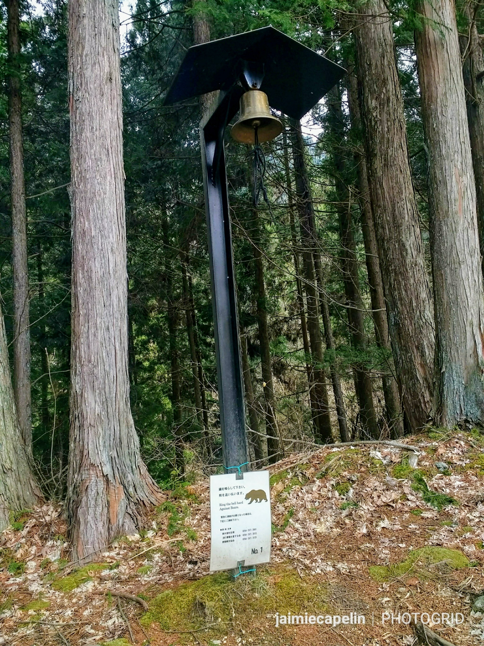
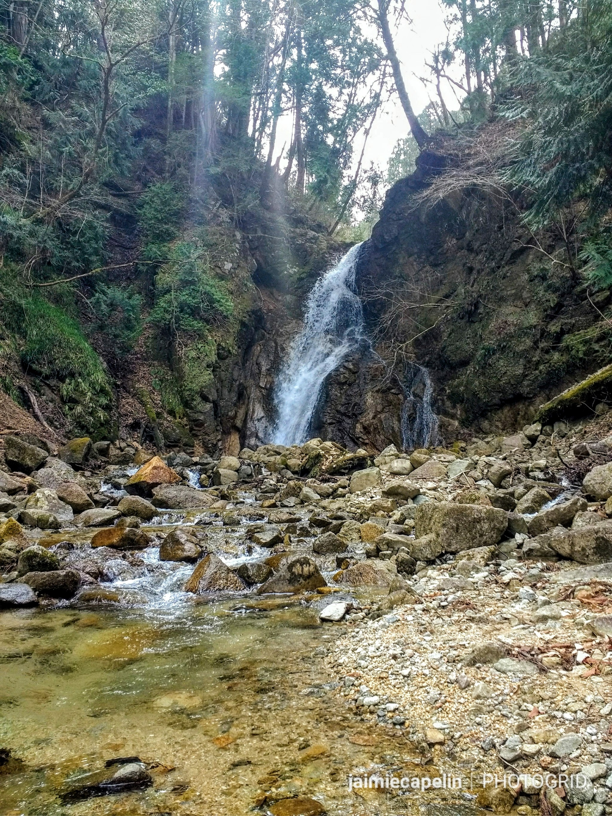
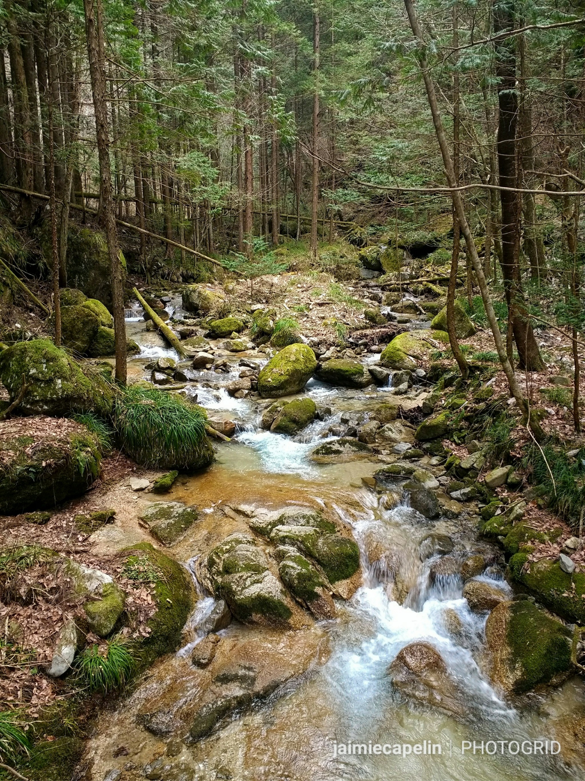
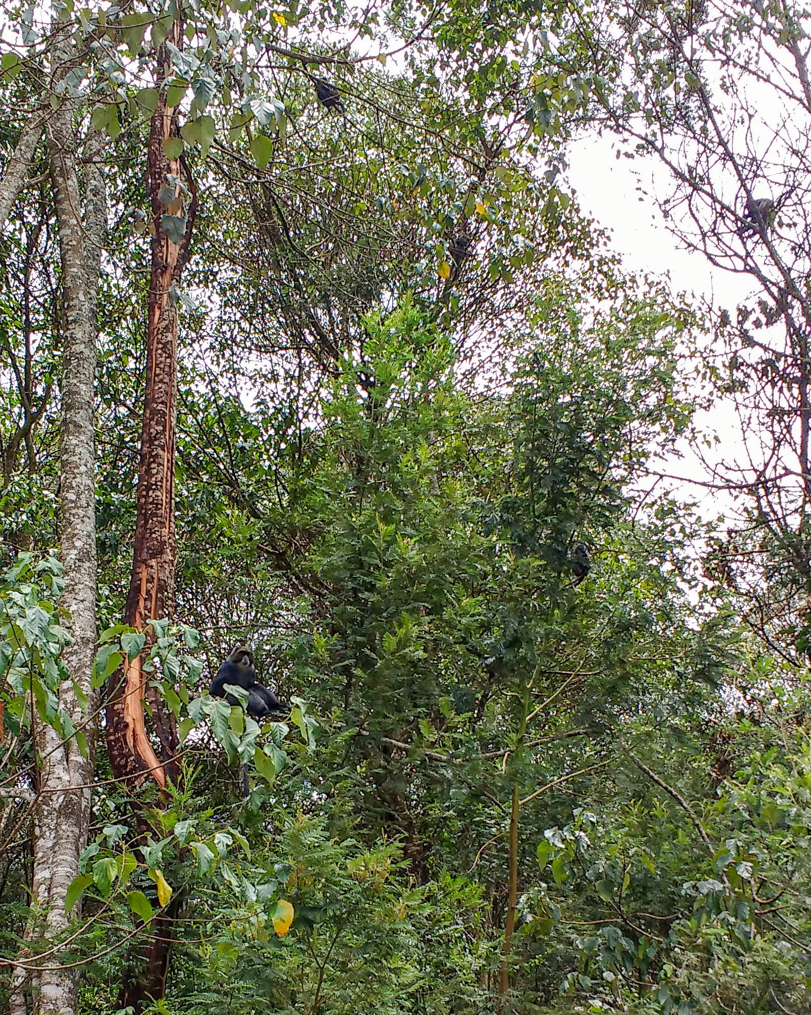
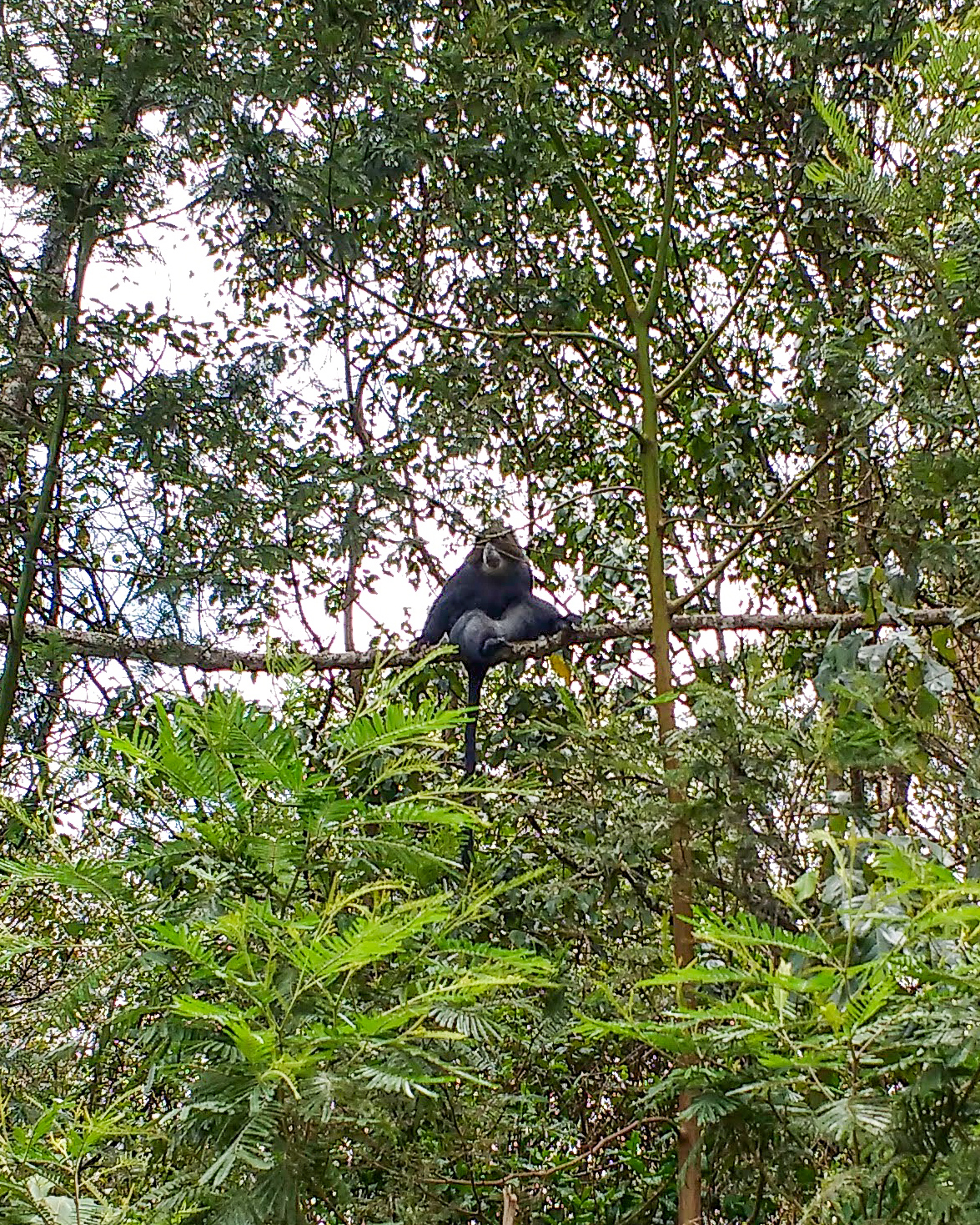
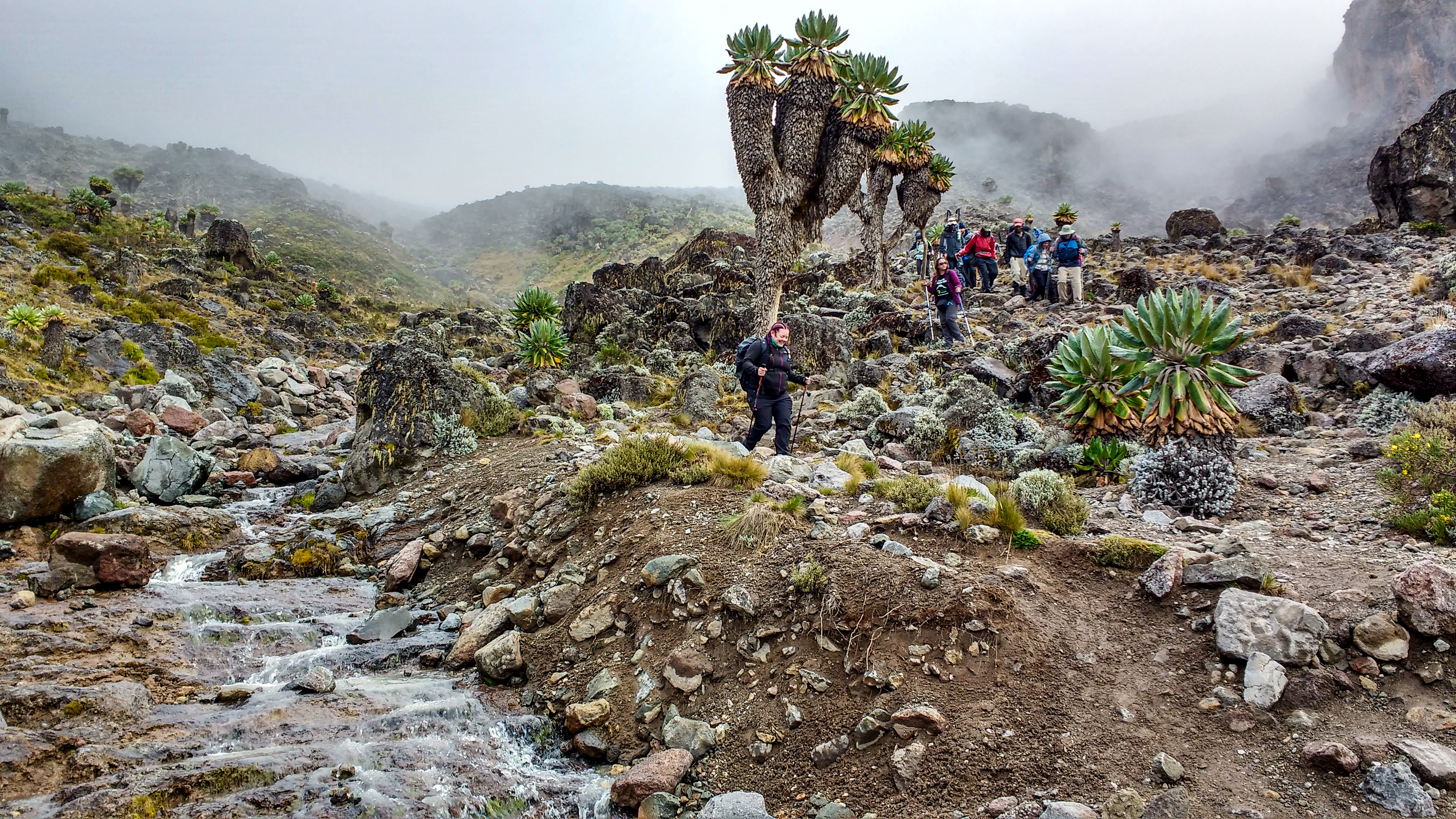
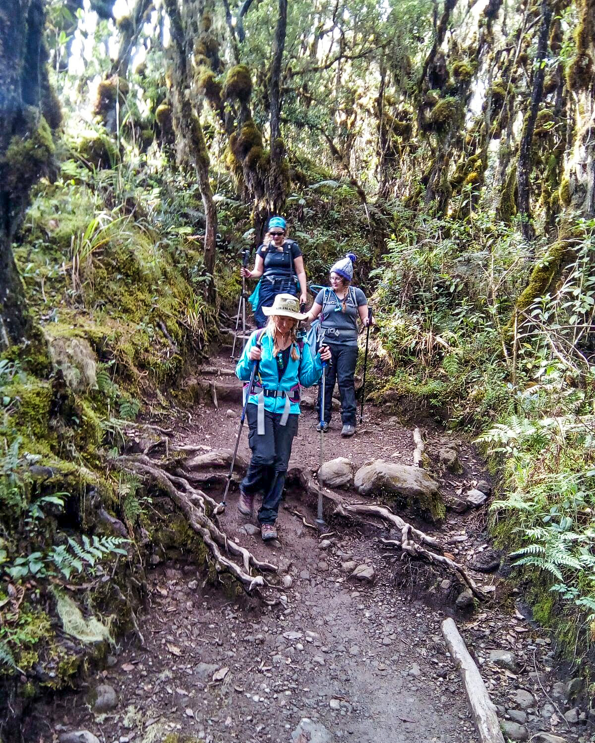
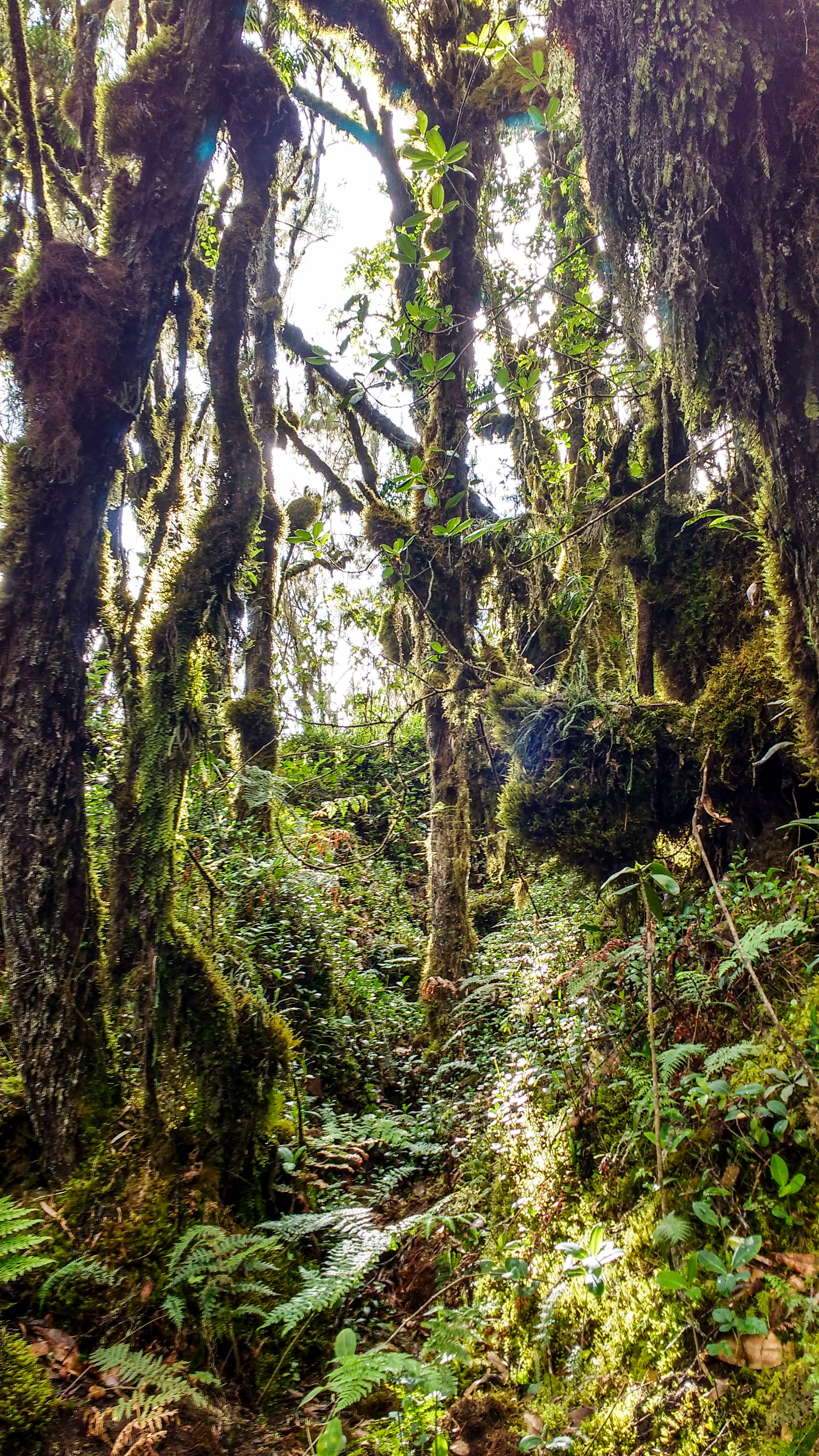
Blue Monkeys watched us curiously from the trees as we trekked into the cloud rainforest. Time was lost in the climb, as the forest grew taller and denser; the footpath becoming narrower. The first toilet stop wasn’t too traumatising – as you can imagine, the long drops get more horrendous the further you go up! After that, the heavens opened and we waterproofed up, walking to the serene soundtrack of the African rainforest.

(My mountain photos were taken on a 2015 Android phone… click to see them in their full pixelated glory!)

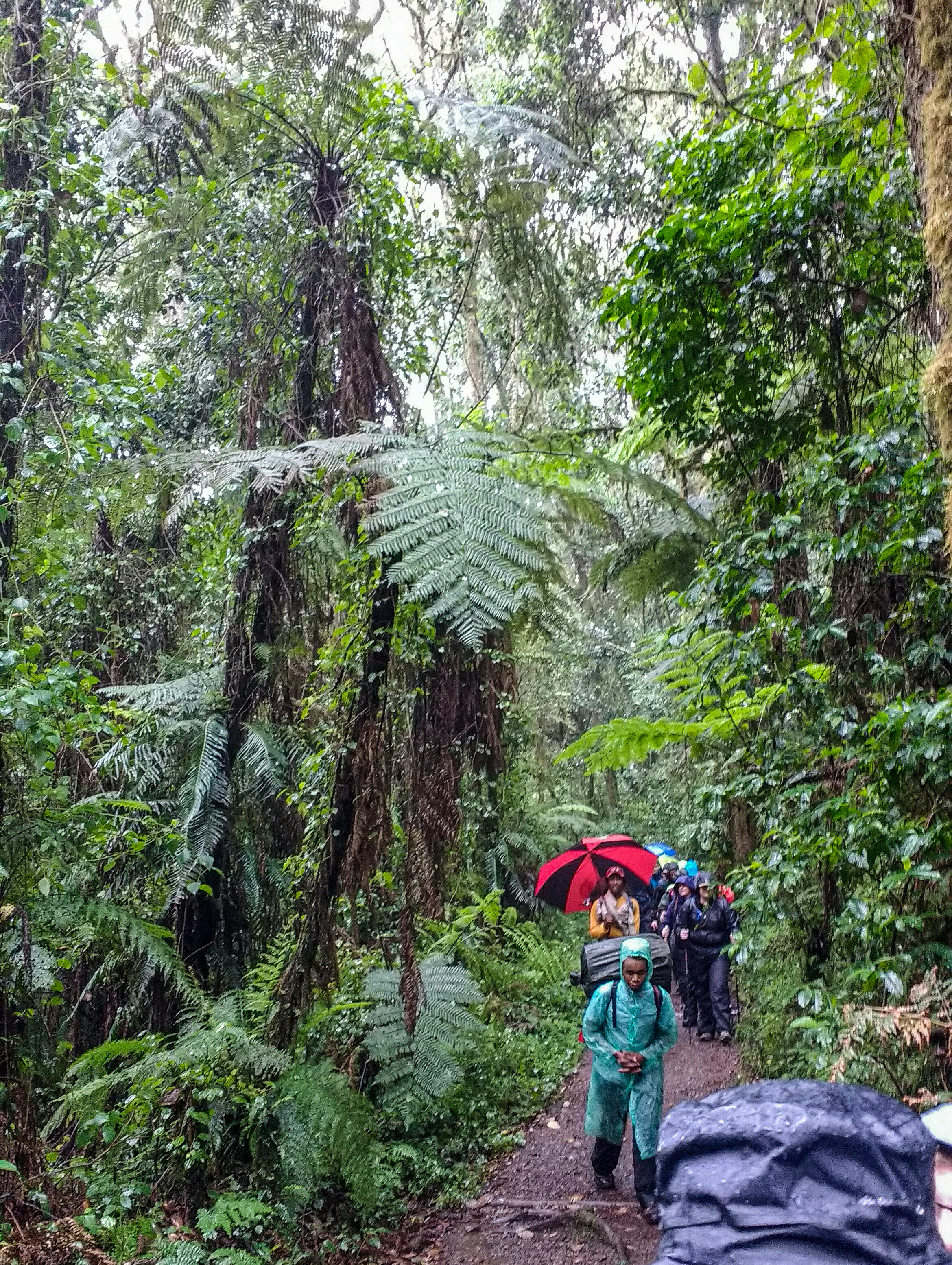
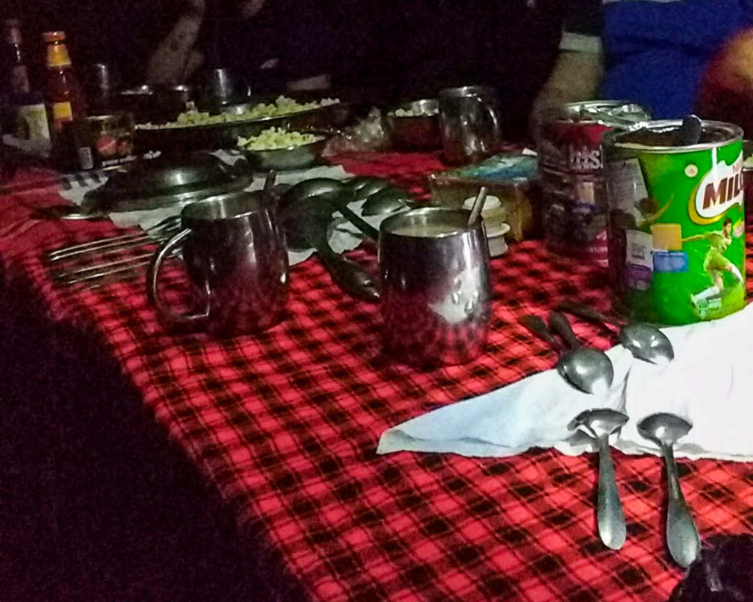
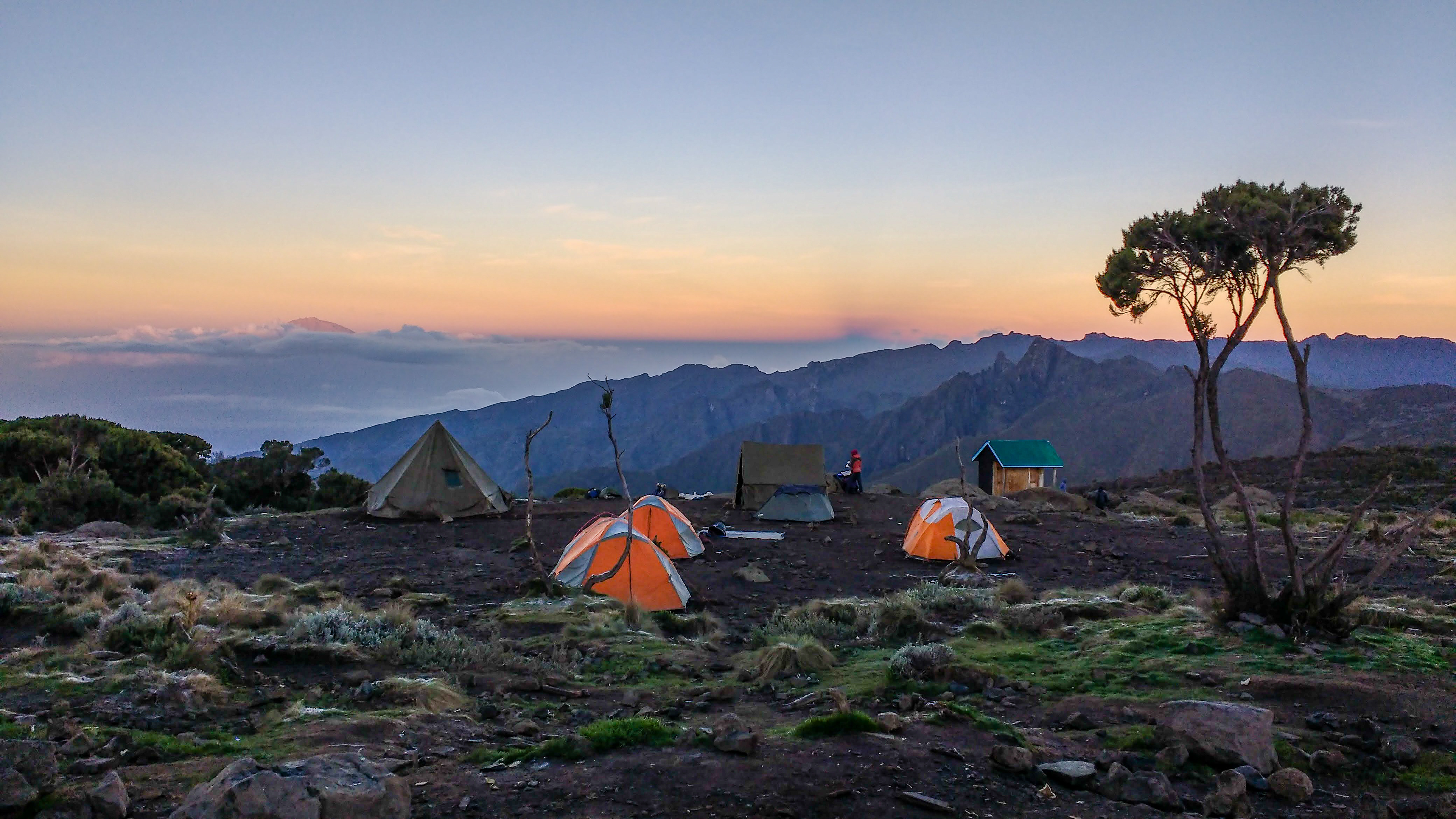
We had our first lunch stop perched on logs beneath the cloud forest canopy – miscellaneous deep fried things we couldn’t identify – regardless, it was quite tasty! Hiking up and up through the dense forest, to around 1,200m elevation, with glimpses of vast sky stretching over miles and miles of flat African plains between the trees, we finally broke out of the cloud forest and reached our first camp just before nightfall. The porters or ‘Rafiki’ had already built our fold-away settlement, and we were escorted to our respective tents to drop off our day packs. Tea, milo and popcorn was waiting for us in the mess tent, where we sat around a trestle table on fold up chairs, barely believing our tired eyes that we were receiving such luxuries from the amazing team of Rafiki. Then dinner was served… skin soup to start, followed by beef stew with roast potatoes on the side, with sliced avocado for afters before staggering back to our tents for our first night’s rest on the mountain.

Day Two – “Kilimanjaro, Hakuna Matata”

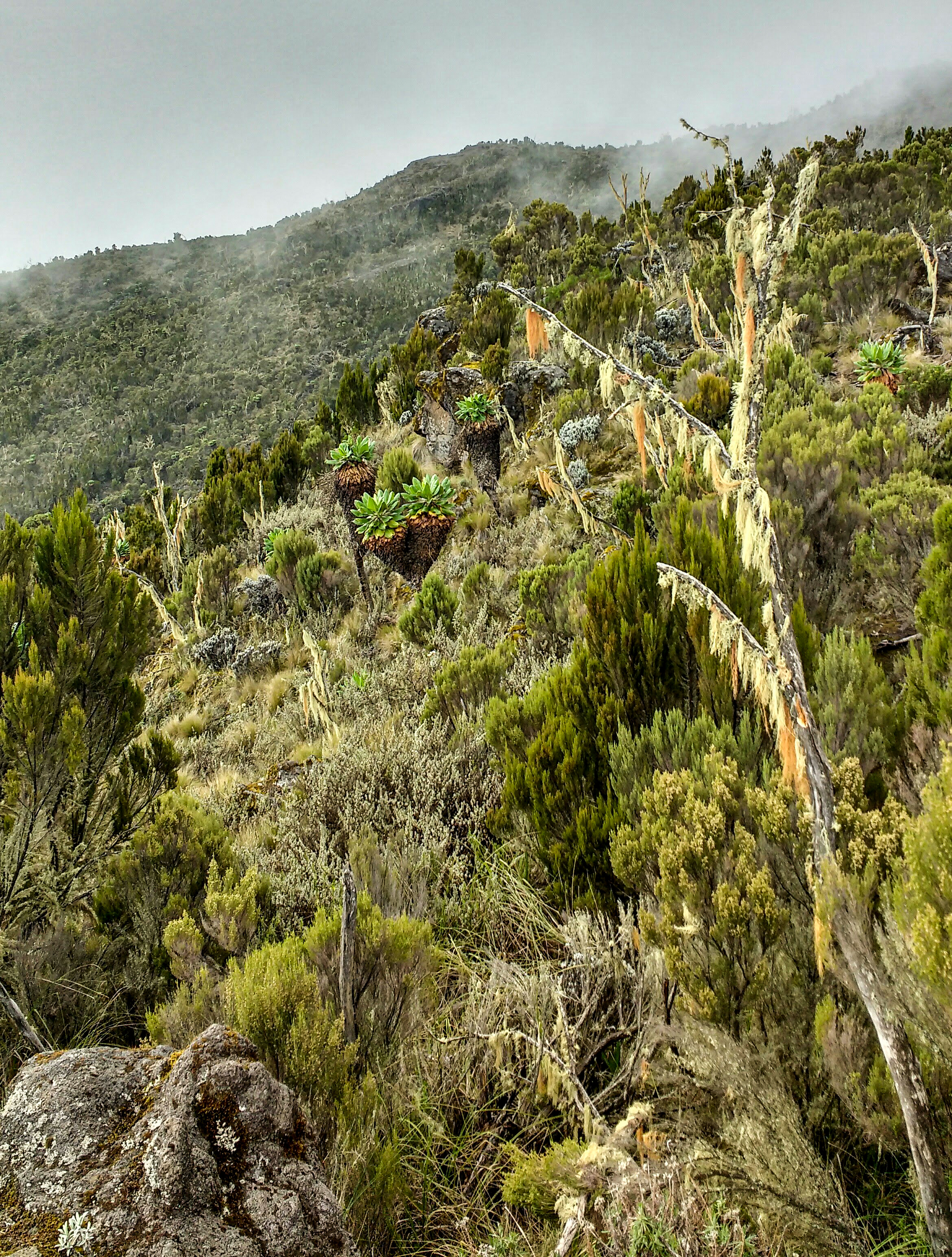
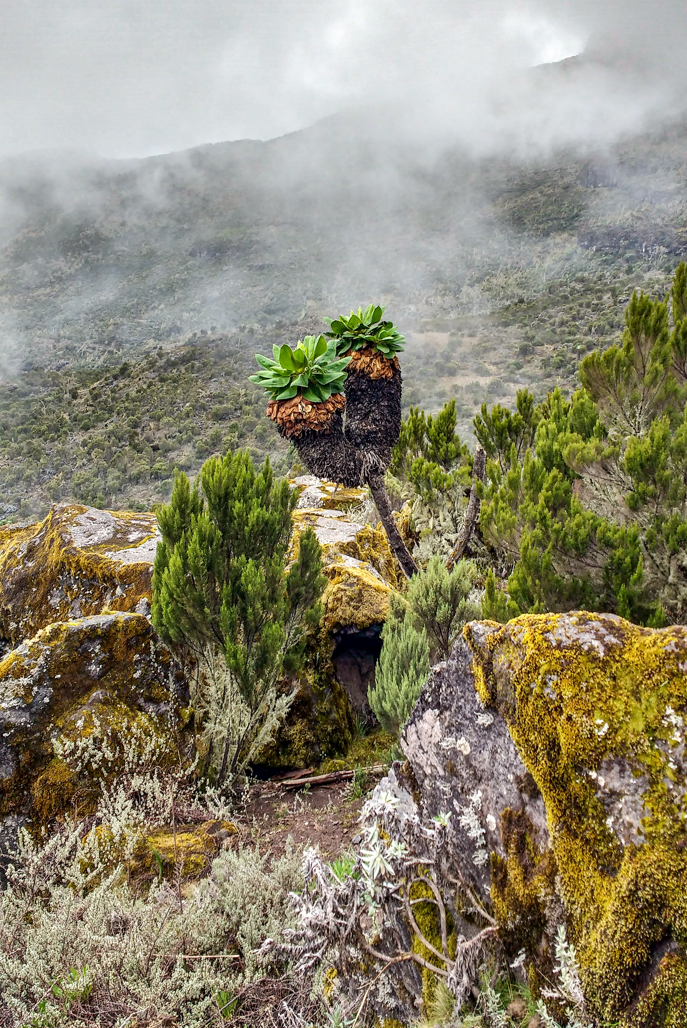
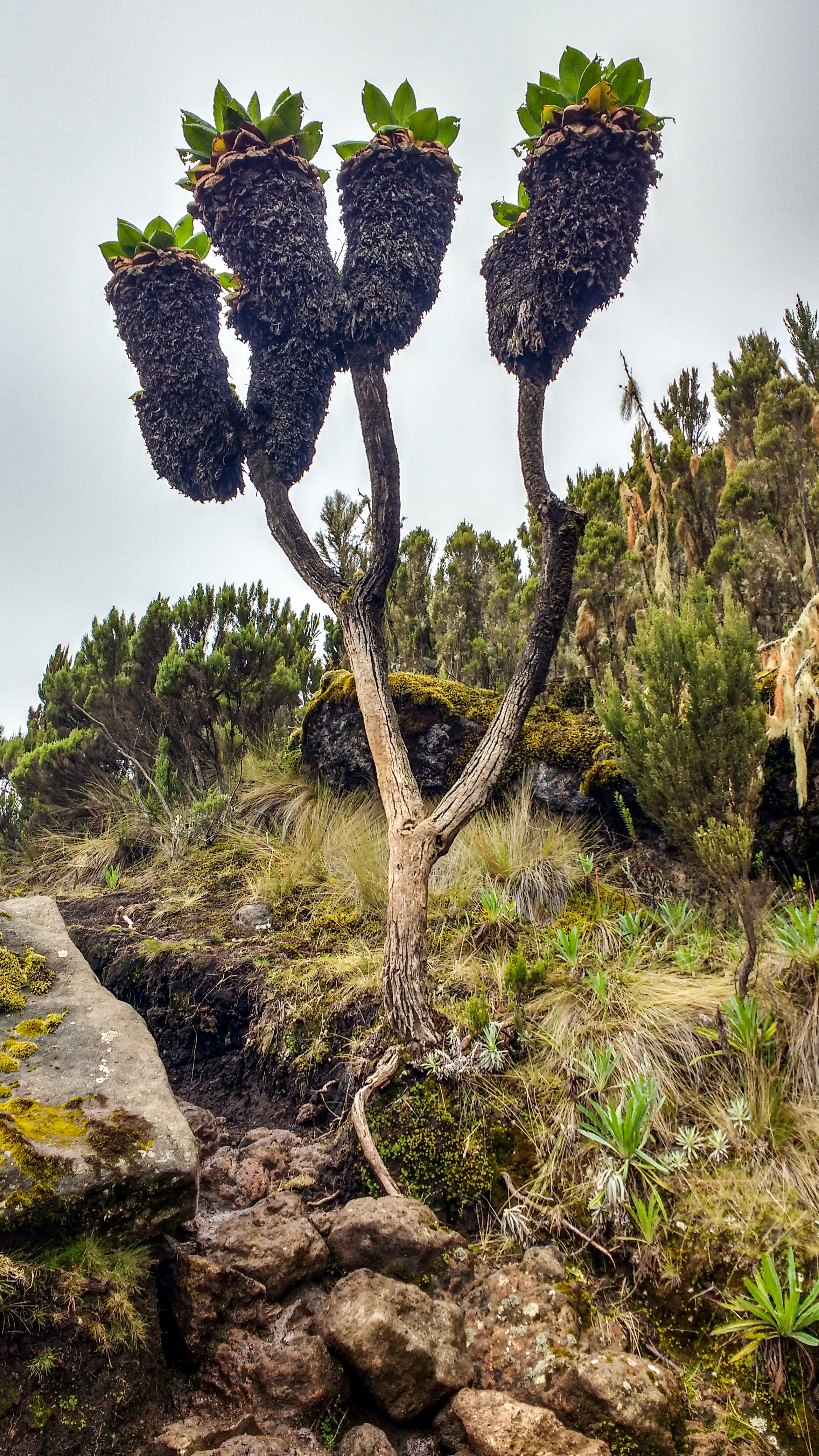
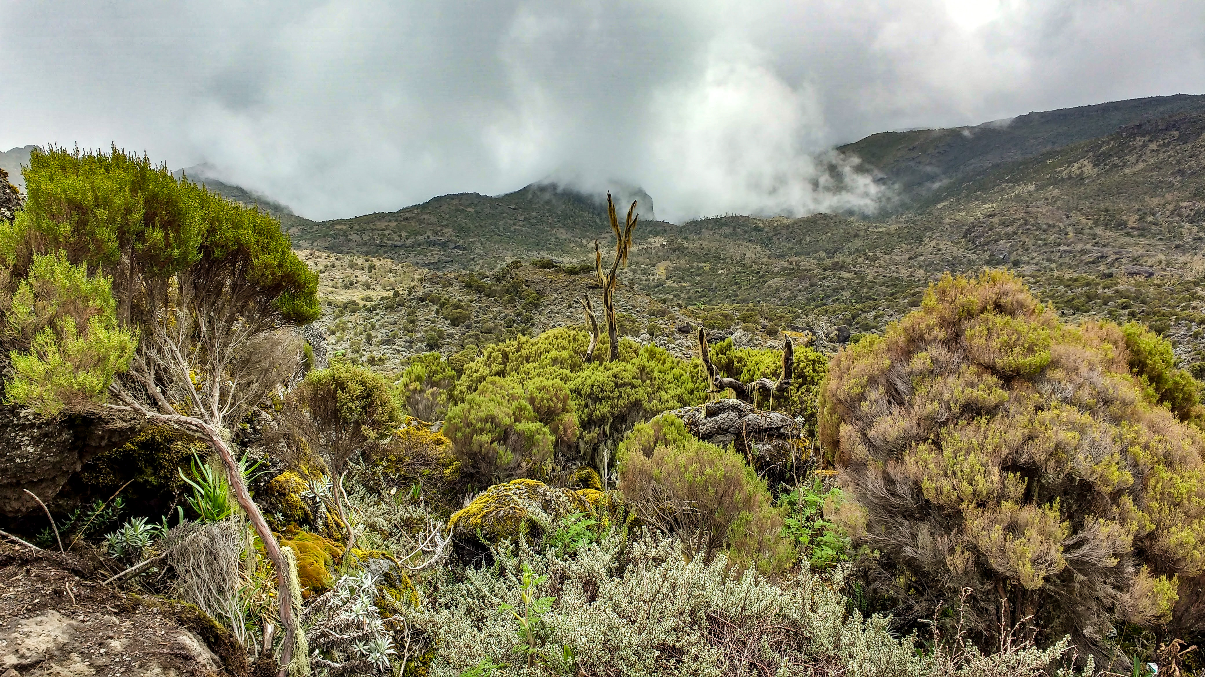
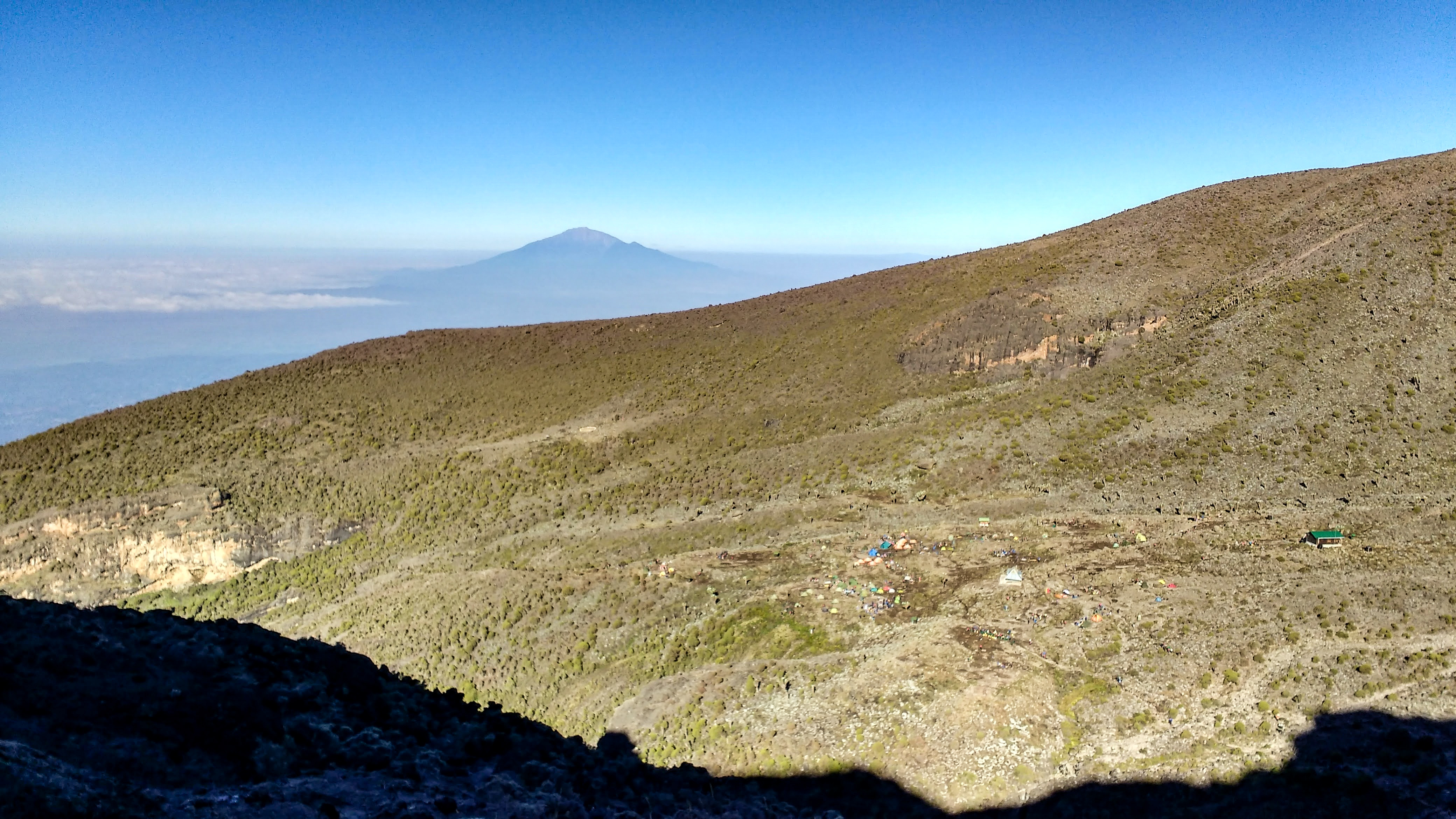
Our 5:30am wake up call came with a cup of Kilimanjaro tea delivered straight to our zip up door! “Asante Sana!” (Thank you very much!) Daylight lapped at the edges of the sky as we dressed and packed our things. The sky turned pink over the snowy peak above us and the sun began to rise. After a bowl of porridge and a sausage, we set off around 7:30am, climbing in glorious sunshine. Spirits were high for most of the group, and we rose up out of the bush to a pristine view of the cloud rainforest below and breaking the horizon was Mount Meru – Tanzania’s second highest volcano. As we climbed into the afternoon, clouds rolled in, engulfing the scenery in patches of fog. The plant life around us changed, with unique flowers and trees popping up between rocks and moss. One of our guides, ‘Prof’ passed the time chatting about the local wildlife in Tanzania’s plains, comparing their hunting techniques. Prof also carried a vuvuzela, which he intermittently trumpeted on to boost morale and give us all a giggle!

After a snack stop in the company of Aaron, Si, Steph, and Tom, (the others were scattered further ahead and behind) we scaled the steepest bit of the day, scrambling up a rock face and passing other-worldly caves with miniature waterfalls and rockpools high in the mountain mist. Prof reminded us that the cloud was dangerous for UV: he carefully painted some of Si’s sun cream on his own cheeks and nose and said that Masai men wear white paint like that for ceremonies as a mark of manhood! We met with two other guides, Henry and Ibra, and collectively they taught us some Swahili phrases:

  • Nina Njaa – I’m hungry
  • Ndio – Yes
  • Mbu – Mosquito
  • Poa kichizi kama ndizi kwenye friji – Cool & crazy like a banana in the fridge!
  • kazi nzuri – Good job

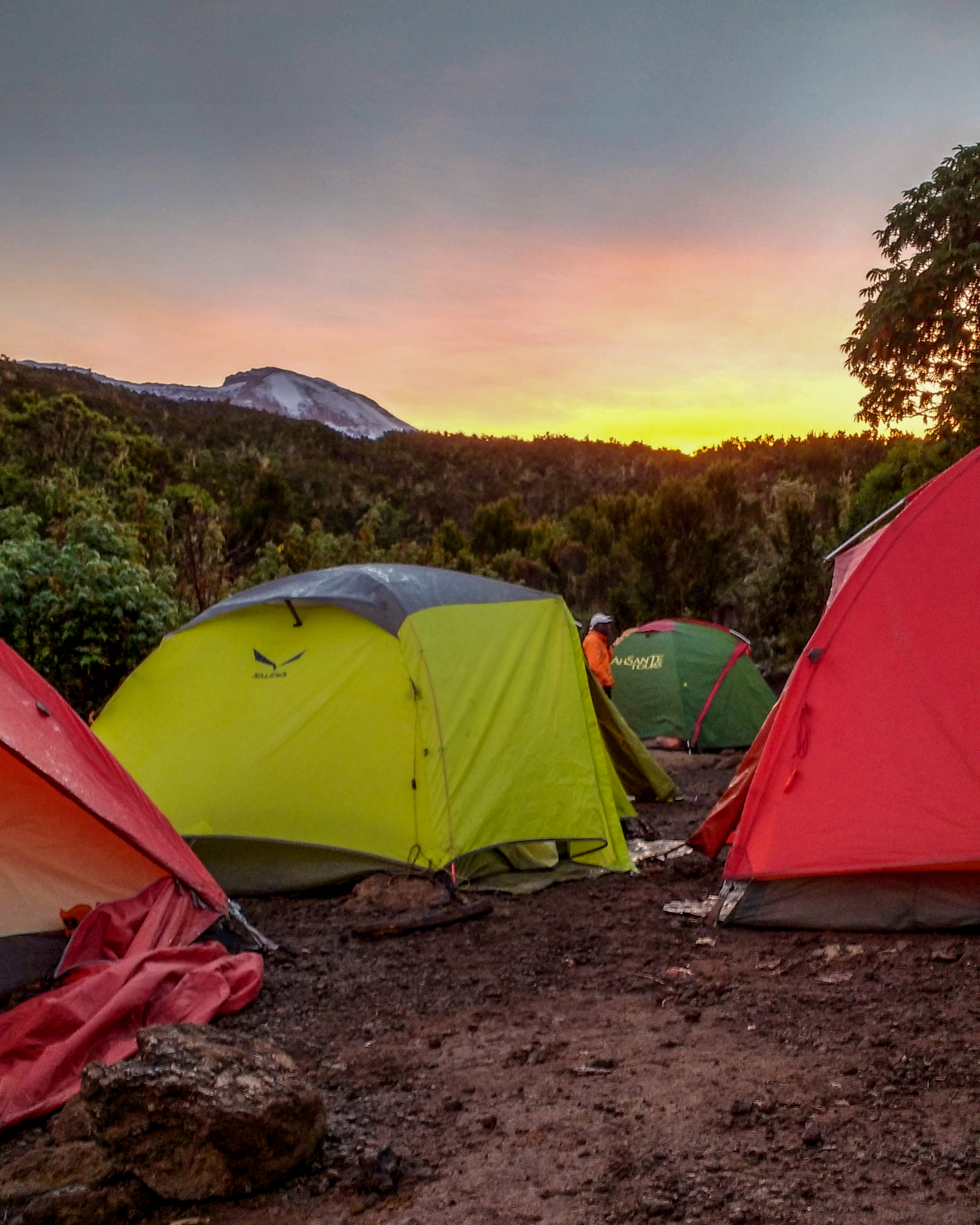
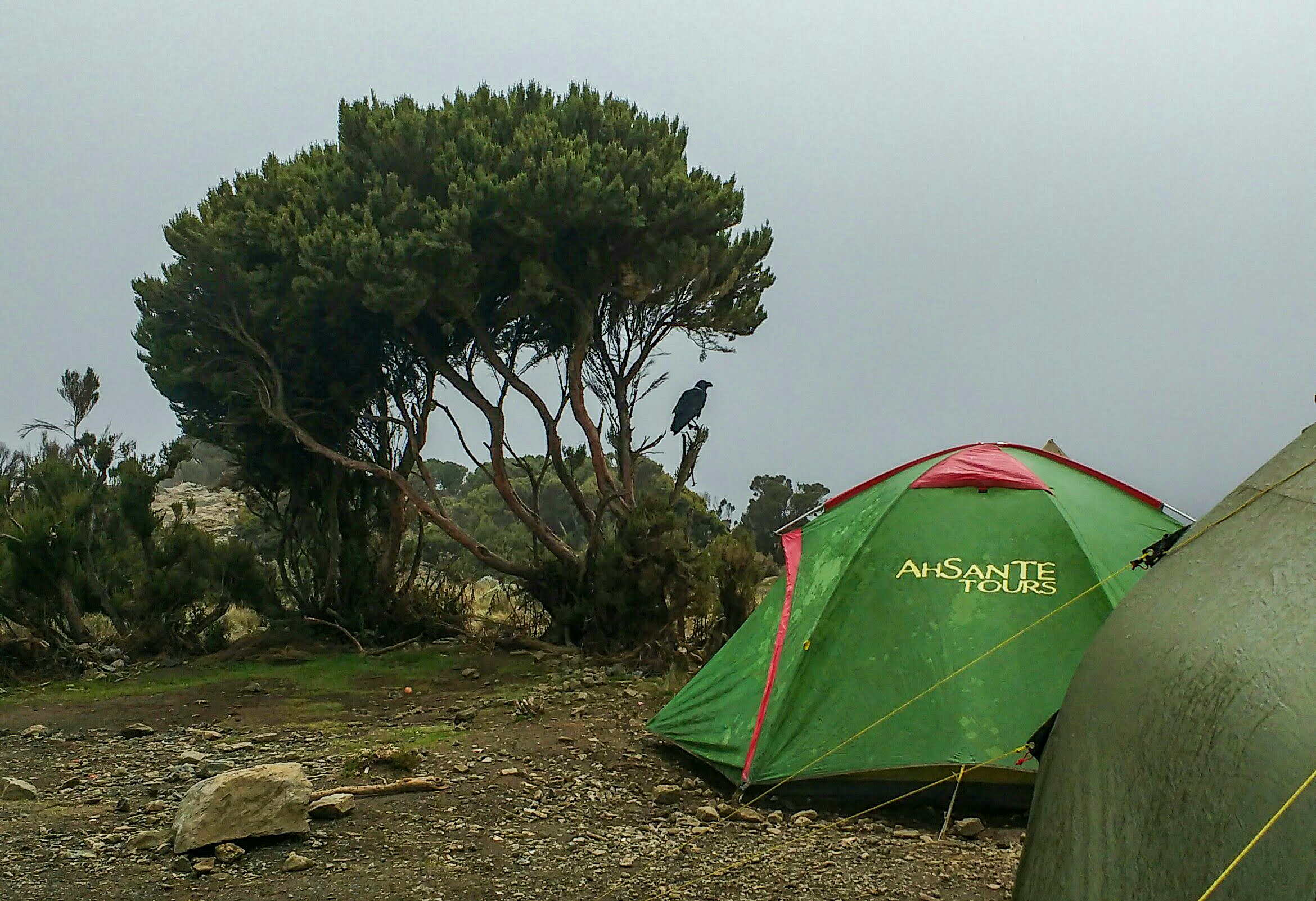
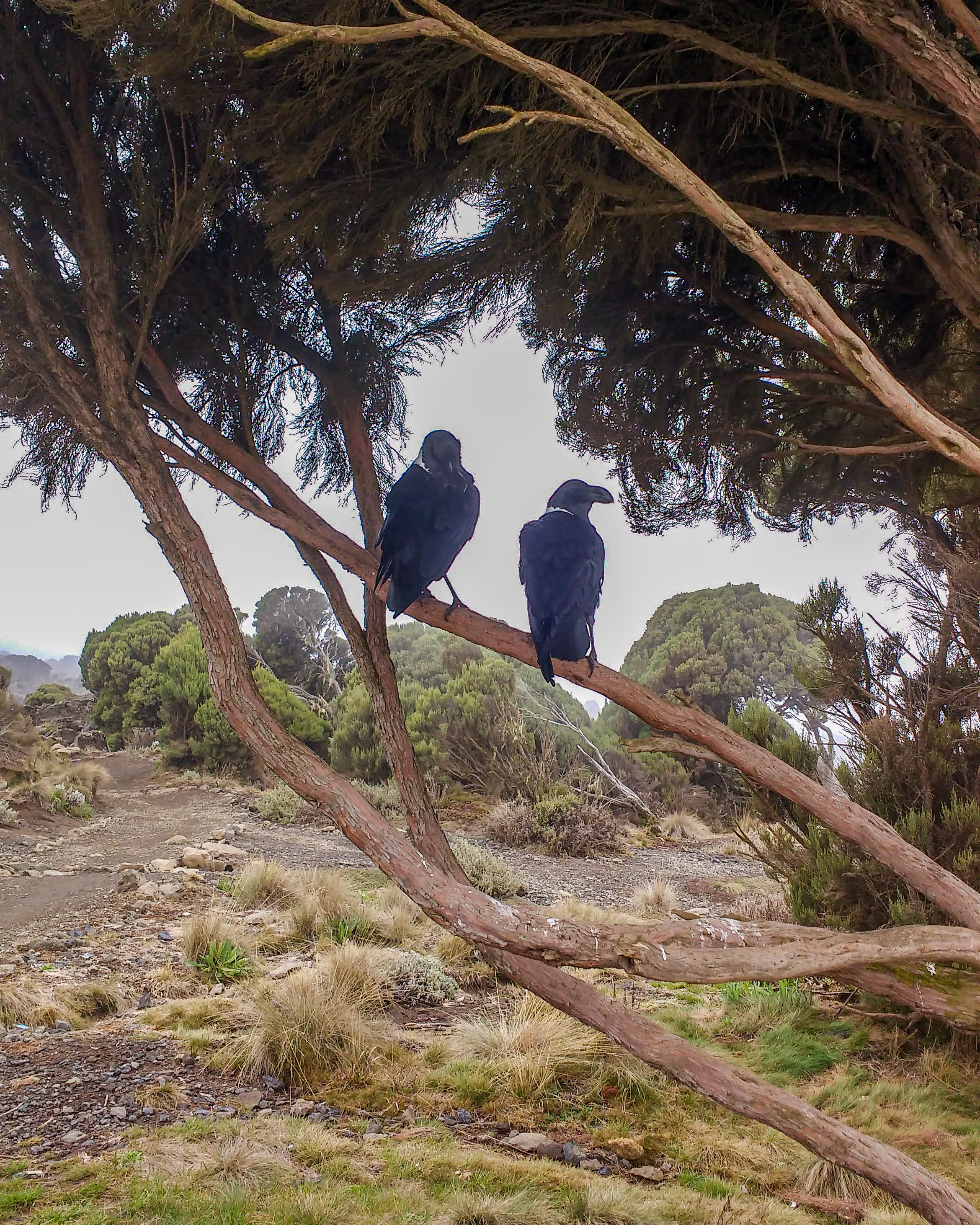
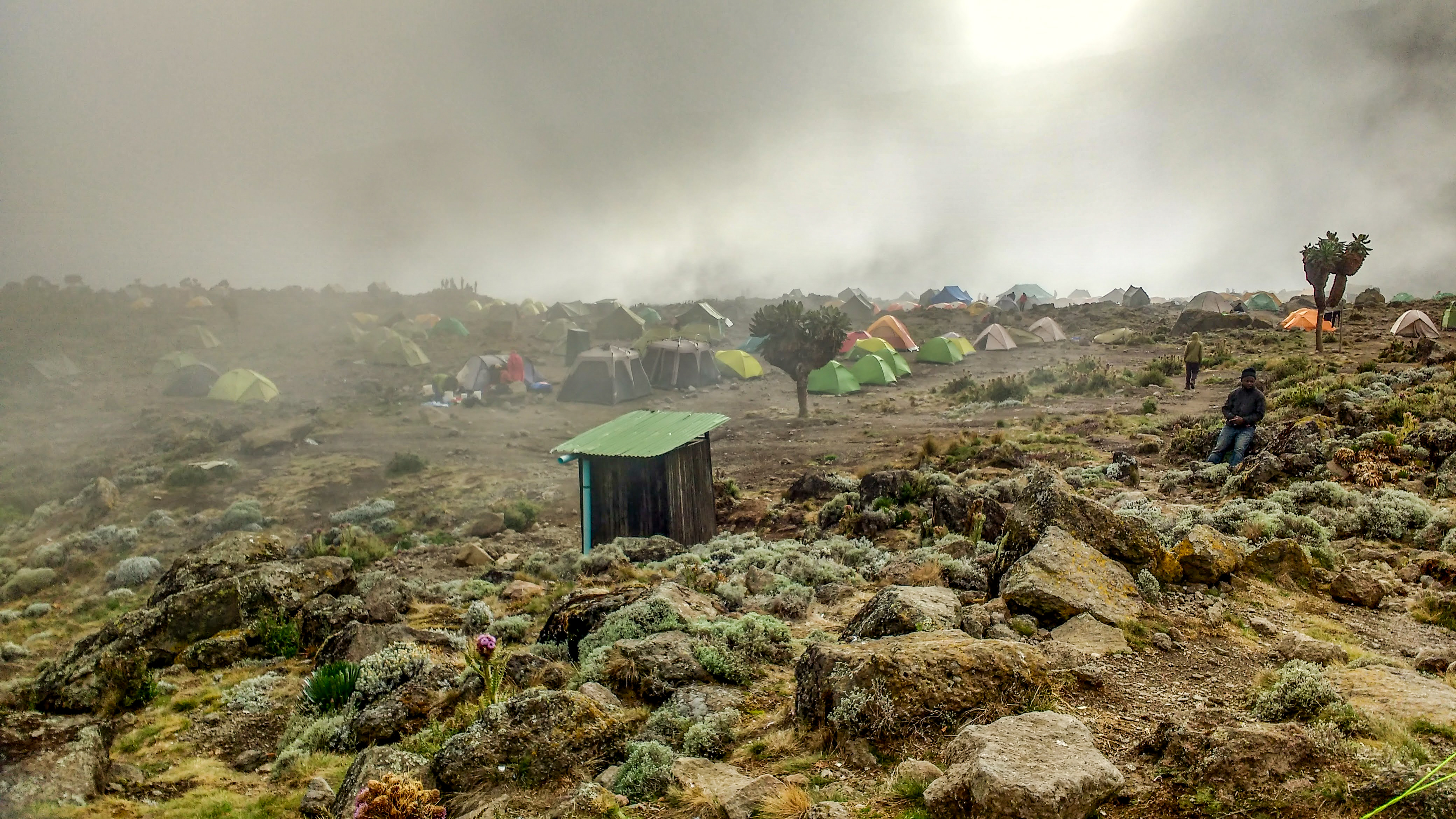
We descended into the misty Shira Cave Camp, where we were greeted with high fives and fist bumps from our Rafiki, and shown to our tents. Enormous White-necked Ravens hopped about the landscape, pecking at the dirt with their bulbous beaks. A couple of them were preening themselves in a tree, silhouetted on the fog. Lunch was served in the mess tent; spaghetti and vegetable curry with cheese on top – we gave the Chefs a round of applause.

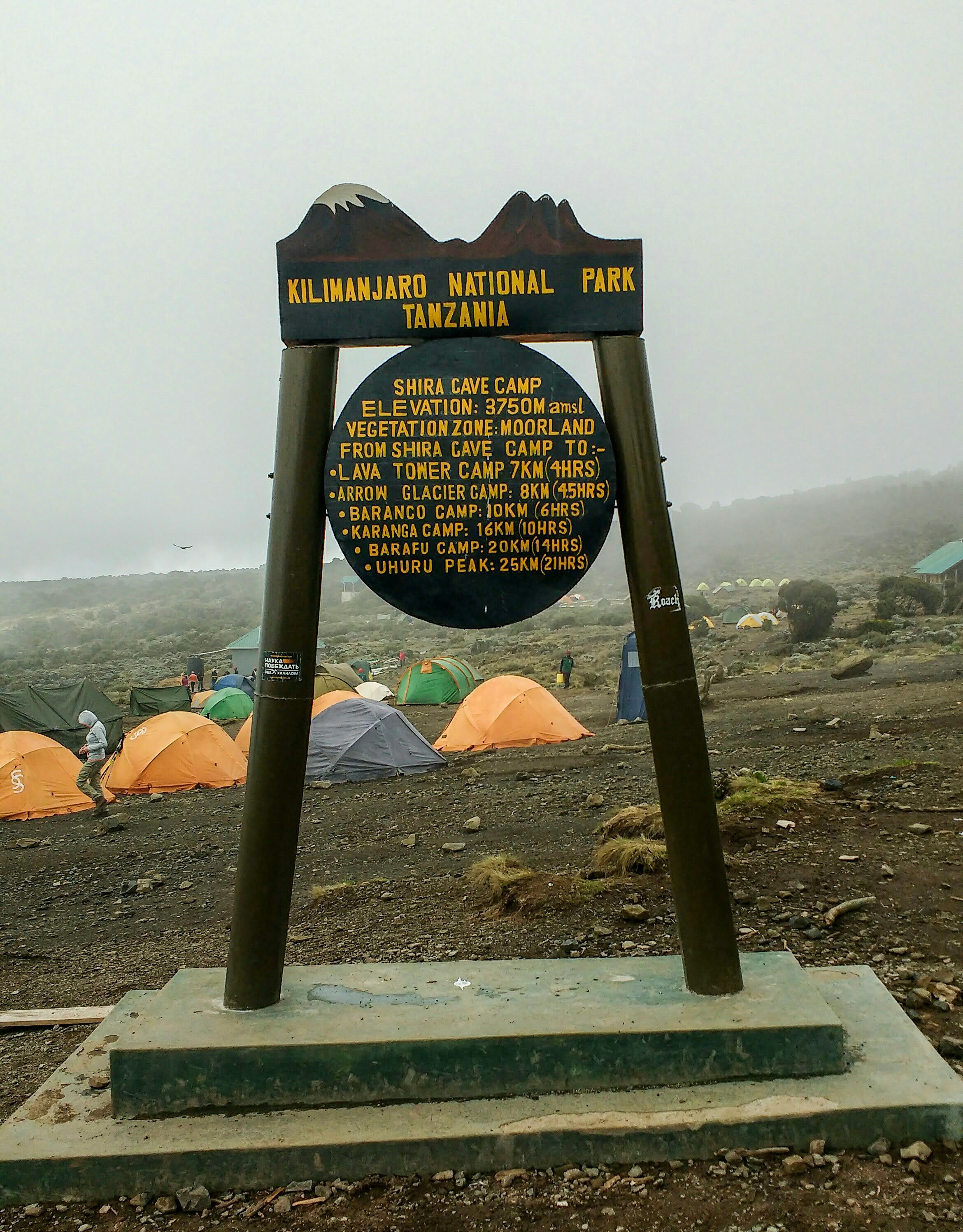
The afternoon at Shira Cave Camp was a bit different to the usual schedule – after a shorter day of walking, we had time to rest in anticipation of tomorrow’s big day of acclimatisation. Before dinner, the entire team of guides and porters began a dancing and singing circle, giving us some motivational African entertainment. We learned the words to ‘Jambo Bwana’ and we sang and danced until we had all gone silly!

Jambo, jambo Bwana (Hello, hello Sir)
Habari gani (How are you?)
Mzuri sana (Very fine)
Wageni, mwakaribishwa (Foreigners, you’re welcome)

Kilimanjaro, hakuna matata (Kilimanjaro, there is no problem)

Tembea pole pole, hakuna matata (Walk slowly, slowly, no problem)
Utafika salama, hakuna matata (You’ll get there safe, no problem)
Kunywa maji mengi, hakuna matata (Drink plenty of water, no problem)

There was a small matter of our guides asking us to sing a song from England for them, and we all had some sort of brain paralysis and mutually started singing ‘Freed from Desire,’ but as a football chant… let’s pretend that didn’t happen! That evening, the clouds rolled away and the stars shone so brightly over camp. Somewhere in the distance beyond Mount Meru a storm lit the sky in silent purple strobes, and I slept well.

Day Three – “Headaches and Fried Potatoes”

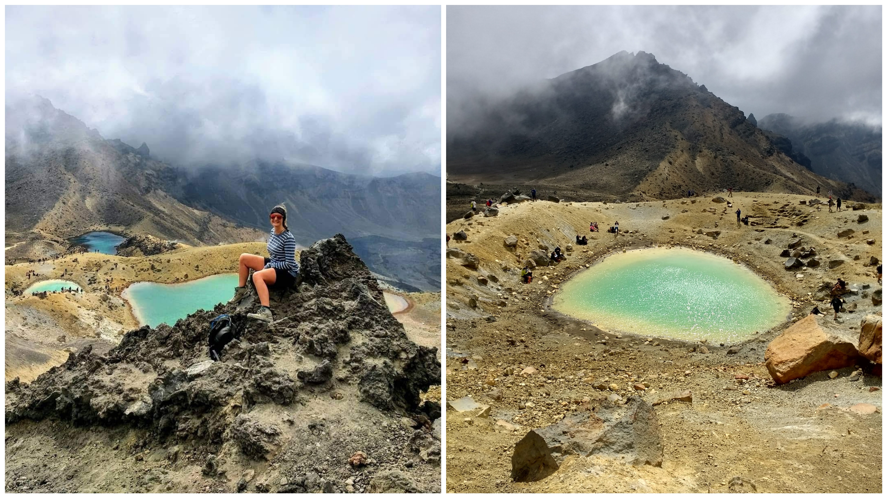
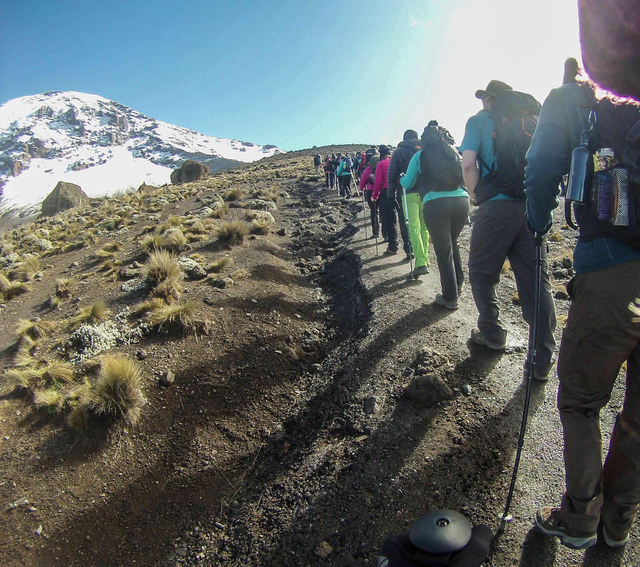
We said farewell to two of our group this morning – it was sad to break up the group, but they decided they’d reached their limits, which is a difficult and respectable thing to do. We had risen before dawn for a quick breakfast and began the tough trek into the beautiful rising sun at 7:30. It was glorious and warm, but as the hours passed and we climbed higher into cloud, the chill crept in quickly. We were gaining altitude fast, and the land became very bleak as we crossed into the Alpine Desert, with nothing but huge boulders and red mud. Much of the group began to feel the effects of altitude, suffering with pressure headaches and struggling to catch our breath. It really made me sensitive to the cold and the exhaustion, but with a piece of ginger and some ibuprofen, I managed to stay on top of it. The guides made sure we stopped regularly and sipped our water steadily.

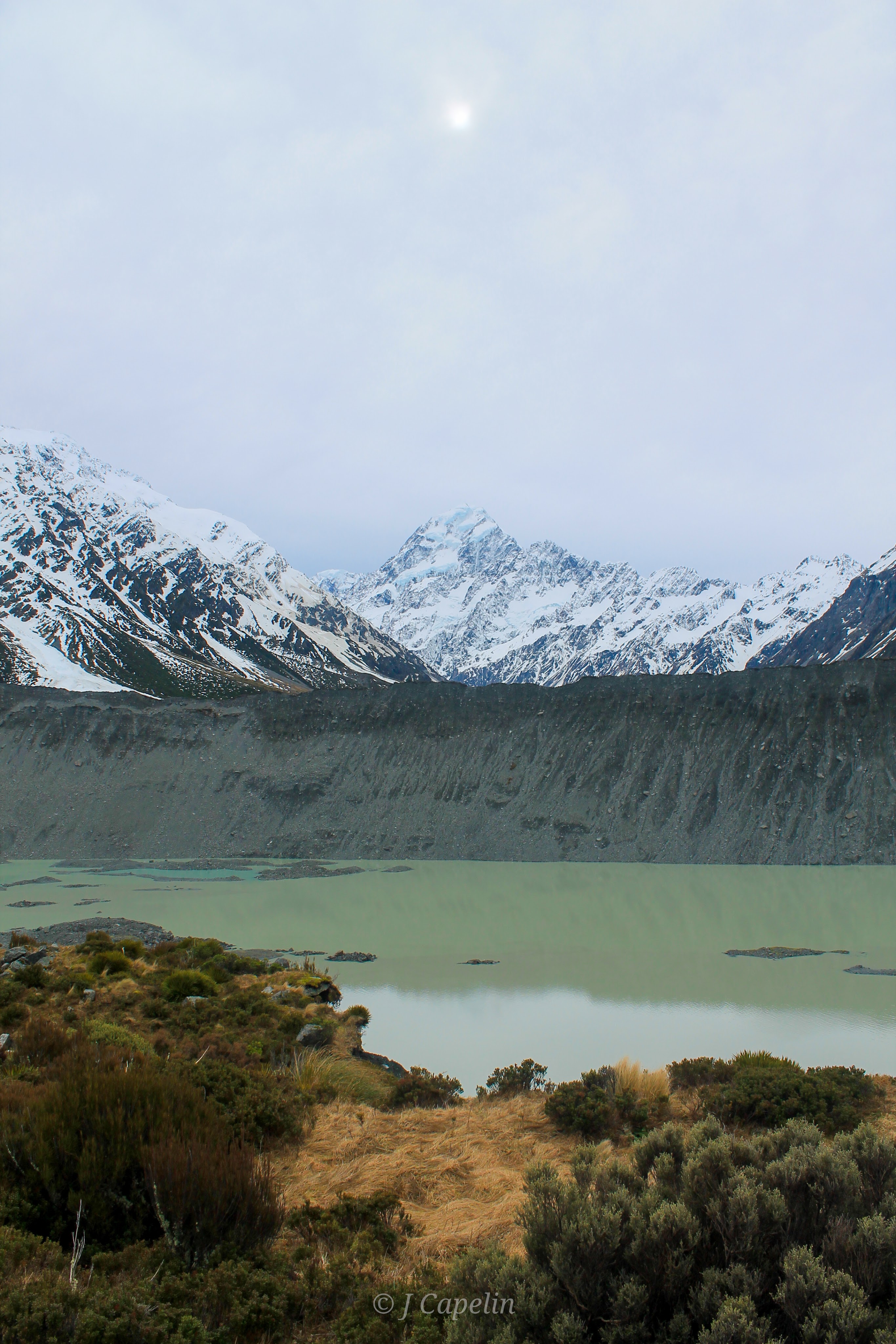
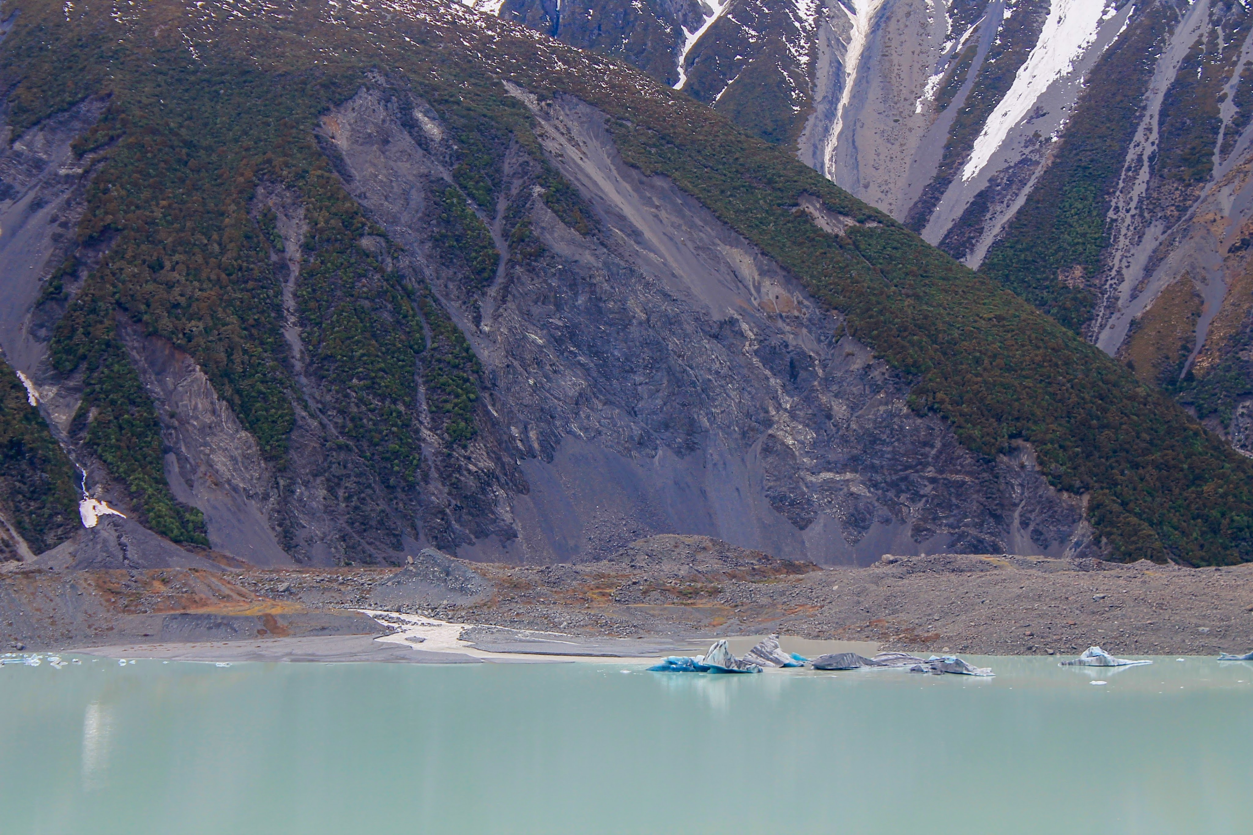
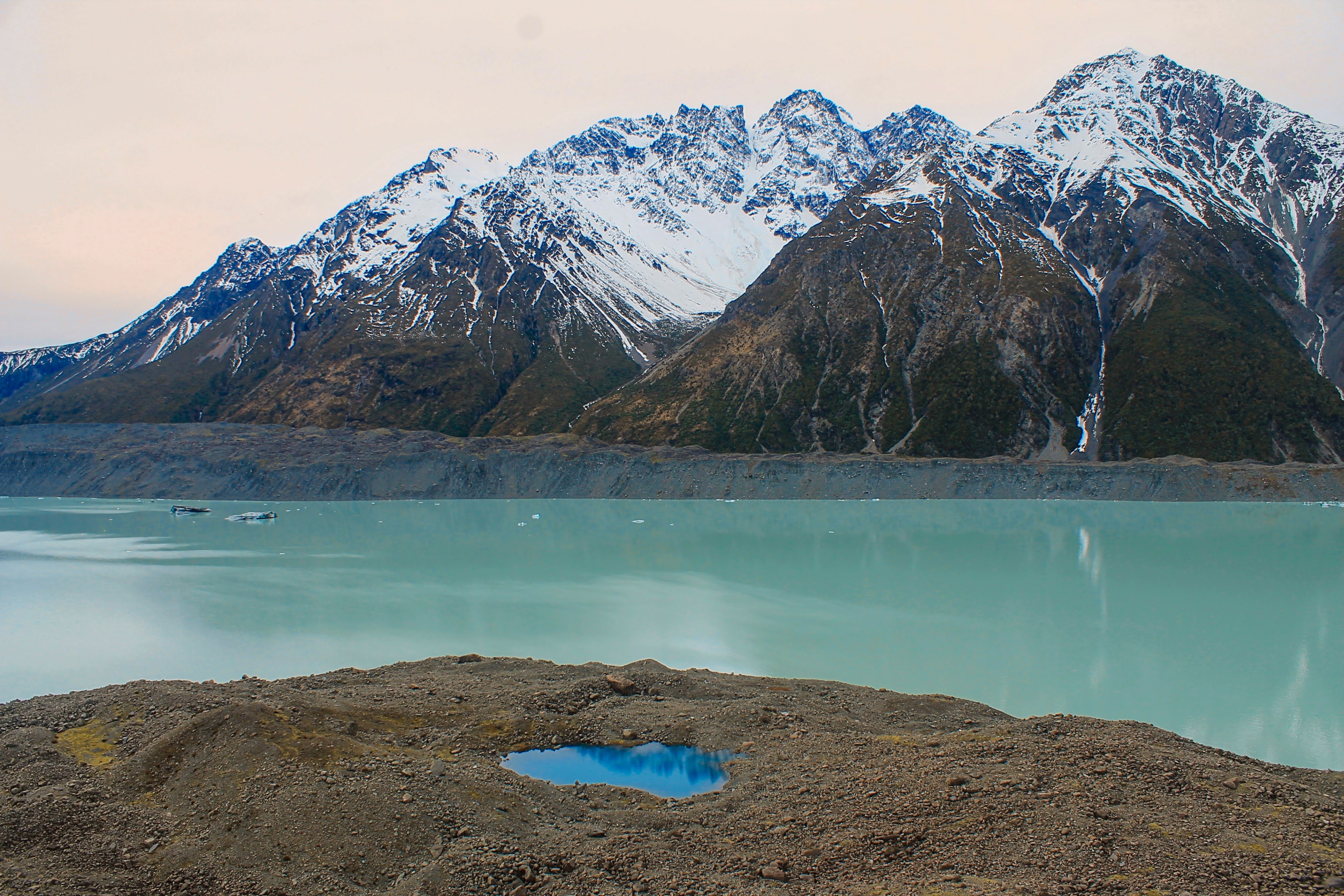
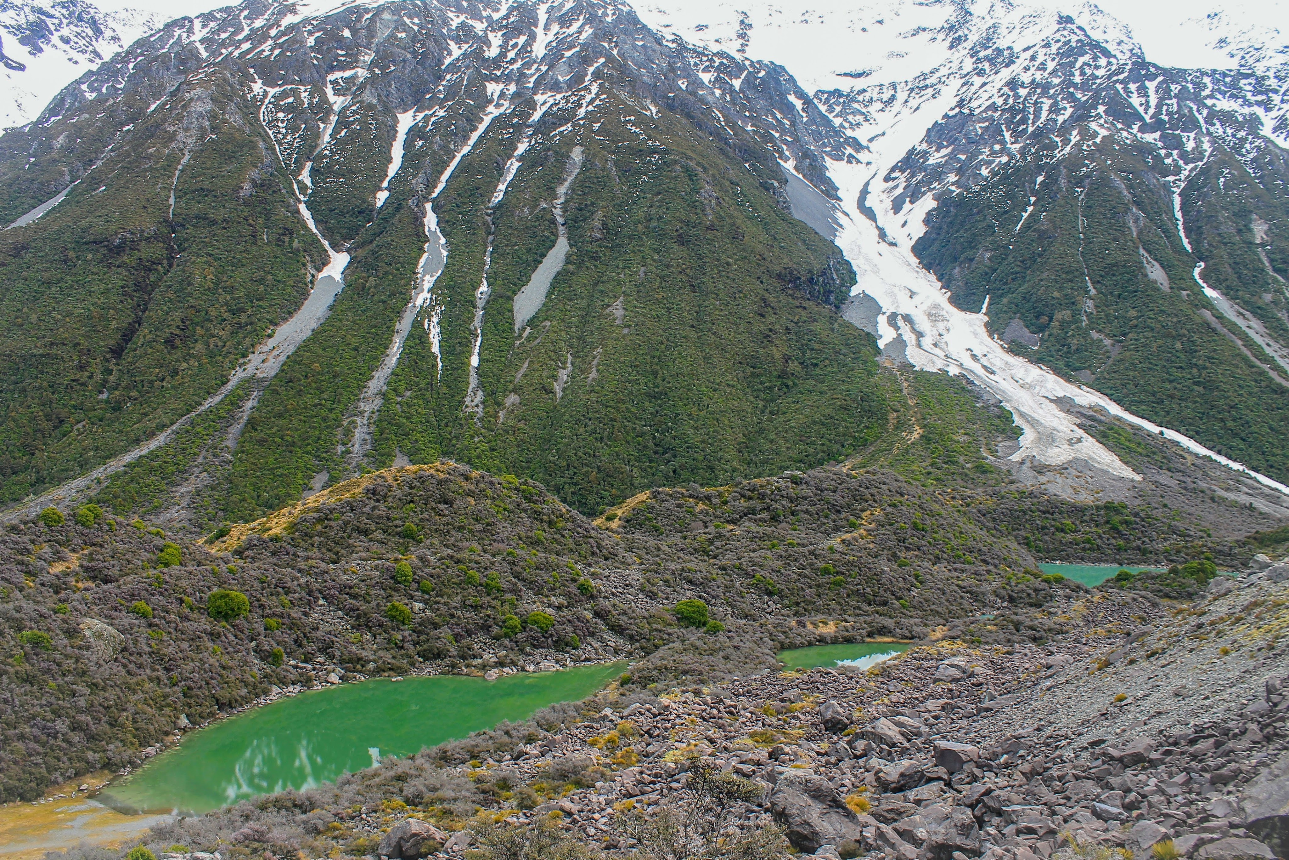
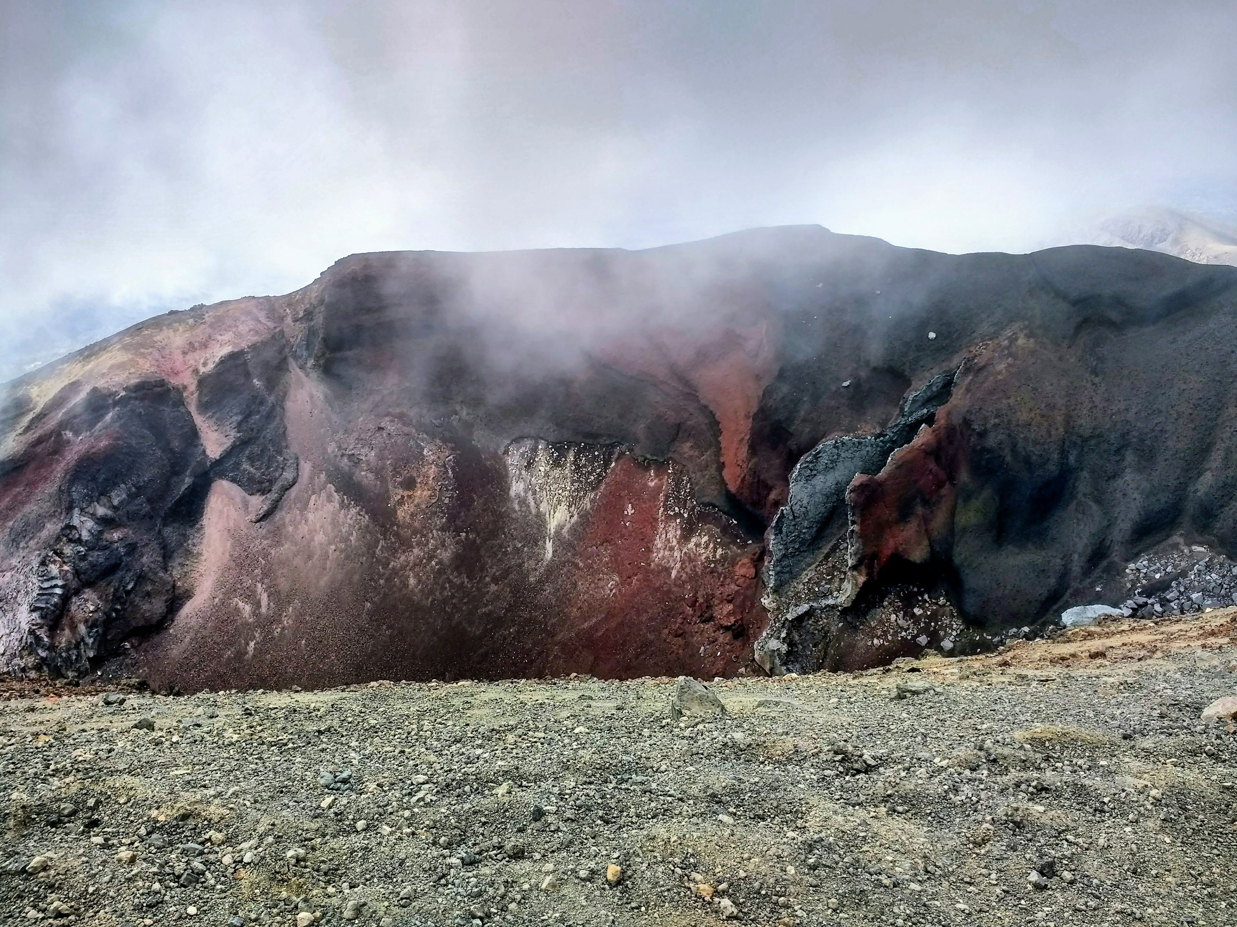
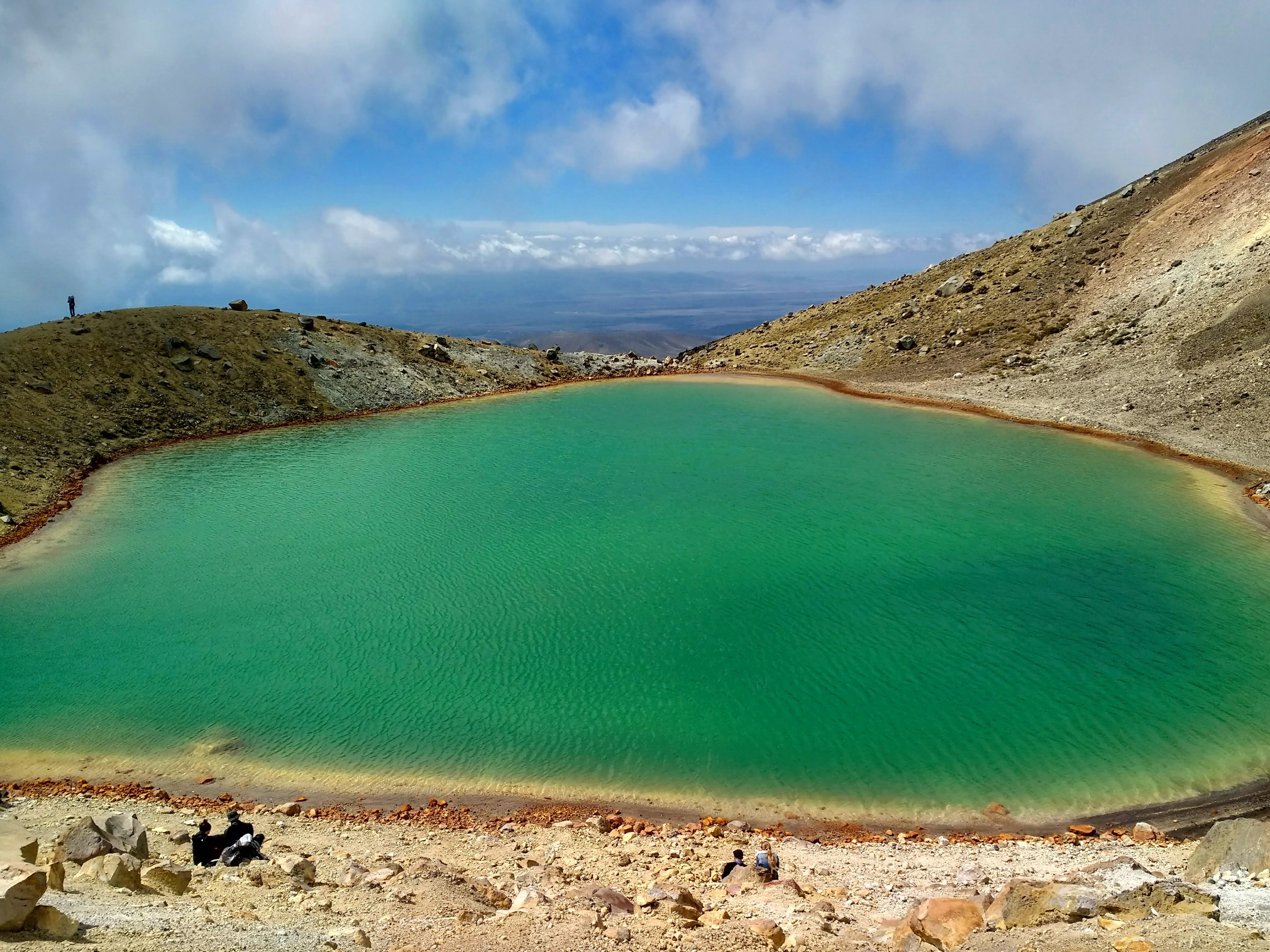
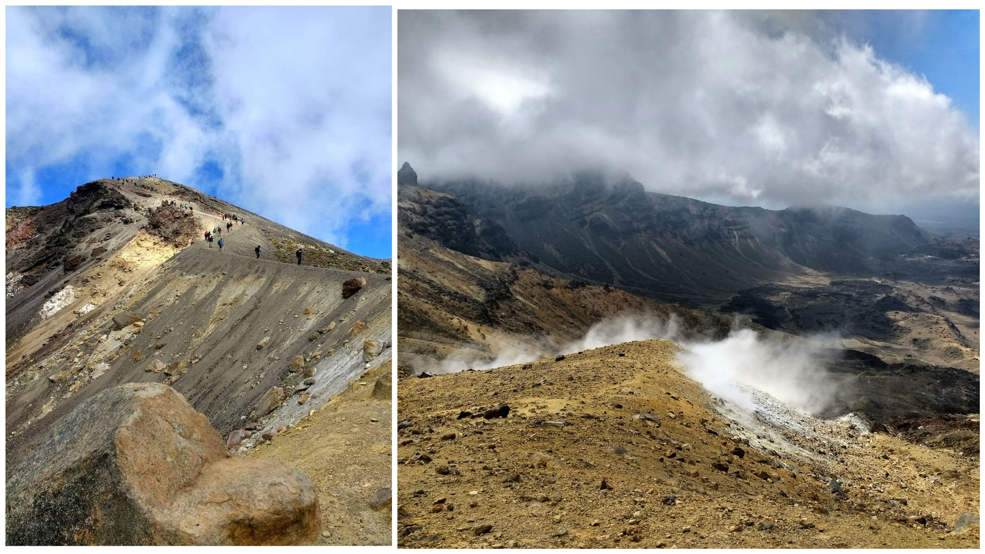
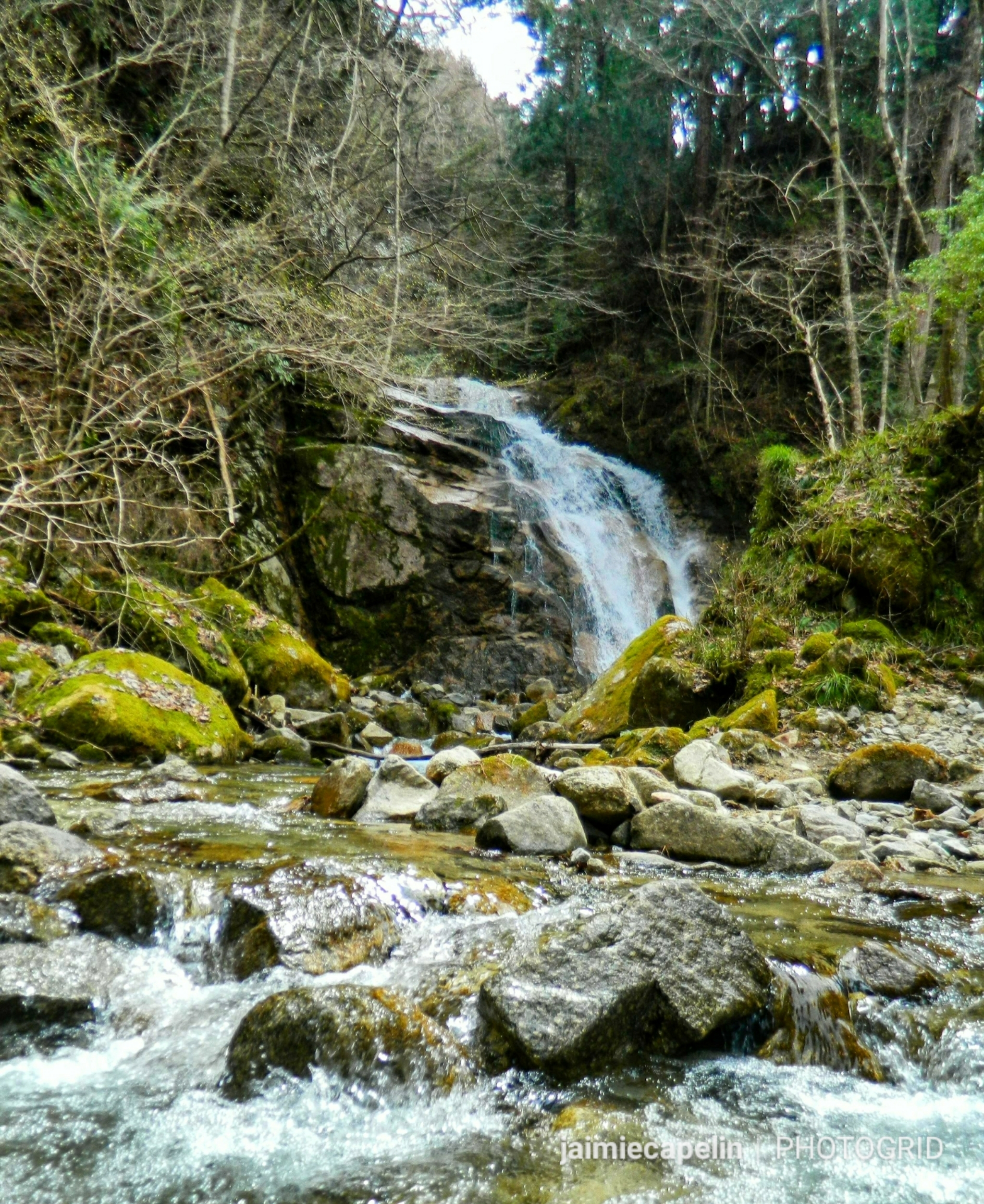
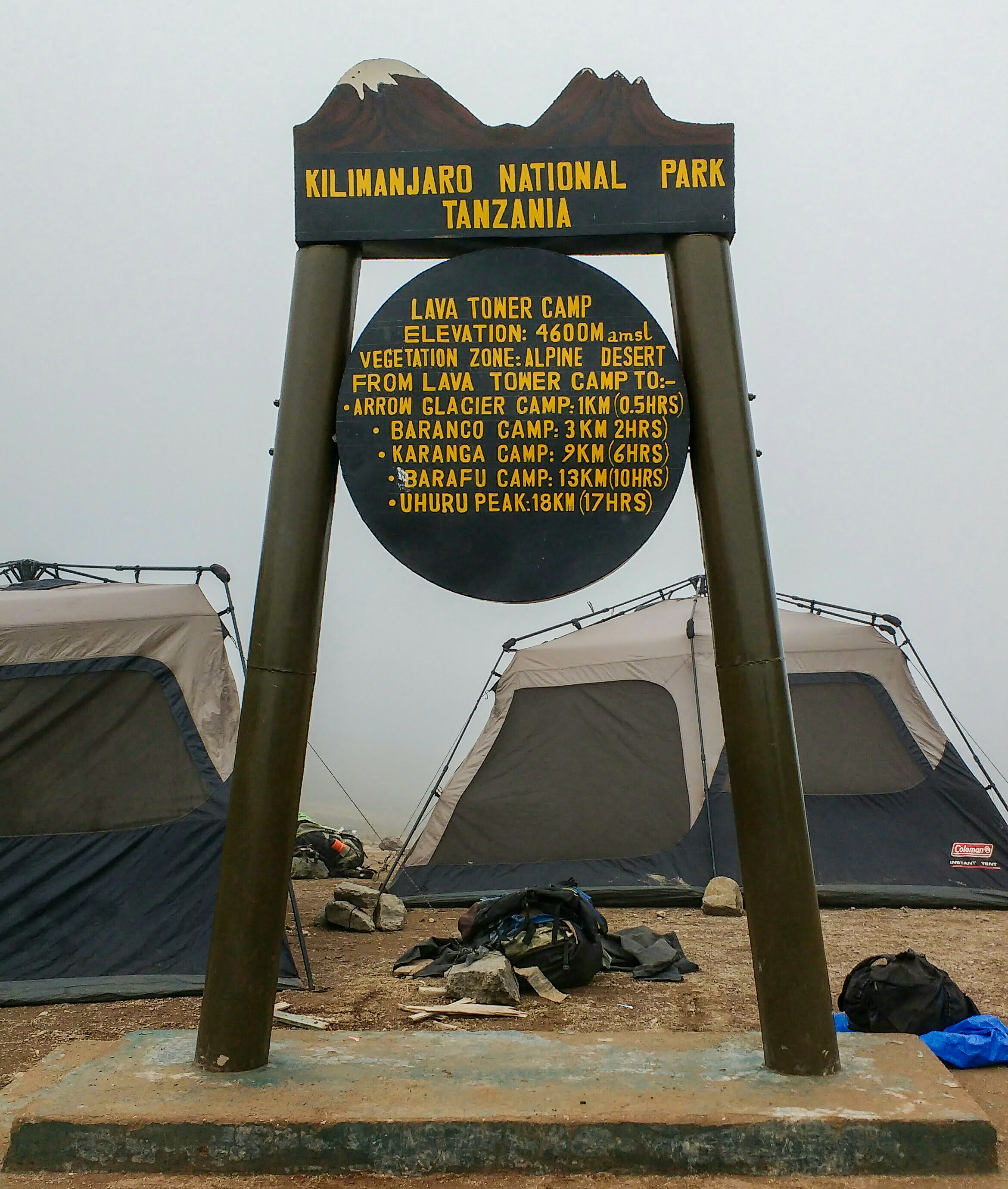
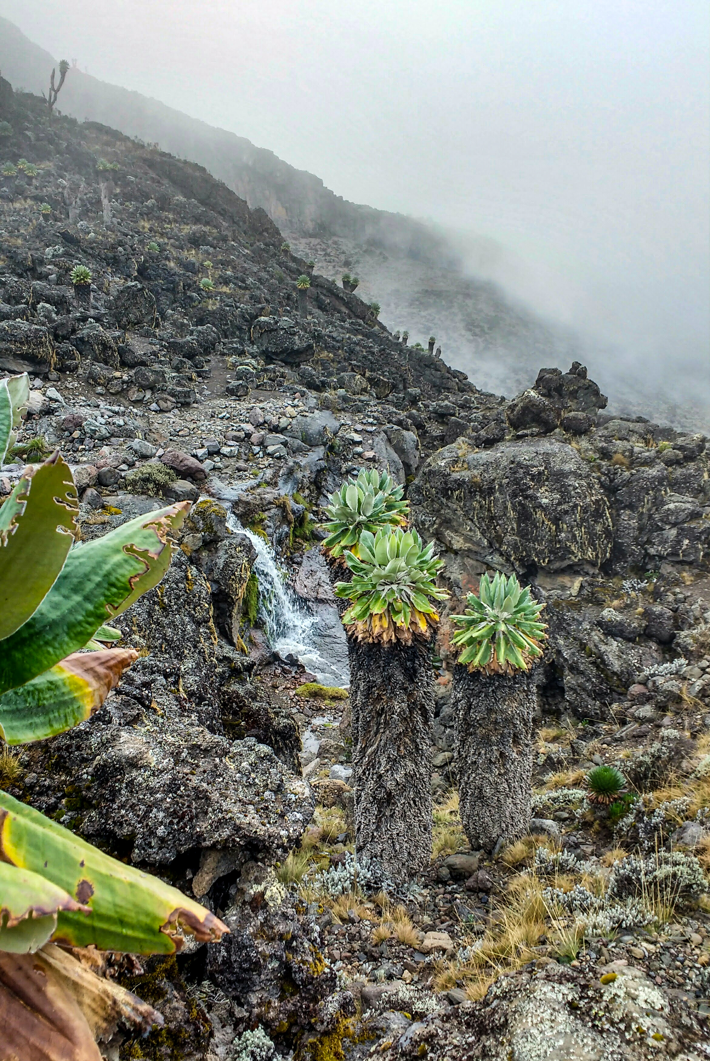
We climbed the vast, rocky landscape up to the Lava Tower, mist skimming the ground beneath our feet, finally reaching an altitude of 4,600m. This was our acclimatisation hike, and the highest point of our trek until we reached the Kibo Cone. From here we’d descend again – this exercise would, in theory, make our summit attempt much easier in terms of getting our bodies used to the altitude. Our Rafiki had already arrived and put up the mess tents beneath the tower of solidified lava, where we were treated to hot fried potatoes, cheese toasties and cake! Since altitude sickness feels a bit like a hangover, hangover food was extremely welcome! Even those who were sick to their stomach felt better after the feed, and we continued hiking down the other side of the Lava Tower, across streams and little waterfalls on this strange barren landscape.

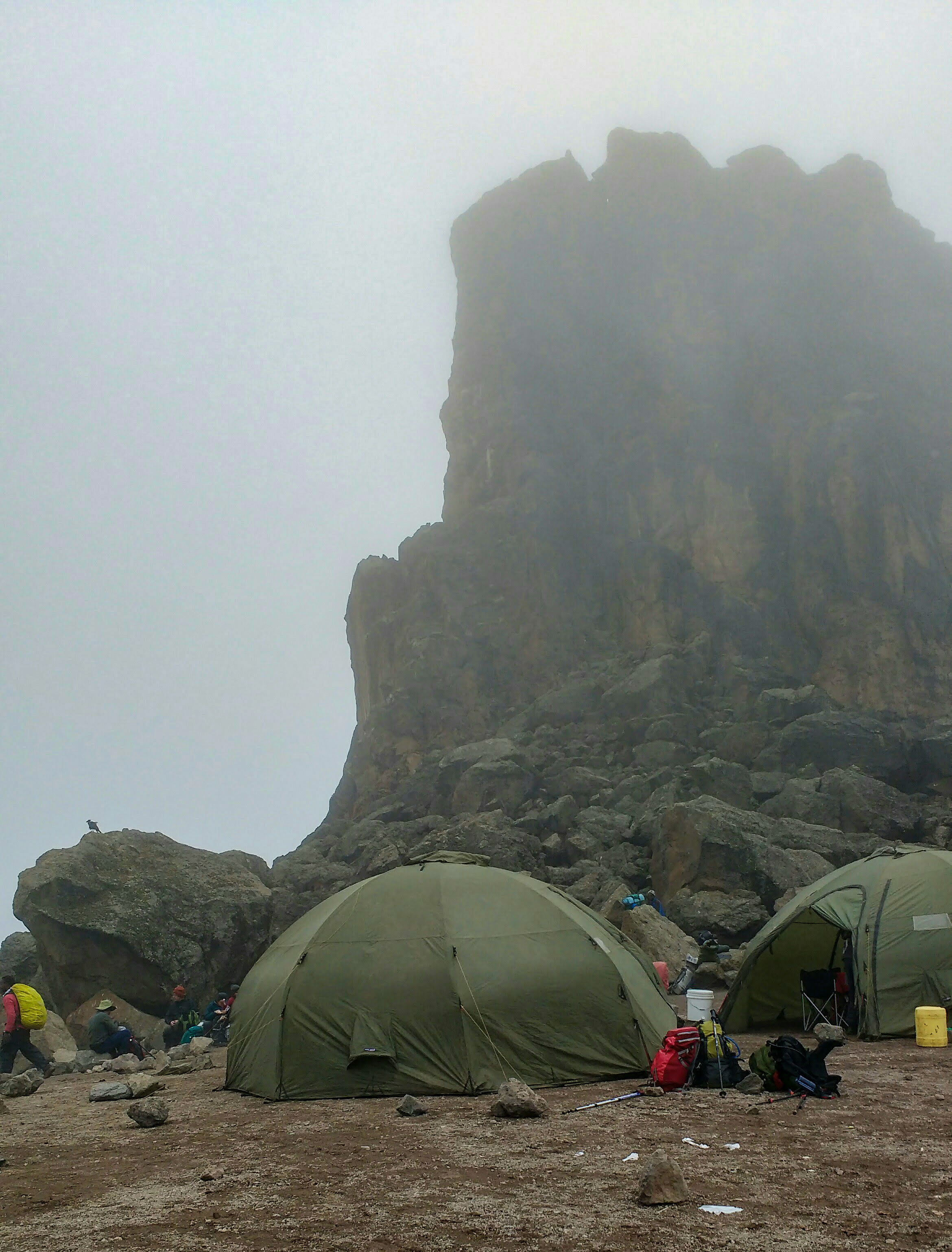
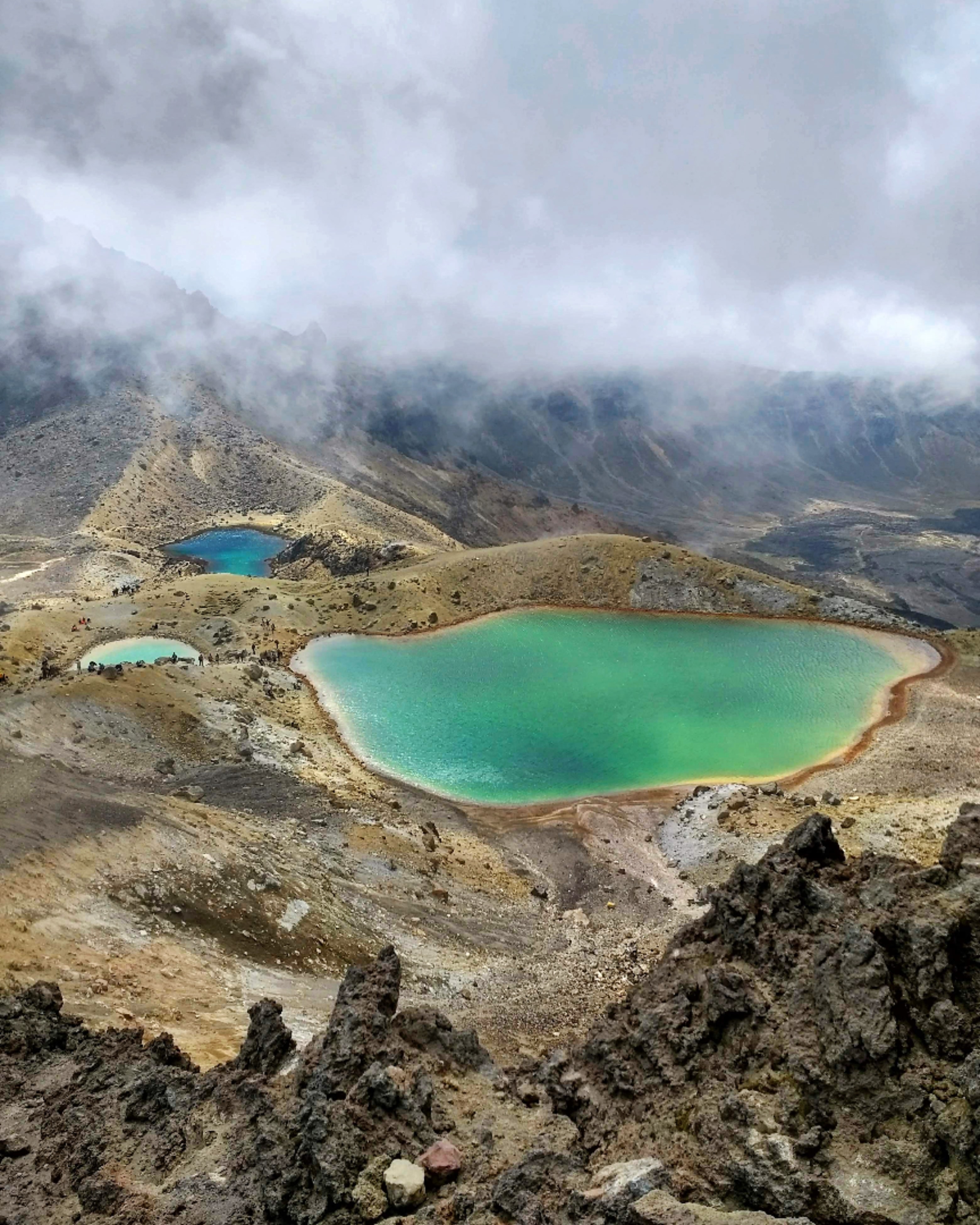
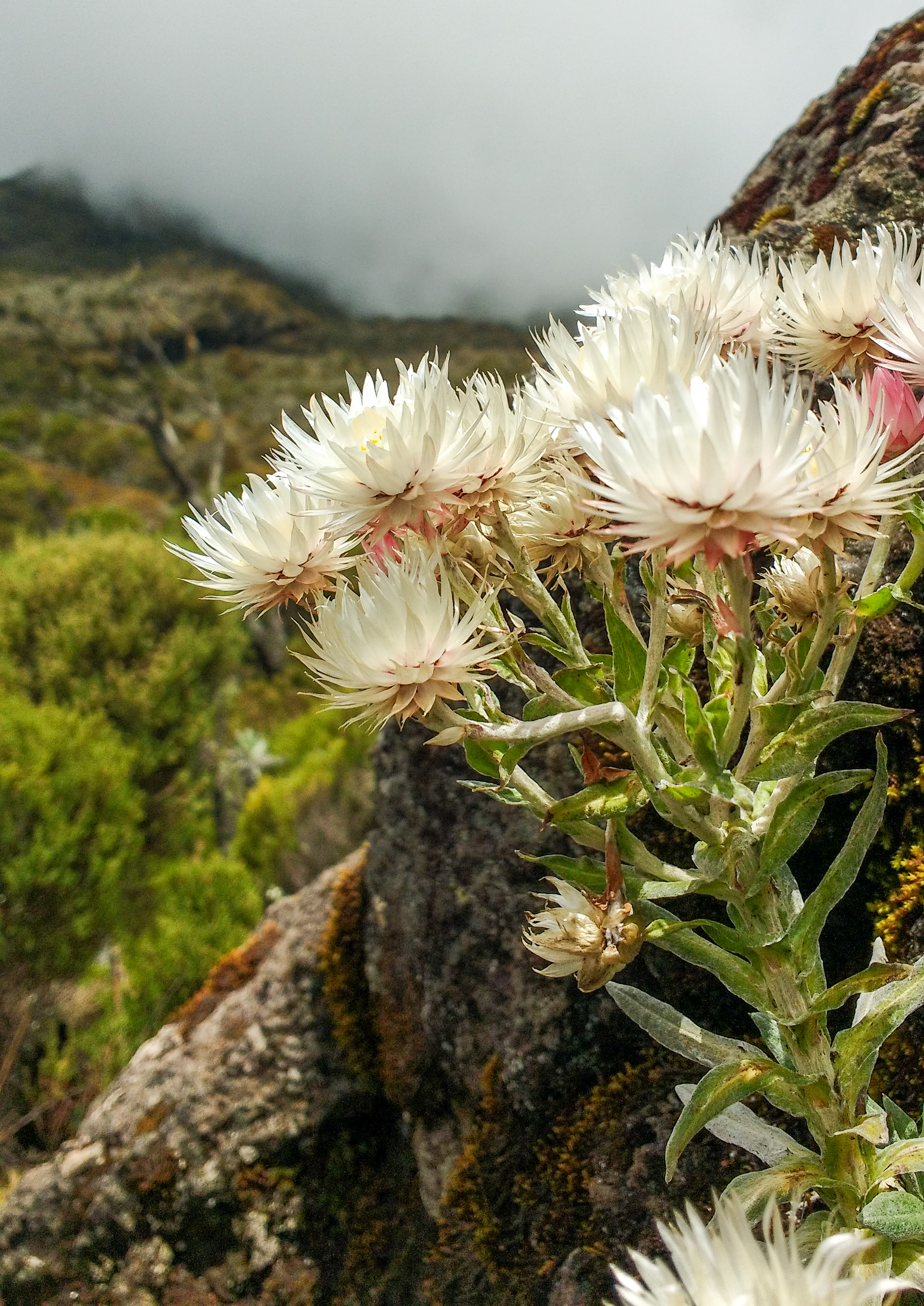
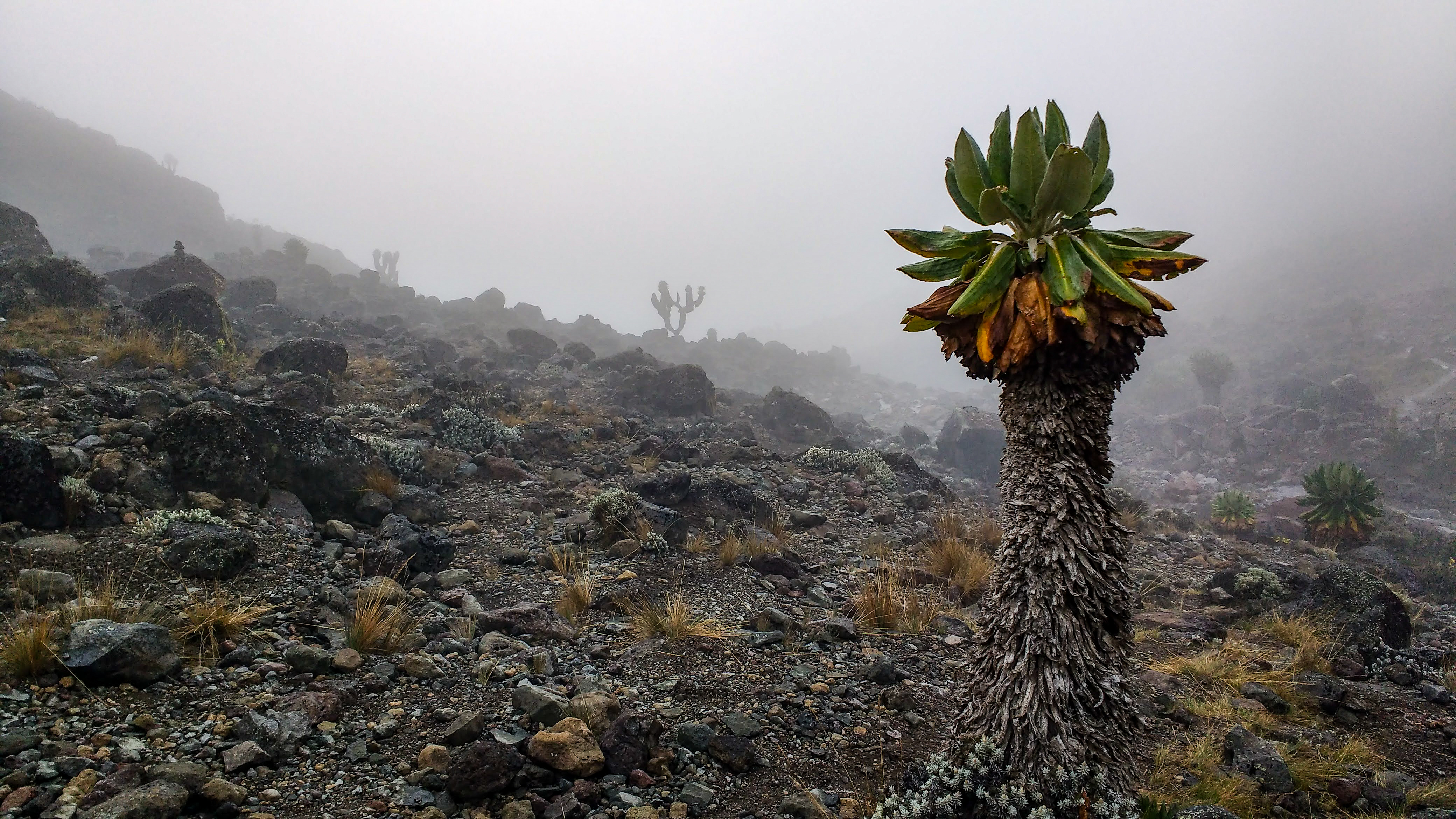
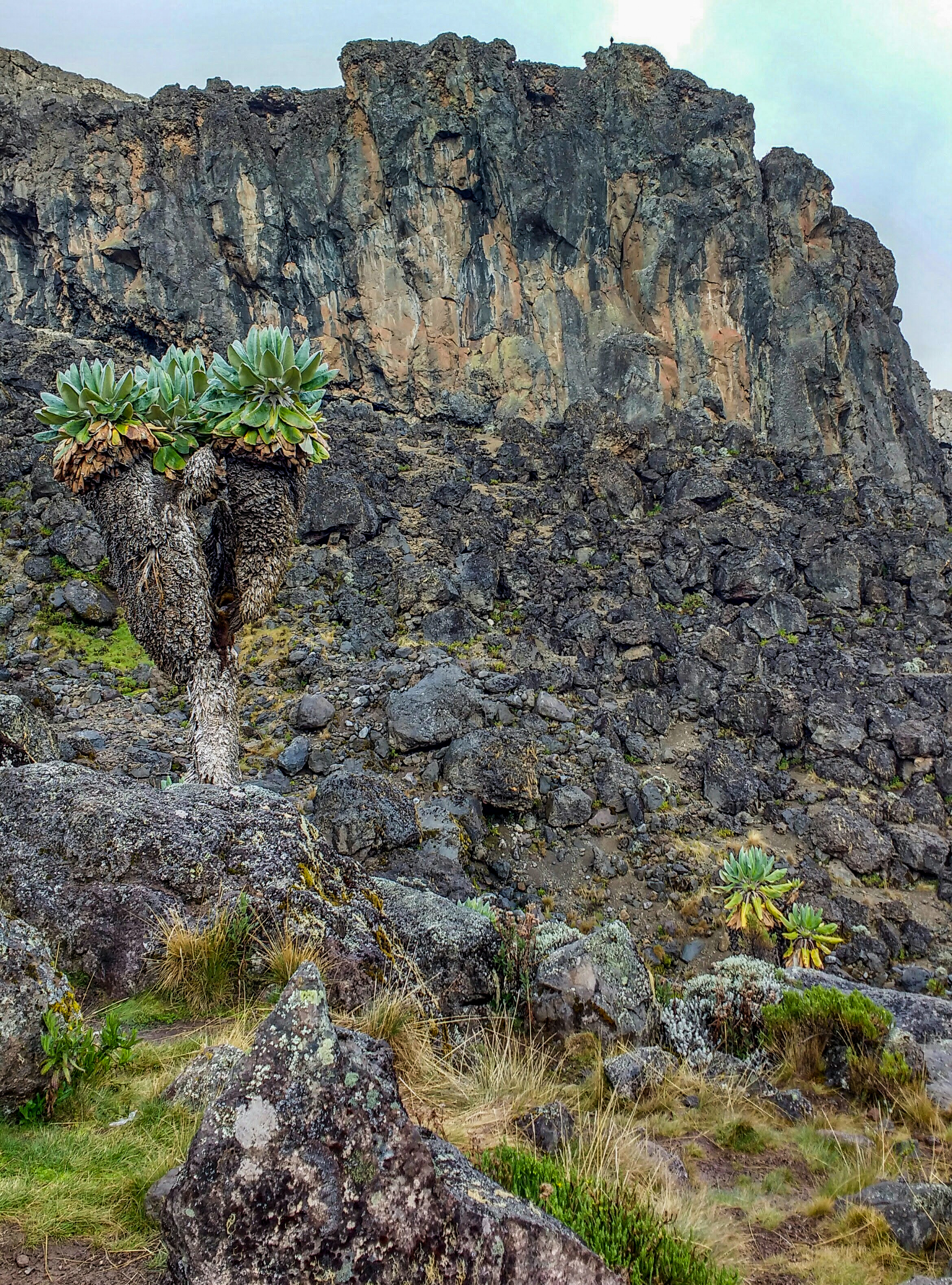
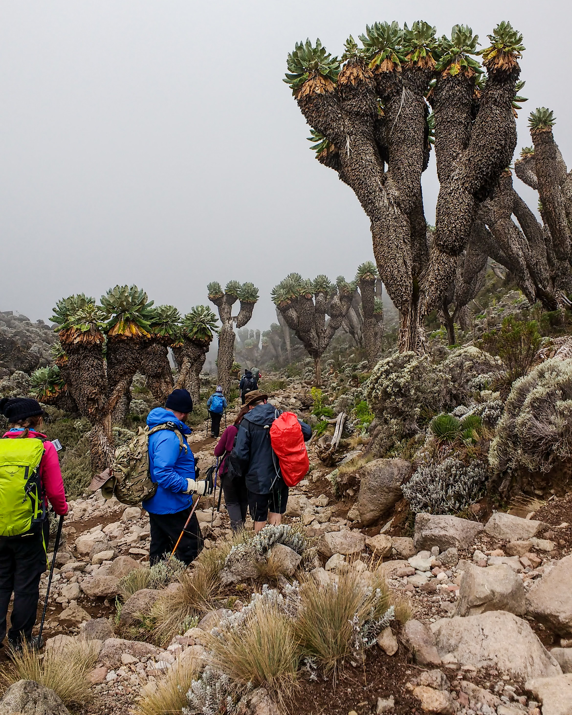
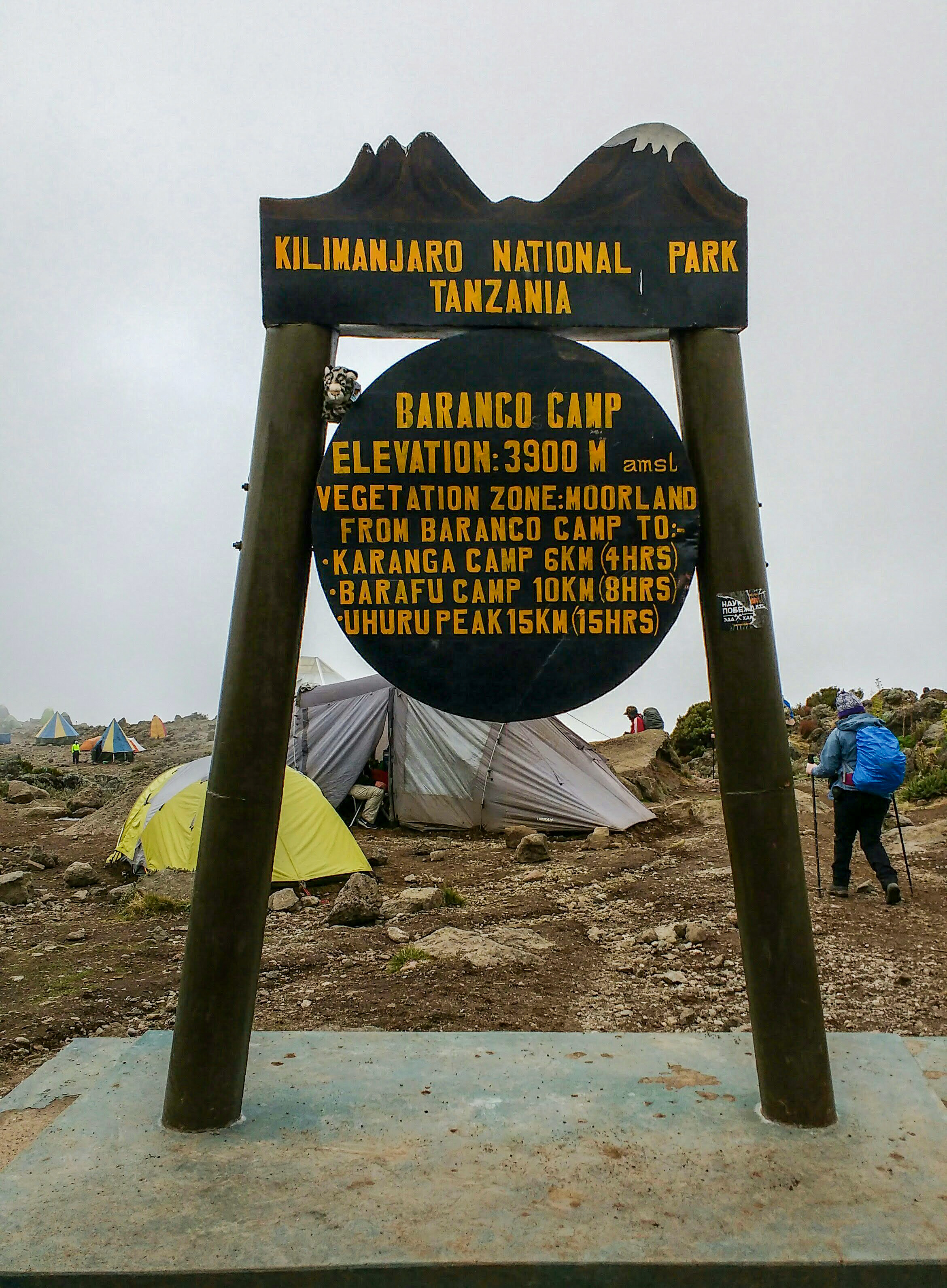
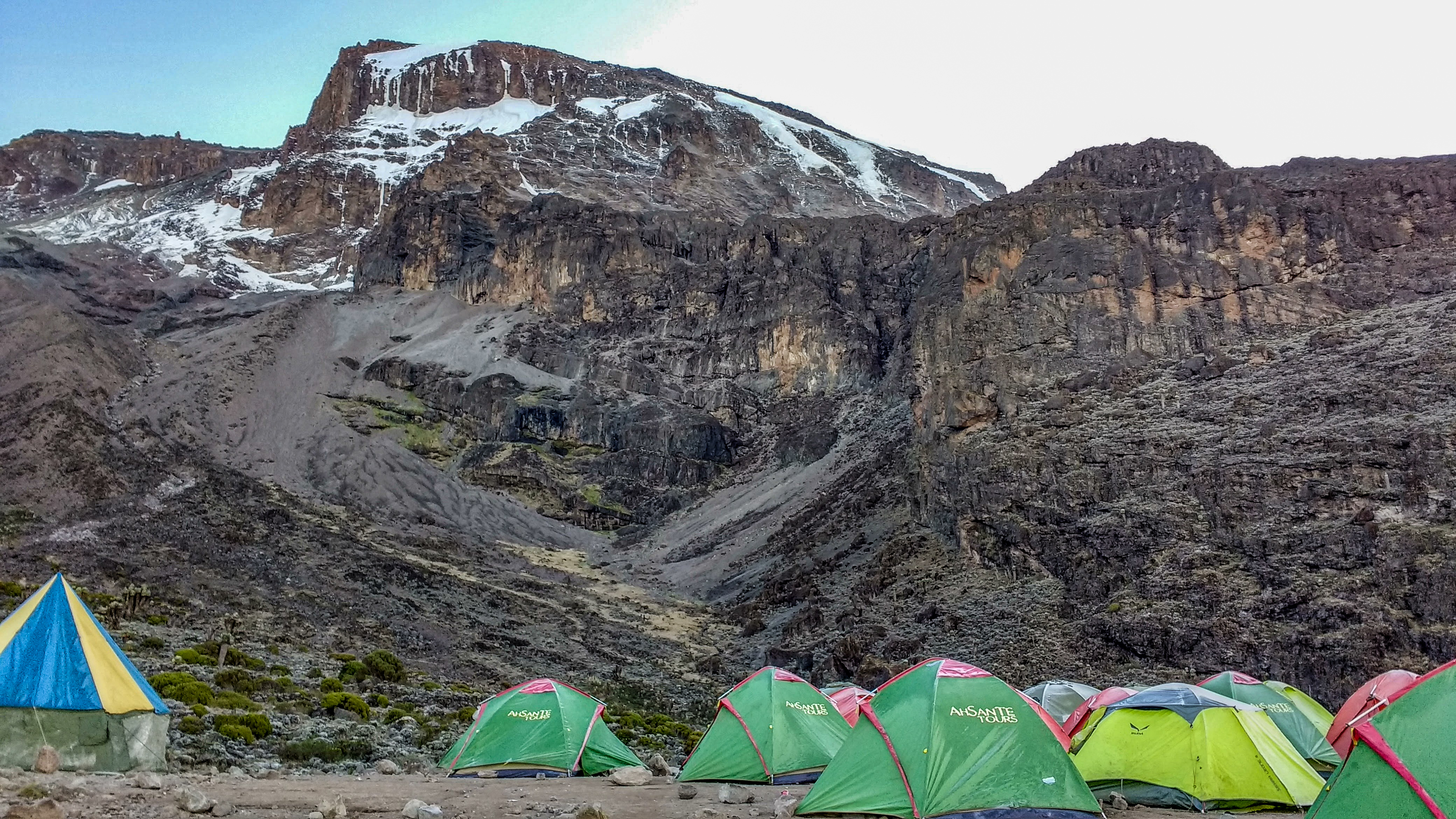
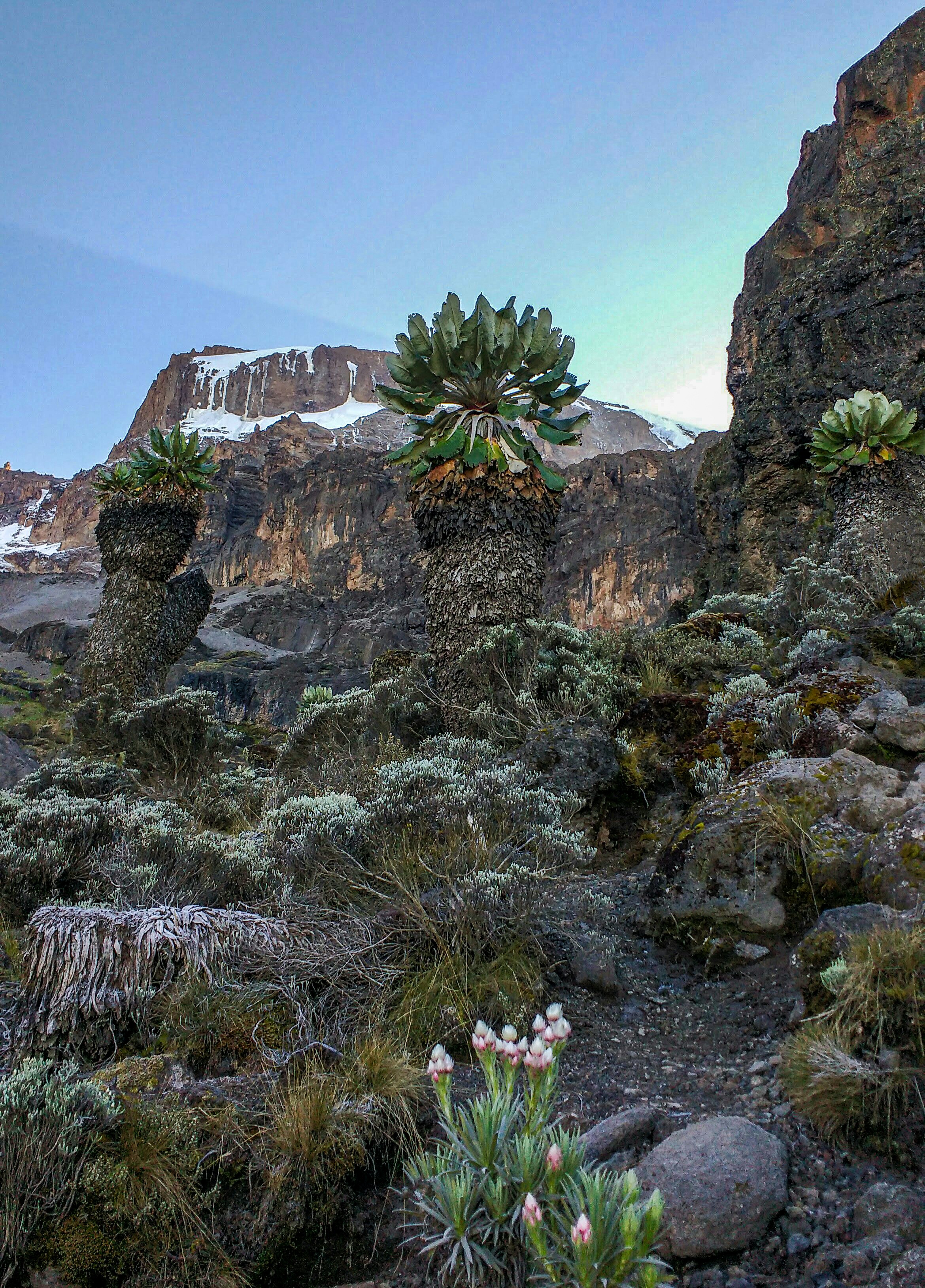
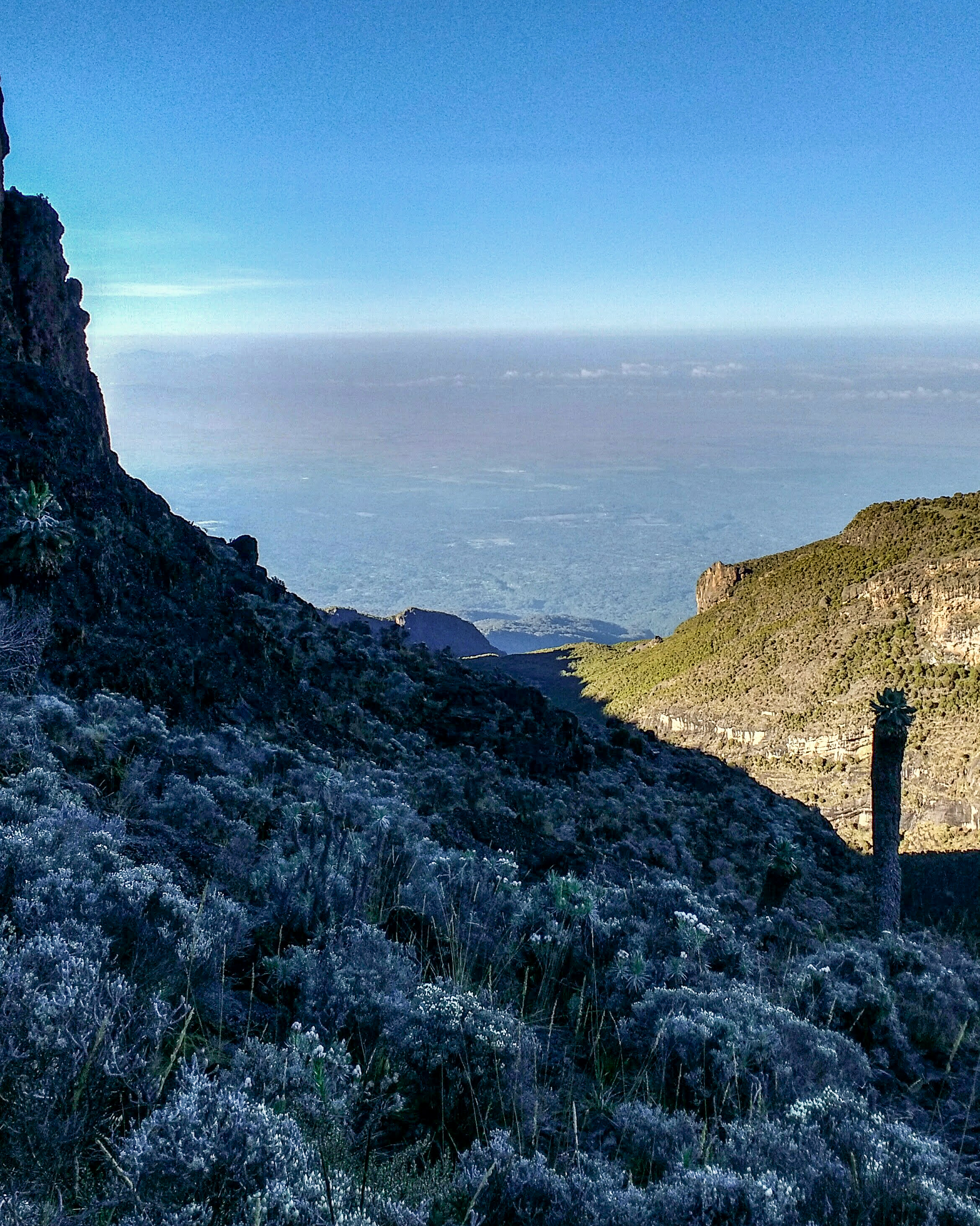
It began to hail quite heavily as we trekked, which then turned into snow, and we plodded ever onwards until we started to see vegetation again. Strange, almost cactus-like trees, and flowers growing in the mist, surrounded by little rocky waterfalls. Eventually, we found ourselves gladly at Barranco Camp, where Macaroni and Bolognese went down a treat for dinner. We were informed that Barranco Camp was the highest point for rescue helicopters to land on our route – from here on up, if we got injured, we’d have to rely on being wheeled back down on a ‘Mountain Taxi,’ which we’d discover in a day or two… Once again, the stars were stunning and we could see lights far below in the real world. I watched a little Four-Striped Grass Mouse hopping around outside the tent under the looming Barranco Wall; the infamous cliff we would be scaling in the morning.

Day Four – “On Top Of The World”

We were ready to leave Barranco Camp at 7am, with the sky just lighting up at the edges, and we sang Happy Birthday in Swahili to Grace. I had awoken with a painful, swollen red face, which I think was a combination of yesterday’s morning sun, and an allergic reaction to my SPF50 sun cream – great combination! Tim – our group medic – advised me to borrow a different sun cream and keep applying tea tree gel. The group reacted very sympathetically to my appearance, which in turn made me feel very self conscious. In all this commotion, I didn’t get a chance to fill my water bottles, leaving camp with under 2 litres of water – not ideal. As we began climbing I was forcing back tears, feeling on the back foot, but I was soon brought back to reasoning by the stunning surroundings.

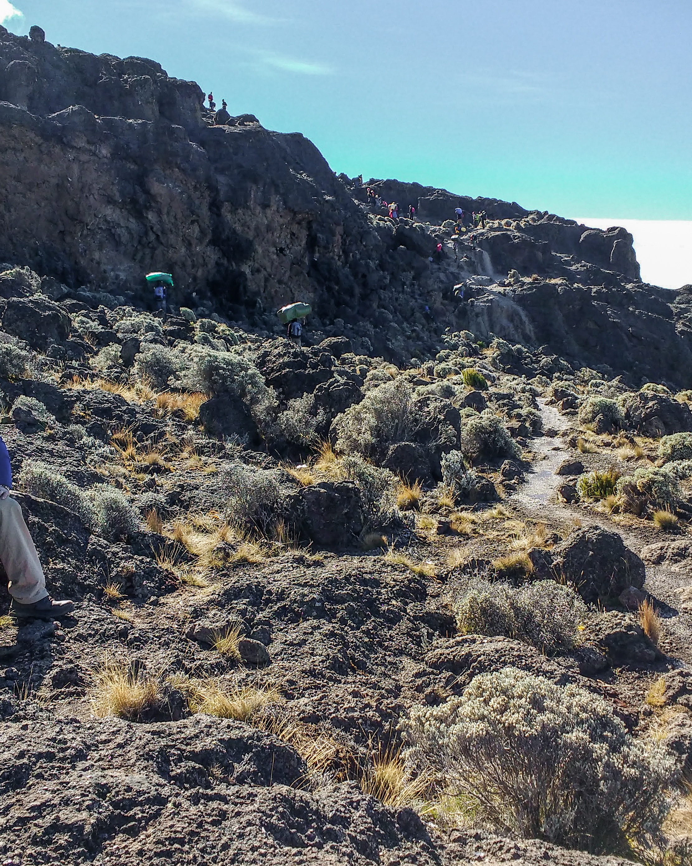
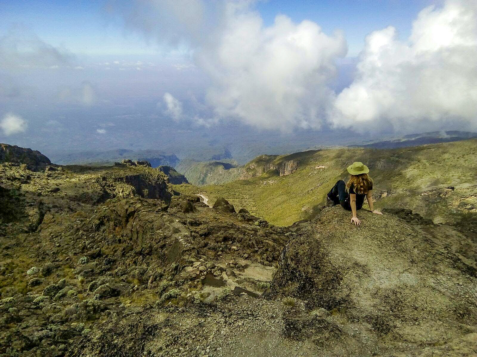
More than two hours of hoisting ourselves up sheer cliffs, edging along narrow ledges, giving one another leg ups, and even climbing on our guides’ knees, the camp was slowly falling into the distance beneath us, tiny green tents dotted on a real-life map. The valley and rainforest stretched out to blurry lines towards Mount Meru on the horizon, and the sun rose up over the wall to meet us. We sang and danced the ‘Barranco Shake’ while our Rafiki trooped past us with bags and baskets balanced on their heads. Grace stopped to tie a shoelace for one of them so he didn’t have to put down his pack! Maximum respect!

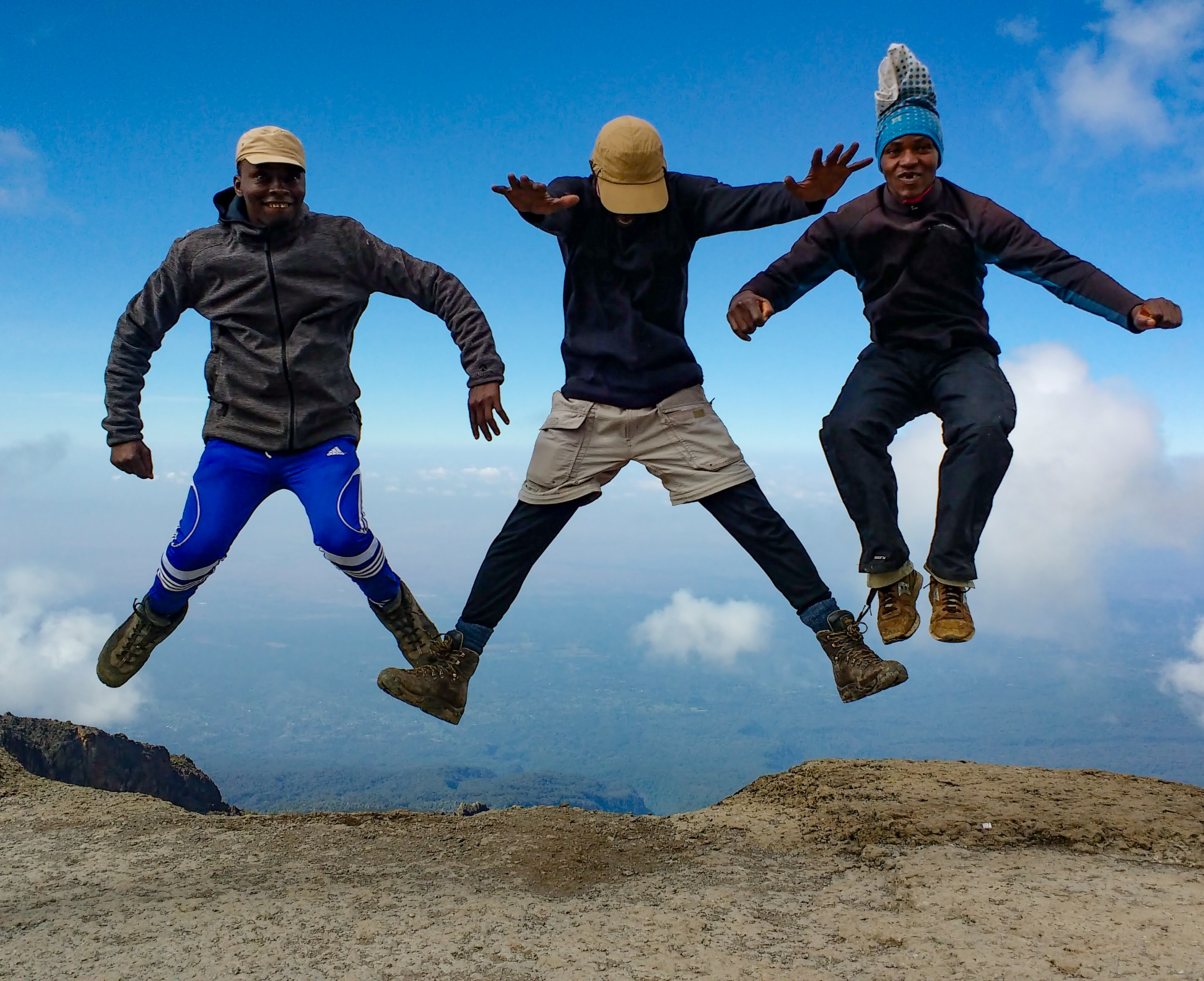
At the top of the wall the way ahead levelled out beneath the blazing sun, and the view was glorious, like looking out of an air plane! We took lots of photos, jumping in the air with our guides, and gave ourselves a moment on top of the world to take it all in.

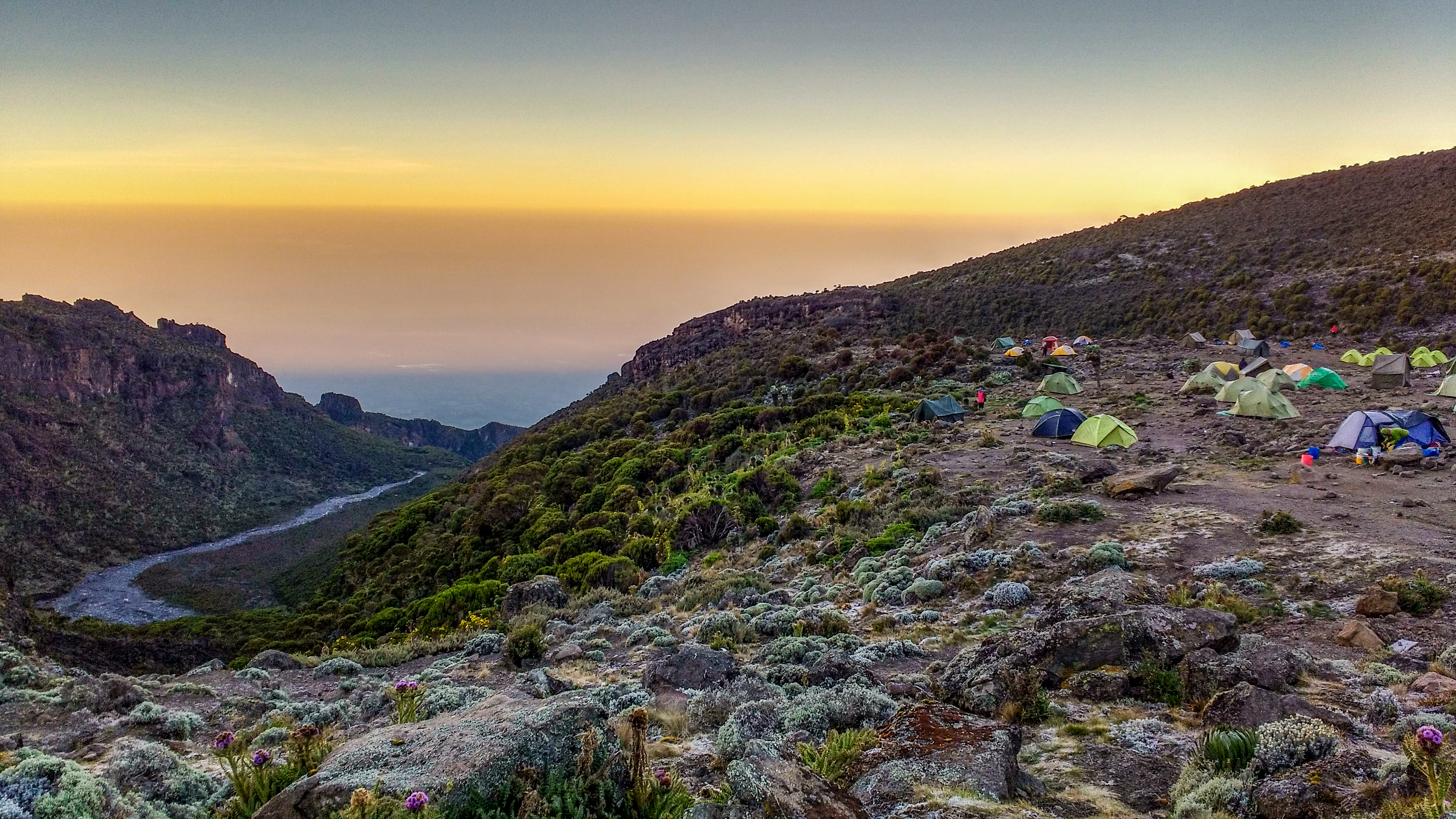
As cloud started to pour in again, we took the zig-zagging path up through the valley to Karanga Camp, all singing as we went. After we arrived, there was an epic thunderstorm and the mountain summit drifted in and out of view in the mist. Then it hailed! We had dinner and Birthday cake, and then we all ran back to our tents through the torrential rain to settle down for a long sleep.

Day Five – “Way of the Stone Stacks”

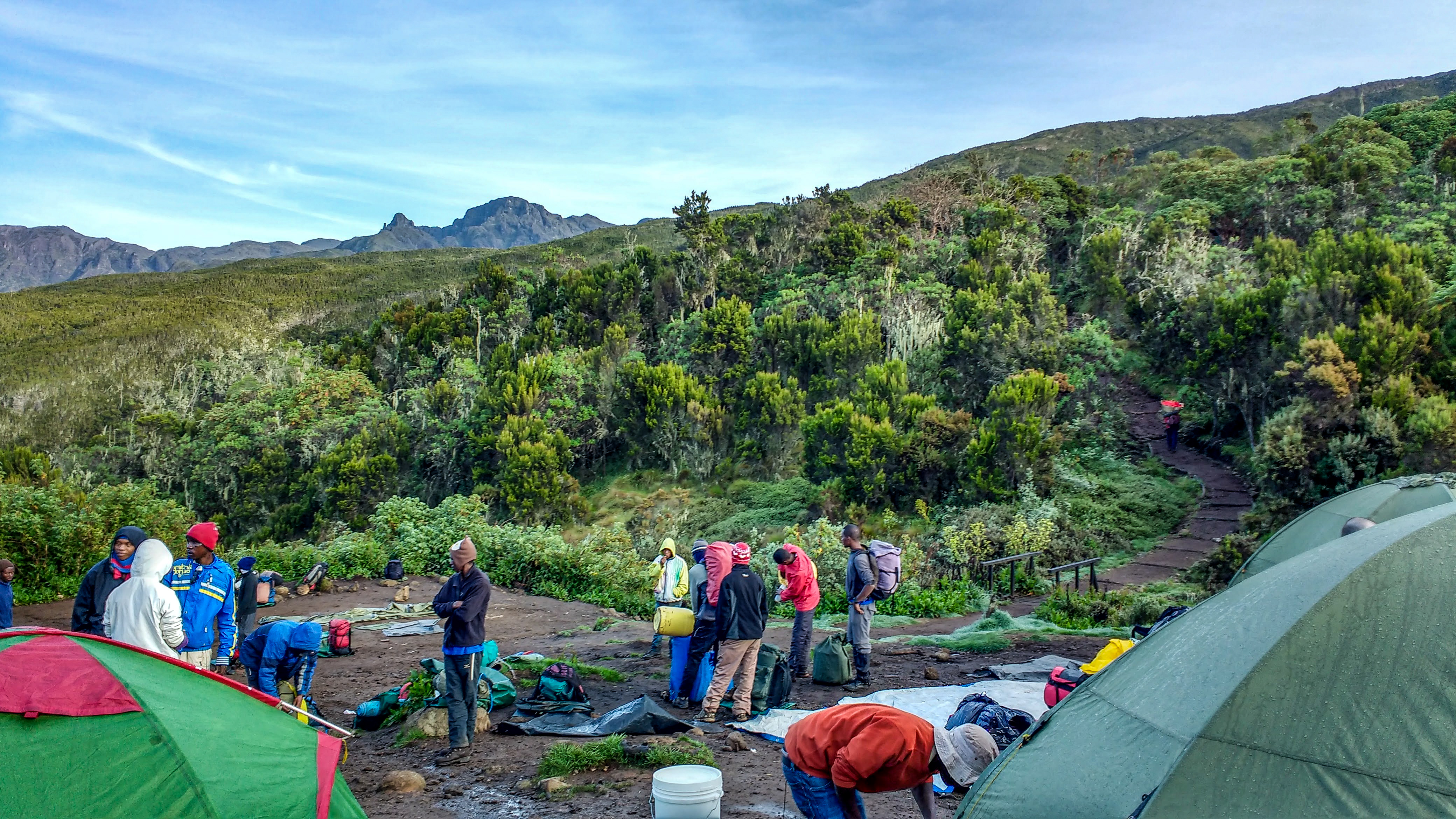
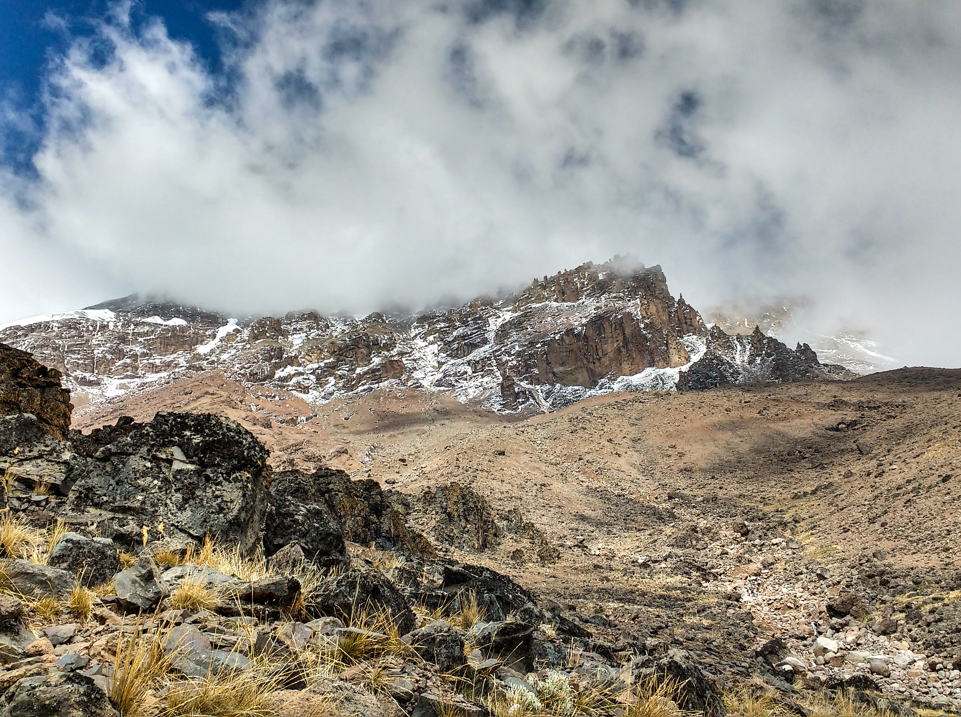
We were granted a lie in until 7am! But we were all up at 5:30 anyway. Our Rafiki brought tea to our tents as usual, saying “Habari za Asubuhi,” (Good Morning) and we went for breakfast, which today included some waxy yams that were quite interesting… We bid farewell to one more of the group, who left valiantly and proud, and some tears were shed. The summit loomed over Karanga Camp, and the snow line was lower than the day before, but the sky was blue and the sun was rising, making the snowy peak look like candy.

Morning at Karanga Camp

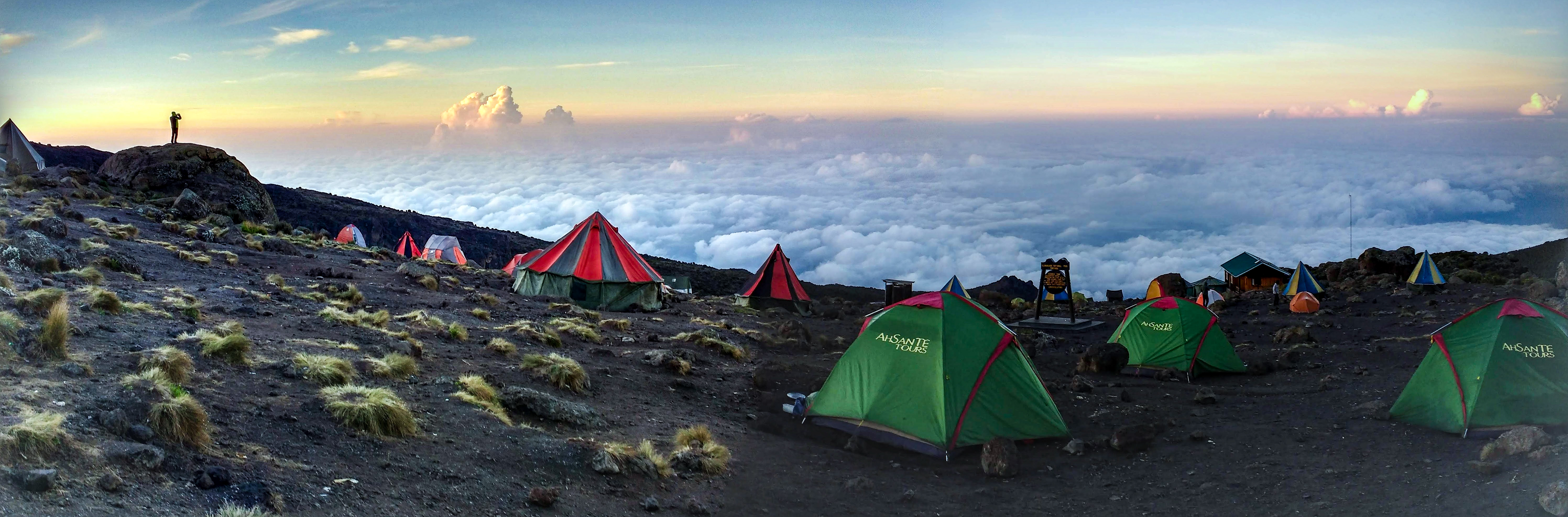
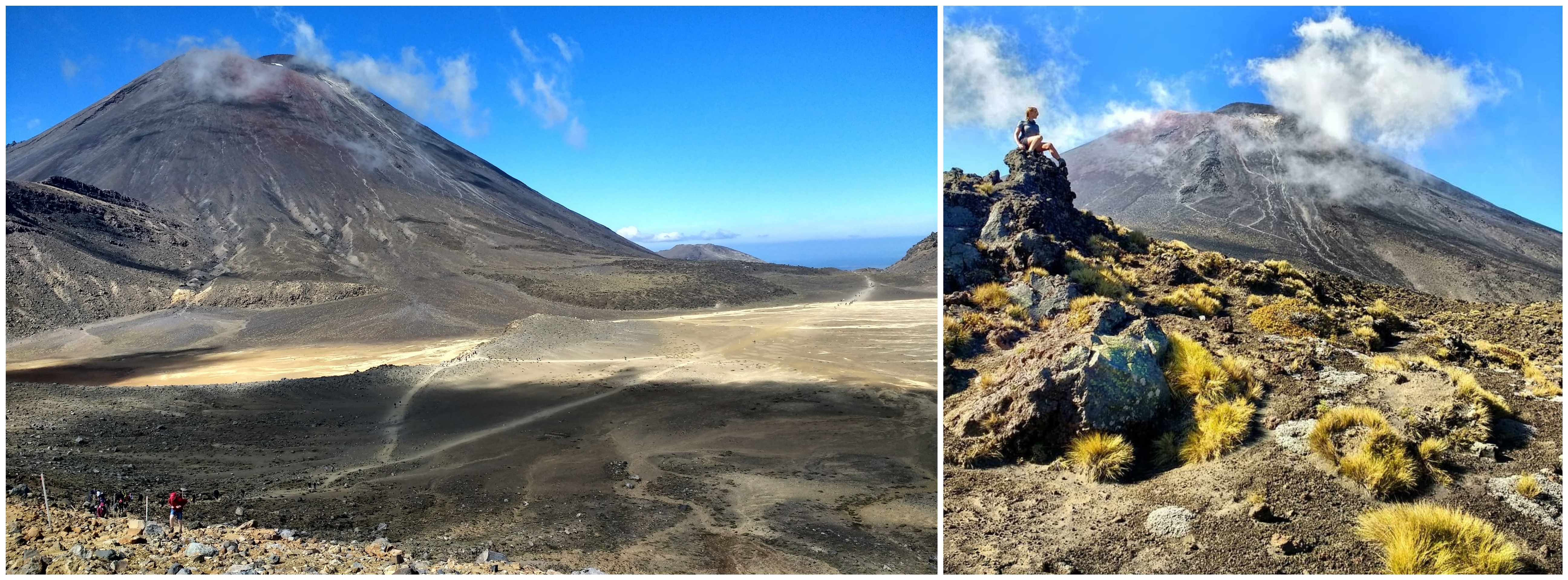
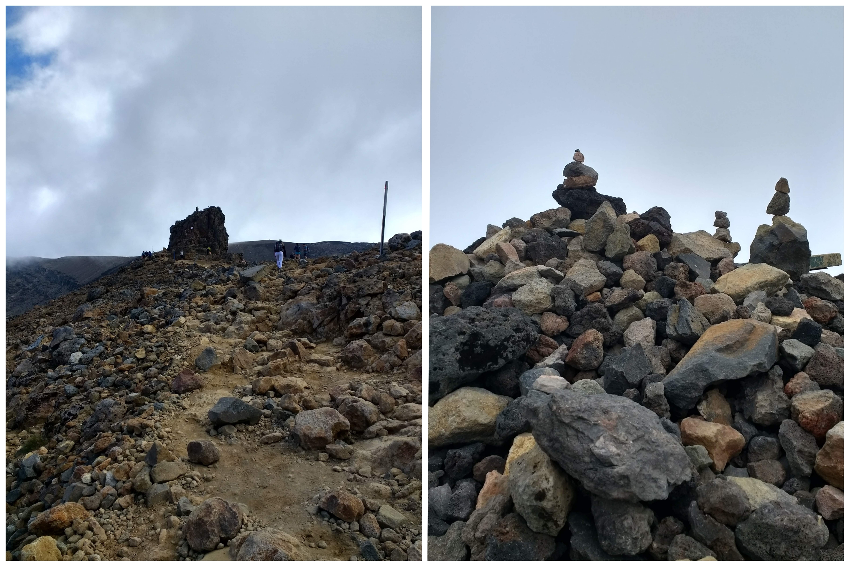
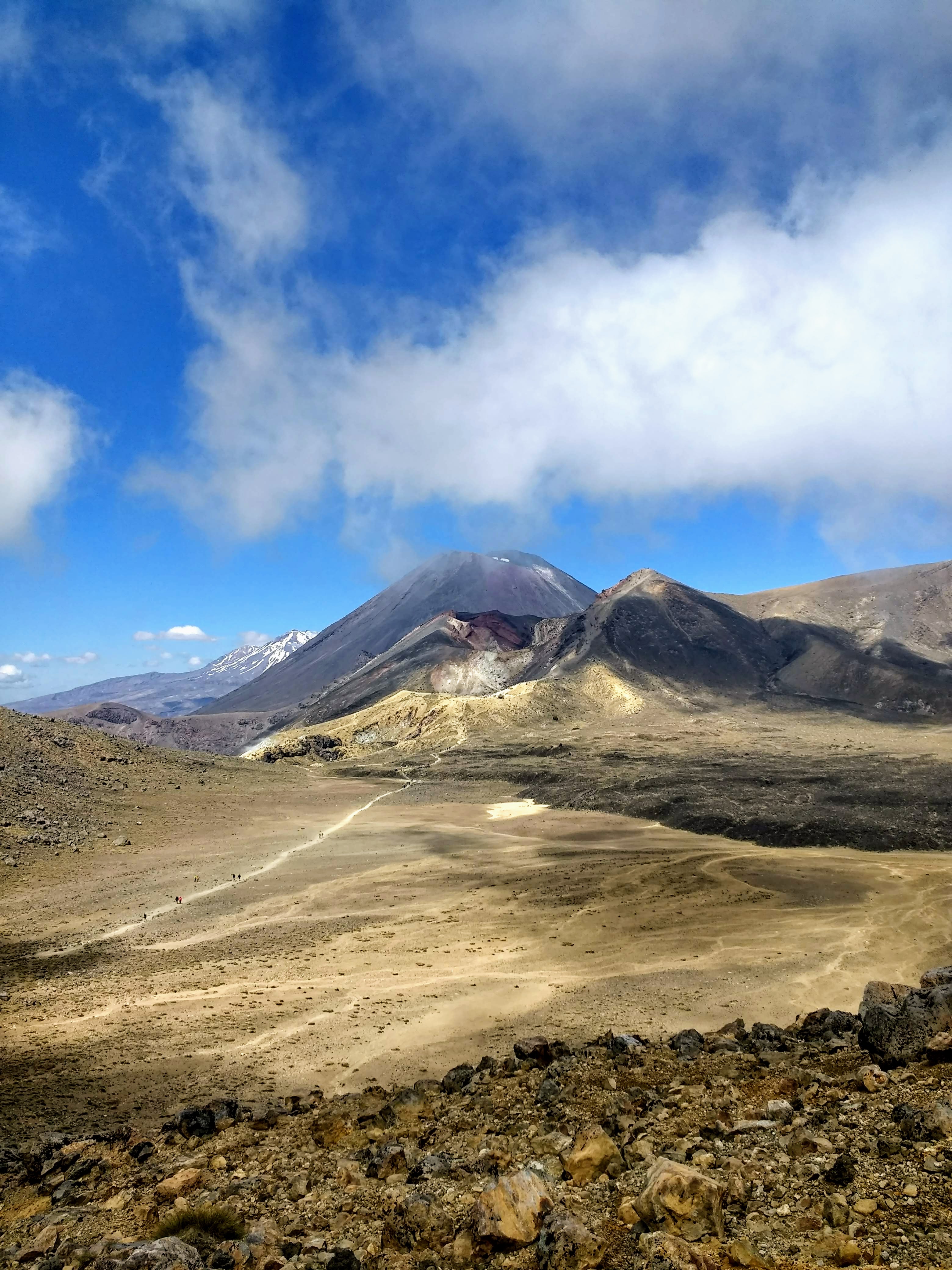
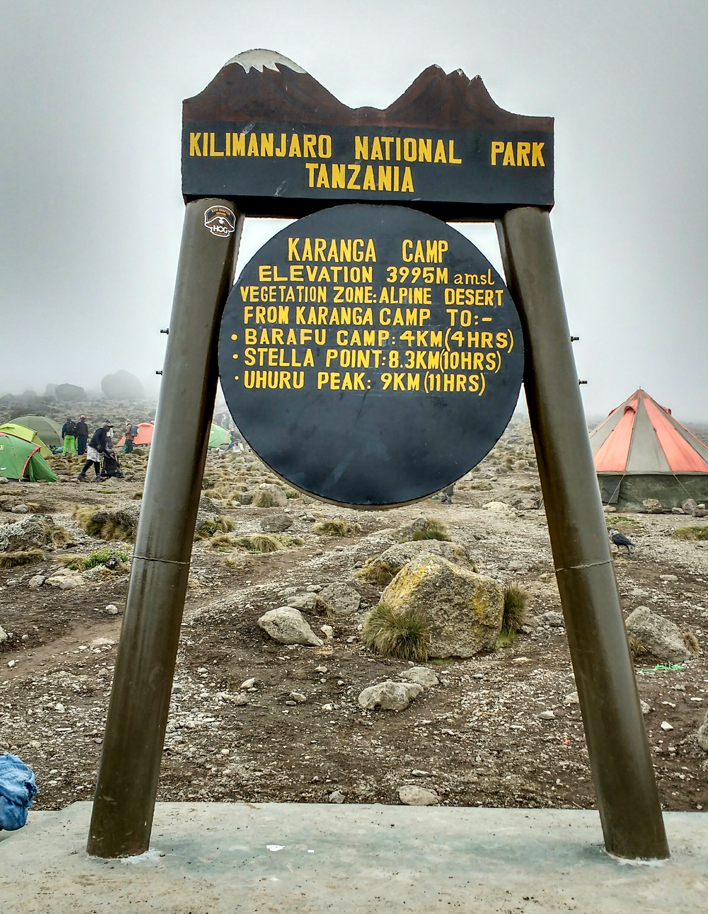
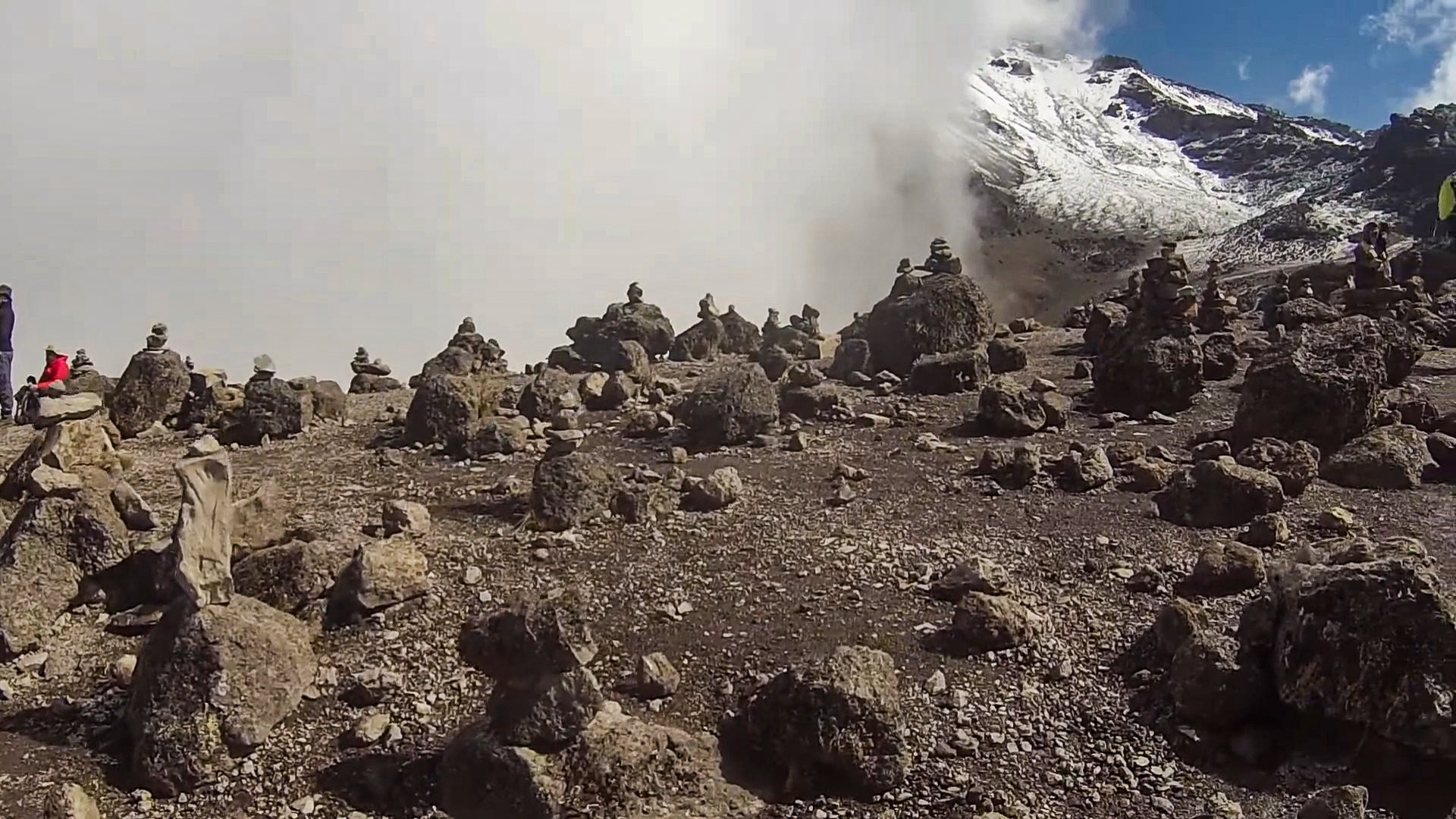
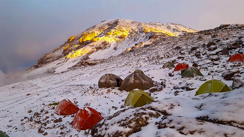
Today’s hike was short, but extremely “Polē Polē” due to the thin air. We crossed the stark, desert-like slope between strange walls of cloud, where hundreds of previous hikers had made stone stacks all around us, like something from another world. A couple of people in our group were really struggling – it wasn’t an easy ride – but we all made it up across the steep, rocky plain around the base of Kibo Cone to Barafu Camp by 1pm. Lunch was at 1:30pm – mashed potato and lentil curry, followed by one last briefing before our summit attempt began at 11pm.

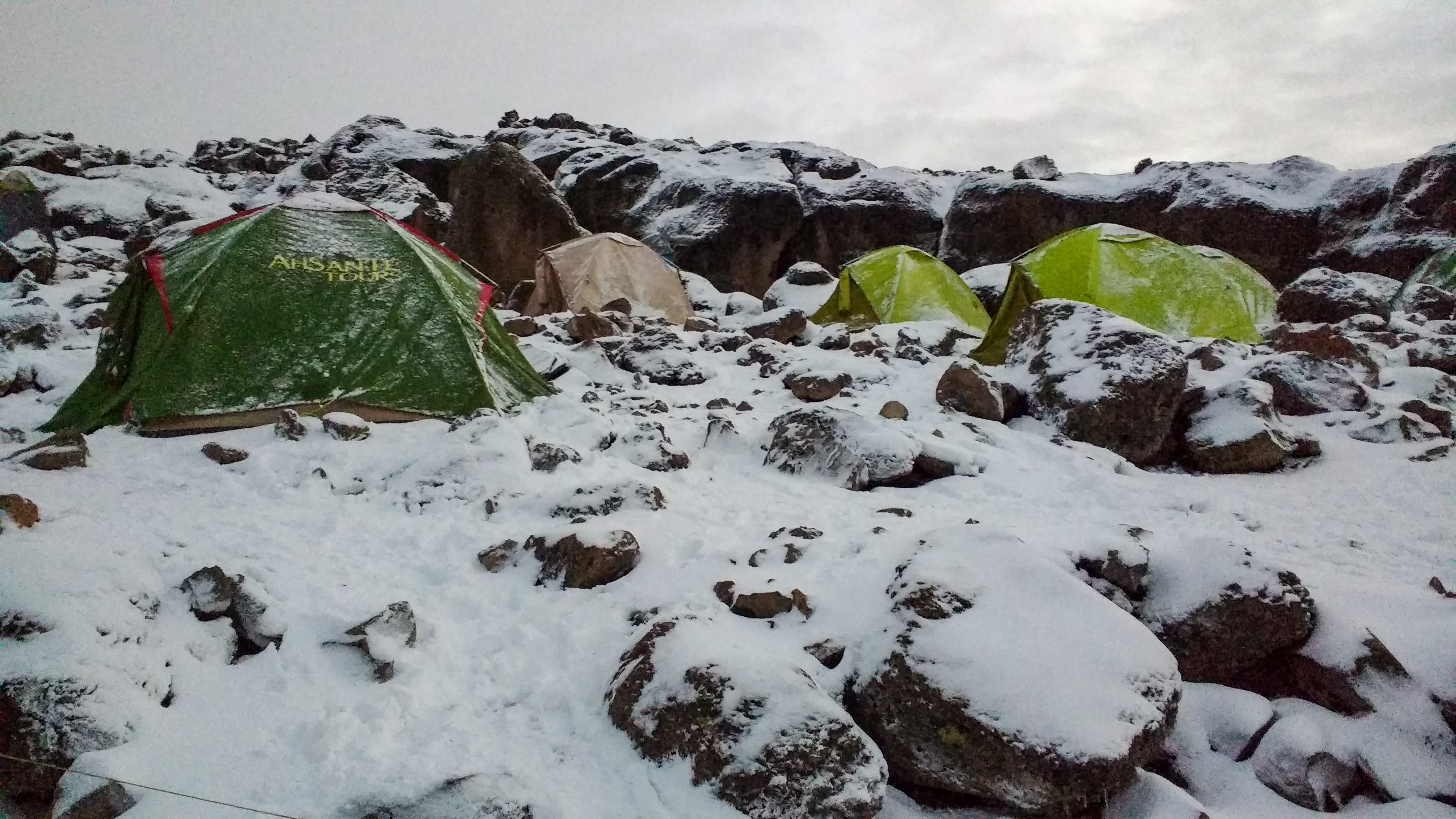
Barafu Camp sits at the base of Kibo Cone at around 4,673m, on a sparse, windswept slope. Even as I sat talking with Si, wind gusts punched into the tent, howling and rattling the door zips. The temperature here typically ranges between 4°C and -29°C, so high quality kit and a certain level of fitness are requirements. From here, it is a shuffling 6-7 hour hike, 1,255 metres to the top of Kibo Cone to Uhuru Peak – The Roof of Africa: the highest volcano outside of South America, and the top of the tallest free-standing mountain in the world.

“Up”

After a long, anxious afternoon rest, we were summoned from our tents at 10pm. Wearing every layer I’d brought with me, my pockets were stuffed with food and medication for easy access; phones and cameras buried deep in our layers to keep the batteries from freezing so we could get that long-awaited sunrise shot at Uhuru Peak. We congregated in the mess tent for our last supper – a massive plate of spaghetti – and made sure to fill our water containers. We followed our guides single file through Barafu Camp by head torch light, quiet anticipation buzzing through us. It had already begun to snow before we left camp, a light, gentle snow, and I sensed a subtle twinge of concern on Julio’s face. Maybe this bit was always stressful for the guides. Flashes of lightning from the clouds below us lit the snow pink and thunder rumbled around the mountain, and we grinned at one another through our face coverings. We trooped in a neat line through the darkness, a guide positioned between every second or third person – experienced pioneers of the mountain, who had become our friends – making sure nobody got left behind.

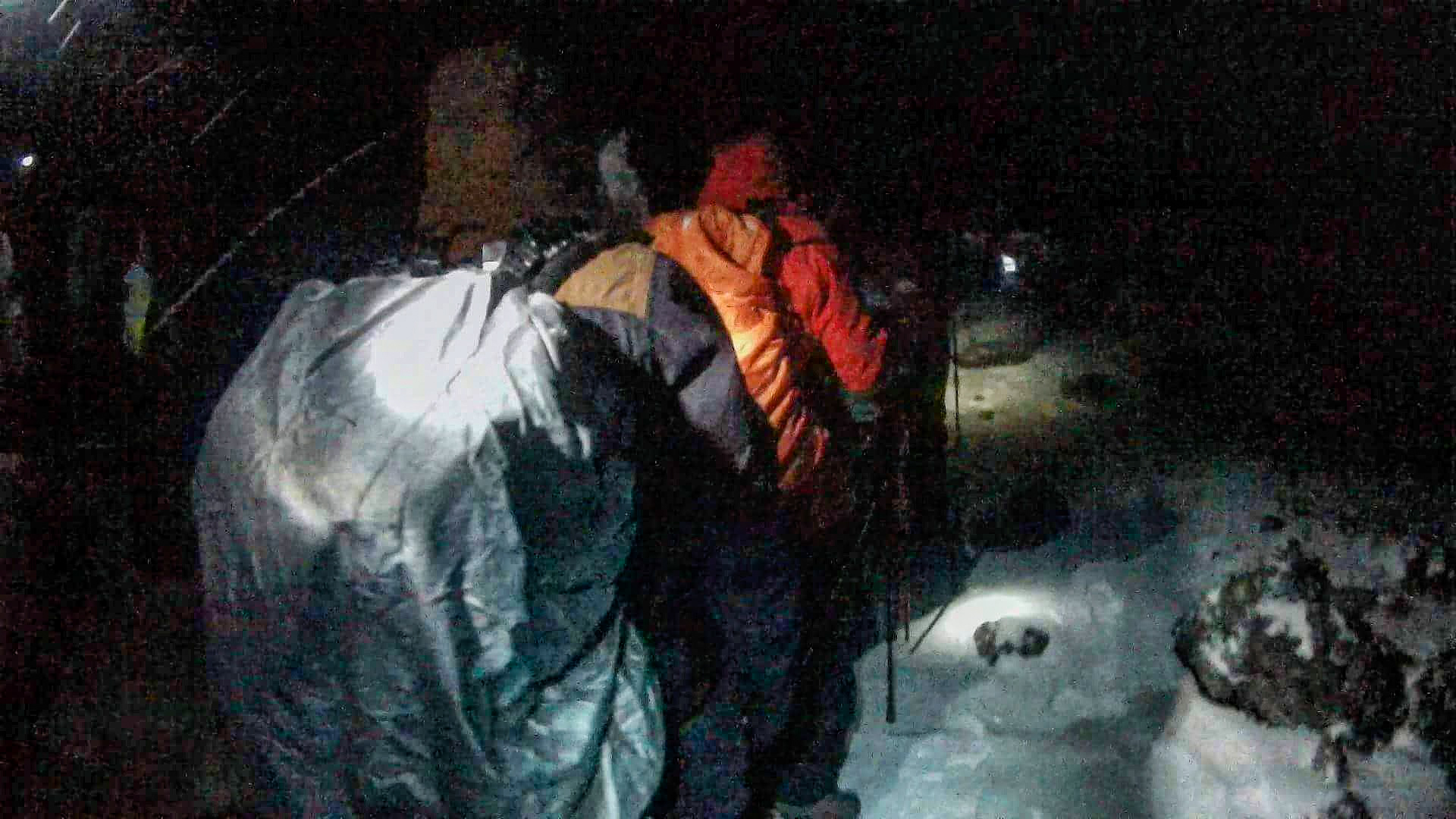
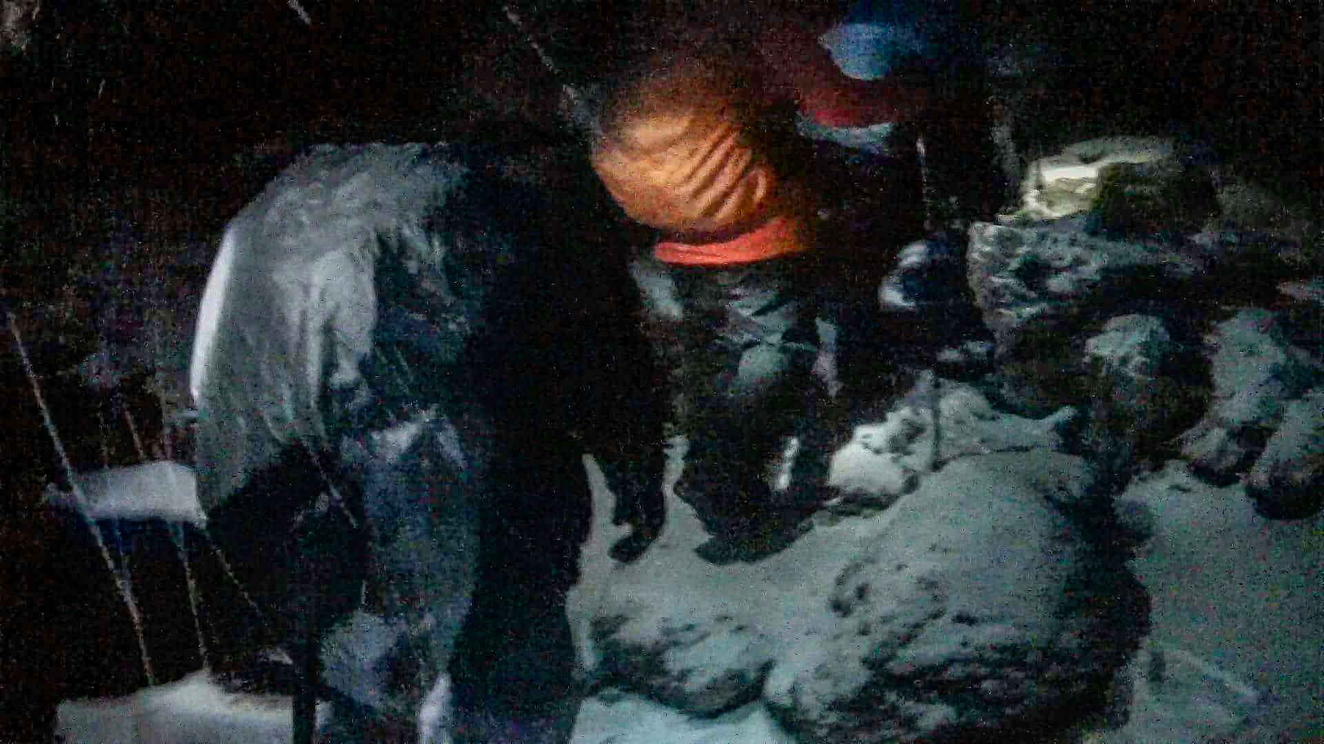
The snow was falling fast and thick now, coating the path ahead as we crossed into what is known as ‘The Arctic Zone’, so we were relying solely on the direction of the guides. Freezing wind whipped our faces while the lightning grew more frequent, shedding ultraviolet flashes on the snowy summit above, and thunder applauded loudly, echoing around the volcano cone. The whole group stopped in the shelter of a large rock, as the guides wanted to make sure we were all coherent, and taking in enough fluid and sustenance. But one of our group members wasn’t ok, acting delirious from altitude sickness, so Ian and Julio made the tough call to send him back to camp with another guide. We’d stopped for a moment too long and everyone was feeling the brutal cold as the wind grew stronger. Pushing forwards into the dead of night, the wind picked up more and more energy as we climbed closer to the summit. Snow was lashing down in sharp stones of ice, blowing sideways into our faces, fusing the fabric of our hats and face covers to our skin. Miniature icicles stuck to my eyelashes, and despite layers of thermal gloves, my fingertips were getting so cold they were painful. I had to stop to find a handwarmer – Julio helped me, rubbing my hands to get the blood flowing, but eventually we decided to just keep trekking on as we risked getting even colder by just standing there.

The weather was horrendous now. Snow somehow covered our tracks before our feet had left the ground. We couldn’t see, could barely breathe for the wind, and our faces stung. Si was close behind me, and Gemma was ahead, her poles skidding as the gale-force wind whipped the icy ground from beneath her feet. But we were determined! Heads down, one foot after another, all muttering little pep-talks under our breath, thinking about that first glimmer of sunrise.

We reached a change in the path and Julio halted us in our tracks, telling us to wait in the shelter of another big rock. We followed his orders, it was probably just another drink stop, or to let the rest of the group catch up, but he’d disappeared from our sight. Si, Gemma and I shivered, agreeing that we’d have to get moving soon or we’d freeze to death. As we stared up at the line of lights walking ahead of us, searching for Julio, our hearts dropped. The line of head torches were all facing us, coming back towards us. I froze, and Gemma and Si shared my silence. What did it mean? Julio re-appeared, gesturing for us to turn back.

“We have to go back. The storm is too bad; it’s too dangerous,” he was serious, rushing on to convey the message to the others. I couldn’t turn around. I simply watched as our team walked back past me in the wrong direction; I couldn’t make my feet move. We’d been walking for over four hours – just 600 metres to go! We couldn’t be quitting, not now!

“Down”

Everyone’s water had frozen hours ago. I saw people melting their eyelashes between their fingertips in order to see. My hat was literally frozen on to my forehead. I couldn’t feel my feet. But all of this felt numb compared to the feeling in my chest. I didn’t want to return to camp, not with just a few more hours to struggle through until we reached the top. It was in our grasp, so close, the closest we’ll ever be – we’d been walking for five days, what’s five hours more!? I wasn’t thinking rationally, and everything in my soul was fighting against what was happening, but my limbs just plodded on, numbly following the group back to camp, dragging my hiking poles behind me. I didn’t want to be alone, but at the same time I couldn’t talk to anyone. I placed myself behind Ben and Luke, and in front of Katie and Jack. No one spoke. A few of us shared glances of mutual disappointment. Luke was sobbing and Sophie quietly walked with him for a bit. Even our guides looked devastated – not for themselves, they do this frequently – but for us. They’d worked so hard to get our group this far, seen our relationships grow and our determination to reach the top. Now all they could see was our dream shattered across our faces. A year of hard work, training, fundraising and mentally preparing, convincing ourselves, ‘we can do this!’ Building a huge expectation and failing… it all came crashing down like an angry avalanche.

The path back down was very treacherous with the constant battling snow, and the never-ending stream of feet shuffling down made the path like an ice rink. Several people fell several times. Sophie slipped and just kept going as if she were on a slide, while a guide yelled ‘Polē Polē’ as she went shooting past him. She was ok, a bit bruised, but in a few days we’d be able to look back and find it hilarious. Not right now. Jack slipped behind me, unfortunately doing a number on his ankle, making it difficult for him to walk at all. Julio and all the other guides were incredible, running back and forth, asking individuals if they were OK, fashioning themselves into human railings, sometimes physically lifting us to a safer foot hold. Prof appeared behind me, I glanced at him and he was looking at me with concern. “You OK?” he asked. I shrugged, “Just sad,” I said. Prof just gave a little nod, took my hand and walked beside me for a little while, until he needed to help someone else.

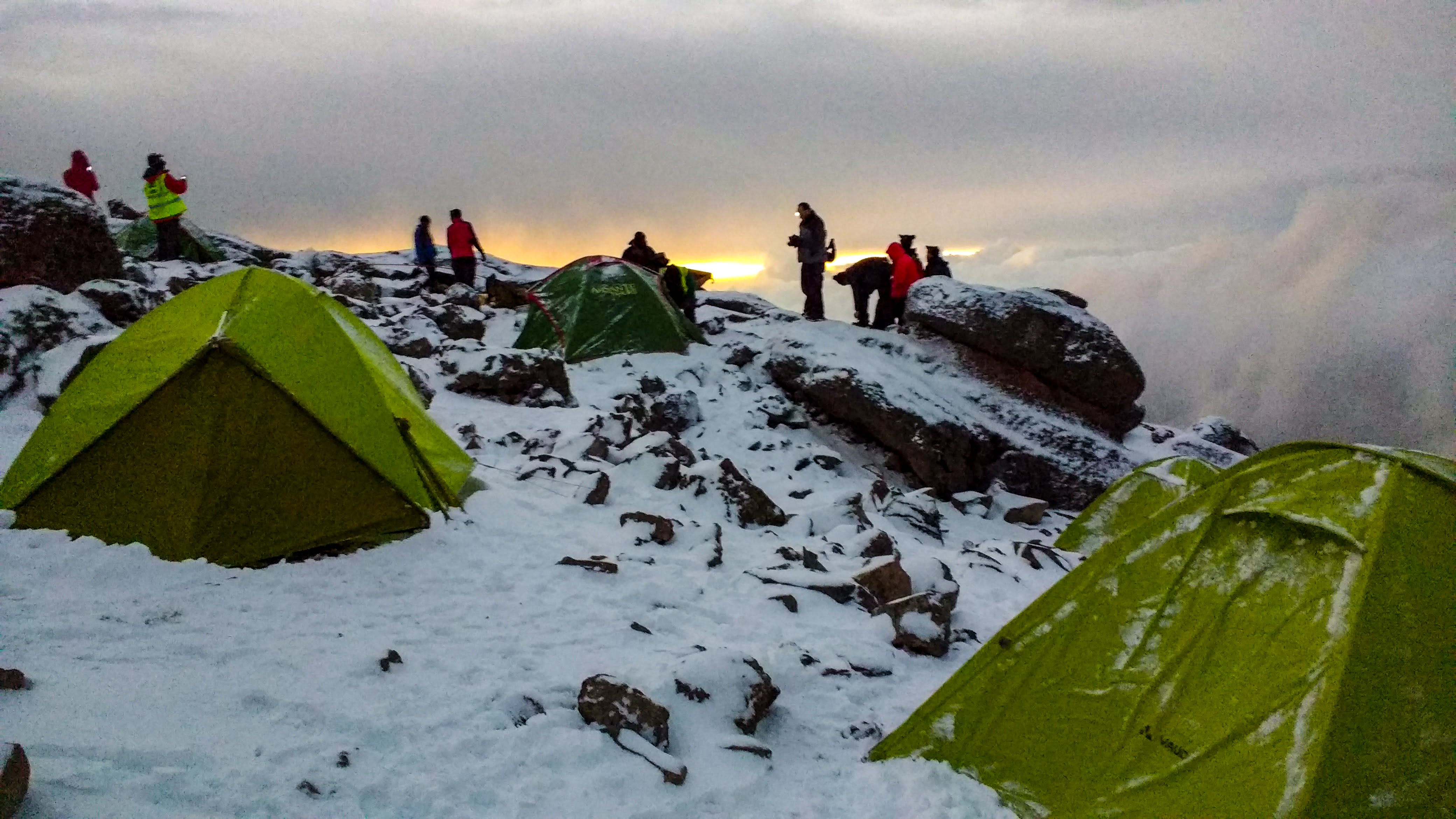
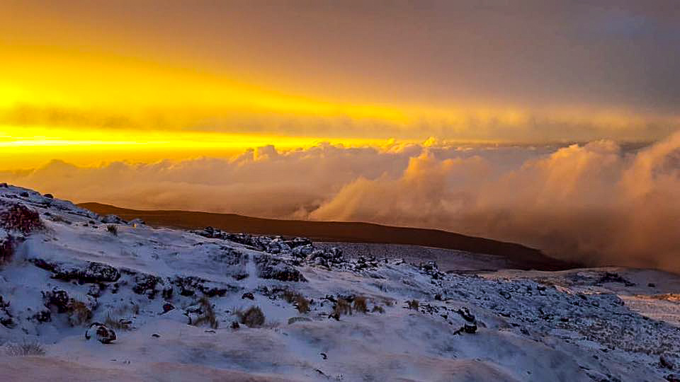
Tents gradually started to come into view as we made our way slowly into the higher reaches of Barafu Camp. The weather had subsided; it was no longer snowing down here and the wind only came in occasional gusts. We arrived at our camp at the time we should have been arriving at the summit, and all our Rafiki were applauding and cheering, which we didn’t want to hear. The sun was rising, dangerously orange through the lingering storm clouds. Some people stayed up to watch it, but for the first time in my life, it was the last thing I wanted to see.

Day Six – “An Emotional Rollercoaster”

Si appeared at the tent with instructions from Julio, to rest for an hour and regroup in the mess tent. I must have slept, for when I opened my eyes I felt that sense of impending doom, of reality falling back into my consciousness. It wasn’t a bad dream. It was quiet and I was alone – immediate negativity flooded me – they’re reattempting the summit and have left without me! But I snapped myself out of it, pulled on my damp shoes and went to the mess tent. There were only seven of the group there, all sitting extremely quietly. I edged in and found myself a seat, forcing myself to eat a piece of fried bread the cooks had somehow mustered up (we weren’t supposed to be there for breakfast.) Conversation was sparse, and tears were flowing around the group, catching on to the next person as we exchanged eye contact. Suddenly, Tim appeared in the entrance and said we have three options. None of them were to have another go, so I didn’t hear the rest. Everyone went to pack their bags and prepare for the descent down the mountain, but Si and I just sat there.

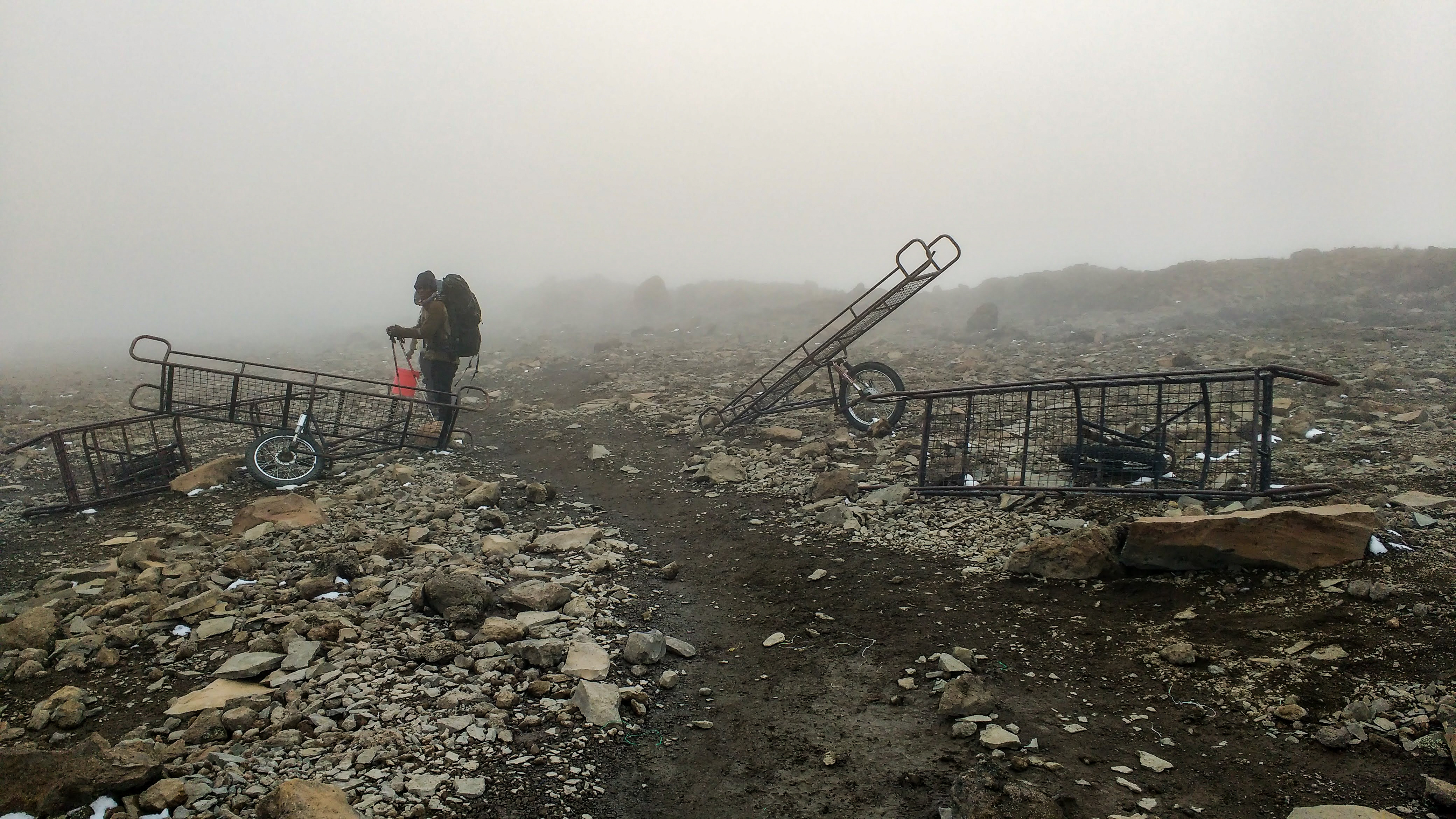
Julio sent some of our Rafiki to get a ‘mountain taxi’ or ‘Kilimobile’ for Jack, who was struggling to walk on his busted ankle. They returned with a big mesh wheelbarrow, like a metal stretcher with a bicycle wheel on the bottom! Wrapped in his sleeping bag, they laid Jack on the ‘Kilimobile’ and strapped him in, so just his smiling face was showing, and a small group of Rafiki grabbed all sides of the stretcher and wheeled him down the mountain. He was probably back at the lodge with a nice cold beer within half an hour!

Meanwhile, me and Si agreed that we really weren’t ready to pack it all in. I went back to my tent and started throwing things haphazardly into my bag, when Si appeared at the tent again. “If there’s any possible chance, would you want to try again?” he said, fire in his eyes. “Hell yes.” I responded without a second thought, and with a nod, Si disappeared again. I followed him back into the mess tent, where we sat down with Tim and Ian. Si made his pitch, raw with emotion, and they understood how important it was to us, but they were talking us out of it – there were too many complications. By this stage it would be near impossible to pull off. The guides and porters were doing a job, and they no doubt had to be back in time for their next tour, and if we took an extra day we’d have to pay for it too, which isn’t cheap. Not to mention the unprecedented snowstorm up there. This was just the harsh reality of nature.

“I had to ask,” Si kept saying as we packed our bags. I was ever so glad he did. At least we’d fought to try. As we could hear the group starting to leave outside, I rushed to put my shoes back on. Julio came to our tent, calling for us, “Yep, just coming!” I called, but he popped his head in and put his hand on my shoes to stop me. He told us he wanted to try anything to get us to the summit and told us to just wait a couple of minutes so he could check the options. He acknowledged that we were both strong enough and well acclimatized. Julio made a few calls on his radio and spoke to various people, suggesting we could join another tour group who were summiting today. We’d have to leave now, and we’d reach Uhuru Peak at 7pm, in the dark. Then we’d have to get all the way back down the mountain the following day. It was a lot, with no time for any more rest. I was exhausted, and Si looked it too, though adrenaline had us both wired. Julio got back on his radio to confirm, but the final answer came. “OK, I think we have to go down now,” he relayed to us, “they just told me there was a fatality up there, so we’ll go down.” That was the final decision. We didn’t argue with that. I’d been so hyper focused on completing the challenge, that I almost neglected to Respect The Mountain.

“Safe”

Julio led me and Si down at his quick pace, so we were able to catch the rest of the group within half an hour. We stopped at Millennium Camp for our last cooked lunch from the amazing chefs and continued the steep descent through the rainforest on the Mweka Route – the mountain’s shortest and steepest trail. Sunshine pouring through the rainforest (and potentially extreme fatigue) seemed to lift the world from our shoulders as we got closer to the bottom, and a few of us had already begun planning Kilimanjaro Challenge ‘Take Two,’ which made us feel better. At Mweka Camp, a medical car picked us up in shifts, taking us to a coach that would bring us back to the Weru Weru River Lodge.

Having descended a day early, we had an extra day at the Lodge, where we all got together and had a pool party in beautiful Lodge grounds! Together we reflected on the journey, marvelled at the guides and porters, and praised Ian and Tim for making very hard but necessary decisions for the safety of the entire group. Julio revealed that there hadn’t been a snowstorm like that on Kilimanjaro in many years, and it wasn’t normal for the season. We were all very thankful that we had each other, and that we came back as a team; grateful that we were all safe. It would have felt very wrong summitting without the rest of the group, and as we blew off some steam, I was able to appreciate what we had achieved. Later, the River Lodge threw us a celebration dinner in the garden, and we received certificates because we’d exceeded 5,200m elevation. Everyone was there, including our guides, and we all had a merry amount to drink!

In hindsight, the real challenge for me was the fear of not being able to complete it. I already don’t like building up other people’s expectations if I can’t fulfil them, which was my initial fear in the fundraising part of the challenge. Then I had to face that fear, and sit with it, which I had done everything in my control to avoid. Myself and a few others in the group always said we’d get together one day and try again, and that was a comforting prospect as we felt we had unfinished business! It has taken years, but I am finally content with my attempt. We might not have touched the frozen sign on top of Uhuru Peak, but we DID climb Kilimanjaro. We DID see the plains of Africa from above the clouds. We DID catch our breath at the highest altitudes we’ve ever stood. We DID hike into the Arctic Zone in an adverse snow storm in the middle of the night. We DID see the violent, pink lightning illuminating the clouds beneath us. We DID watch the sunrise from the highest volcanic cone in Africa. We DID witness the power of the Mountain, and we DID survive to tell the tale.

Maximum Respect!

If you enjoyed this blog, please share, & consider making a one-off donation to my ‘Buy Me A Coffee’ page, where you can also check out my art works inspired by my travels. Copy & paste the link below into your browser! And thank you for reading.

buymeacoffee.com/jaimiescapers: The Roof of Africa: Climbing Kilimanjaro

Sláinte, Dublin! 🍀

All you need for a couple of days in Ireland’s capital in March!

6–9 minutes

March is a popular time to visit Dublin, with St. Patrick’s Day drawing crowds from all over the world, but if you avoid March 17th and the Paddy’s Day weekend, you can score some pretty cheap deals and still witness the city in all its Paddy’s Day glory.

Packing Essentials:

  • A comfy jumper or two
  • Layers (with very changeable weather and central heating & pub fire places, you’ll be glad to be able to add or remove a layer on the go!)
  • Comfortable, waterproof shoes (don’t slip on Dublin’s old cobbled streets!)
  • Waterproof jacket (for when the drizzle kicks in!)
  • Sunglasses (March is spring time, and when the sun comes out it means business!)
  • Daytime backpack (to carry your haul of miniature whiskey bottles!)

Lunch & Shopping

The little Aer Lingus plane with its shamrock on the tail landed in Dublin just in time for lunch. A crowded bus took us from the airport into the city, where we alighted close to Temple Bar. We went in the first pub we saw – The Duke on Duke Street, and ordered the special – traditional lamb stew served with rye bread. It would be rude not to celebrate our arrival with a local Dublin brew, so a pint of Five Lamps ale was enjoyed beneath the St. Patrick’s Day decorations.

Duke Street leads out onto Grafton Street, Dublin’s pedestrianised shopping hub, where you can find your favourite international stores lining the bustling brick paving. Street artists and buskers fill the atmosphere, while the side streets lead off to vibrant bars, restaurants, and interesting venues including St. Anne’s Church of Ireland. We found a whiskey shop offering free tasters!

Where to Stay

I can highly recommend Staycity Aparthotel for comfort and convenience and reasonable prices. The hotel is walking distance from a multitude of pubs, restaurants and shops, and just across the river from Temple Bar. The studio rooms have self-catering facilities, perfect if you want to save some pennies on meals!

The Guinness Storehouse

Now we’re getting into the real reason you’re all here… let’s face it, everyone wants to know, does Guinness really taste better in Dublin? The Guinness Storehouse sees 1.5 million visitors per year, so it is definitely necessary to book ahead, and be prepared for crowds.

The walk to St. James’s Gate was interesting in itself, through narrow streets, lined with brick factory walls, second and third level walkways criss-crossing above us. It was like walking back in time through the Industrial Revolution. Little horses and jaunting cars stood in a line outside the Guinness Storehouse entrance, enticing tourists for a ride – €50 for half an hour!

Inside the Guinness Storehouse, levels and levels of escalators zigzag up an endless hollow building. We followed the line up to the first level of the sensory immersive museum, where we were funnelled through the early stages of beer production – growing the barley, extracting the finest spring water, etc. I found it artistic and sensory, though I struggled to take in all the information with the tide of humans flowing at a constant rate. There were things to open and touch and smell, replicas and giant mash-tuns you could walk into. Beyond this section, the Storehouse got a little more relaxed; the crowds dispersed a little as you could choose an experience, see the advertising history, or go to one of the restaurants on the fifth floor. As for me, I chose the Tasting Experience.

We waited in line for a few minutes, until the door opened and we were welcomed through a tunnel of mood sound and lighting and what I could only describe as the smell of vape flavours! The tunnel opened into a very bright white room with four matching white tubes coming out of the floor, steam rising from each of them. It felt very Willy Wonka! The four tubes represented four different flavours of Guinness ingredients. Into the next room, which resembled the foyer of a Royal abode, and we stood amongst bust statues and oil portraits to down a very tiny glass of Guinness. Sláinte!

A walk through the interesting history of advertising, with the famous Irish harp, a flock of toucans, a seal, a kangaroo, a whistling oyster and a cycling fish, it was time to make our way to the roof for a beer. The Gravity Bar boasts that it is 300 pints of Guinness tall, and it would take 2.5 million pints of Guinness to fill it! It is designed to look like a giant head of Guinness sitting atop the Storehouse, and offers 360° views of Dublin. This is where you come to taste your complimentary, perfect-pour pint of Guinness and find out if Dublin does it best. (The answer is obvious!)

It’s difficult to leave the Guinness Storehouse without visiting the enormous gift shop. I came away with a bottle of Porter, which turned out to be my favourite Guinness drink, and I wish I’d bought more than one!

Arran Quay

It’s not all about Guinness in Dublin. Coffee has popped off in the city and there are a number of excellent artisan cafes. My favourite was Copper & Straw in Arran Quay. Overlooking the 1800s flagstone quay on the river, we sat and enjoyed perfect barista-made coffee and a freshly baked croissant. This is literally around the corner from the Jameson Whiskey Distillery, where you can take a tour or just go check out the old factory building.

Dublin Castle

The castle in Dublin’s city centre is a little different to castles around the UK. It is hidden in the city rather than sitting guard on top of a hill, and its buildings are a mash-up of many different historical eras. The latter is because parts of the castle kept getting destroyed, and therefore there is only one original medieval turret remaining. Interestingly, Bram Stoker, the author of Dracula worked at Dublin Castle in the 1870s, and his first, lesser known publication was based on his time there. But it is thought that his time at the gothic castle also influenced his telling of Dracula.

National Museum of Ireland – Kildare Street

The National Museum on Kildare Street is free to roam around at your own pace. Set inside a grand Victorian Palladian building, this particular museum focuses on Irish archaeology through the ages. From gold hoards found in swamps, to graphic artefacts from medieval Catholic Ireland, there was even a Viking exhibition while I was there.

Temple Bar

We paused for lunch at KC Peaches – a Dublin chain of fresh food eateries, before walking back through the old town to Temple Bar. Temple Bar is a bustling, riverside neighbourhood, famous for its ‘good craic’, traditional pubs and array of live folk music. These pedestrianised streets can become very crowded, especially at beer-drinking o’clock, which – it comes as no surprise – is all day! Through alleyways lined with neon ‘Guinness’ signs, and down curving cobbled streets, past old pubs and the famous statue of Molly Malone and on to the very popular Temple Bar Pub. Probably the most touristic pub in Ireland, The Temple Bar Pub was smothered in massive shamrocks, and had a loud yet inviting ruckus blaring out of it! We went inside and found some empty bar stools next to some giant green Celtic God heads. A man was playing guitar and singing classic sing-alongs in the small bar, and we sat with a Guinness and soaked up the atmosphere.

Ireland’s Oldest Pub

The Brazen Head, est. 1198, is undoubtedly old and very atmospheric. We were early and lucky enough to get a table inside for dinner, and the food was traditional and impeccable. It isn’t cheap, but for the full atmosphere it was worth it. Timber beams hold up the small, dark inn, with a fireplace in the wall, and a tiny, ancient bar with every beer and whiskey you can imagine behind it. The walls are smothered in foreign money, photos, signatures and memories, and if you manage to get in later in the evening, they promise live music every night.

A short walk back to Temple Bar to continue our walking tour of pubs! We stopped in The Porterhouse Brew Pub, a tap room for their own range of beers and ales, where a Fiddle Trio were jamming at a table in the window! Next we followed the sound of live music into Fitzsimons Pub, world famous for its non-stop entertainment! We sat along the bar and enjoyed proper folk music with Irish bagpipes. The night was topped off with a sip of Distillery Edition Jameson’s – because “when in Rome.”

A good way to conquer the day after the night before is to try out Supermac’s – Ireland’s own competitor for McDonalds. We found one at Dublin Heuston Train Station and it hit the spot.

Te Waipounamu ~ A Winter Road Trip

15–23 minutes

15 nights on New Zealand’s South Island, travelling to some of my favourite parts of the World for the first time since Lockdown.

Te Waipounamu is South Island’s official name; ‘wai’ meaning ‘waters,’ and ‘pounamu’ meaning ‘greenstone.’

We drove around 2,000km in 14 days!
(Click for more info whenever you see this little black arrow.)

The original plan was to drive all the way up the West Coast to Nelson, but devastating floods took out most of the roads during the start of our trip, so we had to make a last minute detour through Arthur’s Pass.

Budget

Our overall budget in New Zealand Dollars was around $5,800 between two of us.
To save money, I pre-booked all our accommodation and transport, and got early bird ski passes.

  • Interislander Ferry – Flexible Return for 2 adults: $256 NZD
  • Omega Car Rental, Picton – 14 days: $773 NZD
  • Accommodation for 15 nights (through Booking.com): $1,778 NZD
  • Cardrona & Treble Cone Ski Resorts – x2 Earlybird Multiday Passes for 4 days: $680 NZD

We spent around $290 on petrol, which left us with around $2,000 for general supplies. This went mostly on food and drink, which was definitely the most expensive part of our trip.

Starting in Wellington, we caught the Interislander ferry to Picton – a 3.5 hour crossing in good weather – arriving late in the evening. We stayed overnight, collecting our hire car from Picton Omega the following morning, and made our way to Kaikōura.

Kaikōura

Who doesn’t love a good seaside town? Where a storm is always imminent; the ceaseless rush of the Pacific Ocean gently fills your ears, gulls call distantly on the wind, and with the snow-capped mountains hugging its perimeter, you can always expect the unexpected in Kaikōura. Kai means food and kōura means crayfish, and you can find plenty of places in and around the area serving up this classic NZ dish.

Fur Seal Colony

We took an afternoon walk along the Kaikōura Peninsula Walkway, (11.7km – allow a generous 3 hours) which climbs up over the headland, past lush pastures full of cows, with panoramic views of the Kaikōura coast and mountains, and a bird’s eye view of hundreds of fur seals scattered below the cliff.

The walkway loops back down the cliff and along the beach, back towards the carpark. It’s recommended you keep 20 metres away from the fur seals, and watch where you step! The path took us through some long grass at the top of the beach, and before I knew it I had an enormous fur seal at my knees, roaring at me tremendously. I gave it lots of space, and by the time my heart had started beating again, it laid back down and we were able to give it a wide birth!

There were hundreds of fur seals sprawled all over the rocks, up the beach, in the grass, and on the path! (We made sure to find a safe route around them, because you really don’t want to get yourself cornered by these beasts!) We witnessed a couple of large males having a fight; thrashing their heads around and letting out rumbling roars. During the winter months (May-September) you can see seals with their pups all along the rocky peninsula.

South Bay is another pretty reserve to explore on the south side of the Kaikōura peninsula. Stunning views across the bay lead your eyes up to the mountains, and there’s plenty of wildlife to be seen. You can follow the boardwalk across the coastline; there were shags nesting noisily in the trees, and the setting sun cast a lovely orange glow on the sea.

Accommodation: Sierra Beachfront Motel <$100 NZD – 1 night
Food & Drink: The Pier (pub/restaurant), The Whaler Bar & Restaurant (Local seafood, pub food, beer), Bee Box (Coffee)
Drive Time: Picton – Kaikōura: 2 hours

Lake Tekapo

A long drive south with the sun peeping between rain clouds over the earthquake-broken landscape. As we veered inland the sky turned black and heavy rain lashed the windscreen while we wound our way up the treacherous mountain pass towards Mackenzie Country. Set amidst the mountain wilderness, Lake Tekapo was wet and murky, low cloud shrouded the lake; a veil concealing the spectacular backdrop. We strolled down to The Good Shepherd Church – a pretty, little stone building by the lake, where stacks of silver stones and sepia tussocks surround the brilliant turquoise lake front.

Church of The Good Shepherd

Lake Tekapo’s brilliant turquoise colour comes from rock minerals ground up in glaciers, which are deposited in the surrounding rivers and lakes when the glaciers melt and move. This is why most of the South Island’s lakes and rivers have such stunning water.

Lake Tekapo is famous for its night-sky. The small township’s proximity to the mountains (and not much else) means it has zero light pollution, bringing tourists from all over the World to look at the milky way. So, of course, it rained the night I brought my partner here, after telling him about it for so many years! But mountain weather like this brings its own atmosphere and mysterious beauty. It was still night at 5am when the rain stopped, so we wrapped ourselves up and ventured down to the lake. The cloud had lifted, revealing the wintery mountains that frame Lake Tekapo, but a cold mist still lingered across the sky, covering the stars. The moon glared through, its halo lighting up the snow on the mountains as they slowly turned purple, and we sat on the cold rocks with a hot coffee waiting for it to get light.

Accommodation: Lake Tekapo Cottages <$120 NZD – 1 night
Food & Drink: Ramen Tekapo (Japanese ramen), Doughboys Bakery (early morning coffee), Greedy Cow Cafe (brunch)
Drive Time: Kaikōura – Lake Tekapo: 5.5 hours

Aoraki

A bright sky led us South through Mackenzie Country to Lake Pukaki, and I thoroughly enjoyed driving this leg. The open road in the early morning; jagged touches of snow between icy lakes and streams – New Zealand was beginning to show us the Winter Wonderland it could be. The road to Aoraki (Mt Cook) skirts the Western edge of Lake Pukaki, and Aotearoa’s tallest mountain rises up over the lake before you as you approach. There is a small community at the end of the road, and a tourist information centre about as big as the village, complete with an Edmund Hillary exhibition (it’s no surprise that one of the first people to summit Everest grew up with this as his back yard.)

Scenic flights are an option to see this iconic landscape, along with things like heli-skiing and mountain climbing, but hiking (or ‘tramping’ as they say in NZ) is the most popular activity (and it’s free!) There are at least 12 hikes in the national park, ranging from 10 mins to 3 days. We chose two short hikes; one in each section to get the most out of our time.

You can download the Department of Conservation walking track guide here > https://www.doc.govt.nz/parks-and-recreation/places-to-go/canterbury/places/aoraki-mount-cook-national-park

Kea Point – Village Section

Gently ascending through Alpine scrubland around the foothills, the path opens out into a 180 degree viewing platform over The Hooker Valley. The light was flat and glaring, but at least the clouds were high enough to see the mountain peaks. Mueller Glacier and Mt Sefton stand across the milky hues of the Glacier Lake, while Aoraki (Mt Cook) looms in the background.
Walking Time: 50 mins return from White Horse Hill Campground.

Blue Lakes & Tasman Glacier – Tasman Valley Section

A rocky staircase winds up the moraine wall, revealing an other-worldly panorama at the top. Haupapa Glacier encroaches from the mountains into its lake, where blue-dipped icebergs drift. Back to the South, the Tasman River meanders through the valley where it eventually fills Lake Pukaki.

On the return walk, we stopped to admire the contrasting reflections in the Blue Lakes, nestled between snow peaks.

The Blue Lakes are actually green since the freezing glacial water no longer feeds them, due to shrinking glaciers. This has made the water warmer, and allowed green algae to grow. Despite this, the Department of Conservation still deem the pools safe to swim in during summer.

Walking Time: 30 mins return from Blue Lakes Carpark.

(Click on any photo to enlarge.)

Drive Time: Lake Tekapo – Aoraki: 1 hour 15 mins

Wānaka

When I came to Wānaka to live many years ago, I described the season as a ‘crisp, colourful winter, in which every sunset paints the lake a different story.’ I vividly remember the smell of wood smoke from the chimneys beneath dark snow clouds, and the stacks of firewood under the coloured lights in Post Office Lane. Well none of that has changed, and coming back to visit always makes part of me feel like I’m home.

We used Wānaka as a base for snowboarding, visiting the nearby towns, and of course taking in the local sights. There are several stunning hikes around Wānaka and Mt Aspiring National Park, but we didn’t have the hiking gear for winter, so we stuck to the more local walks.

Mount Iron

The local exercise hill, Mt Iron, is a fairly short but steep walk. The sun had the warmth of spring on its breath as we climbed and we were soon in our T-shirts, quads burning by the time we reached the top. The spectacular view across the town and the lake stole the fresh mountain air from our lungs.

Waterfall Creek Track

A gorgeous flat walk around Lake Wānaka, which takes you along side the pebbly waterfront, and past the tapering vines of Rippon Vineyard. This walk provides good views of Ruby Island, and of course, the Wānaka Tree – thanks to instagram, this tree in the lake is famous, and nowadays it attracts many tourists aiming for that perfect shot.

Beacon Point

One evening we headed to Beacon Point for sunset. It was freezing, but the view of Mt Aspiring National Park across the lake was perfect under the setting sun.

Around Town

We spent hours wandering around the little town, window shopping for local crafts and stopping in bars and pubs for refreshment. All the while that stunning lake is right there, tempting your eyes for a glance, and every time you look it seems to get more beautiful. There is so much variety of food, drink, fashion and gifts in Wānaka, there’s something for everyone.

The cost of living is generally high in NZ, and eating out can get expensive. Wānaka’s supermarkets may be some of the more expensive in the country, but it’s a cheaper alternative. We found that New World does takeaway style meals for two – much better than your average ready meal – and all you need in your accommodation is a microwave. We also utilised their bakery section for quick on-the-go lunches.

It’s worth mentioning the impact of the pandemic on the hospitality sector. Every food & drink venue was either fully booked or closed due to staffing. The hospitality staff were holding on by their fingertips, battling understaffing, and the isolation restrictions in place at the time. There were signs in windows screaming out for employees, or asking for your patience because they simply didn’t have enough staff. Unfortunately due to rent inflation, travellers were less likely to take these seasonal jobs because there was nowhere affordable to live, which is an ongoing issue globally.

Accommodation: Private Studio on Kings <$1,190 NZD – 8 nights
Food & Drink: Water Bar (Pub food), La La Land (Cocktails), Curbside Coffee & Bagels (Coffee cabin), Kai Whakapai (All day cafe/bar), Big Fig (All day cafe, hearty home style food), Patagonia (chocolate shop – best chilli hot chocolate), Burrito Craft (Mexican food trailer), Wanaka Beerworks (Brewery)
Drive Time: Aoraki – Wānaka: 2 hours 20 mins

Cardrona & Treble Cone

Cardrona and Treble Cone are two separate ski fields, both about a 40 minute drive from Wānaka, who have teamed up so you can use their lift passes at both locations. Cardrona is located on the Crown Range road and is a great, family friendly ski resort for all abilities, though it is notoriously busy these days. Cardrona is an old haunt for me, and we got treated to a nostalgic ‘Cardie’s’ sunrise on my return.

After a big day of sliding around in the early spring snow, we paid a visit to Cardrona’s old gold mining village at the bottom of the mountain, and the beautiful Cardrona Hotel, where the atmosphere was pumping and Après Ski beers were flowing.

Treble Cone is located in the Aspiring National Park, and has the most stunning views across Lake Wānaka. The terrain is steeper than Cardrona and is better for more experienced skiers and snowboarders. They used to say Treble Cone was the locals’ mountain, and it still felt that way for the most part. The staff seemed more ‘at home’ here, and while the skiing was more serious, the whole place had an heir of casual familiarity, like walking into your local pub.

Arrowtown

Over the Crown Range Pass, about 20 minutes from Queenstown, is a pretty little gold mining town from the 1860s – Arrowtown. The Crown Range road is an adventure in itself, winding through the mountain peaks before weaving down the opposite side with valley views on every hairpin bend.

We arrived in Arrowtown mid-morning and the little colonial high street lined with gold shops was already bustling. We walked around the Chinese village – where some of the first migrant miners lived, finishing with a stroll along the river, before making our way onwards to Queenstown.

Drive Time: Wānaka – Arrowtown: 1 hour

Queenstown

The place to be during NZ winter. The air is crisp, the pubs have their log burners crackling, and the line outside Fergburger is 3 miles long. Queenstown is an easy day trip from Wānaka (mountain road conditions providing) and it’s the adventure hub of New Zealand. There are a lot of tourist attractions and thrill seeker activities in this part of the world, with information and booking centres dotted all over town. However, we were quite content with just soaking up the atmosphere. We watched the old steamboat, the T.S.S Earnslaw, chug back and forth across Lake Whakatipu; admired The Remarkables (the impressive mountain range,) trod the boardwalks and browsed the abundance of bars and souvenir shops until the sun disappeared and turned the whole town pink and sparkly.

Food & Drink: Fergburger (quality burger bar,) The World Bar (pub,) Whakatipu Brewing (Tap room.)
Drive Time: Wānaka – Queenstown: 1 hour 15 mins

Mount Aspiring National Park – Haast Pass

Leaving Wānaka for the West Coast, we drove alongside the neighbouring Lake Hāwea, and up the ridge between the two lakes into Mt Aspiring National Park. Passing through the tiny community of Makarora at the top of Lake Wānaka, we came to The Blue Pools Track – a beautiful short walk, and a popular swimming destination in the summer. We crossed the suspension bridges over the glacial river that gushes down from the Mt Aspiring Range through a forest-covered gorge, gently pooling before pouring its magical, clear blue water into Lake Wānaka.
Walking Time: 1 hour return

Continuing to the Otago / West Coast border, we drove through the Haast Pass, where the driving views become more and more like Jurassic Park. There are view points and short walks dotted all along the Pass, each one as beautiful as the next, so it’s worth giving yourself plenty of time. You’re completely in the back country wilderness here, so bring a picnic!

West Coast

We finally reached Haast, where the river meets the wild ocean. Beautifully desolate beaches sit at the foot of the ever changing mountains, home to nothing but sandflies, and the West Coast road winds through a variety of landscapes with more viewpoints along the way.

Fox Glacier

Finally, we reached our destination for the night – Weheka (Fox Glacier village.) I don’t know if it was the time of year, or the time of the week, but we felt like the only people in the village – the road there had been pretty deserted too, which is unusual. But with the place to ourselves, and a few hours of daylight left, we went exploring.

Fox Glacier – traditionally ‘Te Moeka o Tuawe,’ can be glimpsed from the village all the way to the coast. The glacier streaks down the western valley between Aoraki (Mt Cook) and Mt Tasman, ending 250m above sea level in the lush rainforest of Westland’s Tai Poutini National Park.

Gillespies Beach

11km down a narrow, unsealed road, which curves and twists and bumps through the forest of Westland Tai Poutini National Park, is Gillespies Beach. A Department of Conservation Campsite sits at the end of the road, leading over the grass and to the ocean. Stones smoothed by the sea lay scattered all over the black sand between driftwood logs and sturdy tufts of Flax, and through the sea spray you can see Fox Glacier shimmering between the peaks behind the beach.

Lake Matheson

On the way back to Weheka village from Gillespies Beach, we visited Lake Matheson. It is a small lake by Queenstown and Wānaka standards, but with an impressive view. We walked the complete circuit around the lake as the sun set, making it very dark in the ferny rainforest that surrounds it, but the changing colours reflected in the water off the snowy peaks were breath taking. Endangered Kiwis live in this forest, so as it grew dark we listened out for their high pitched trill in the trees.
Walking Time: 1 hour 30 mins

Accommodation: Sunset Motel <$83 NZD – 1 night
Driving Time: Wānaka – Fox Glacier: 3.5 hours

Franz Josef Glacier

The following morning, we continued our journey up the West Coast, stopping at Franz Josef Glacier, traditionally ‘Ka Roimata o Hine Hukatere.’ I found it interesting to visit this glacier and compare the photos from my previous visits; it’s an eye-opener just how quickly the glaciers are shrinking.

Arthur’s Pass

As if the mountains so far hadn’t been dramatic enough, we ventured inland to Arthur’s Pass. The road climbs, getting gradually more extreme as you scale the sheer ledges, suspended in the mountains by some feat of engineering. This mountain wilderness is home to Kea – the alpine parrots endemic to New Zealand’s South Island. These cheeky fellas are very curious and tactile, and if you stop too long they may peel the rubber seals off your car windows just for fun! We encountered a pair with their baby fledgling at the Otira Viaduct Lookout, where I was lucky enough to capture their beautiful feathers in flight. (Click on the images below.)

Devil’s Punchbowl Falls

This short walk crosses the river from Arthur’s Pass Village, and climbs through beech forest to a viewpoint at the foot of the waterfall. All the way we could hear the rushing force of water crashing down the mountainside, and feel the cool spray clinging to our skin.

Walking Time: 1 hour return

Kura Tawhiti / Castle Hill

Rolling plains expand into the foothills below the mountains, covered in limestone rock formations. This is an official ‘tōpuni’ site; a symbolic cloak of protection to the local Māori, and has always been a significant meeting place. Nowadays Kura Tawhiti attracts rock climbers and walkers to admire the strange land.
Walking Time: 20 mins

Just the drive itself through the mountain pass is stunning, but there are many side tracks, hikes and ski resorts to explore along the way if you have time. Morning mist slithered through the valleys, plunging the road into darkness every so often, a great contrast to the brilliant blue sky reflected in the river.

Accommodation: Mountain House YHA < $95 NZD – 1 night
Food & Drink: Bealey Hotel (Pub,) Arthur’s Pass Store (Cafe / general store)
Drive Time: Fox Glacier – Arthur’s Pass Village: 3.5 hours

Picton

As the road descended into the Canterbury flats, and the snow-capped mountain peaks grew smaller in the wing mirrors, I couldn’t help but feel a little sad. There’s a certain magic in the mountains of Te Waipounamu that I crave, but Spring was officially in the air and a change of scenery was waiting for us in the Marlborough Sounds.

We drove back up the east coast, via Kaikōura for a night, and were greeted with warm sunshine at Picton – the gateway between North and South Island. It was like two different worlds, a day apart, going from the cold blues of bleak mountain wilderness to the sub-tropical greens of the Sounds and their beaches. This is why I love New Zealand!

Snout Track

The carpark for the Snout Track is situated on Victoria Domain Road, and is in itself, a viewpoint. The walk took us along the ridge of the peninsula that encases Waikawa Bay, with gorgeous views of the Marlborough Sounds and islands. We walked through the sub-tropical rainforest, fantails following our trail as we stirred up mosquitoes, all the way down to the tip of ‘The Snout.,’ where the blue sea lapped at the rocks while large sea birds soared above.

Walking Time: 2 hours 15 mins

The Marlborough region is famous for its wine, so while in the area, it would be rude not to try some! In the morning, we watched the Interislander ferry come in on the shimmering Sounds, before boarding back to Wellington.

Accommodation: Atlantis Backpackers < $90 NZD – 1 night
Food & Drink: Cortado (Pizza restaurant,) Le Café (café,)
Drive Time: Arthur’s Pass – Kaikōura: 4 hours. Kaikōura – Picton: 2 hours

Layover in Singapore

2015 – I’d spent the last two years travelling and making a wonderful life in New Zealand, but sadly my working holiday visa was coming to its ultimate end, and it was time to head back to Europe (back when we Brits could call Europe our home). The best flight I could find had a 2 night layover in Singapore. I was nervous – I didn’t know anything about Asia, but I soon realised I had nothing to fear. The city is very convenient for a short stopover, and because people from all the surrounding countries unite here, Singapore is the perfect place for first time travellers to dip their toes in a multitude of Asian cultures.   

Flying with Singapore Airlines

My experience began in the taxi-to-take-off on the tarmac of Auckland International Airport. Singapore Airlines were classes above any of my previous experience with budget airlines. They truly live up to their highly professional reputation, and the cabin crew were masters at concealing their distaste towards “yet another sweaty traveller”. Each procedure was a well-rehearsed routine, performed with silver-screen smiles.

There was turbulence over the Java Sea, terrible, shaking, dropping turbulence that made the passengers gasp and grab their seats. I exchanged glances with the young Indian girl sat next to me as we both went to clutch the same armrest, and we burst into a fit of nervous giggles, identifying the mutual flame of fear in each other’s eyes.   

I lifted the shutter on the reinforced porthole window, and through the glare of brilliant white light bouncing off the 747’s gargantuan wing, my eyes adjusted onto the glistening shipping lanes of Singapore below. A connect-the-dots of white boats, scattered on the vast swirling sea, just visible through the chalky haze.

Journey to Bussorah Street

Arriving in the hustle and bustle of a new city can be overwhelming, but getting around is made pretty simple in Singapore. I hopped on the Mass Rapid Transit (MRT) straight from the airport. The MRT is a similar concept to the London Underground, with 4 different lines that will take you anywhere you need to go in the city. This ran between 6am and midnight and was far less expensive than the tube!

There are MRT maps in the carriages and at most stations, and each stop is announced in 4 languages (usually all at the same time!) English is the official language of the city, although you will equally see or hear Malay, Mandarin and Tamil, as these languages constitute the 3 main cultures of the city.

From the word go, it was evident that locals were friendly and happy to help. The moment I stepped out of Bugis station into the open air, a man asked if I needed any help. He pointed me in the right direction of my hostel and I thanked him. Then, as I waited to cross the busy street, a man zooming past on his fold up scooter shouted, “Thank you, my darling!” I continued to walk through quieter streets, until I came to a lit arch, leading to a beautiful mosque. I could already hear the dull babble of Kampong Glam nightlife, and followed the glow of light to Bussorah Street.

Bussorah Street

A pretty, pedestrianised street, fronted by the spectacular Sultan Mosque; tall, green palm trees rise up either side, while below, bars and restaurants thrive, spilling onto the paving in chatter and laughter. Right there amongst it all was the Sleepy Kiwi Backpackers, its own tables and chairs outside, scattered with happy travellers enjoying a beer and a laugh. (In my recent research, I found this backpackers is permanently closed, but there are plenty of hostels dotted around the city.)

A Night in Singapore

It’s 28 degrees at night, and the city has no breeze. The hostel lacks carpets and exterior doors, and even windows, but they’re luxuries that are certainly not missed! You raise the bamboo blind in the communal bathroom, to find a large, window-framed hole in the wall. The showers are little wet-rooms through pretty, mosaicked archways, and the wooden shutters in the dorm open straight out onto the street, pigeon spikes lining the ledge. Every dorm has a ceiling fan, which may sound daft in a place that has no glass in its windows, but it is all in the aid of keeping cool.

Inside the Hostel

 5 am. The sky shows no relief from night, and the air outside is still and silent. I am awoken suddenly by songs from the mosque before dawn. Haunting and poignant, the Islamic call echoes through the darkness, calling local Muslims to prayer. The night is filled with a voice of incredible compassion that resonates an ache for peace, for just a few minutes, before resuming dark silence.

Outside the Hostel

The Sultan Mosque is a fine work of architecture, not to mention the sacred role it plays in the heart of Singapore’s Muslim community.

Sultan Mosque

When dawn finally broke, the streets were alive with birds, hopping from building to building, and singing in strange and exotic tones. I went downstairs for the all inclusive breakfast – a buffet of fresh dragon fruit, watermelon, juicy orange, and sweet green jam on toast! Tea, coffee and milo were also made on request, and I sat outside to enjoy it.

I met two of the girls in my dorm – Karen and Fan, who were on holiday from Taiwan, hoping to enjoy a beach day on Sentosa (Singapore’s get-away island) and shopping at Orchard Road. They were sweet, curious girls, eager to practise their English.

There is plenty to see in Singapore, and more than enough guides and friendly people to point you in the right direction, but I was lucky enough to have a couple of friends I’d met on my travels, who had agreed to show me around.

Lunch at Marina Bay

I met my friend Tze in the train station at around 11, and we went downtown to Marina Bay where he treated me to some delicious Chinese cuisine in one of the enormous shopping malls. We had sliced duck in pastry, “drunken” chicken, and steamed pork dumplings, refreshing our pallets with ginger and chamomile tea.

After lunch, we took a stroll along the river to the Gardens in the Bay, where we stared up at the “Super Trees” – amazing metal structures, entwined with plants and flowers, up to 50 metres high. Tze told me that the artificial trees are not just there to look good, but are actually solar panelled and at the time supplied 20% of the city’s power.

Super Trees / Marina Bay Sands

Looming over the gardens like a zeppelin, (or a giant silver sausage on a fork) is Marina Bay Sands – the world’s second most expensive building in 2015. With 57 floors, this extravagant hotel is 194 metres high, and a room would have cost anything between 500 and 5,000 Singapore dollars per night! One of the building’s many features, is its Infinity Pool – a swimming pool located on the roof, which gives the illusion of just dropping off the edge.

Singapore Dam / Singapore City Skyline

At the end of the river walkway is the Pump House, from which we got a splendid view of the dam, the shipping lanes, and the city skyline behind. You can see everything from the Super Trees to the Singapore Flyer – a 165metre high observation wheel, inspired by the London Eye.

The Merlion

Feeling refreshed by the sea air, it was time to head back towards the CBD for some proper tourism! The 8.6m tall Merlion stands proudly on the edge of the harbour at Merlion Park, spewing 20,000 litres of sea water into the harbour per hour. It was the era of selfie sticks, and everyone wants a selfie with the Merlion, as it’s Singapore’s icon.

Merlion

The Merlion represents Singapore in many ways; there are a few vague links to Indian folklore, but Tze’s explanation was that Singapore is a gateway to the ocean, and surrounding countries, and so a creature that is half king of land, half king of sea, represents unity. The island is not divided by the sea, but instead connected by it. It is also said that the fish’s body symbolises the origins of a fishing village, Temasek, and the lion’s head symbolises the original name ‘Singapura’ – ‘Lion City’ in Sanskrit.

Beer on Boat Quay

We made our way back around the marina, past the only ‘floating’ Louis Vuitton outlet in the world, and walked around to Boat Quay for a much needed beer. Bartering is not uncommon in Singapore; every seller is out to offer you the ‘best’ deal, and every buyer is out to find the best price. We walked along Boat Quay, bar after bar, in the shells of old Chinese merchant Godowns. There was a string of riverside marquees all laid up with silver service and decorated with red cloths and orange lanterns, on a backdrop of little water taxis going back and forth along the river. Tze finally found a bargain he was happy with, and we sat beside the river and enjoyed a Chang beer.

Boat Quay

Train Hopping

We spent the afternoon train hopping through the city districts. One of the most colourful parts of Singapore that I saw was Little India.

Little India

Here is where you’ll find one of Singapore’s oldest Hindu temples – Sri Veeramakaliamman – try saying that after a few bottles of Chang! The temple is a visual treat as you approach, a cornucopia of Hindu Gods and Goddesses peering down from the colourful tiers of the roof. Tourists can enter the temple, but must practice the same respect as worshippers, removing all footwear and washing your feet before going inside. Every inch of the interior is dedicated to a shrine, representations of Gods on every wall. Worshippers chant and pray, seemingly unaware of the tourists encroaching on their beloved sacred place.

Sri Veeramakaliamman Hindu Temple

Next we explored China Town, walking through the bustling markets, little laughing Buddha trinkets and wooden bracelets as far as the eye could see.

It was a stifling, muggy afternoon, and at the China Town gate, Tze bought us a little ice cream sandwich each from a street vendor to cool us down.

Buddha Tooth Relic Temple, China Town

Dinner in the City

As darkness settled above the city, the markets and food stalls of Bugis started to come to life. I met another friend, Boon, who took me to a Japanese restaurant for dinner. He was quite the connoisseur, and had so many recommendations, so I let him order for me. The dish he ordered was called ‘Summer’, and was a beautiful ramen, rich with spices and topped with nori. Boon also ordered a bowl of hardboiled eggs for the table, completely over estimating my appetite! One of the cool things about this restaurant was the pestle and mortar on the table to grind our own fusion of spices to taste.

‘Summer’ Ramen

After dinner, we went into one of the great shopping halls to a Kopi tiam – coffee shop. Boon explained the cultural significance of this style of coffee, and that everyone from all ethnicities orders in the Chinese Hokkien dialect. Now, perhaps it was my training as a barista in New Zealand that peaked my interest, or the fact that it was practically a Singaporean tradition, but this was a definite highlight.

Kopi & Teh

He ordered a ‘kopi’ for me, a ‘teh’ for himself, some kaya toast, (a crisp, sugary toast, with a layer of the yummy green jam I’d had at breakfast, which is made from coconut milk, eggs and sugar,) and some soft boiled egg, (because apparently we hadn’t had enough egg already!) They prepared it all before us, and laid it on a tray for us to take to one of the communal benches. The kopi was thick; filtered from jug to jug, and poured over condensed milk, sugar and soya milk, with water poured on top. It was dark, rich and syrupy, I’d never tasted anything like it, and it was well complimented by the crisp, sweetness of the kaya toast. Having since been to Vietnam, I can liken the taste to Vietnamese coffee, but it isn’t the same. Singaporean ‘Kopi’ is unique in its roasting process: a glaze of sugar is added to the beans, giving it that caramelised sweetness. It is highly caffeinated, and dangerously sugary, so despite being a traditional drink, it’s not recommended for frequent consumption.

The Ideal Layover

Singapore is conveniently situated between Oceania and Europe, making it a common layover spot for long haul flights. In 2015, I found the city so accessible, with a wide variety of food choices, plenty of nearby places to visit, and unless you’re visiting to shop the designer outlets, it wasn’t overly expensive.

Lantau Island – Hong Kong

Po Lin Monastery

Hong Kong’s largest island is Lantau. This is where Hong Kong International Airport is situated, along with Disney Land, plenty of beaches, national parks, and traditional fishing towns. The island is a popular summer holiday escape, but remains a tourist hotspot even in the middle of winter, as I discovered! While staying in Hong Kong in December 2018, our host, Cecilia took us for a day trip to Lantau Island. We left Kowloon City early in the morning commencing our 3 hour journey, via hydrofoil and bus, to the Po Lin Monastery and Tian Tan Buddha in the heart of Lantau Island. This giant bronze Buddha is one of the biggest in the world, and sits on an enormous lotus flower plinth atop the mountains, seen for miles around. I could see it from the bus as we wound through the mountains, glimpses of beaches in the distance between curls of mist that floated in from the sea. By the time we arrived at the Big Buddha, a thick fog had plunged the mountain into grey soup. At the gate, street-wise cows wandered around, perusing the available snacks and terrorising picnics!

Lantau Cow at the Entrance Gate

With the Big Buddha entirely obscured by fog, we went to check out the temple. Wisps of incense rose up into the white sky, where mountain peaks made ghostly appearances through the mist. The beautiful architecture of the 1920s Buddhist buildings splashed colour onto the bleakness, dragons carved into the stonework roaring silently. There was peacefulness in the fragrant air, despite the number of visitors.

Po Lin (Precious Lotus Zen Temple)

Inside the Po Lin Monastery there is a vegetarian restaurant where you can eat like a Buddhist monk. The dishes are classic Chinese meals, however, in contrast to the meals we’d had in the city (see ‘Flavours of Hong Kong’ blog) Buddhist monks eat modestly, therefore they don’t use any kind of flavours like garlic, chilli or ginger, or spices that may be regarded as rich or frivolous. That said, the lunch was deliciously simple!

Buddhist Lunch at Po Lin Monastery Restaurant:
Vegetable spring rolls, Shiitake mushrooms, tofu roll pancakes with lemon & honey, glazed vegetables, and steamed white rice. There was also a fortune cookie each for good luck!

Content with lunch, Cecilia showed us the “Ngong Ping 360”, a 5.7km long cable car system, which is usually an ideal way to view Lantau Island and all its shore lines, mountain peaks and landmarks. We stood at the Ngong Ping Terminal, watching the gondolas launch off into the cloud, disappearing into nothingness – it wasn’t the day for it!

Tian Tan Buddha

Admitting defeat by the weather, we decided to just go up to the Big Buddha anyway. We climbed the 268 stone steps to the invisible Buddha, and entered beneath the giant Lotus plinth. Inside is a mausoleum, which was unexpected, and families have paid huge sums of money to join the waiting list to be brought here after they die. Cecilia told us the mausoleum was almost full, so the remaining spots were in high demand. There is also a museum of Buddhist artefacts, including the Buddhist Bone Relic, which brings worshippers from far and wide.

When we stepped back outside onto the platform beneath the Big Buddha, the fog had cleared, revealing moody views all around! Lantau Peak rose up, touching the clouds beside the Big Buddha.

Po Lin Monastery down the 268 steps / Lantau Peak behind Buddhist statue

We ran down to the platform below to finally catch a clear glimpse of the Tian Tan Buddha in all his glory.

Tian Tan Buddha – completed in 1993

Tai O Fishing Village

A 30 minute bus ride from the Po Lin Monastery brought us to the West coast of Lantau Island, to a traditional fishing village – Tai O. This is an island in itself, and once you get off the bus, you walk up to the inlet, which is full of tourist boats that, for a fee, will take you out to spot the native pink dolphins. Walking over the pedestrian bridge onto the island and into the narrow streets is like going back in time to some ancient village. Shops line these streets; seafood stores, fishing stores, whole food stores, local fast food stores, everything sea related. Dried Puffer fish and sharks hang from the windows, while mini aquariums display the catch of the day. Grills and deep fryers are constantly on the go outside shop fronts, ready for you to taste some fresh, local seafood.

Streets of Tai O

We came to the edge of the village, where the streets meet the sea, and the old residencies stretch out over the water on wood & bamboo stilts. Nicknamed the Venice of Hong Kong, a pier maze of wooden walkways lead across the water, old houses, fisheries and restaurants clinging to the edges, all weathered by the sea. Instead of driveways or garages, the houses have their little boats suspended from winches outside, ready to be lowered into the water whenever they need to leave. Many of these buildings were in ruins due the adverse weather conditions of this extreme location. A year prior to our visit, Super Typhoon Hato (August 2017) had destroyed much of Tai O’s stilt village, and sadly, modern lifestyle meant that it was more cost efficient and practical to simply move away, rather than try to rebuild in such a temperamental place. Still, that which remains represents the traditional nature of Tai O fishing village, and maintains its weathered charm.

Tai O Traditional Fishing Village

Keep Reading….

Tongariro Alpine Crossing – New Zealand

This is it – the iconic view of the Tongariro Crossing. Three emerald and blue lakes stand out from the grey, volcanic rock, regardless of the weather. Curls of steam rise from the rock all around, that rich, boiled egg smell filling your nostrils.

Osaka – A Taste of Japan

A pair of hands appeared through the hole, and took my ticket and preference card! Shortly, a pair of hands appeared again, presenting a large bowl of aromatic ramen. Rich, creamy tonkotsu broth, filled with noodles and sliced pork, beautifully spiced.

Kyoto – Sakura Season Highlights

~ Kyoto – a little history ~ Kyoto was once the Imperial capital city of Japan, for a thousand years, until 1869 when the Imperial court was transferred to Tokyo. The city suffered extensively from the Onin war in the mid 1400s, and wasn’t restored fully until the 1700s – the Edo era – when…

Flavours of Hong Kong

It was December, 2018, and Hong Kong was chilly and damp. I saw the city as a futuristic London; the British colonisation influenced the double decker buses, and fusions of architecture, old and new, crammed together in narrow streets teaming with diverse culture, but the double decker trams, and wide highways cutting through the skyscrapers, more lights than Piccadilly Circus, made it like London 2.0. Of course, Hong Kong certainly has its own identity, with its idyllic location, surrounded by sea and mountains; it is stunning to look at from a distance. But when you’re in the heart of it all, dwarfed by buildings, traffic noise filling your head while you try to navigate the 7.4 million people around you, it’s the glowing lanterns of restaurants and food stands, and the rich smells of Chinese cooking that remind you where you are, warming your cockles in the cold December chaos.

Breakfast

We were hosted by a friend, Cecilia, who lived in a typical tiny flat in Kowloon City. The first meal of our visit was brunch, so Cecilia took us to a small cafe around the corner from her place to try Hong Kong style breakfast.

Congee – a Chinese porridge made with white rice. We tried it with and without beef, (I preferred it without) it was fairly bland and savoury, unlike Western oat porridge. We also tried Cheung Fun – Cantonese steamed rice noodle rolls, with seafood or pork, and on the side we had some egg rolls and stir fried noodles. It was a heavy breakfast for me, and Cecilia admitted that she would usually have fruit and toast, and save this kind of breakfast for special occasions!

Symphony of Lights

A short ferry ride across to Hong Kong Island brings you into the shopping district and tourism hub. We rode the double decker tram around the city, which was all lit up and filled with crowds. Christmas was in the air, and once again I was reminded of the dark, winter afternoons in London, Christmas shopping in Oxford Street. It was on Hong Kong Island that Cecilia introduced us to a sweet treat from a roadside food stand – Put Chai Ko.

Put Chai Ko is a traditional Cantonese desert, popular in Hong Kong. A starchy rice pudding with sweet red beans, it is sugary and creamy with the texture of soft Turkish Delight.

Every evening after sunset, Hong Kong Island puts on a musical light display, which you can view from across the water, at the Tsim Sha Tsui Waterfront. Thousands of people flock here every evening to see the Symphony of Lights, and it’s free to watch, so it’s a great way to end a big day of maxing out your credit card in the shopping district!

Symphony of Lights

To top the evening off, Cecilia took us to a Taiwanese Craft Pub where we met a friend of her’s. Hong Kong’s multi-cultural history means that it’s taken the best bits from its influences over the years, and the pub scene is roaring. There are many craft beer pubs and tap rooms scattered all over Hong Kong, and there is such a diverse amount of different beers from different places, it’s hard to be disappointed. I was too busy ordering tasting paddles with every beer on the menu to take any photos!

Lunch

Cecilia wanted to show us an authentic food hall for lunch, where groups of people go for casual banquet style dining. This can be a business lunch, or just an outing with family or friends, where dishes are shared around the table, rather than ordering a meal per person.

We had some classic steamed shrimp Dim Sum, crispy, crumbly taro nests, and of course Cecilia had to get us a Millennium Egg to try! The egg isn’t really 1000 years old, but it can take weeks to months to complete the curing process. It came with plenty of pickled ginger, which helps disguise the strong flavour of the egg, which had turned to salty jelly. Millennium Eggs are safe to eat, and surprisingly, don’t taste too bad! We finished with something scrumptious – fluffy steamed custard buns.

Millennium Egg / Shrimp Dim Sum / Taro Nests / Steamed Custard Buns

Victoria Peak

If there is one thing I could say is a ‘must do’ in Hong Kong, it would be to climb Victoria Peak. There are so many national parks in Hong Kong to explore, that it can become overwhelming trying to figure out the best way to use a short amount of time. So, go simple! Victoria Peak is easily accessible, and is probably one of the most trodden paths in Hong Kong. At 552m, it’s Hong Kong Island’s highest hill, and the views at the top are a beautiful showcase of the contrasting landscapes.

As you climb the paved footpath of the ‘circular walk’ you get glimpses through the bushes unveiling views on either side. Victoria Harbour towers up from below and the mainland districts frame the mountains beyond, while country parks and oceans on the other side give you two totally different views.

Sunset is a popular and busy time to go up Victoria Peak, but as the sun sets the ocean on fire in one direction, the skies and mountains over the city are painted with ever changing pastels, reflected in the shining buildings, and as the colours fade the lights come on.

I was surprised to find a tower at the top of the peak, with a cafe inside, open ’til late, and a bus and tram station underneath! Public transport was welcoming, now the sun had set and taken all its warmth with it, but the queue was insane. Once we made our way back down to the city on a busy bus, (which took twice as long as walking) we’d built up quite the appetite.

Dinner

Cecilia took us to a Szechuan restaurant for dinner. Szechuan cuisine is popular due to its bold flavours, with liberal use of garlic and chilli, which is warming when you’re cold, tired and hungry. We had a slow roasted duck and rice claypot, with Chinese kale and fried noodle crackers on the side. During my time in Asia, claypots turned out to be some of my favourite dishes, old fashioned and wholesome with varying spices. The meal was served with real Chrysanthemum tea, which was beautiful and florally refreshing.

Noodle Crackers / Duck Claypot / Chrysanthemum Tea

Herbal tea is drunk regularly in Chinese culture, as an accompaniment with meals, for general health, or a pick-me-up when you’re feeling run down. Chinese tea shops are all around the city, usually a stand or window with various cauldrons filled with steaming herbal teas lined up on display. You can choose your tea according to your ailments, or simply by flavour, and they either serve it in a little plastic bowl for you to drink there, or in a takeaway cup. Cecilia took us to one of these windows, and we tasted a medicinal tea for general colds & hangovers.

Night Cap

An evening in Hong Kong wasn’t complete without a trip to the local supermarket to pick out a beer to take back to Cecilia’s. The supermarkets are similar to British supermarkets, in that you can purchase alcohol from them, and the range is quite extensive. I chose to try a TsingTao Stout, which is a classic dark beer with bold flavours, and the next night I got a Hong Kong Amber Ale, which was delightfully malty. It was the perfect end to the day, before falling asleep to the subtle city sounds in the streets below.

Chinese Beers

Tongariro Alpine Crossing – New Zealand

The Tongariro Crossing had been on my bucket list for about 6 years, and finally, in January 2019, my opportunity arrived. Friends of mine, Simon & Mike, two brothers from back home, happened to be visiting New Zealand while I was staying with family there, and so we decided to take on the crossing together. According to my Strava app (which may or may not be accurate) it is about 14 miles (22km), with an elevation gain of about 2,762ft (850m), and crosses between 3 of New Zealand’s iconic active volcanoes. It is recommended that you fully plan the journey, with plenty of water, snacks, sun protection, good hiking shoes with support, and layers of clothing. Always check the weather, as whatever the weather is doing at ground level, it changes fast and will be at least 5 degrees colder at the crater.

A January Day, 2019

5:30am – Summer Bellbirds ‘pinged’ outside the Turangi motel, on the south side of Lake Taupo, as my hiking buddies and I awoke to make bacon sarnies. After breakfast, we packed up the car and set off beneath the grapefruit sky to Ketetahi Long Stay Car park, about half an hour’s drive from Turangi.

7:00am – We boarded the shuttle bus from Ketetahi Long Stay Car Park to Mangatepopo Hut – the opposite side of Tongariro National Park, to the start of the Tongariro Crossing.

^Prep & Conditions Board at the start of the track, Mangatepopo^

7:30am – 5°c, clear, light winds – As the sun hid behind the mountains before us, we checked all our gear, stretched our legs and used the facilities. We began hiking, gently climbing the grassy hillside, the sun making its glaring appearance over the crest and quickly raising the temperature to T-shirt weather. Through the sulphurous pumice fields, we hiked, where white daisies sprout from the rough, black earth.

^Pumice Fields^

The path led onto a boardwalk, which crossed the silty plains of strange moss, framed by dark, jagged rock. Mount Ngauruhoe – known for portraying Mt. Doom in Lord of the Rings – loomed over the pathway, puffs of mist unfurling from its craters, casting its long, morning shadow over the landscape.

^Mount Ngauruhoe – the youngest & most active vent in the area – last erupted in 1977^

We began to climb; rock and man-made steps paving the lung-squashing incline. As we did, a panoramic view of the vast national park stretched out behind us.

^Tongariro National Park looking West^

Suddenly we were level and a giant plateau of sandy rock appeared before us, surrounded by an uneven black rim. We followed the trickle of hikers across the plateau, at the foot of impressive Ngauruhoe, and began to scale the lip on the other side.

^View back across the plateau & Mt. Ngauruhoe^

A fast, thick fog was moving over the summit, so we paused on the steep side of the lip for lunch. The air quickly became cool and dark, and it wasn’t long before we, and fellow hikers around us, had donned thermal jackets.

^The skiddy ascent to Red Crater / Mound of lucky stone stacks at the summit^

The route up is a treacherous combination of loose scree and sand, on both sides of the summit of Tongariro’s Red Crater, making footing impossible, and you have to kind of cross country ski your way over. At the top, a huge mound of rocks and pebbles marks the summit, built over the years by each hiker adding a stone. You feel like you’re on the edge of the world, especially when you can’t see through the dense fog!

^The Red Crater, formed around 3000 yrs ago, coloured due to oxidised iron in the rock – last erupted 1926, but Tongariro has many craters, some of which last erupted in 2012^

Skidding down the other side, the fog began to break, revealing the dramatic Red Crater. Clouds rushed over the landscape, thinning more and more until the brilliant Emerald Lakes shone through, patchy sunlight glistening on their surface.

^Emerald Lakes, Tongariro^

This is it – the iconic view of the Tongariro Crossing. The national park is a stretch of green, far and wide, all the way to the horizon where it meets the blue, fluffy clouded sky. Mountains drop down to hills, rainforests, rivers and vast plains. On the edge of the foreground three emerald and blue lakes stand out from the grey, volcanic rock, regardless of the weather. Curls of steam rise from the rock all around, that rich, boiled egg smell filling your nostrils.

^Emerald Lake, Tongariro^
^Emerald & Blue Lakes, Tongariro^
^Descent from the Red Crater / Steam rising from volcanic rock^

We continued across the next plain, looking back on the three iconic volcanoes lined up like a postcard; Tongariro – jagged and broken at the forefront, Ngauruhoe – the perfect volcano shape in the centre, and snowy Ruapehu peeping out from behind.

^Trio of Volcanoes – Ruapehu, Ngauruhoe, and Tongariro^

The walk down to Ketetahi is a neverending zig-zag, through bushland and rock, which never seems to get closer to the end. Lake Taupo shines on the horizon below, before the path eventually drops into rainforest, and quickly descends down wooden steps, joining a cascading river down to Ketetahi.

^Descent to Ketetahi^

2:00pm – 13°c, sunny – Once we reached the Ketetahi end of the Tongariro Crossing, it was another 20min walk along the dusty road to the Long Stay Carpark. The hike back to the car felt long, but far from disappointing! The landscape is marvellous, and there’s plenty of nature to see; we were three satisfied & very happy hikers. Our moving time was about 5 hours, all the photo stops and snack breaks made it much longer, but why rush through an experience like that?

^Reaching the end of the crossing at Ketetahi^

Our Tongariro adventure ended at the car park, where the car wouldn’t start, and the next adventure began – getting home!

^View across Lake Taupo to Tongariro National Park, from Taupo^

Kyoto – Sakura Season Highlights

~ Kyoto – a little history ~

Kyoto was once the Imperial capital city of Japan, for a thousand years, until 1869 when the Imperial court was transferred to Tokyo. The city suffered extensively from the Onin war in the mid 1400s, and wasn’t restored fully until the 1700s – the Edo era – when it flourished as one of Japan’s 3 major cities, along with Edo (now known as Tokyo) and Osaka.

Nowadays, Kyoto is famous for its Buddhist temples, Imperial palaces, Shinto shrines, Geisha culture, and its beautiful sakura spots in spring.

My experience of Kyoto and the nearby prefectures was broken up into hectic pieces, linked together by the inexpensive train network of the Kansai region. Every day was an adventure of finding the next resting place for the night. It was a unique and spectacular way of seeing the region, if not utterly exhausting, but there was always an ideal little camping spot at the end of the road eventually, which made the hard work worthwhile, and meant I got to explore places I would never have seen otherwise!

On the nights I actually stayed in the city, I used Air BnB, which proved very useful and great value for money.

Kyoto put out all the stops while I was there, and I was incredibly lucky to catch the city in its prime, with fantastic weather, at the height of sakura season.

~ Sakura Festival ~

Sakura is the Japanese name for cherry blossom, and Japan is obsessed with it! To the extent of flavouring their chocolate and candy with it, decorating their beer cans with cherry blossom, and having an annual festival, nation wide, dedicated to the dainty blossom. From around March, the weather forecast will include a cherry blossom forecast, and people flock from all over the world just to see the trees in bloom. With this, accommodation becomes high in demand, prices go up, and the public transport becomes very busy, so be prepared and book early!

Why? – The cherry blossom season symbolises the Buddhist concept of mono no aware – ‘the pathos of all things’, and celebrates the constant changing of everything, appreciating its fleeting beauty. There is a humble sadness in this concept, as it is meant to remind us that all beautiful things are passing, much like life itself.

~ Cycling through Sakura ~

On the first full day in Kyoto, Mic and I hired bicycles. Cycling is a simple and popular way of getting around the city, and there are cycle hire shops dotted around everywhere. We cycled beneath warm blue skies, towards the Kamo River, which runs north to south through the centre of the city. Busy footpaths follow either side of the river, lined with cherry blossoms, where men and women posed for photographs beneath the trees in their unique kimonos.

PhotoGrid_1531171578959.jpg

Crossing the river along one of its many busy bridges, we found a popular ‘sakura spot’ – located on Google Maps – an area where the blossoms are at their peak. Every corner you turn, you come across another cluster of pink canopy, with soft flurries falling down like snowflakes, and girls in beautiful kimonos everywhere.

PhotoGrid_1531171647135.jpg

Hiring bikes is usually a really efficient way of getting around the city and seeing the sights, (and a great excuse to indulge in the street foods without feeling guilty!) However, the deeper we got into the city, the harder it was to manoeuvre. The streets were so busy, with cars and pedestrians fighting for space, that even pushing our bicycles was near enough impossible. We finally reasoned with locking our bikes up and going to find lunch on foot.

PhotoGrid_1531171995943.jpg

Kamo River

~ Tofu ~

Yumi, a friend and colleague I met in Hakuba, is originally from Kyoto, and she advised that I must try a tofu dish while in Kyoto, as the city is locally known for its variety of tofu specialities. We found a tiny but busy restaurant just across from Gion Corner, and sure enough, it had a special tofu dish: ‘Mapo Tofu’ – a salty tofu soup, with chicken and gyoza on the side.

PhotoGrid_1531171078254.jpg

Mapo Tofu

~ Hanami in Mariyama Park ~

Following a dense crowd up the stone steps of the impressive entrance gate to Yasaka Shrine, we went into the gardens of Mariyama Park. Yasaka Shrine stands bold in the main courtyard, hordes of people gather around to ring the giant bell and pray, while the stage covered with hundreds of lanterns makes a wonderful photo opportunity.

PhotoGrid_1531172037149.jpg

Yasaka Shrine stage

A network of walkways lead through all manner of plant life, but most importantly, cherry blossom. Mariyama Park is a popular Hanami spot at this time of year, and the whole park was decorated with lanterns and picnic areas. Hanami means flower viewing, and this is associated with spending hours beneath the cherry blossom, feasting and drinking sake.

PhotoGrid_1531171728000.jpg

Lunch beneath the Sakura

Throughout the park, food stalls thrived in the sunshine, serving up traditional Japanese street food, from takoyaki, to crab sticks; okonomiyaki to mochi; and many sweet treats like fruit dipped in chocolate and sprinkles.

PhotoGrid_1531172085988.jpg

Hanami in Mariyama Park

~ Gion Corner ~

Retrieving our bikes, we cycled up to nearby Gion Corner, also known as Geisha Corner. This is a unique theatre, in which you can see seven traditional arts of the Geisha, including dance, comedy and music. You can also experience a genuine tea ceremony, and learn about the etiquette. The Yasaka Hall and surrounding buildings, is where the Maiko (Geisha in training) stay and learn to become a Geiko (Full Geisha), and the area surrounding the Yasaka Hall is quite closed off to the public for their safety and privacy.

PhotoGrid_1531172126811.jpg

Gion Corner

~ Imperial Gardens ~

The sky was pumping out sunshine, and we spent the afternoon cycling along the river, appreciating the colour and the cherry blossoms, coming to rest on its grassy banks to soak up the sun and watch the birds of prey swoop and dive over the water. On the way back through the city, we passed the Imperial Palace and its famous gardens. The palace was home to the Emperor and his family, until 1868 when he moved to Tokyo Imperial Palace.

The Imperial gardens are open to the public throughout the day, and the broad gravel paths stretch through vast lawns and tree groves. Most locals use the gardens as a serene shortcut through the city, and though at first it does appear to be nothing but a gravel path through a fairly plain park, don’t knock it too quickly! As we cycled around, wheels spinning out in the thick gravel, we began to notice hidden gems in the trees: little footpaths sneaking off between the bushes. Tiny water gardens with birds and ducks frollicking, and pretty little shrines in the woodland, so well hidden you would never guess they were there.

PhotoGrid_1531516161482.jpg

Shrine to Shinto God of Music, Imperial Gardens, Kyoto

~ Coffee & Curry ~

After a long and exhausting bike ride along the busy city streets, we deposited our bikes back at the hire shop, and followed a blackboard sign for coffee and curry into an alley way, lined with beautiful plants. The tiny homemade curry restaurant at the end of the alley was called Asipai, and was teamed up with Hibi Coffee, and together they made a truly unique and delicious dining experience to end our first busy day in Kyoto.

PhotoGrid_1531514832833.jpg

Hibi Flat White

~ Nijo Castle ~

By sheer coincidence, a very good friend from home happened to be visiting Kyoto with her parents at the time I was there, and so with both of us cramming a lot of touristing in to a short amount of time, I suggested we meet at Nijo Castle in the morning. This was on recommendation from ANOTHER friend from home, who’d been to the castle a few weeks before and said it was his favourite sight in the city. (Thank you, Simon, it was a great suggestion!)

There was quite a queue for the ticket booth on the street outside the castle entrance, but in true, organised Japanese fashion, the queue moved very quickly. Tickets were 600yen – £4 / $5US – which is ridiculously good value, when you consider you’d have to pay between £10 and £20 to visit any English Heritage castle! AND you get a nice little paper ticket to keep, with a picture of the castle on it, perfect for sticking in your travel journal! The simple things.

My friend, Abi, met us at the gates, and after doing all the hugging, jumping, giggling things girls do when they meet after a long period of time, we crossed the draw bridge into the castle grounds, pulling faces at the hordes of Koi in the moat below as we went.

The vast gardens are spread with ponds and trickling waterfalls, beautiful plants, and of course, thriving sakura. We breathed in the spring sunshine, catching up on lost time, and having a few ‘extended family’ photos beneath the cherry blossom.

PhotoGrid_1531172179618.jpg

Nijo Castle Gardens

The castle was built in 1679, and its large, wooden Keep was struck by lightning and burned down in 1750. A viewing platform stands in its place, overlooking the palace, and the surrounding gardens and moat.

PhotoGrid_1531172213904.jpg

View of Ninomaru Palace from the Keep, Nijo Castle

Ninomaru Palace stands in the centre of the castle grounds, beyond the spectacular Karamon Gate. The gate is smothered with intricate animal figures, and flowers in rich colours and gold leaf.

PhotoGrid_1531171459654.jpg

Karamon Gate

Inside the palace, you must remove your shoes and shuffle along the smoothed-through-time floorboards, which squeak and whistle with each step, giving them the name: “The Nightingale Corridors.” The palace rooms are vast tatami rooms, with authentic floors woven from rice straw. Murals cover the walls depicting tigers, leopards and cranes. No one in Japan had seen a tiger in that period, so the paintings are impressions inspired by sketches and hides imported from China. Thus, the tiger paintings have a certain mythical, Eastern-dragon look about their faces. Be sure to look up as you walk the labyrinth of corridors, as even the ceilings are decorated with individually painted flowers and delicate metal fixtures.

No direct light is allowed in the palace, therefore all the blinds are drawn, and photography is banned, to help preserve the colours and richness of the ancient rooms.

Walking around the beautiful grounds some more, enjoying the warm sunshine and the array of flora, we came across a courtyard market; gazebos and stalls selling all kinds of gifts and souvenirs. A man waved us over, offering a taste of lemon sake, which tasted nicer than any sake I’d tried before, so we went away with a bottle to share later!

~ Nishiki Market ~

Bidding farewell to Abi and her family, as they had a tour booked, Mic and I headed south from the castle to find the place famous for street food – Nishiki Market. On the way, we passed some street entertainment drawing a small crowd on a sunny street corner. Everyone was dancing, while a three-piece jazz band played, led by a clarinetist, backed by a jazz guitar and a double bass.

Walking through the busy shopping streets of downtown Kyoto, we followed Google maps to Nishiki Market, joining the hustle and bustle beneath the long strip of stained glass canopy, purchasing and nibbling as we shuffled along in the dense crowd.

We tried salmon sashimi, smoked duck, grilled lemon salmon, sushi, and some peculiar potato balls that had a particularly bouncy texture! Finishing with a refreshing craft beer, we browsed the array of questionable foods, among baby octopus on sticks, loose tentacles, cuttle fish, and some funky looking vegetables – snozzcumber comes to mind – I later learned these were called Bitter Melon.

PhotoGrid_1522799996170-1.jpg

Treats from Nishiki Market

Nishiki Market can get horribly busy, with crowds packing into the narrow space for their fix of delicacies, so be prepared to get hot and sticky! The Japanese are generally a polite and reserved culture, but they are also used to the busy, overpopulated cities, and will happily glide through the crowds. The tourists, however, are likely to get pushy.

PhotoGrid_1531171277622.jpg

Nishiki Market

~ Fushimi-Inari Shrine – The Walk of a Thousand Gates ~

Fushimi-Inari, or ‘The Walk of a Thousand Gates’ actually has around 10,000 gates! The total hike can take 2-3 hours, climbing through a tunnel of torii gates to the summit of Mt. Inari-san, at 233m high.

Catching the train to Fushimi station in the South East quarter of main Kyoto, there was no need to find directions, as we just joined the crowd of people moving up the hill.

PhotoGrid_1531171410957.jpg

Entrance to the Main Precinct

Beneath one of the impressive entrance torii gates, you will notice that this shrine is guarded not by dragon-dogs, but by foxes. The fox is the messenger of the God Inari, for whom this shrine exists, and Inari is the God of rice harvest and commerce. The fox often holds a key between its teeth, representing its guarding of the rice store.

PhotoGrid_1531685439659.jpg

Inari’s Messenger – the Fox

Through the main precinct and around the subshrines and gardens, we noticed the crowd thickening as we climbed the stone steps into the trees, and found the entrance to the inner shrine. The first enormous torii gate is breath taking, framed by trees, and backed by another torii, and another, and on and on as far as you can see.

PhotoGrid_1531172348235.jpg

This part of the shrine gets particularly busy, with crowds fighting for that perfect selfie. But get used to it; this is the theme for the next hour or so, as the torii gates transform in shape and size as you climb further up the mount. In fact, we noticed that the further you climb, the less people there are, so save your perfect selfie for somewhere near the top!

The walkway climbs through beautiful Japanese woodland, with birds fluttering and tweeting above, where sunlight streams through bamboo and sakura, spring flowers bloom, and the red gates cast lines of orange along the ground. There are ponds and streams, and shrines upon shrines in the network of torii gates, which shrink and change, keeping the hike fresh on the eyes. Japanese girls celebrating the Sakura Festival in their best kimonos, were climbing the never ending stone stairs in wooden flip-flops, creating an ambient ‘clopping’ sound.

PhotoGrid_1531172451461.jpg

A girl in a kimono looks on quietly at the rush of tourists

Towards the top, you are treated to a grand view of Kyoto, stretching beyond towards Osaka, and then you are just a few more steps away from the main shrine at the top. Signs forbid photography on the stone steps entering the Kami-no-Yashiro shrine, which stands atop the 233m summit of Mt. Inari-san. Miniature replicas of the red torii gates are stacked all around the shrine, filling all available space, and candles dance in the breeze. There is a quiet stillness here, high above the city, surrounded by nature, a perfect opportunity for a moment of zen!

PhotoGrid_1531688900033.jpg

Kami-no-Yashiro Shrine

Continuing in the direction we were travelling, we began the long descent down the other side of the mount. I can’t glaze over the fact it was rather strenuous on the knees, but the magical scenery was enough of a distraction. Woodland grottos filled with shrines, and waterfalls for Shinto worshippers to bathe and pray in, while the paths of torii gates forked in multiple directions through the trees. There are maps at the road-forks if you should need them, but generally you can just follow the crowd all the way down to the exit.

~ Kiyomizudera Temple ~

The final thing on my bucket list for the day, was another recommendation from my Japanese friend, Yumi. This is her favourite temple in Kyoto, and I was keen to see what the fuss was about. With just over an hour before sunset, we hopped on the train, for about 10 minutes northbound from Fushimi station. It was quite a long walk from the train station to the back entrance of Kiyomizudera Temple, (as we wanted to avoid catching a bus in the intense city traffic), and we found ourselves walking through an endless hilltop cemetery, with shrines and temples dotted on either side. Unfortunately, a bypasser kindly warned us that the back entrance to the temple was now closed, and we’d have to walk around to the front, and we passed on the message to others walking in hope of getting to the temple.

PhotoGrid_1531691648299.jpg

Kyoto Cemetery

Once we finally reached Kiyomizudera Temple, the sun was beginning to set, and they’d begun the ‘night time viewing’, for which you have to pay an entry fee. It was at this point we realised we’d crammed far too much into one day, and with throbbing feet and tired eyes, we decided we didn’t have the energy to get our money’s worth!

PhotoGrid_1531171334281.jpg

Dragons guard the entrance to Kiyomizudera Temple

So, with the setting sun twinkling through the sakura, and illuminating the temple’s red and gold exterior, we took a moment to appreciate the view, (after all it was stunning) and made our way back down the hill, across the city to our accommodation, to drink our well earned lemon sake we’d almost forgotten about!

PhotoGrid_1531691869338.jpg

Homeward Bound after Walking 30km around Kyoto

~ Arashiyama and the Bamboo Forest ~

About a 30 minute train ride out of Kyoto is Arashiyama, where you can see snow monkeys, go hiking in the mountains, boating on the river, and walk through the famous bamboo forest. In hindsight, I would have liked to have spent a lot more time in Arashiyama, as every corner we turned there was another wonder to explore. As is the theme with this trip, there were hordes of people in Arashiyama, mostly heading for the bamboo grove, but if you switch off from the tourists and their selfie sticks, and just look up and around you, it is possible to fully appreciate the vast nature and serenity of the bamboo forest. Listen carefully to the gentle knocking and creaking of the wood, as it sways and rustles in the breeze, catching the sunlight through its sprouting canopy.

PhotoGrid_1531171884327.jpg

Sagano Bamboo Grove, Arashiyama

The forest leads into a huge park, where you might encounter a snow monkey or two if you’re lucky. The park climbs into the hillside, giving a spectacular view down into the gorge and the mountains beyond.

PhotoGrid_1531171927552.jpg

Õi River, Arashiyama

Following the steps down through the gardens, we came out on the river bank, which was dotted with fancy cafes and restaurants, while punting tour boats floated along the turquoise water.

PhotoGrid_1531172275957.jpg

Punting on the River, Arashiyama

Strolling back through the town, I browsed the traditional kimono style clothes shops, marvelling at the array of rich and unique fabrics. Before getting back to the station, we went to a street vendor and tried some matcha ice cream – a Japanese favourite – bitter sweet green tea flavoured.

PhotoGrid_1531688748236.jpg

Matcha Ice Cream

Our time in Kyoto was up, and it was time to join our friends in Osaka. It was exhausting, but Kyoto was easily my favourite city. Maybe it was the Sakura festival, the glorious weather, and the fact everything was buzzing, but if you can get past the crowds, I’d fully recommend visiting at this time of year.

If I can give any kind of advice, it would be don’t rush to see everything! Kyoto is huge, and there is so much to see, I don’t know how you are supposed to choose. But with over 1600 temples and 400 shrines, you’ll find it difficult to miss out!

Nakasendo Trail pt.3 – Journey through the Heart of Japan

~ Breakfast in Tsumago ~

I awoke with the birds at sunrise, beneath the warm yellow canvas of the tent, somewhere in the woodland surrounding the ancient Japanese post town of Tsumago. It had been the first night camping so far that I hadn’t woken up shivering in the night, and the quietness of the castle ruins was unreal underneath the clear stars, surrounded by mountains.

Mic, my travel partner, had a noticeable spring in his step as we began to pack up camp, and we both felt fresh and excited to complete the final (and most historical) leg of the Nakasendo Trail. Ensuring we’d left no mess or litter in the ancient countryside, we made our way into Tsumago-juku for breakfast.

Tsumago-juku was just as bustling in the early morning, with fresh tourists and hikers just arriving off the first shuttle bus from Nagiso station, bright eyed and ready to sight see. We went to a tea house, taking off our shoes at the door, and sitting down crossed-legged on the tatami mat floor next to the fire. The lady who lived there brought two strong coffees, placing them on the little table, before scurrying off back to her living room, from which we could hear the radio.

PhotoGrid_1528324087148.jpg

Traditional Japanese Tea Room

Suddenly, the radio program was intersected by a loud instructive voice, which was also echoing outside in the street. Mic and I looked at each other, concern crossing my mind and his face, but we couldn’t understand the words (and even if we did speak fluent Japanese, I think we’d have struggled through the fuzz and crackle), and there was no reaction from the residents.

I remembered hearing something similar in the mornings when I was living in Hakuba – at the time I put it down to the local train station, but in hindsight, it was probably too far away to hear, and I’m not sure they even made announcements. I read about the “5pm Bell”: a nickname for what is formally known as Sichoson bosai gyosei musen hoso, which is just as much of a mouthful in English – “Local government disaster administration wireless broadcast!” This is a daily test of an emergency broadcasting system, which is blasted out of old-fashioned loud speakers attached to poles in the streets, at the same time everyday. It was introduced in the late 1960s, following a deadly earthquake, and has run like clockwork ever since, with each town having it’s own broadcast, tune and time schedule. Although this is an efficient safety measure in a land of earthquakes, volcanoes, tsunamis, and potential Korean missiles, it still sends shivers down my spine, as it reminded me that for such a beautiful, kind-natured culture, it has such a dark and harrowing history, and still has so much to fear. I find it quite boggling that a country that excels in advanced technology, still uses old fashioned, traditional methods, and will continue to until they stop working. It is like something out of a futuristic, sci-fi apocalypse war movie!

PhotoGrid_1529440541382.jpg

Mochi Skewer (or Dango) – sweet snack made of rice starch

With this revelation, we drank our coffee, paid the lady, and went to the next shop to sit in its little ornamental garden in the morning sun, and eat beef skewers and mochi while watching the koi swim around in a pretty fish pond.

~ The Original Nakasendo ~

PhotoGrid_1528843803825-1.jpg

Leaving Tsumago-juku on the Nakasendo

The Kanji symbols for Nakasendo literally translate as 中 = central; 山 = mountain; 道 = route. Following the roaring river out of Tsumago, we passed through more Edo style villages, fully inhabited, with pretty gardens making use of the water flow in many creative and useful ways. Some had little fish farms in their gardens, and there were quirky, homemade water features incorporating the ancient stream, along with more original, wooden water wheels.

PhotoGrid_1528843710782-1.jpg

Original Nakasendo Way

Climbing into the mountains towards the river’s source, we began the ascent up the original cobbled path into the forest. Part way up the incredibly steep incline, we came across an Ishibotoke – a ‘rest-in-peace pagoda’ dedicated to the black cattle that used to carry the merchants’ heavy loads up the steep hills of the Nakasendo. And here we were lugging our own heavy packs!

~ Bear Bells ~

PhotoGrid_1529703246191.jpg

First Bear Bell

Every few hundred metres you come across a bell at the side of the path – these are bear bells – you are supposed to ring them to scare off any nearby bears… (apparently there are brown bears, and black grizzly bears in Japan, and all reliable sources confirm this… but I’m still skeptical!) I counted 12 bear bells between Tsumago and Magome, which are fun to ring loudly and deafen your fellow hikers!

~ Odaki & Medaki Waterfalls ~

PhotoGrid_1529793979957.jpg

Odaki Waterfall

On the border between Nagano and Gifu, a little road takes you down towards the roaring sound of the Odaki and Medaki waterfalls. Legend has it that the larger, more impressive fall is male, and the serene and modest one is female. It is said that travellers in the Edo era would bathe in the falls for good fortune before continuing their journey to the next post town. This was a beautiful place to pause and take in the nature, especially as we were lucky enough to get a moment without any other tourists. The light beams through the woodland, while birds twitter somewhere above, to the sound of rushing, bubbling water, trickling over rocks and swirling into the river.

PhotoGrid_1529703309487-1.jpg

Medaki Waterfall

Soon we came to an ancient rest house, with a 200 year old weeping cherry blossom beside it. As I stood admiring the beautiful drooping blooms, an old man wearing traditional robes and a rice farmer’s hat invited us into his traditional house, which was open to the public. He was giving out free Ocha tea for tourists hiking the Nakasendo.

We welcomed the break, and the opportunity to get out of the scorching valley sun for ten minutes, and sat down enjoying the refreshment, chatting with some fellow English and Aussie travellers who were doing the route in the opposite direction. They warned us of a big climb to come, and they weren’t lying!

PhotoGrid_1528843742888.jpg

Pouring Ocha in the Traditional Rest House

The hike up to the ridge continues along the original cobbles, which are rugged and warn, and don’t necessarily make the trek any easier on your feet. The path follows through thick, ancient woodland, with enormous trees, some of them protected and even worshipped. The river still flows down in the opposite direction beside the path, babbling rockery and green moss bringing music and colour to the scene.

PhotoGrid_1529703325056-1.jpg

Following the River

~ Magome-juku ~

Following the long road winding down from the ridge, we finally reached the iconic post town of Magome-juku, with its dramatic mountain backdrop. The little winding street etches down the hill; paved with wooden buildings either side, trees and flowers decorating the edges, and between houses, you can look down over crops and rice paddies, Mt. Ena looming impressively over the scenery. To me, Magome appeared slightly more modern than Tsumago, which could be due to its location – closer to the main highway, and only a short drive from Nakatsugawa, therefore easily accessible and closer to modern civilization.

PhotoGrid_1528843761118.jpg

Magome-juku

We followed our noses towards a tantalising smell coming out of a busy restaurant. The board outside boasted of ‘Chef’s Special Hot Curry Soba’, and we were sold! Taking our shoes off (gladly, and a little self-consciously) we sat down on the tatami mats and ordered two well-earned beers, and Mic finally got his Soba noodles!

PhotoGrid_1528843781057.jpg

Mt. Ena

After basking in the sun and making use of the local wifi -researching where to camp and browsing the local shops, we bought a couple of deliciously malty, local dark beers – Kisoji Beer – and cracked them open for our final hike of the day. There was a river with an onsen complex down in the valley, about an hour away on foot. The walk was pleasant, following along the Old Nakasendo, which has been converted into the main highway, carving through the stunning Ena-Yama mountains, the evening heat reaching 24 degrees celsius. We came to the small village of Misaka on the Ochiai River, about a 20 minute drive from Nakatsugawa, where we set up camp on the river bank, and spent our evening relaxing in the onsen of the nearby ‘Kua Resort Yuzawa’ complex.

~ The Shinkansen Bullet Train ~

The following morning was bright and warm once again, and we were able to catch the free shuttle bus from the ‘Kua Resort Yuzawa’ complex to Nakatsugawa Station. From here we caught a train to Nagoya: Chubu region’s largest city, where the sun was unbearable, and we realised it was time to change out of our winter attire for good, and dig out the summer clothes from the bottom of our backpacks!

PhotoGrid_1530227347821.jpg

Shinkansen Ticket – Nagoya

Nagoya station is an underground network of ticket machines and passages leading to various platforms. Mic and I joked about catching the Shinkansen – the Japanese Bullet Train – and then both realised there was nothing actually stopping us! But where to? We knew we wanted to head for Kyoto, and it was the cheapest and quickest route from Nagoya, so we went to the nearest ticket machine and bought two tickets. Only, they weren’t complete tickets. We couldn’t get through the barrier; the train was going to leave without us! So, to prevent a terrible Harry Potter parody, Mic went straight to the ticket office to sort it out.

If you are buying a ticket for the Shinkansen, and aren’t machine savvy, I’d recommend cutting out the moment of panic, and going straight to the ticket office, as they are usually English speaking and very helpful.

Notably, the Shinkansen is definitely the more luxurious way to travel, with our short trip costing 6,000yen each – that’s £42 at the current exchange rate.

At 200mph, the Japanese Bullet Train pushes you into the back of your seat, and blurs your eyes as it accelerates across the country. It is incredibly smooth for something so fast, and the journey from Nagoya to Kyoto only takes 30 minutes. That’s 84 miles, the equivalent to a 2 hour drive, past towns and mountains and the south side of Lake Biwa.

We were soon arriving in Kyoto, at the end of the Nakasendo, where Gerry, Cam and Zac were already staying. After quickly finding a very reasonable Air BnB, it was time to reunite with our friends and compare our stories of tough climbs and freezing nights in tents, before falling asleep in a comfortable bed above the warm glow of down town Kyoto.
PhotoGrid_1530229682132.jpg

Nakasendo Trail pt.2 – Walking the Way of the Water Wheels

Have you ever woken up with a layer of ice on the inside of your tent? It had been another below-freezing night on the Yabuhara river bank, deep in the Kiso Valley in the heart of Japan, and even our sleeping bags were a tad frosty. But we’d slept, and after completing the first leg of the Nakasendo Trail the day before, I don’t think anything would have prevented sleep. The ‘samui’ (cold) nights we’d experienced while camping so far weren’t letting up, but at least the day temperatures were reaching the high-teens.

PhotoGrid_1528927465607.jpg

Frosty Lodgings

~ Breakfast of Champions ~

After thawing out the tent in the rising heat of the morning sun, my travel companion Mic and I washed and drank from the river, packed our backpacks and set off to the nearby Yabuhara train station. Breakfast was a great and unexpected find. I’d remembered seeing a sign in a window for fresh bakes the night before, (Japan has really mastered the art of delicious pastries) and we headed back there on the off-chance it was open. It was, but when we stepped inside, it seemed to be a craft shop, selling unique, handmade trinkets, but no food. We were just about to leave, when I noticed it was connected to what looked like a community centre, where a group of ladies were sitting around a large table doing an origami workshop. They all cheerfully called, “Konnichiwa” as we edged in, spotting a stand at the side of the room, covered in fresh breads and pastries, and also coffee! We paid and took our bag of loot, and our coffee in paper cups, the origami ladies waving goodbye as we left, and ate the lot while waiting for our train.

PhotoGrid_1528843572041.jpg

Breakfast of Champions

~ Nagiso ~

A 50min train ride through pictoresque scenery; window seats; a kindle in Mic’s lap, a notebook in mine, we enjoyed the opportunity of soft chairs, prior to embarking on the second leg of our hike, from Nagiso to Tsumago-juku.

Nagiso was another sleepy little town, a little more equipped for passing hikers and tourists, with a handful of little shops and cafes by the station, their keepers perched outside on fold up chairs, watching the world go by. This is the base for most tourist companies running shuttles between Tsumago and Magome – the two most touristic Post Towns on the Nakasendo Trail, which book-end the last remaining original part of the ancient road. It is also a starting point to the old Nakasendo Pass, which follows closely where the original road would have led to Tsumago – this is what we were doing.

~ Nakasendo ~

We bought lunch in a local grocery store, repacked our backpacks, ensuring the weight was evenly distributed, and began the trek. The Nakasendo Pass to Tsumago begins just metres away from Nagiso station, and ascends beside the river, past a mini shrine on the left, and an old steam engine on the right. Blue skies added enhanced colour to our beautiful surroundings, with the river and gorge fading off into the distance behind us, and the temperature was rising, so we were soon changing into our shorts.

This part of the trail joins up with a country lane, passing through rural residential areas. The incline is small compared to the Torii Pass between Narai and Yabuhara, and the scenery is less dramatic, more serene, with pretty farmland and hills. We passed hillside shrines, which reminded me of the tiny worship houses built into the Catalonian mountains of Spain, and small villages with the authentic Edo era wooden houses, and wooden water wheels turning.

PhotoGrid_1528843601877.jpg

A Working Water Wheel

Every now and then, between the farms and old villages, we’d pass a great big modern new-build, with lots of land and fancy cars parked on the drive, in contrast to the ancient history etched into the landscape. A few cherry and plum blossoms were already in full bloom, dappling pink sunlight on the grass below, and teasing at what the following few weeks in Japan had to offer.

PhotoGrid_1528843617981.jpg

Early Cherry Blossoms


~ Tsumago-jo Castle ~

We reached a fork in the road; the right leading up hill to Tsumago-jo Castle remains, the left leading to Tsumago-juku. Leaving our backpacks trustingly against the sign post, we took the right-hand fork, up a steep incline, passing through dense bamboo forest, from which a wooden bridge once connected the castle grounds, and is now filled with earth. The sound of the birds twittering and echoing through the bamboo was incredible, and Mic was forced to patiently endure my excitement about being in my first bamboo forest! Not another human in sight; just endless bamboo, quietly creaking and making the light fresh and green.

PhotoGrid_1528844189797.jpg

Filled-in-bridge curving round the bamboo forest

We passed the place where the ‘Hori-Kiri’ (moat) once was, and up through the woodland past the ‘Obi Kuru Wa’ (defensive stone wall). The top of the mount was a large, circular plateau, with big rune stones strewn about, commemorating the wooden, Edo era castle that once stood there. It offered 360degree mountain views, leading our eyes down through the valley, with Tsumago-juku ahead. Behind us lay the Central Alps, snow peaks bright in the afternoon sun.

PhotoGrid_1528843643065.jpg

Kiso Valley & Central Alps, from Tsumago-jo ruins

Back down to the road, we collected our backpacks and descended to the little post town of Tsumago-juku – soon to be my favourite place on the Nakasendo Trail.

~ Tsumago-juku ~

PhotoGrid_1528843821921.jpg

Entering Tsumago-juku

Turning the corner leading down along the narrow road, following the stream on the left, and the classic Edo era wooden houses along the right, the view zigzags down the valley before you.

PhotoGrid_1528843844233.jpg

Tsumago Water Wheel

A wooden water wheel turns, splashing the stream part way down, while miniature ornamental gardens decorate the courtyards, with flora and forna filling each available space between. The green mountains surrounding the post town create a lush frame for the picture-perfect foreground.

PhotoGrid_1528843862832.jpg

Ornamental Courtyard

Tsumago was the 42nd of 69 post towns on the original Nakasendo between Kyoto and Tokyo, and is now one of the best preserved Edo era post towns, and a popular tourist destination. You can reach Tsumago by travelling to Nagiso on the Chuo Main Line railway, and catching one of the shuttle buses, or hiking the old Nakasendo. Ironically, it was the building of this railway line that caused Tsumago to fall into poverty, until it was revamped for tourism in the 1970s. I think the best thing about this town is that even though it thrives purely on tourism, none of it is staged. Tsumago is fully inhabited, and therefore completely authentic, as the locals you meet selling their goods actually do live there, and make their living by making and selling traditional products to travellers, just as they would have in the Edo era.

PhotoGrid_1528843695433.jpg

Tsumago-juku

There are lots of Ryokan guest houses in Tsumago, where you can get the full experience, with tatami mat rooms, onsens, and traditional meals. You can also get your luggage shuttled between towns, so you can enjoy a leisurely hike, but if like us, you enjoy a challenge and want to save a bit of money, I’d fully recommend going off the grid!

PhotoGrid_1528843664005.jpg

Tsumago-juku

A beautiful afternoon was spent wandering up and down, exploring the shops with different foods, coffee and tea houses, groceries stores, souvenirs, and of course, bottle shops filled with expensive sake. Beside the last house at the very end of the town, where the road continues onwards along the Nakasendo towards Magome, there is a life-size straw horse, apparently a symbol for good fortune, which is the first thing you’d see if you’re walking to Tsumago from Magome, as most people do.

PhotoGrid_1529259002813.jpg

Straw Horse for Good Fortune

Another little statue we began to notice outside a lot of buildings was the Tanuki – a sort of raccoon – wearing a straw hat and a dappy smile. They seemed to be outside all the ryokans and restaurants, so we guessed they were a symbol of hospitality, and once you notice them, you realise they’re everywhere! On some research I’ve discovered that they were originally Chinese evil spirits; shape shifters and tricksters. The Japanese, with their imaginative compassion, adapted this folklore, and the Tanuki is seen as benevolent and cheeky: a welcoming and wealth-bringing icon.

a_tanuki-transparent-found-on-web-TN_1

Tanuki

With the evening sun turning the wooden houses red, and the shadows growing long on the ground, our stomachs were beginning to rumble. Once again, there was no place in Tsumago to pitch a tent, and a last minute ryokan would have cost the earth, so we decided to back track a little way. We passed an old chap wearing a woven hat, and selling something from authentic bamboo steamers with delicious aromas coming out. Steamed buns! We purchased six with different fillings, which he wrapped in bamboo paper and bid us farewell with a smile, and we hiked back up towards Tsumago-jo ruins.

PhotoGrid_1528844263980.jpg

Traveller’s Supper

~ Camping in the Castle Ruins ~

The sun was setting, painting the valley with vivid colour, and we ate our steamed buns while they were still hot and delicious – my favourite had a walnut filling; Mic’s was eggplant. We pitched the tent on some nearby scrubland with valley views – previous campers had used this spot, and their was a ready-made fire pit. The sun set, and the flames rose, and the temperature didn’t drop! Finally, spring breathed in the night sky, and it was going to be the first comfortable night’s sleep in a long time.